Égliseneuve-d'Entraigues
| Égliseneuve-d'Entraigues | ||
|---|---|---|
| Commune | ||
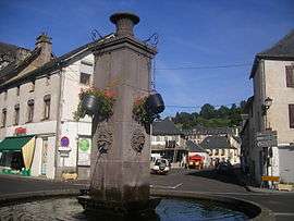 The town center | ||
| ||
 Égliseneuve-d'Entraigues Location within Auvergne-Rhône-Alpes region  Égliseneuve-d'Entraigues | ||
| Coordinates: 45°24′32″N 2°49′41″E / 45.4089°N 2.8281°ECoordinates: 45°24′32″N 2°49′41″E / 45.4089°N 2.8281°E | ||
| Country | France | |
| Region | Auvergne-Rhône-Alpes | |
| Department | Puy-de-Dôme | |
| Arrondissement | Issoire | |
| Canton | Le Sancy | |
| Intercommunality | Communauté de communes du Massif du Sancy | |
| Government | ||
| • Mayor (2008–2014) | Jean-René Tournadre | |
| Area1 | 56.43 km2 (21.79 sq mi) | |
| Population (1999)2 | 561 | |
| • Density | 9.9/km2 (26/sq mi) | |
| Time zone | UTC+1 (CET) | |
| • Summer (DST) | UTC+2 (CEST) | |
| INSEE/Postal code | 63144 /63850 | |
| Elevation |
877–1,358 m (2,877–4,455 ft) (avg. 950 m or 3,120 ft) | |
|
1 French Land Register data, which excludes lakes, ponds, glaciers > 1 km2 (0.386 sq mi or 247 acres) and river estuaries. 2 Population without double counting: residents of multiple communes (e.g., students and military personnel) only counted once. | ||
.svg.png)
Égliseneuve-d'Entraigues is a commune in the Puy-de-Dôme department in Auvergne in central France.
Geography
The village lies in the southern part of the commune, on the right bank of the Rhue, which flows southward through the commune.
See also
| Wikimedia Commons has media related to Égliseneuve-d'Entraigues. |
References
This article is issued from
Wikipedia.
The text is licensed under Creative Commons - Attribution - Sharealike.
Additional terms may apply for the media files.