Çiftlik, Niğde
| Çiftlik | |
|---|---|
| Town and district | |
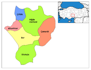 Location of Çiftlik (District), Niğde within Turkey. | |
 Çiftlik Location of Çiftlik (District), Niğde within Turkey. | |
| Coordinates: 38°10′N 34°29′E / 38.167°N 34.483°ECoordinates: 38°10′N 34°29′E / 38.167°N 34.483°E | |
| Country |
|
| Province | Niğde |
| Government | |
| • Mayor | Yusuf Öcal (CHP) |
| Area[1] | |
| • District | 421.99 km2 (162.93 sq mi) |
| Population (2012)[2] | |
| • Urban | 3,468 |
| • District | 29,536 |
| • District density | 70/km2 (180/sq mi) |
| Time zone | UTC+2 (EET) |
| • Summer (DST) | UTC+3 (EEST) |
| Postal code | 51xxx |
| Area code(s) | 0 |
| Licence plate | 51 |
Çiftlik is a town and district of Niğde Province in the Central Anatolia region of Turkey, 67 km from the town of Niğde, and 65 km from Aksaray. There is a much shorter route over the mountains to Niğde but that road is often under snow and closed in winter. Population is (2010) 29,183 of which 3,304 live in the town of Çiftlik.[3]
Çiftlik is Turkish for farm, appropriately in this rural area which was previously known as Melendiz.
Obsidian is found in the area.
Places of interest
- A number of extremely ancient burial mounds höyük.
- The hot spring and crater lake near the village of Narköy.
References
Falling Rain Genomics, Inc. "Geographical information on Ciftlik, Turkey". Retrieved 2008-03-13.
- ↑ "Area of regions (including lakes), km²". Regional Statistics Database. Turkish Statistical Institute. 2002. Retrieved 2013-03-05.
- ↑ "Population of province/district centers and towns/villages by districts - 2012". Address Based Population Registration System (ABPRS) Database. Turkish Statistical Institute. Retrieved 2013-02-27.
- ↑ Statistical Institute Archived 2011-08-24 at the Wayback Machine.
External links
- District governor's official website (in Turkish)
- District municipality's official website (in Turkish)
- A local news website (in Turkish)
- A web portal of Niğde (in Turkish)
- Yesilbor.com (in Turkish)
- information about cappadocia and ciftlik (in Turkish)
This article is issued from
Wikipedia.
The text is licensed under Creative Commons - Attribution - Sharealike.
Additional terms may apply for the media files.