Ventura, California
Ventura, officially the City of San Buenaventura,[11] is the county seat of Ventura County, California, United States. The coastal site, set against undeveloped hills and flanked by two free-flowing rivers, has been inhabited for thousands of years. European explorers encountered a Chumash village, referred to as Shisholop, here while traveling along the Pacific coast.[12] They witnessed the ocean navigation skill of the native people and their use of the abundant local resources from sea and land.[13](p36) The eponymous Mission San Buenaventura was founded nearby in 1782 where it benefitted from the water of the Ventura River. The town grew around the mission compound and incorporated in 1866. The development of nearby oil fields in the 1920s and the age of automobile travel created a major real estate boom during which many designated landmark buildings were constructed. The mission and these buildings are at the center of a downtown that has become a cultural, retail, and residential district and visitor destination.
Ventura San Buenaventura | |
|---|---|
City | |
| City of San Buenaventura | |
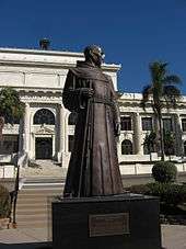
.jpg) .jpg) .jpg) 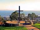 .jpg) Clockwise: Mission San Buenaventura; Elizabeth Bard Memorial Hospital; historic Bank of Italy building; The Cross at Grant Park; Junípero Serra statue in front of Ventura City Hall | |
 Seal | |
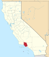
_Highlighted.svg.png) Location in Ventura County | |
 Ventura Location in the United States | |
| Coordinates: 34°16′30″N 119°13′40″W | |
| Country | United States |
| State | California |
| County | Ventura |
| Mission | March 31, 1782 |
| Incorporated | April 2, 1866[1] |
| Named for | Saint Bonaventure |
| Government | |
| • Mayor | Matt LaVere[2] |
| • City manager | Alex McIntyre[3] |
| • CA Senate | Hannah-Beth Jackson (D)[4] |
| • CA Assembly | Monique Limón (D)[4] |
| • U.S. Congress[5] | CA-24: Salud Carbajal (D) CA-26: Julia Brownley (D) |
| Area | |
| • Total | 32.25 sq mi (83.53 km2) |
| • Land | 21.82 sq mi (56.50 km2) |
| • Water | 10.43 sq mi (27.03 km2) 32.53% |
| Elevation | 36 ft (11 m) |
| Population | |
| • Total | 106,433 |
| • Estimate (2018)[9] | 111,128 |
| • Rank | 4th in Ventura County 61st in California |
| • Density | 5,077.45/sq mi (1,960.88/km2) |
| Demonym(s) | Venturan |
| Time zone | UTC−8 (Pacific) |
| • Summer (DST) | UTC−7 (PDT) |
| ZIP codes[10] | 93001–93007, 93009 |
| Area code(s) | 805 |
| FIPS code | 06-65042 |
| GNIS feature IDs | 1667934, 2411779 |
| Website | cityofventura |
Ventura lies between Los Angeles and Santa Barbara along U.S. Route 101, which was one of the original U.S. Routes. The highway is now known as the Ventura Freeway, but the original route through the town along Main Street has been designated El Camino Real, the historic pathway connecting the California missions. During the post–World War II economic expansion, the community grew easterly, building detached single-family homes over the rich agricultural land created by the Santa Clara River at the edge of the Oxnard Plain. The population was 106,433 at the 2010 census, up from 100,916 at the 2000 census with the median age being 39.[14] Ventura is part of the Oxnard–Thousand Oaks–Ventura, CA metropolitan area.
History
Prehistory and indigenous peoples
Archaeological discoveries in the area suggest that humans have populated the region for at least 10,000-12,000 years.[15] Archaeological research demonstrates that the Chumash people have deep roots in central and southern coastal regions of California, and has revealed artifacts from their culture.[13](p11) Shisholop Village, designated Historic Point of Interest #18 by the city at the foot of nearby Figueroa Street, was the site of a Chumash village.[12] The Ventura Chumash were in contact with the Channel Islands Chumash; both mainland and island Chumash utilized plank-sewn seagoing canoes, called Tomolo, with the island people bringing shell bead money, island chert, and sea otter pelts to trade for mainland products like acorns and deer meat.[16][17]
Spanish period (1769–1822)
In 1769, the Spanish Portolà expedition, first recorded European visitors to inland areas of California, came down the Santa Clara River Valley from the previous night's encampment near today's Saticoy and camped near the outlet of the Ventura River on August 14. Fray Juan Crespi, a Franciscan missionary traveling with the expedition, noted that "we saw a regular town, the most populous and best laid-out of all that we had seen on the journey up to the present time."[18] Archaeological records found that the Chumash village they encountered was settled sometime around 1000 A.D.
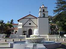
Junípero Serra, first leader of the Franciscans in California, founded Mission San Buenaventura in 1782 as his ninth and last mission established near the Chumash village as part of Spain's colonization of Alta California.[19] The mission was named for St. Bonaventure, a Thirteenth Century Franciscan saint and a Doctor of the Church. San Miguel Chapel was the first outpost and center of operations while the first Mission San Buenaventura was being constructed. The first mission burned in 1801 and a replacement building of brick and stone was completed in 1809. The bell tower and facade of the new mission was destroyed by an 1812 earthquake.[20][21] The Mission was rebuilt and functions as a parish church. Historic tours of downtown include the mission compound.
Mexican period (1822–1848)
The Mexican secularization act of 1833 was passed twelve years after Mexico won independence from Spain in 1821. Mission land was sold or given away in large grants called ranchos. Rancho Ex-Mission San Buenaventura was a 48,823-acre (197.58 km2) grant that included downtown Ventura. Governor Juan Bautista Alvarado granted Rancho San Miguel to Felipe Lorenzana and Raymundo Olivas whose Olivas Adobe on the banks of the Santa Clara River was the most magnificent hacienda south of Monterey. Fernando Tico also received a Mexican land grant for Ojai and a lot near the river in downtown Ventura.[22]
Early agricultural development (1848–1919)
California became a territory of the United States in 1848 and the 31st state in the Union in 1850. After the American Civil War, settlers came to the area, buying land from the Mexicans, or simply as squatters. Vast holdings were later acquired by Easterners, including railroad magnate Thomas A. Scott. He was impressed by one of the young employees, Thomas R. Bard, who had been in charge of train supplies to Union troops, and Bard was sent west to handle Scott's property. Not easily accessible, Ventura was not a target of immigrants, and remained quiet and rural. For most of the century following the incorporation of Ventura in 1866, it remained isolated from the rest of the state.
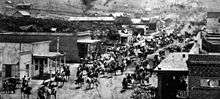
Ventura had a flourishing Chinese settlement in the early 1880s. The largest concentration of activity, known as China Alley, was just across Main Street from the Mission San Buenaventura. China Alley was parallel with Main Street and extended easterly off Figueroa Street between Main and Santa Clara streets.[23] The city council has designated the China Alley Historic Area a Point of Interest in the downtown business district.[24]
Ventura Pier was built in 1872 at a cost of $45,000 and was the longest wooden Pier in California. In 1914 a ship severed the pier. It was rebuilt to a length of 1,700 feet (520 m) by 1917. An active wharf for 64 years, it was reinforced with steel pilings after 420 feet (130 m) of the pier was destroyed by a storm in 1995.[25][26][27][28]
Oil and development boom (1920–1945)
The Union Oil Company was organized with Bard as president in 1890, and had offices in Santa Paula. The large Ventura Oil Field was first drilled in 1919 and at its peak produced 90,000 barrels per day (14,000 m3/d).[29][30] The development of the oil fields in the 1920s, along with the building of better roads to Los Angeles and the affordability of automobiles, enabled a major real estate boom. Contemporary downtown Ventura is defined by extant buildings from this period.[31][32] In this bustling oil boom town Ventura Theatre opened in 1928.[33] During this decade, many other buildings were constructed: the Hobson Brothers Meat Packing Company (1923),[34] the First National Bank of Ventura (1926) (commonly called the Erle Stanley Gardner Building),[35] the Ventura Hotel (1926), the First Baptist Church of Ventura (1926), the Elks Lodge - B. P. 0. E. #1430 (1928),[36] the Mission Theater (1928), the Hotel Washington (1928), the Swift & Company Building (1928), and the Masonic Temple (1929).[31]
Located between the Ventura River and the Santa Clara River, the soil is so fertile that town boosters claimed that citrus grew better here than anywhere else in the state. The citrus farmers joined Sunkist Growers, Incorporated, the world's largest organization of citrus producers. On March 12, 1928, the St. Francis Dam, 54 mi (87 km) inland, failed catastrophically, creating a flood that took over 600 lives as it flowed down the Santa Clara River to the ocean. The flood reached Montalvo (a settlement that is now a neighborhood of Ventura) about 5:30 a.m., almost two miles (3 km) wide and traveling at a speed of 5 mph (8.0 km/h) per hour.
Postwar years and the 1950s boom (1946–present)

From the south, travel by auto was slow and hazardous, until the completion of a four-lane freeway (US Highway 101) over the Conejo Grade in 1959. This route, now further widened and improved by 1969, is known as the Ventura Freeway, which directly links Ventura with the rest of the Los Angeles–Long Beach, CA Combined Statistical Area. Another route, US Highway 101 ALT (now the Pacific Coast Highway) traveled along the coast from Santa Monica via Oxnard, but was not heavily used.
From the north, entrance was by way of a single road along the beach and stagecoach passengers either had to wait until low tide when the horses could cross on the exposed wet sand, or go up the Ventura River Valley and then cross over the mountains to Santa Barbara via Casitas Pass, a long and difficult trip. In 1913, the Rincon Sea Level Road and the Ventura River Bridge opened; motoring tourists no longer had to fear coming through here.[37]
Inland, Ventura was hemmed in by the mountainous country and deep canyons of the Los Padres National Forest. This route became passable with the completion of the Maricopa Highway (U.S. 399, now State Highway 33) in the 1930s, connecting Ventura and Ojai with the San Joaquin Valley.
Ventura continued to grow steadily. In 1920 there were 4,156 people. In 1930 the population had increased to 11,603, by 1950 the population reached 16,643, by 1970 the population was 57,964, and in 1980 the population had increased to 73,774. In the last three decades it has increased to approximately 107,000. To minimize outward growth onto the agricultural land that surrounds the existing community, the city is pursuing a strategy of "in-fill first" with the 2005 General Plan which means growth will focus inward to certain "Districts, Corridors, and Neighborhood Centers" that will become more intensely populated.[38]
Thomas Fire (2017)
Following a late-fall Santa Ana winds event, a fire was sparked about 15 miles (24 km) north of Ventura in Santa Paula, California, at around 6:30 PM on December 4, 2017. Winds had peaked in the overnight hours causing major spreading of the fire over thousands of acres in a short time. Early on December 5 the fire had quickly spread through the western portion of Ventura County causing mass evacuations and power outages. The winds swept into the Ventura area burning through hillside neighborhoods.[39] The fire spread above the downtown area burning several apartment buildings before continuing north along the Rincon coast. The Thomas Fire was part of a series of at least four major fires caused by this prolonged wind event. Mass evacuation orders were prompted and US Route 101 was shut down. The fire burned over 281,000 acres in total.
Geography

Ventura is located northwest of Los Angeles on the California coast. The western portion of the city stretches north along the Ventura River and is characterized by a narrow valley with steeply sloped areas along both sides. The steep slopes of the Ventura foothills abut the northern portion of the community. Much of the eastern portion is on a relatively flat alluvial coastal plain lying along the western edge of the Oxnard Plain. The Santa Clara River forms the city's southerly boundary with the city limits reaching up to the beginning of the Santa Clara River Valley at the historic community of Saticoy.[40]
Ventura is within a seismically active region like much of California and is crossed by several potentially active fault systems.[41] The Ventura Fault is capable of an 8.0 earthquake and a local tsunami up to 23 feet in height.[42][43][44] According to the United States Census Bureau, Ventura has a total area of 32.1 square miles (83 km2), of which 21.7 square miles (56 km2) is land and 10.4 square miles (27 km2) (32.53%) is water.
Climate
Ventura has a Mediterranean climate, typical of most coastal California cities, with the sea breeze off the Pacific Ocean moderating temperatures. It is not uncommon for the city to be affected by Santa Ana winds off the Transverse Ranges on occasion, which increase temperatures dramatically.
| Climate data for Ventura, California | |||||||||||||
|---|---|---|---|---|---|---|---|---|---|---|---|---|---|
| Month | Jan | Feb | Mar | Apr | May | Jun | Jul | Aug | Sep | Oct | Nov | Dec | Year |
| Record high °F (°C) | 88 (31) |
91 (33) |
99 (37) |
100 (38) |
101 (38) |
102 (39) |
103 (39) |
103 (39) |
103 (39) |
103 (39) |
99 (37) |
96 (36) |
103 (39) |
| Average high °F (°C) | 66 (19) |
66 (19) |
65 (18) |
68 (20) |
68 (20) |
70 (21) |
73 (23) |
74 (23) |
74 (23) |
73 (23) |
70 (21) |
66 (19) |
69 (21) |
| Daily mean °F (°C) | 55.5 (13.1) |
56.5 (13.6) |
56.5 (13.6) |
59 (15) |
60.5 (15.8) |
63 (17) |
66 (19) |
67 (19) |
66.5 (19.2) |
64 (18) |
59.5 (15.3) |
55.5 (13.1) |
60.8 (16.0) |
| Average low °F (°C) | 45 (7) |
47 (8) |
48 (9) |
50 (10) |
53 (12) |
56 (13) |
59 (15) |
60 (16) |
59 (15) |
55 (13) |
49 (9) |
45 (7) |
52 (11) |
| Record low °F (°C) | 29 (−2) |
28 (−2) |
31 (−1) |
35 (2) |
39 (4) |
42 (6) |
44 (7) |
46 (8) |
42 (6) |
37 (3) |
33 (1) |
29 (−2) |
28 (−2) |
| Average rainfall inches (mm) | 3.41 (87) |
3.90 (99) |
3.04 (77) |
0.72 (18) |
0.21 (5.3) |
0.05 (1.3) |
0.02 (0.51) |
0.07 (1.8) |
0.36 (9.1) |
0.36 (9.1) |
1.37 (35) |
2.11 (54) |
15.62 (397) |
| Source: http://www.weather.com/outlook/travel/businesstraveler/wxclimatology/monthly/graph/USCA1193 | |||||||||||||
Demographics
| Historical population | |||
|---|---|---|---|
| Census | Pop. | %± | |
| 1880 | 1,370 | — | |
| 1890 | 2,320 | 69.3% | |
| 1900 | 2,470 | 6.5% | |
| 1910 | 2,901 | 17.4% | |
| 1920 | 4,156 | 43.3% | |
| 1930 | 11,603 | 179.2% | |
| 1940 | 13,264 | 14.3% | |
| 1950 | 16,534 | 24.7% | |
| 1960 | 29,114 | 76.1% | |
| 1970 | 57,964 | 99.1% | |
| 1980 | 73,774 | 27.3% | |
| 1990 | 92,575 | 25.5% | |
| 2000 | 100,916 | 9.0% | |
| 2010 | 106,433 | 5.5% | |
| Est. 2018 | 111,128 | [9] | 4.4% |
| U.S. Decennial Census[45] | |||
2010
The 2010 United States Census[46] reported that Ventura had a population of 106,433. The population density was 3,316.2 people per square mile (1,280.4/km²). The racial makeup of Ventura was 76.6% White, 1.6% African American, 1.2% Native American, 3.4% Asian (0.9% Filipino, 0.6% Chinese, 0.4% Indian, 0.4% Korean, 0.4% Japanese, 0.3% Vietnamese, 0.5% Other), 0.2% Pacific Islander, 5.2% from two or more races. Hispanic or Latino of any race were 31.8% of the population.
The Census reported that 103,940 people (97.7% of the population) lived in households, 755 (0.7%) lived in non-institutionalized group quarters, and 1,738 (1.6%) were institutionalized.
There were 40,438 households, out of which 13,014 (32.2%) had children under the age of 18 living in them, 18,907 (46.8%) were opposite-sex married couples living together, 4,936 (12.2%) had a female householder with no husband present, 2,153 (5.3%) had a male householder with no wife present. There were 2,621 (6.5%) unmarried opposite-sex partnerships, and 371 (0.9%) same-sex married couples or partnerships. 10,959 households (27.1%) were made up of individuals and 4,271 (10.6%) had someone living alone who was 65 years of age or older. The average household size was 2.57. There were 25,996 families (64.3% of all households); the average family size was 3.14.
The population was spread out with 23,918 people (22.5%) under the age of 18, 9,581 people (9.0%) aged 18 to 24, 28,814 people (27.1%) aged 25 to 44, 29,957 people (28.1%) aged 45 to 64, and 14,163 people (13.3%) who were 65 years of age or older. The median age was 39.0 years. For every 100 females, there were 97.7 males. For every 100 females age 18 and over, there were 95.6 males.
There were 42,827 housing units at an average density of 1,334.4 per square mile (515.2/km²), of which 22,600 (55.9%) were owner-occupied, and 17,838 (44.1%) were occupied by renters. The homeowner vacancy rate was 1.3%; the rental vacancy rate was 5.5%. 59,330 people (55.7% of the population) lived in owner-occupied housing units and 44,610 people (41.9%) lived in rental housing units.
2000
As of the census[47] of 2000, there were 100,916 people, 38,524 households, and 25,233 families residing in the city. The population density was 4,790.6 inhabitants per square mile (1,849.3/km²). There were 39,803 housing units at an average density of 1,889.5 per square mile (729.4/km²). The racial makeup of the city was 78.8% White, 1.4% African American, 1.2% Native American, 3.0% Asian, 0.2% Pacific Islander, 11.1% from other races, and 4.3% from two or more races. Hispanic or Latino of any race were 30.4% of the population.
There were 38,524 households out of which 32.1% had children under the age of 18 living with them, 49.2% were married couples living together, 11.7% had a female householder with no husband present, and 34.5% were non-families. 26.5% of all households were made up of individuals and 9.7% had someone living alone who was 65 years of age or older. The average household size was 2.56 and the average family size was 3.12.
In the city, the population was spread out with 25.0% under the age of 18, 7.8% from 18 to 24, 31.5% from 25 to 44, 22.8% from 45 to 64, and 12.8% who were 65 years of age or older. The median age was 37 years. For every 100 females, there were 96.9 males. For every 100 females age 18 and over, there were 93.8 males.
The median income for a household in the city was $52,297, and the median income for a family was $60,466. Males had a median income of $43,828 versus $31,793 for females. The per capita income for the city was $25,065. About 6.4% of families and 9.0% of the population were below the poverty line, including 12.2% of those under age 18 and 5.3% of those age 65 or over.
Economy
The outdoor clothing manufacturer Patagonia is based in Ventura.[48] The headquarters of the company are located just west of the downtown area. The eco-designer Stewart+Brown has their factory just a few blocks from the ocean. Diaper bag manufacturer Petunia Pickle Bottom is headquartered near downtown Ventura. Visionary research and resource company The Barna Group is located near downtown Ventura.
Ventura is a course in Tony Hawk's Pro Skater 2. It was called 'Skatestreet Ventura'.
Ventura is a destination for tourists and is popular for people living in southern California. They enjoy the relaxing atmosphere and ambiance with activities such as walking on the beach and other outdoor activities and sports such as kayaking.[49]
Top employers
According to the State of California's Employment Development Department, the America's Labor Market Information System (ALMIS) Employer Database, 2016 1st edition, indicated that the major employers in the city of Ventura are California State University-Channel Islands, Coleman Welding, Community Memorial Health System and Community Memorial Hospital.
According to the City's 2016 Comprehensive Annual Financial Report,[50] the top employers in the city are:
| # | Employer | Number of Employees 2016 | Percent of Total City Employment | Number of Employees 2007 | Percent of Total City Employment |
|---|---|---|---|---|---|
| 1 | County of Ventura | 7,915 | 13.84% | 7,320 | 12.56% |
| 2 | Ventura Unified School District | 2,674 | 4.67% | 2,138 | 3.67% |
| 3 | Community Memorial Health System | 1,458 | 2.55% | 1,900 | 3.26% |
| 4 | Ventura College | 712 | 1.24% | 1,835 | 3.15% |
| 5 | Employer's Depot | 608 | 1.06% | na | na |
| 6 | City of San Buenaventura | 597 | 1.04% | 1,144 | 1.96% |
| 7 | Patagonia Works (Lost Arrow Corp.) | 537 | 0.94% | na | na |
| 8 | Kaiser Permanente | 525 | 0.92% | na | na |
| 9 | Target | 402 | 0.70% | na | na |
| 10 | Ventura Superior Court | 289 | 0.51% | na | na |
| Ventura County Health Care Agency | na | na | 2,197 | 3.77% |
Incubator
In 2009 the City of Ventura created Ventura Ventures Technology Center,[51] a business incubator with a high-tech focus. Ventura Ventures Technology Center was created as an economic engine to develop jobs and companies locally, as well as attract entrepreneurs to the area.
Arts and culture
The Ventura County Fairgrounds is the home of the annual Ventura County Fair, and over the years has hosted such acts as Jimi Hendrix, The Grateful Dead, Smokey Robinson, All American Rejects, Smash Mouth, and Sugar Ray, as well as the Vans Warped Tour. The Train Station for Amtrak's Pacific Surfliner route is adjacent to the fairgrounds.
The Majestic Ventura Theater is an early 20th-century landmark in the downtown. It has been a venue for concerts such as The Doors, Pearl Jam, Van Halen, X, Ray Charles, Red Hot Chili Peppers, Social Distortion, Bad Religion, Fugazi, Incubus, Tom Petty, They Might Be Giants, and Johnny Cash, as well as homegrown artists like KYLE, Big Bad Voodoo Daddy and Army of Freshmen.
Sports and recreation
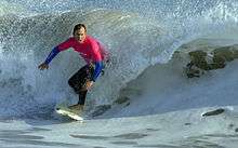
Ventura is famed for the quality and frequency of the surfing conditions at spots such as Surfer's Point near the Ventura County Fairgrounds.[52] The Ventura County Fairgrounds is the home to the Ventura Raceway, "The best little dirt track in America",[53] Ventura is the home to the soccer clubs Ventura County Football Club[54] and Ventura County Fusion, of the USL Premier Development League.
Parks

- Arroyo Verde Park
- Arundell Linear Park
- Aurora Linear Park
- Barranca Vista Park
- Belaire Linear Park
- Blanche Reynolds Park (Rainbow Bridge)
- Bristol Bay Linear Park
- Brock Linear Park
- Camino Real Park
- Cemetery Memorial Park
- Chumash Park
- County Square Linear Park
- Eastwood Park
- Fritz Huntzinger Youth Sports Complex
- Grant Park[55]
- Harry Lyon Park
- Hobart Park
- Juanamaria Park
- Junipero Serra Park
- Kennebec Linear Park
- Kellogg Park [56]
- Marina Park
- Marion Cannon Park
- Mission Park[57]
- Montalvo Hill Park
- Northbank Linear Park
- Ocean Avenue Park
- Plaza Park[58]
- Promenade Park
- Ralston Village Linear Park
- Rancho Ventura Linear Park
- Riverview Linear Park
- Seaside Park (and Ventura County Fairgrounds)
- Seaside Wilderness Park
- San Buenaventura State Beach
- Thille Park
- Ventura Community Park
- Westpark[59]
- Woodside Linear Park
Government
Ventura has an at-large system of electing council members.[60] The council elects from among its own members a mayor and deputy mayor who serve for 2-year terms.[61]
Education
Ventura has four college campuses: Ventura College of Law, Southern California Institute of Law, Santa Barbara Business College and Ventura College. Ventura College of Law is a non-profit law school founded in 1969. Ventura College is a community college, part of the Ventura County Community College District.[62] The Brooks Institute of Photography shut down in 2016 after many years in the community.
Public school students from kindergarten through 12th grade attend schools in the Ventura Unified School District. The district has five high schools: Ventura High in the midtown area, Buena High in east Ventura, Foothill Technology High School, Pacific High School[63] and El Camino High School, an independent study program located on the Ventura College campus. Private schools include St. Bonaventure High School, a Catholic school, Ventura County Christian School, an evangelical Christian school,[64] and Holy Cross School, Sacred Heart, and Our Lady of the Assumption, Roman Catholic schools for grades pre-kindergarten through 8.
Infrastructure
Broadband
With only one internet provider, the City Council will have a study by June 2019 to look at the issues.[65]
Libraries
Public
There are three branches of the Ventura County Library in the City of Ventura: E.P. Foster Library[66][67] on Main Street, Avenue Library[68] on Ventura Avenue, and Hill Road Library on the east side of the city.[69] Saticoy Library[70] is in the unincorporated area of Saticoy outside the east end of the city of Ventura. H.P. Wright Library[71] was closed on November 30, 2009 due to a shortfall in funding in the Ventura County Library System.[72] All books from the H.P. Wright Library were integrated into the E.P. Foster Library in March 2010.[73] Proponents of an east side library continued to agitate for the re-establishment of a branch to replace the H.P. Wright Library, which came to fruition in 2017 with the opening of Hill Road Library on December 3.[74][69]
Academic
The Evelyn and Howard Boroughs Library of Ventura College, dedicated in 2005, serves the students, faculty and staff of the college as well as the general public of Ventura County.[75]
Other
The Research Library of the Museum of Ventura County holds books and archival materials related to the history of the county and surrounding regions. Its holdings are catalogued in the Ventura County Library system and the Central Coast Museum Consortium, and the library is open to the public.[76]
Ventura County Law Library, located in the Ventura County Government Center, makes current legal resources available to judges, lawyers, government officials, and other users.[77]
Transportation
The major road through Ventura is the Ventura Freeway (U.S. Route 101), connecting the California Central Coast and San Francisco to the north, and Los Angeles to the south. State Route 33, the Ojai Freeway, heads north to Ojai. State Route 126 and State Route 118 head east to Santa Clarita and Simi Valley, respectively.
The East Ventura Station, in the historic Montalvo neighborhood, serves as the western terminus of the Ventura County Line of the Metrolink commuter rail system, which extends to Los Angeles' Union Station. The Ventura Amtrak Station is served by Amtrak's Pacific Surfliner from San Luis Obispo to San Diego.
Local bus service is provided by Gold Coast Transit. Commuter and intercity bus services are provided by VISTA and by MTD to Santa Barbara.
The Downtown - Harbor Trolley began its free service on July 3, 2013. The Trolley makes loops from Downtown to Ventura Harbor.[78]
Water and sewer utilities
Ventura provides water and sewer utilities services to its residents.[79]
Water sources are Lake Casitas, the Ventura River, and groundwater.[80] Some recycled water is used for landscaping and other non-potable uses.[81][82][83]
The Montalvo Community Services District looked at the cost of a new treatment plant in 2014 and considered having the city take over their service area and dissolve the district. The Montalvo Municipal Improvement District had been formed 60 years prior to bringing sewer service to what was then a remote unincorporated area southeast of Ventura. The city of Ventura annexed the last unincorporated portions of Montalvo in 2012[84] and had already begun to provide water to the community before the annexation.[85]
In popular culture
Film
The movies Swordfish, Little Miss Sunshine and Erin Brockovich were partially filmed in Ventura.[86]
The comedy film The Bet was filmed entirely in the city of Ventura and was written by Ventura residents Chris Jay and Aaron Goldberg, both members of the band Army of Freshmen.
Books
Ventura was fictionalized as 'Madison City' by long-time resident Erle Stanley Gardner in his D.A. series of crime novels featuring Doug Selby, crusading district attorney of a rural California county.
Ventura is the setting for Julie Carobini's 2007 book Chocolate Beach.
Songs
The America song Ventura Highway was inspired by the feel of the coastal highway running through Ventura, when the songwriter as a child saw the sign to Ventura on a family trip.
Points of interest
Downtown
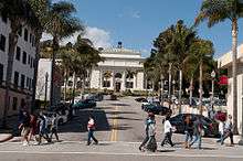
Downtown Ventura is home to the Mission San Buenaventura, museums, galleries, dining, and shopping. Located in downtown is the historic Ortega Adobe, once home to the Ortega family known for chili products. Downtown Ventura is home to Ventura's ornate city hall with its statue of Junipero Serra.[87] Downtown includes restaurants, wine bars, breweries, and the Rubicon Theatre Company.
Visitors Center
The 4,300-square-foot (400 m2) Ventura Visitors Center, at 101 South California Street, has exhibits on the Heritage Valley, Channel Islands National Park, the local arts scene, and maps and brochures about the area.

Two Trees
One of the most recognizable landmarks in Ventura was "Two Trees" – two prominent lone trees on a hilltop, visible from most of Ventura. Access to the hill is private property. Signs at the bottom of the trails and at the trees themselves warn against trespassing.[88]
In early October 2017, one tree was destroyed by high winds.[89][90]
Plaza Park
In Plaza Park (Chestnut and Santa Clara streets, downtown) stands a large Moreton Bay fig tree. Across the street, the main post office has murals on interior walls commissioned by the Section of Painting and Sculpture of the U.S. Treasury Department as New Deal art.[91]
Harbor
Ventura Harbor has fishing boats, seafood restaurants and a retail center, the Ventura Harbor Village. The Channel Islands National Park Headquarters is also located at the harbor, and boats to the Channel Islands depart from there daily.
The Westside of Ventura is a large subdivision of neighborhoods along Ventura Avenue.
The California Office of Environmental Health Hazard Assessment has issued a safe eating advisory for any fish caught in Ventura Harbor to Santa Monica Pier due to elevated levels of mercury and PCBs.[92]
Pierpont Bay
Pierpont Bay (Pierpont) is a residential neighborhood in the one-mile stretch between Ventura Harbor and San Buenaventura State Beach. Reclaimed marshland was subdivided in 1925 and houses were built in fits of development interrupted by years of economic depression, war, and coastal floods (in 1937 and 1962). Long a hodge-podge of rental dwellings, weekend cottages and vacant lots, it was transformed by successive California real estate booms into a fashionable but eclectic mix of newer large homes and older modest beach cottages, now mostly owner-occupied. Pierpont Bay has widely varying architectural styles, a small retail district Seaward Avenue, newer residents' demands for increased municipal maintenance, and continuing disputes about the proper regulation of the neighborhood's public beaches.[93]

Olivas Adobe
The Olivas Adobe, one of the early "California Rancho" styled homes, is operated today as a museum and performing arts venue. Located adjacent to the Olivas Park Golf Course, the home is one of the most visited historic sites on the central Pacific Coast. Living history reenactments, demonstrations of Rancho life and wonderful ghost stories abound. A summer music series of performances held in the old home's courtyard features an eclectic assortment of artists from blues to jazz to country.
Other
- A J Comstock Fire Museum
- Albinger Archeological Museum
- Father Serra Cross
Notable people
Theodosia Burr Shepherd (1845-1906) was an American botanist, horticulturist and pioneer in plant breeding. She was called the “Flower Wizard of California”,[94] and "The Pioneer Seed-grower" as she was the first woman in California and possibly in the United States to hybridize flowers.[95][94] Her seed and bulb business, the Theodosia B. Shepherd Company, is considered to be the foundation of the California seed industry and is listed as number 34 in the City of Ventura Historic Landmarks and Districts. She was compared favorably to Luther Burbank.[96]
Erle Stanley Gardner (1889-1970) created the fictional lawyer Perry Mason, who appeared first in novels and then later in a television series from 1957 to 1966, followed by several "made-for-TV" movies in the 1980s. Gardner himself was a lawyer and did much of his early writing in Downtown Ventura. The First National Bank building at California and Main streets, where Gardner's law office was located, bears his name on a state historical marker and is also identified as the "Erle Stanley Gardner Building" over the front entrance.
James Ennis III (1990-) Professional Basketball Player for the Philadelphia 76ers.
Frank Churchill a composer for Disney cartoons, started as a pianist in Ventura.
Sister cities
See also
- Foster Park Bowl
References
- "California Cities by Incorporation Date". California Association of Local Agency Formation Commissions. Archived from the original (Word) on November 3, 2014. Retrieved August 25, 2014.
- "City Council". City of Ventura. Retrieved December 7, 2017.
- "City Manager Mark Watkins". City of Ventura. Archived from the original on December 7, 2014. Retrieved January 11, 2015.
- "Statewide Database". UC Regents. Retrieved November 23, 2014.
- "Communities of Interest - City". California Citizens Redistricting Commission. Retrieved September 27, 2014.
- "2016 U.S. Gazetteer Files". United States Census Bureau. Retrieved June 28, 2017.
- "Ventura". Geographic Names Information System. United States Geological Survey. Retrieved December 3, 2014.
- "E-1 Current Population Estimates for Cities, Counties, and the State: January 1, 2013 and 2014". State of California, Department of Finance. May 2014. Retrieved May 5, 2017.
- "Population and Housing Unit Estimates". Retrieved July 16, 2019.
- "ZIP Code(tm) Lookup". United States Postal Service. Retrieved December 3, 2014.
- Erwin G. Gudde, California Place Names: The Origin and Etymology of Current Geographical Names, 4th ed., rev. and enlarged by William Bright (University of California Press, 1998), p. 410.
- Landmark #18: Shisholop Village Site Archived December 8, 2014, at the Wayback Machine accessed October 7, 2013 from link on City Map with Historic Landmarks
- McCall, Lynne; Perry, Rosalind (2002). California's Chumash Indians : a project of the Santa Barbara Museum of Natural History Education Center (Revised ed.). San Luis Obispo, Calif: EZ Nature Books. ISBN 978-0936784151.
- "San Buenaventura (Ventura), CA". Data USA. Retrieved November 29, 2017.
- Clerici, Kevin (July 17, 2007). "Artifacts are found at site". Ventura County Star. Archived from the original on December 3, 2013.
- Anderson, John (1999). "The Chumash Indians Who Live in Ventura County California: The Ventura Chumash". Retrieved May 7, 2013.
- "Santa Cruz Island History and Culture". National Park Service. Retrieved November 24, 2019.
- Bolton, Herbert E. (1927). Fray Juan Crespi: Missionary Explorer on the Pacific Coast, 1769-1774. HathiTrust Digital Library. pp. 159–160.
- Murphy, Arnold L. (ed.) (1979). A Comprehensive Story of Ventura County, California. Oxnard, CA: M & N Printing. p. 8.CS1 maint: extra text: authors list (link)
- Hogle, Gene NAC Green Book of Pacific Coast Touring (1931) National Automobile Club p.25
- Stolz, Kit (January 5, 2014). "Ventura earthquake fault more dangerous than previously thought, geologists say". Ventura County Star. Retrieved January 5, 2016.
- "Spanish and Mexican Land Grants". Ventura County Genealogical Society. Archived from the original on March 18, 2007. Retrieved March 17, 2007.
- "Wayback Machine" (PDF). March 27, 2014. Archived from the original (PDF) on March 27, 2014. Retrieved December 11, 2018.
- Resolution 99-3 of the City Council adopted and passed January 11, 1999
- Scheibe, John (January 24, 2014). "Ventura Pier closed after piling gives way". Ventura County Star. Retrieved October 26, 2015.
- Young, Don (2009). Southern California Adventure Guide. Hunter Publishing, Inc.
- Gorman, Anna (February 8, 1999). "Landmark Pier Readies for Latest Renovation Project". Los Angeles Times. Retrieved July 6, 2016.
- Langlois, Roseann (July 19, 1999). "Pier Renovation Begins This Week". Los Angeles Times. Retrieved July 6, 2016.
- Stolz, Kit (April 16, 2009). "Tar on your foot". Ventura County Reporter. Retrieved April 7, 2016.
- Martinez, Arlene (April 6, 2016). "Ventura Oil Field celebrates 100 years". Ventura County Star. Retrieved April 7, 2016.
- "The Swift & Company Building" (PDF). Historic Landmark Designation Application. City of Ventura. March 24, 2014. Archived from the original (PDF) on April 13, 2014. Retrieved April 7, 2016.
- "Historic Landmark #108" (PDF). City of Ventura. Retrieved April 7, 2016.
- Hamilton, Denise (June 9, 1988) "A New Life Awaits Ventura Theater : Restaurateur Has Big Plans to Book Jazz, Country, Salsa Acts at Ornate Ex-Movie House" Los Angeles Times
- City of Ventura. Historic Landmark #23
- City of Ventura. Historic Landmark #37
- City of Ventura. Historic Landmark #99
- Gyllstrom, Paul. "Rincon Sea-Level Road Soon Completed" Motor Age, Volume XXII, 17 October 1912, p. 25
- City Of Ventura "Ventura's General Plan" Archived June 26, 2014, at the Wayback Machine Planning Webpage Accessed April 28, 2014
- O'NEILL, STEPHANIE (August 19, 2019). "California Residents Say They Need More Information On Previous Wildfires To Prepare". NPR News. Retrieved August 20, 2019.
- Rincon Consultants, Inc. (June 2014). "Olivas Park Drive Extension Project Final Environmental Impact Report SCH # 1995081004"" (PDF). City of Ventura. Archived from the original (PDF) on July 13, 2014.
- "What do the experts say about Ventura earthquakes?". Ventura County Star. November 9, 2019. Retrieved November 10, 2019.
- Lloyd, Jonathan (August 20, 2015). "Ventura, Oxnard Might Be at Greater Tsunami Risk: Study". Associated Press. Retrieved November 20, 2019 – via NBC Southern California.
- LIN II, RONG-GONG (November 8, 2019). "Swarm of earthquakes hits Ventura". Los Angeles Times. Retrieved November 10, 2019.
- Lin II, Rong-Gong (April 20, 2015). "Earthquake fault heightens California tsunami threat, experts say". Los Angeles Times. Retrieved July 31, 2016.
- "Census of Population and Housing". Census.gov. Retrieved June 4, 2015.
- "2010 Census Interactive Population Search: CA - San Buenaventura (Ventura) city". U.S. Census Bureau. Archived from the original on July 15, 2014. Retrieved July 12, 2014.
- "U.S. Census website". United States Census Bureau. Retrieved January 31, 2008.
- "Patagonia Job Listing for Ventura, CA, Reno, NV, and worldwide". Patagonia.com. Retrieved May 12, 2014.
- Hersko, Tyler (May 25, 2017). "Beaches and trails lure tourists to Ventura County". Ventura County Star. Retrieved May 27, 2017.
- "Comprehensive Annual Financial Report Fiscal Year Ended June 30, 2016" (PDF). City of San Buenaventura.
- "v2tc.com". v2tc.com. Archived from the original on May 12, 2014. Retrieved May 12, 2014.
- Thompson, Doug (February 25, 2016). "Stand-up paddleboarders hit Ventura's big waves". Ventura County Star. Retrieved March 23, 2016.
- "Ventura Raceway Channel". Ustream.tv. Retrieved May 12, 2014.
- "Ventura County FC". Ventura County Football Club. Retrieved December 1, 2016.
- SURMAN, MATT (November 17, 2000). "Parks Board Aims to Relocate Gun Range". Los Angeles Times. Retrieved February 23, 2018.
- "Kellogg Park". cityofventura.com. Retrieved June 19, 2017.
- "Mission Park". Ventura.com. Retrieved May 12, 2014.
- "Plaza Park". Ventura.com. Retrieved May 12, 2014.
- Kallas, Anne (May 5, 2016). "Fitness area opens in Ventura's Westpark Community Center". Ventura County Star. Retrieved May 5, 2016.
- Martinez, Arlene (September 6, 2017). "Ventura faces threat of voting rights suit". Ventura County Star. Retrieved November 11, 2017.
- "Selection of Mayor | Ventura, CA". www.cityofventura.ca.gov. Retrieved December 7, 2017.
- "Ventura County Community College District". vcccd.edu. Retrieved May 12, 2014.
- "Pacific". www.venturausd.org.
- "Ventura County Christian School". Ventura County Christian School.
- "The 4th utility: How Ventura County is working to increase broadband". Ventura County Star. Retrieved February 22, 2019.
- MacGregor, Hilary E. (April 1, 1997). "E. P. Foster Is Deemed Top Candidate for Main Library". Los Angeles Times. Retrieved June 18, 2017.
- "E. P. Foster Library | Ventura County Library". Vencolibrary.org. Retrieved May 12, 2014.
- "Avenue Library | Ventura County Library". Vencolibrary.org. Retrieved May 12, 2014.
- "Hill Road Library Grand Opening – Ventura Friends of the Library". venturafriendsofthelibrary.org. Retrieved December 7, 2017.
- "Saticoy Library — Serving Saticoy, Somis and Ventura's East End | Ventura County Library". Vencolibrary.org. Retrieved May 12, 2014.
- http://www.vencolibrary.org/locations/wright
- Steinhauer, Jennifer (December 9, 2009). "Despite Ray Bradbury's Efforts, A California Library Closes". New York Times. Retrieved June 18, 2017.
- Clerici, Kevin (November 10, 2009). "Wright Library to close at end of month". Ventura County Star. Retrieved June 18, 2017.
- "Library branch returning to east Ventura". Ventura County Star. Retrieved December 7, 2017.
- "About the Library | Ventura College". www.venturacollege.edu. Retrieved December 7, 2017.
- "Research Library - Museum of Ventura County". Museum of Ventura County. Retrieved December 7, 2017.
- "About the Library". Ventura County Law Library. November 10, 2012. Retrieved December 7, 2017.
- "venturatrolley.com". venturatrolley.com. Retrieved May 12, 2014.
- Heitmann, Cheryl (November 19, 2014) "Ventura mayor defines full-service city" Ventura County Star
- Martinez, Arlene (September 30, 2019). "Who gets Ventura River water? Ventura agrees to track, potentially reduce its usage". Ventura County Star. Retrieved October 1, 2019.
- Martinez, Arlene (September 14, 2019). "Ventura's awash in water litigation. This time, the target is state water". Ventura County Star. Retrieved September 14, 2019.
- Martinez, Arlene (September 5, 2019). "A look inside Ventura's wastewater operations. What's the future of its estuary discharge?". Ventura County Star. Retrieved September 6, 2019.
- BIASOTTI, TONY (October 15, 2019). "Ventura OKs $200 million-plus plan to remove wastewater from estuary. Here's what's next". Ventura County Star. Retrieved October 16, 2019.
- Biasotti, Tony (October 19, 2011). "Agency approves Parklands annexation in east Ventura". Ventura County Star.
- Biasotti, Tony (November 14, 2014) "'End of an era' in Montalvo, as sewer district prepares to hand off services" Ventura County Star
- Clerici, Kevin (October 2, 2010) "Ventura launches campaign to promote film, television" Ventura County Star
- Department of Geography, University of California, Berkeley "Father Junipero Serra" Sculpture – Ventura CA"Living New Deal Accessed March 3, 2014
- Martinez, Arlene "Two Trees: Look but don't touch (or hike near)" Ventura County Star (November 20, 2013) Retrieved January 25, 2014
- "Rest in peace, Two Tree; you will be missed but not forgotten".
- "Windy weather takes out one of Ventura's 'Two Trees'".
- Department of Geography, University of California, Berkeley "Ventura Post Office "Agriculture and Industries of Ventura" – Ventura CA" Living New Deal Accessed March 3, 2014
- Admin, OEHHA (June 18, 2009). "Ventura Harbor to Santa Monica Pier". OEHHA. Retrieved November 13, 2018.
- Martinez, Arlene (June 9, 2019). "Ventura engaged in another costly battle in Pierpont neighborhood over sand". Ventura County Star. Retrieved June 12, 2019.
- Kallas, Anne (May 14, 2014). "Ventura garden harkens to historic woman's contributions to hybridize flowers". Ventura County Star. Retrieved September 14, 2018.
- Gray, Lillian (July 7, 1905). "Women who do things: Theodosia Burr Shepherd". The Wilkes-Barre Record. Wilkes-Barre, Pennsylvania. Retrieved September 15, 2018.
this quiet indefatigable woman floriculturist was the first person to grow flower seed for the eastern states' trade. Her seeds have found their way throughout Europe. She is the pioneer flower seed grower of California.
- "Women of the Horticultural World". The Pacific Garden. 5 (1): 6–7. December 1911. Retrieved September 14, 2018.
On the foundation which she laid is builded the great seed industry of California.
- Staff (March 30, 2015). "Ventura, Loreto discuss new sister city program during binational visit". Ventura County Star. Retrieved March 1, 2016.
External links
| Wikimedia Commons has media related to Ventura, California. |
| Wikivoyage has a travel guide for Ventura. |
- Official website

- Ventura, California on City Data
- Movies and televisions shows filmed in Ventura
- Ventura Visitor's and Convention Bureau
- Ventura Port District
- Ventura Chamber of Commerce
Places adjacent to Ventura, California | ||||||||||
|---|---|---|---|---|---|---|---|---|---|---|
| ||||||||||
Municipalities and communities of Ventura County, California, United States | ||
|---|---|---|
| Cities |
|  Ventura County map |
| CDPs |
| |
| Unincorporated communities |
| |
| Footnotes | ‡This populated place also has portions in an adjacent county or counties | |
| Central city |  | |
|---|---|---|
| Counties |
| |
| Cities >200k | ||
| Cities and towns 100k−200k |
| |
| Other towns |
| |
| Other communities |
| |
| Area regions |
| |
| Landforms |
| |
| Bodies of water |
| |
California Central Coast | ||
|---|---|---|
| Counties |
|  |
| Cities and towns 100k-250k | ||
| Cities and towns 25k-100k |
| |
| Cities and towns 10k-25k |
| |
| Sub-regions |
| |
Counties in italics sometimes included in the definition of the Central Coast | ||
Sacramento (capital) | ||
| Topics |
|  |
| Regions |
| |
| Metro regions |
| |
| Counties |
| |
| Most populous cities | ||
| |
^* Mayor selected from city council |
| Authority control |
|
|---|