San Jose, California
San Jose[upper-alpha 1] (/ˌsæn hoʊˈzeɪ, -ˈseɪ/; Spanish: [saŋ xoˈse]; Spanish for '"Saint Joseph"'),[11] officially the City of San José,[upper-alpha 2] is one of the economic, cultural, and political centers of Silicon Valley, and the largest city in Northern California (both by population and area). With an estimated 2018 population of 1,030,119, it is the third-most populous city in California (after Los Angeles and San Diego) and the tenth-most populous in United States.[12] Located in the center of the Santa Clara Valley, on the southern shore of San Francisco Bay, San Jose covers an area of 179.97 square miles (466.1 km2). San Jose is the county seat of Santa Clara County, the most affluent county in California and one of the most affluent counties in the United States.[13][14][15][16] San Jose is the main component of the San Jose–Sunnyvale–Santa Clara Metropolitan Statistical Area, with an estimated population of around 2 million residents in 2018.[17] It is also the most populous city in both the San Francisco Bay Area and the San Jose-San Francisco-Oakland Combined Statistical Area, which contain 7.7 million and 8.7 million people respectively.[18][19][20]
San Jose, California | |
|---|---|
| City of San José | |
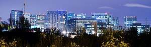  .jpg) .jpg) .jpg) .jpg) _(cropped).jpeg) Top to bottom, left to right: Downtown San Jose skyline, Hotel De Anza, Bank of Italy Building, San José City Hall, Hotel Valencia at Santana Row; Lick Observatory on Mount Hamilton | |
 Flag  Seal | |
| Motto(s): The Capital of Silicon Valley | |
 Shown within Santa Clara County | |
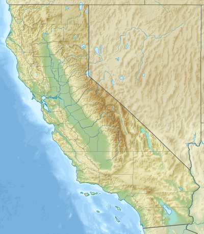 San Jose Location within California  San Jose Location within the United States  San Jose Location within North America | |
| Coordinates: 37°20′N 121°54′W | |
| Country | |
| State | |
| County | |
| Region | San Francisco Bay Area |
| Metro | San Jose-Sunnyvale-Santa Clara |
| CSA | San Jose-San Francisco-Oakland |
| Pueblo founded | November 29, 1777 |
| Founded as | Pueblo de San José de Guadalupe |
| Incorporated | March 27, 1850[1] |
| Named for | Saint Joseph |
| Government | |
| • Type | Council–manager[2] |
| • Body | San Jose City Council |
| • Mayor | Sam Liccardo[3] (D) |
| • Assemblymembers[4] | List
|
| Area | |
| • City | 180.52 sq mi (467.55 km2) |
| • Land | 177.51 sq mi (459.75 km2) |
| • Water | 3.01 sq mi (7.80 km2) 1.91% |
| • Urban | 342.27 sq mi (741.03 km2) |
| • Metro | 2,694.61 sq mi (6,979 km2) |
| Elevation | 82 ft (25 m) |
| Lowest elevation | 0 ft (0 m) |
| Population (2010) | |
| • City | 945,942 |
| • Estimate (2018)[8] | 1,030,119 |
| • Rank | 3rd in California[9] 10th in the United States |
| • Density | 5,776.3/sq mi (2,230.24/km2) |
| • Urban | 1,894,389 (29th) |
| • Metro | 1,998,463 (34th) |
| • CSA | 8,837,789 (5th) |
| Demonym(s) | San Josean(s) Josefino/a(s) |
| Time zone | UTC−8 (Pacific Time Zone) |
| • Summer (DST) | UTC−7 (Pacific Daylight Time) |
| ZIP codes | List
|
| Area code(s) | 408/669 |
| FIPS code | 06-68000 |
| GNIS feature IDs | 1654952, 2411790 |
| Website | www |
San Jose is a global city,[21] notable as a center of innovation, for its affluence,[22][23][24] Mediterranean climate, and extremely high cost of living.[25] San Jose's location within the booming high tech industry, as a cultural, political, and economic center has earned the city the nickname "Capital of Silicon Valley". San Jose is one of the wealthiest major cities in the United States and the world, and has the third highest GDP per capita in the world (after Zürich, Switzerland and Oslo, Norway), according to the Brookings Institution.[26] The San Jose Metropolitan Area has the most millionaires and the most billionaires in the United States per capita.[27] With a median home price of $1,085,000,[28] San Jose has the most expensive housing market in the country and the fifth most expensive housing market in the world, according to the 2017 Demographia International Housing Affordability Survey.[29][30][31][32] Major global tech companies including Cisco Systems, eBay, Adobe Systems, PayPal, Broadcom, Samsung, Acer, Hewlett Packard Enterprise, and Zoom maintain their headquarters in San Jose, in the center of Silicon Valley.
Before the arrival of the Spanish, the area around San Jose was inhabited by the Tamien nation of the Ohlone peoples of California. San Jose was founded on November 29, 1777, as the Pueblo de San José de Guadalupe, the first city founded in the Californias.[33] It then became a part of Mexico in 1821 after the Mexican War of Independence. Following the American Conquest of California during the Mexican–American War, the territory was ceded to the United States in 1848. After California achieved statehood two years later, San Jose became the state's first capital.[34] Following World War II, San Jose experienced an economic boom, with a rapid population growth and aggressive annexation of nearby cities and communities carried out in the 1950s and 1960s. The rapid growth of the high-technology and electronics industries further accelerated the transition from an agricultural center to an urbanized metropolitan area. Results of the 1990 U.S. Census indicated that San Jose had officially surpassed San Francisco as the most populous city in Northern California.[35] By the 1990s, San Jose and the rest of Silicon Valley had become the global center for the high tech and internet industries, making it California's fastest-growing economy.[36]
History

.svg.png)

.svg.png)
Pre-Columbian period
The Santa Clara Valley has been home to the Tamyen group of the Ohlone people since around 4,000 BC.[37][38][39] The Tamyen spoke Tamyen language of the Ohlone language family. With the Spanish colonization of California, the majority of the Tamyen came to inhabit Mission Santa Clara de Asís and Mission San José.[40]
Spanish period
.jpg)
.jpg)
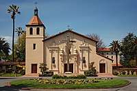
California was claimed as part of the Spanish Empire in 1542, when explorer Juan Rodríguez Cabrillo charted the Californian coast. During this time, California and Baja California were administered together as Province of the California (Spanish: Provincia de las California). For nearly 200 years, the Californias were sparsely populated and largely ignored by the government of the Viceroyalty of New Spain in Mexico City. Only in 1769 was Northern California finally surveyed by Spanish authorities, with the Portolá Expedition.[41]
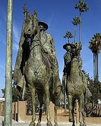
In 1776, the Californias were included as part of the Captaincy General of the Provincias Internas, a large administrative division created by José de Gálvez, Spanish Minister of the Indies, in order to provide greater autonomy for the Spanish Empire's lightly populated and largely ungoverned borderlands. That year, King Carlos III of Spain approved an expedition by Juan Bautista de Anza to survey the San Francisco Bay Area, in order to choose the sites for two future settlements and their accompanying mission. First he chose the site for a military settlement in San Francisco, for the Royal Presidio of San Francisco, and Mission San Francisco de Asís. On his way back to Mexico from San Francisco, de Anza chose the sites in Santa Clara Valley for a civilian settlement, San Jose, on the eastern bank of the Guadalupe River, and a mission on its western bank, Mission Santa Clara de Asís.[42]
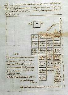
San Jose was officially founded as California's first civilian settlement on November 29, 1777, as the Pueblo de San José de Guadalupe by José Joaquín Moraga, under orders of Antonio María de Bucareli y Ursúa, Viceroy of New Spain.[43] San Jose served as a strategic settlement along El Camino Real, connecting the military fortifications at the Monterey Presidio and the San Francisco Presidio, as well as the California mission network.[44] In 1791, due to the severe flooding which characterized the pueblo, San Jose's settlement was moved approximately a mile south, centered on the Pueblo Plaza (modern-day Plaza de César Chávez).[45]
In 1800, due to the growing population in the northern part of the Californias, Diego de Borica, Governor of the Californias, officially split the province into two parts: Alta California (Upper California), which would eventually become a U.S. state, and Baja California (Lower California), which would eventually become two Mexican states.
Mexican period
San Jose became part of the First Mexican Empire in 1821, after Mexico's War of Independence was won against the Spanish Crown, and in 1824, part of the First Mexican Republic. With its newfound independence, and the triumph of the republican movement, Mexico set out to diminish the Catholic Church's power within Alta California by secularizing the California missions in 1833.
In 1824, in order to promote settlement and economic activity within sparsely populated California, the Mexican government began an initiative, for Mexican and foreign citizens alike, to settle unoccupied lands in California. Between 1833 and 1845, thirty-eight rancho land grants were issued in the Santa Clara Valley, 15 of which were located within modern day San Jose's borders. Numerous prominent historical figures were among those granted rancho lands in the Santa Valley, including James A. Forbes, founder of Los Gatos, California (granted Rancho Potrero de Santa Clara), Antonio Suñol, Alcalde of San Jose (granted Rancho Los Coches), and José María Alviso, Alcalde of San Jose (granted Rancho Milpitas).
In 1835, San Jose's population of approximately 700 people included 40 foreigners, primarily Americans and Englishmen. By 1845, the population of the pueblo had increased to 900, primarily due to American immigration. Foreign settlement in San Jose and California was rapidly changing Californian society, bringing expanding economic opportunities and foreign culture.[46]
By 1846, native Californios had long expressed their concern for the overrunning of California society by its growing and wealthy Anglo-American community.[47] On July 11, 1846, with the onset of the Mexican–American War, Captain Thomas Fallon conquered San Jose in the name of the Bear Flag Revolt for the California Republic, officially ending Mexican rule in Alta California.
American period

By the end of 1847, the Conquest of California by the United States was complete, as the Mexican–American War came to an end.[38] In 1848, the Treaty of Guadalupe Hidalgo formally ceded California to the United States, as part of the Mexican Cession. On December 15, 1849, San Jose became the capital of the unorganized territory of California. With California's Admission to the Union on September 9, 1850, San Jose became the state's first capital.[48]
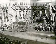
On March 27, 1850, San Jose was incorporated. It was incorporated on the same day as San Diego and Benicia; together, these three cities followed Sacramento as California's earliest incorporated cities.[49] Josiah Belden, who had settled in California in 1842 after traversing the California Trail as part of the Bartleson Party and later acquired a fortune, was the city's first mayor.[50] San Jose was briefly California's first state capital; legislators met in the city from 1849 to 1851. (Monterey was the capital during the period of Spanish California and Mexican California).[51] The first capitol no longer exists; the Plaza de César Chávez now lies on the site, which has two historical markers indicating where California's state legislature first met.[52]
In the period 1900 through 1910, San Jose served as a center for pioneering invention, innovation, and impact in both lighter-than-air and heavier-than-air flight. These activities were led principally by John Montgomery and his peers. The City of San Jose has established Montgomery Park, a Monument at San Felipe and Yerba Buena Roads, and John J. Montgomery Elementary School in his honor. During this period, San Jose also became a center of innovation for the mechanization/industrialization of agricultural and food processing equipment.[53]
Though not affected as severely as San Francisco, San Jose also suffered significant damage from the 1906 San Francisco earthquake. Over 100 people died at the Agnews Asylum (later Agnews State Hospital) after its walls and roof collapsed,[54] and San Jose High School's three-story stone-and-brick building was also destroyed. The period during World War II was a tumultuous time. Japanese Americans primarily from Japantown were sent to internment camps, including the future mayor Norman Mineta. Following the Los Angeles zoot suit riots, anti-Mexican violence took place during the summer of 1943. In 1940, the Census Bureau reported San Jose's population as 98% white.[55]
As World War II started, the city's economy shifted from agriculture (the Del Monte cannery was the largest employer and closed in 1999[56]) to industrial manufacturing with the contracting of the Food Machinery Corporation (later known as FMC Corporation) by the United States War Department to build 1,000 Landing Vehicle Tracked.[57] After World War II, FMC (later United Defense, and currently BAE Systems) continued as a defense contractor, with the San Jose facilities designing and manufacturing military platforms such as the M113 Armored Personnel Carrier, the Bradley Fighting Vehicle, and various subsystems of the M1 Abrams battle tank.[58]
IBM established its West Coast headquarters in San Jose in 1943 and opened a downtown research and development facility in 1952. Both would prove to be harbingers for the economy of San Jose, as Reynold Johnson and his team would later invent RAMAC, as well as the hard disk drive, and the technological side of San Jose's economy grew.[59]
The Ford Motor Company relocated its factory in Richmond to a new location in the suburb of Milpitas, called the San Jose Assembly Plant, which was one of the primary locations for manufacturing the Ford Mustang.
During the 1950s and 1960s, City Manager A. P. "Dutch" Hamann led the city in a major growth campaign. The city annexed adjacent areas, such as Alviso and Cambrian Park, providing large areas for suburbs. An anti-growth reaction to the effects of rapid development emerged in the 1970s, championed by mayors Norman Mineta and Janet Gray Hayes. Despite establishing an urban growth boundary, development fees, and the incorporations of Campbell and Cupertino, development was not slowed, but rather directed into already-incorporated areas.[57]
On April 3, 1979, the San Jose City Council adopted San José, with the diacritical mark on the "e", as the spelling of the city name on the city seal, official stationery, office titles and department names.[60] Also, by city council convention, this spelling of San José is used when the name is stated in mixed upper- and lower-case letters, but not when the name is stated only in upper-case letters. The accent reflects the Spanish version of the name, and the dropping of accents in all-capital writing was typical in Spanish. While San José is commonly spelled both with and without the acute accent over the "e", the city's official guidelines indicate that it should be spelled with the accent most of the time and sets forth narrow exceptions, such as when the spelling is in URLs, when the name appears in all-capital letters, when the name is used on social media sites where the diacritical mark does not render properly, and where San Jose is part of the proper name of another organization or business, such as San Jose Silicon Valley Chamber of Commerce, that has chosen not to use the accent-marked name.[61][62] The 1965 city charter, as amended, states the name of the municipality as City of San José, with the accent mark.[63] The city's website appears to use a mixture of both; for example, the "City of San José" in the text uses the mark but the "City of San Jose" logo image does not.[64]
San Jose's position in Silicon Valley triggered further economic and population growth. Results from the 1990 U.S. Census indicated that San Jose surpassed San Francisco as the most populous city in the Bay Area for the first time.[35] This growth led to the highest housing-cost increase in the nation, 936% between 1976 and 2001.[65] Efforts to increase density continued into the 1990s when an update of the 1974 urban plan kept the urban growth boundaries intact and voters rejected a ballot measure to ease development restrictions in the foothills. Sixty percent of the housing built in San Jose since 1980 and over three-quarters of the housing built since 2000 have been multifamily structures, reflecting a political propensity toward Smart Growth planning principles.[66]
Geography
San Jose is located at 37°20′07″N 121°53′31″W. According to the United States Census Bureau, the city has a total area of 180.0 sq mi (466 km2), of which 3.4 sq mi (8.8 km2) (1.91%) is water, making it the fourth-largest California city by land area (after Los Angeles, San Diego and California City).[12]
San Jose lies between the San Andreas Fault, the source of the 1989 Loma Prieta earthquake, and the Calaveras Fault. San Jose is shaken by moderate earthquakes on average one or two times a year. These quakes originate just east of the city on the creeping section of the Calaveras Fault, which is a major source of earthquake activity in Northern California. On April 14, 1984, at 1:15 pm local time, a 6.2 magnitude earthquake struck the Calaveras Fault near San Jose's Mount Hamilton.[67] The most serious earthquake, in 1906, damaged many buildings in San Jose as described earlier. Earlier significant quakes rocked the city in 1839, 1851, 1858, 1864, 1865, 1868, and 1891. The Daly City Earthquake of 1957 caused some damage. The Loma Prieta earthquake of 1989 also did some damage to parts of the city. The other faults near San Jose are the Monte Vista Fault and the Hayward Fault Zone.
Places adjacent to San Jose, California | ||||||||||
|---|---|---|---|---|---|---|---|---|---|---|
| ||||||||||
Cityscape
.jpg)
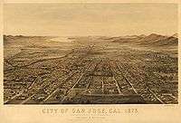
San Jose's expansion was made by the design of "Dutch" Hamann, the City Manager from 1950 to 1969. During his administration, with his staff referred to as "Dutch's Panzer Division", the city annexed property 1,389 times,[68] growing the city from 17 to 149 square miles (44 to 386 km2),[69] absorbing the communities named above, changing their status to "neighborhoods."
They say San José is going to become another Los Angeles. Believe me, I'm going to do everything in my power to make that come true.
— "Dutch" Hamann, 1965[70]
Sales taxes were a chief source of revenue. Hamann would determine where major shopping areas would be, and then annex narrow bands of land along major roadways leading to those locations, pushing tentacles across the Santa Clara Valley and, in turn, walling off the expansion of adjacent communities.[71]
During his reign, it was said the City Council would vote according to Hamann's nod. In 1963, the State of California imposed Local Agency Formation Commissions statewide, but largely to try to maintain order with San Jose's aggressive growth. Eventually the political forces against growth grew as local neighborhoods bonded together to elect their own candidates, ending Hamann's influence and leading to his resignation.[72] While the job was not complete, the trend was set. The city had defined its sphere of influence in all directions, sometimes chaotically leaving unincorporated pockets to be swallowed up by the behemoth, sometimes even at the objection of the residents.[68]
Major thoroughfares in the city include Monterey Road, the Stevens Creek Boulevard/San Carlos Street corridor, Santa Clara Street/Alum Rock Avenue corridor, Almaden Expressway, Capitol Expressway, and 1st Street (San Jose).
Topography
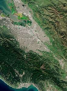
The Guadalupe River runs from the Santa Cruz Mountains (which separate the South Bay from the Pacific Coast) flowing north through San Jose, ending in the San Francisco Bay at Alviso. Along the southern part of the river is the neighborhood of Almaden Valley, originally named for the mercury mines which produced mercury needed for gold extraction from quartz during the California Gold Rush as well as mercury fulminate blasting caps and detonators for the U.S. military from 1870 to 1945.[73] East of the Guadalupe River, Coyote Creek also flows to south San Francisco Bay and originates on Mount Sizer near Henry W. Coe State Park and the surrounding hills in the Diablo Range, northeast of Morgan Hill, California.
The lowest point in San Jose is 13 feet (4.0 m) below sea level at the San Francisco Bay in Alviso;[74] the highest is 2,125 feet (648 m).[75] Because of the proximity to Lick Observatory atop Mount Hamilton, San Jose has taken several steps to reduce light pollution, including replacing all street lamps and outdoor lighting in private developments with low pressure sodium lamps.[76] To recognize the city's efforts, the asteroid 6216 San Jose was named after the city.[77]
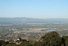
San Jose lies close to the Pacific Ocean and a small portion of its northern border touches San Francisco Bay. Santa Clara Valley is the population center of the Bay Area and, like the hub and spokes of a wheel, surrounding communities emanate outwards from the valley. This growth, in part, has shaped the greater Bay Area as it is today in terms of geographic population distribution and the trend of suburbanization away from the valley.
There are four distinct valleys in the city of San Jose: Almaden Valley, situated on the southwest fringe of the city; Evergreen Valley to the southeast, which is hilly all throughout its interior; Santa Clara Valley, which includes the flat, main urban expanse of the South Bay; and the rural Coyote Valley, to the city's extreme southern fringe.[78]
Climate
San Jose, like most of the Bay Area, has a warm-summer Mediterranean climate (Köppen Csb), bordering very closely on a hot-summer Mediterranean climate (Köppen Csa).[79], with warm to hot, dry summers and mild to cool, wet winters. San Jose has an average of 301 days of sunshine and an annual mean temperature of 60.5 °F (15.8 °C). It lies inland, surrounded on three sides by mountains, and does not front the Pacific Ocean like San Francisco. As a result, the city is somewhat more sheltered from rain, giving it a semiarid feel with a mean annual rainfall of 15.82 inches or 401.8 millimetres, compared to some other parts of the Bay Area, which can receive about three times that amount.
Like most of the Bay Area, San Jose is made up of dozens of microclimates. Because of a more prominent rain shadow from the Santa Cruz Mountains, Downtown San Jose experiences the lightest rainfall in the city, while South San Jose, only 10 mi (16 km) distant, experiences more rainfall, and somewhat more extreme temperatures.
The monthly daily average temperature ranges from around 50 °F (10 °C) in December and January to around 70 °F (21.1 °C) in July and August.[80] The highest temperature ever recorded in San Jose was 109 °F (42.8 °C) on June 14, 2000; the lowest was 19 °F (−7.2 °C) on December 22–23, 1990. On average, there are 2.7 mornings annually where the temperature drops to, or below, the freezing mark; and sixteen afternoons where the high reaches or exceeds 90 °F or 32.2 °C. Diurnal temperature variation is far wider than along the coast or in San Francisco but still a shadow of what is seen in the Central Valley.
| Climate data for San Jose, California (1981–2010 normals, extremes 1893–present) | |||||||||||||
|---|---|---|---|---|---|---|---|---|---|---|---|---|---|
| Month | Jan | Feb | Mar | Apr | May | Jun | Jul | Aug | Sep | Oct | Nov | Dec | Year |
| Record high °F (°C) | 79 (26) |
81 (27) |
89 (32) |
95 (35) |
102 (39) |
109 (43) |
108 (42) |
105 (41) |
108 (42) |
101 (38) |
85 (29) |
79 (26) |
109 (43) |
| Mean maximum °F (°C) | 69.7 (20.9) |
73.2 (22.9) |
83.4 (28.6) |
86.3 (30.2) |
90.1 (32.3) |
92.3 (33.5) |
93.1 (33.9) |
94.3 (34.6) |
98.7 (37.1) |
91.2 (32.9) |
79.5 (26.4) |
69.2 (20.7) |
101.3 (38.5) |
| Average high °F (°C) | 59.8 (15.4) |
63.8 (17.7) |
66.8 (19.3) |
70.1 (21.2) |
75.4 (24.1) |
80.6 (27.0) |
83.4 (28.6) |
82.6 (28.1) |
81.8 (27.7) |
75.9 (24.4) |
67.5 (19.7) |
61.2 (16.2) |
72.4 (22.5) |
| Daily mean °F (°C) | 51.1 (10.6) |
54.5 (12.5) |
56.9 (13.8) |
59.3 (15.2) |
64.0 (17.8) |
68.3 (20.2) |
70.9 (21.6) |
70.7 (21.5) |
69.2 (20.7) |
64.3 (17.9) |
57.0 (13.9) |
51.7 (10.9) |
61.5 (16.4) |
| Average low °F (°C) | 42.3 (5.7) |
45.2 (7.3) |
47.0 (8.3) |
48.5 (9.2) |
52.6 (11.4) |
56.1 (13.4) |
58.4 (14.7) |
58.7 (14.8) |
56.7 (13.7) |
52.6 (11.4) |
46.4 (8.0) |
42.2 (5.7) |
50.6 (10.3) |
| Mean minimum °F (°C) | 33.4 (0.8) |
36.4 (2.4) |
39.1 (3.9) |
42.3 (5.7) |
47.2 (8.4) |
50.2 (10.1) |
53.2 (11.8) |
53.8 (12.1) |
52.1 (11.2) |
47.3 (8.5) |
38.3 (3.5) |
33.1 (0.6) |
31.0 (−0.6) |
| Record low °F (°C) | 18 (−8) |
24 (−4) |
25 (−4) |
26 (−3) |
32 (0) |
33 (1) |
40 (4) |
39 (4) |
35 (2) |
30 (−1) |
21 (−6) |
19 (−7) |
18 (−8) |
| Average rainfall inches (mm) | 2.99 (76) |
3.32 (84) |
2.04 (52) |
1.06 (27) |
0.39 (9.9) |
0.09 (2.3) |
0.00 (0.00) |
0.00 (0.00) |
0.23 (5.8) |
0.78 (20) |
1.88 (48) |
2.12 (54) |
14.9 (379) |
| Average rainy days (≥ 0.01 in) | 10.2 | 10.3 | 9.4 | 5.6 | 3.2 | 0.8 | 0.2 | 0.3 | 1.3 | 3.2 | 7.2 | 10.2 | 61.9 |
| Source: NOAA[81][82][83] | |||||||||||||
With the light rainfall, San Jose and its suburbs experience about 300 fully or partly sunny days a year. Rain occurs primarily in the months from November through April. During the winter and spring, hillsides and fields turn green with grasses and vegetation, although deciduous trees are few. With the coming of the annual hot summer dry period, the vegetation dies and dries, giving the hills a golden cover which, unfortunately, also provides fuel for grass fires.
Measurable precipitation falls in downtown San Jose on an average of 59 days a year. "Rain year" precipitation has ranged from 4.83 inches (122.7 mm) between July 1876 and June 1877 to 30.30 inches (769.6 mm) between July 1889 and June 1890, although at the current site since 1893 the range is from 5.77 inches (146.6 mm) in "rain year" 1975–76 to 30.25 inches (768.3 mm) in "rain year" 1982–83. The most precipitation in one month was 12.38 inches (314.5 mm) in January 1911. The maximum 24-hour rainfall was 3.60 inches (91.4 mm) on January 30, 1968. Although summer is normally quite dry in San Jose, occasional summer monsoon storms from Arizona can bring unusual thunderstorms and high humidity to the area. In fact, a very heavy thunderstorm on August 21, 1968, brought 1.92 inches (48.8 mm) of rain, causing some flooding.
The snow level drops as low as 4,000 ft (1,220 m) above sea level, or lower, occasionally coating nearby Mount Hamilton and, less frequently, the Santa Cruz Mountains, with snow that normally lasts a few days. Snow will snarl traffic traveling on State Route 17 towards Santa Cruz. Snow rarely falls in San Jose; the most recent snow to remain on the ground was on February 5, 1976, when many residents around the city saw as much as 3 inches (0.076 m) on car and roof tops. The official observation station measured only 0.5 inches (0.013 m) of snow.[84]
Neighborhoods and districts
The city is generally divided into the following areas: Downtown San Jose, Central, West San Jose, North San Jose, East San Jose, and South San Jose. Many of these regions were originally unincorporated communities or separate municipalities that were later annexed by the city.
Besides those mentioned above, some well-known communities within San Jose include Japantown, Rose Garden, Midtown San Jose, Willow Glen, Naglee Park, Burbank, Winchester, Alviso, East Foothills, Alum Rock, Communications Hill, Little Portugal, Blossom Valley, Cambrian, Almaden Valley, Silver Creek Valley, Evergreen Valley, Edenvale, Santa Teresa, Seven Trees, Coyote Valley, and Berryessa. A distinct ethnic enclave in San Jose is the Washington-Guadalupe neighborhood, immediately south of the SoFA District; this neighborhood is home to a community of Hispanics, centered on Willow Street.
 Almaden Valley
 The Alameda
.jpeg) Alviso
Alviso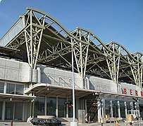 Berryessa
.jpg) Downtown San Jose
Downtown San Jose Evergreen
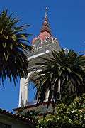 Little Portugal
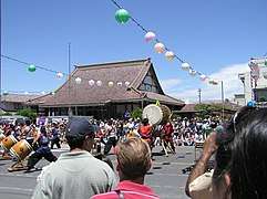 Japantown
.jpg) Midtown San Jose
Midtown San Jose_(cropped)_(cropped).jpeg) North San Jose Innovation District
North San Jose Innovation District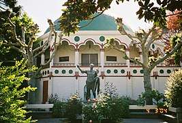 Rose Garden
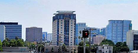 San Pedro Square
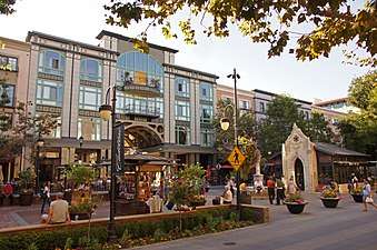
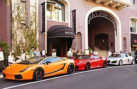 Santana Row
.jpg) College Park
College Park.jpg) Willow Glen
Willow Glen.jpg) Silver Creek Valley
Silver Creek Valley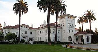 Edenvale
.jpg) Communications Hill
Communications Hill.jpg) Naglee Park
Naglee Park Alum Rock
 SoFA District
.jpg) Palm Haven
Palm Haven
Parks
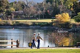
San Jose possesses about 15,950 acres (6,455 ha) of parkland in its city limits, including a part of the expansive Don Edwards San Francisco Bay National Wildlife Refuge. The city's oldest park is Alum Rock Park, established in 1872.[85] In its 2013 ParkScore ranking, The Trust for Public Land, a national land conservation organization, reported that San Jose was tied with Albuquerque and Omaha for having the 11th best park system among the 50 most populous U.S. cities.[86]
- Almaden Quicksilver County Park, 4,147 acres (16.78 km2) of former mercury mines in South San Jose (operated and maintained by the Santa Clara County Parks and Recreation Department).
- Alum Rock Park, 718 acres (2.91 km2) in East San Jose, the oldest municipal park in California and one of the largest municipal parks in the United States.
- Children's Discovery Museum hosts an outdoor park-like setting, featuring the world's largest permanent Monopoly game, per the Guinness Book of World Records.[87] Caretakers for this attraction include the 501(c)3 non-profit group Monopoly in the Park.
- Circle of Palms Plaza, a ring of palm trees surrounding a California state seal and historical landmark at the site of the first state capitol
- Emma Prusch Farm Park, 43.5 acres (17.6 hectares) in East San Jose. Donated by Emma Prusch to demonstrate the valley's agricultural past, it includes a 4-H barn (the largest in San Jose), community gardens, a rare-fruit orchard, demonstration gardens, picnic areas, and expanses of lawn.[88]
- Field Sports Park, Santa Clara County's only publicly owned firing range, located in south San Jose[89]
- Iris Chang Park, located in North San Jose is dedicated to the memory of Iris Shun-Ru Chang, author of the Rape of Nanking and a San Jose resident.
- Kelley Park, including diverse facilities such as Happy Hollow Park & Zoo (a child-centric amusement park), the Japanese Friendship Garden (Kelley Park), History Park at Kelley Park, and the Portuguese Historical Museum within the history park
- Martial Cottle Park, a former agricultural farm, in South San Jose. Operated by Santa Clara County Parks and Recreation Department
- Oak Hill Memorial Park, California's oldest secular cemetery
- Overfelt Gardens, including the Chinese Cultural Garden
- Plaza de César Chávez, a small park in Downtown, hosts outdoor concerts and the Christmas in the Park display
- Raging Waters, water park with water slides and other water attractions. This sits within Lake Cunningham Park
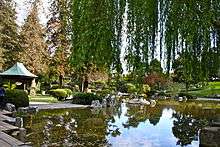
- Rosicrucian Park, nearly an entire city block in the Rose Garden neighborhood; the Park offers a setting of Egyptian and Moorish architecture set among lawns, rose gardens, statuary, and fountains, and includes the Rosicrucian Egyptian Museum, Planetarium, Research Library, Peace Garden and Visitors Center
- San Jose Municipal Rose Garden, 5 1⁄2 acres (22,000 m2) park in the Rose Garden neighborhood, featuring over 4,000 rose bushes
Trails
A 2011 study by Walk Score ranked San Jose the nineteenth most walkable of fifty largest cities in the United States.[90]
San Jose's trail network of 60 miles (100 km) of recreational and active transportation trails throughout the city.[91] The major trails in the network include:
- Coyote Creek Trail
- Guadalupe River Trail
- Los Gatos Creek Trail
- Los Alamitos Creek Trail
- Penitencia Creek Trail
- Silver Creek Valley Trail
This large urban trail network, recognized by Prevention Magazine as the nation's largest, is linked to trails in surrounding jurisdictions and many rural trails in surrounding open space and foothills. Several trail systems within the network are designated as part of the National Recreation Trail, as well as regional trails such as the San Francisco Bay Trail and Bay Area Ridge Trail.
Wildlife
Early written documents record the local presence of migrating salmon in the Rio Guadalupe dating as far back as the 18th century.[92] Both steelhead (Oncorhynchus mykiss) and King salmon are extant in the Guadalupe River, making San Jose the southernmost major U. S. city with known salmon spawning runs, the other cities being Anchorage, Alaska; Seattle, Washington; Portland, Oregon and Sacramento, California.[93] Runs of up to 1,000 Chinook or King Salmon (Oncorhynchus tshawytscha) swam up the Guadalupe River each fall in the 1990s, but have all but vanished in the current decade apparently blocked from access to breeding grounds by impassable culverts, weirs and wide, exposed and flat concrete paved channels installed by the Santa Clara Valley Water District.[94] In 2011 a small number of Chinook salmon were filmed spawning under the Julian Street bridge.[95]
Longtime San Jose resident and conservationist, Roger Castillo, who discovered the remains of a mammoth on the banks of the Guadalupe River in 2005, recently found that a herd of tule elk (Cervus canadensis) has recolonized the hills of south San Jose east of Highway 101.[96]
At the southern edge of San José, Coyote Valley is a corridor for wildlife migration between the Santa Cruz Mountains and the Diablo Range.[97][98]
Demographics
| Historical population | |||
|---|---|---|---|
| Census | Pop. | %± | |
| 1870 | 9,089 | — | |
| 1880 | 12,567 | 38.3% | |
| 1890 | 18,060 | 43.7% | |
| 1900 | 21,500 | 19.0% | |
| 1910 | 28,946 | 34.6% | |
| 1920 | 39,642 | 37.0% | |
| 1930 | 57,651 | 45.4% | |
| 1940 | 68,457 | 18.7% | |
| 1950 | 95,280 | 39.2% | |
| 1960 | 204,196 | 114.3% | |
| 1970 | 459,913 | 125.2% | |
| 1980 | 629,400 | 36.9% | |
| 1990 | 782,248 | 24.3% | |
| 2000 | 894,943 | 14.4% | |
| 2010 | 945,942 | 5.7% | |
| Est. 2018 | 1,030,119 | [8] | 8.9% |
| U.S. Decennial Census[99] | |||
In 2014, the U.S. Census Bureau released its new population estimates. With a total population of 1,015,785,[100] San Jose became the 11th U.S. city to hit the 1 million mark, even though it is currently the 10th most populous city.
| Racial composition | 2010[101] | 1990[55] | 1970[55] | 1940[55] |
|---|---|---|---|---|
| White | 42.8% | 62.8% | 93.6% | 98.5% |
| —Non-Hispanic | 28.7% | 49.6% | 75.7%[102] | n/a |
| Black or African American | 3.2% | 4.7% | 2.5% | 0.4% |
| Hispanic or Latino (of any race) | 33.2% | 26.6% | 19.1%[102] | n/a |
| Asian | 32.0% | 19.5% | 2.7% | 1.1% |
| Other race | 15.7% | 12.3% | 0.8% | (X) |
| Two or more races | 5.0% | n/a | n/a | n/a |
2010
The 2010 United States Census[103] reported that San Jose had a population of 945,942. The population density was 5,256.2 people per square mile (2,029.4/km²). The racial makeup of San Jose was 404,437 (42.8%) White, 303,138 (32.0%) Asian (10.4% Vietnamese, 6.7% Chinese, 5.6% Filipino, 4.6% Indian, 1.2% Korean, 1.2% Japanese, 0.3% Cambodian, 0.2% Thai, 0.2% Pakistani, 0.2% Laotian), 30,242 (3.2%) African American, 8,297 (0.9%) Native American, 4,017 (0.4%) Pacific Islander, 148,749 (15.7%) from other races, and 47,062 (5.0%) from two or more races. There were 313,636 residents of Hispanic or Latino background (33.2%). 28.2% of the city's population was of Mexican descent; the next largest Hispanic groups were those of Salvadoran (0.7%) and Puerto Rican (0.5%) heritage. Non-Hispanic Whites were 28.7% of the population in 2010,[104] down from 75.7% in 1970.[55]
The census reported that 932,620 people (98.6% of the population) lived in households, 9,542 (1.0%) lived in non-institutionalized group quarters, and 3,780 (0.4%) were institutionalized. There were 301,366 households, out of which 122,958 (40.8%) had children under the age of 18 living in them, 162,819 (54.0%) were opposite-sex married couples living together, 37,988 (12.6%) had a female householder with no husband present, 18,702 (6.2%) had a male householder with no wife present. There were 16,900 (5.6%) unmarried opposite-sex partnerships, and 2,458 (0.8%) same-sex married couples or partnerships. 59,385 households (19.7%) were made up of individuals and 18,305 (6.1%) had someone living alone who was 65 years of age or older. The average household size was 3.09. There were 219,509 families (72.8% of all households); the average family size was 3.54.
The age distribution of the city was as follows: 234,678 people (24.8%) were under the age of 18, 89,457 people (9.5%) aged 18 to 24, 294,399 people (31.1%) aged 25 to 44, 232,166 people (24.5%) aged 45 to 64, and 95,242 people (10.1%) who were 65 years of age or older. The median age was 35.2 years. For every 100 females, there were 101.1 males. For every 100 females age 18 and over, there were 99.8 males.
There were 314,038 housing units at an average density of 1,745.0 per square mile (673.7/km²), of which 176,216 (58.5%) were owner-occupied, and 125,150 (41.5%) were occupied by renters. The homeowner vacancy rate was 1.6%; the rental vacancy rate was 4.3%. 553,436 people (58.5% of the population) lived in owner-occupied housing units and 379,184 people (40.1%) lived in rental housing units.
2000
.jpg)
As of the census[105] of 2000, there were 894,943 people, 276,598 households, and 203,576 families residing in the city.
The population density was 5,117.9 people per square mile (1,976.1/km²). There were 281,841 housing units at an average density of 1,611.8 per square mile (622.3/km²). Of the 276,598 households, 38.3% had children under the age of 18 living with them, 56.0% were married couples living together, 11.7% had a female householder with no husband present, and 26.4% were non-families. 18.4% of all households were made up of individuals and 4.9% had someone living alone who was 65 years of age or older. The average household size was 3.20 and the average family size was 3.62.
In the city, the age distribution of the population shows 26.4% under the age of 18, 9.9% from 18 to 24, 35.4% from 25 to 44, 20.0% from 45 to 64, and 8.3% who were 65 years of age or older. The median age was 33 years. For every 100 females, there were 103.3 males. For every 100 females age 18 and over, there were 102.5 males.
According to a 2007 estimate, the median income for a household in the city was the highest in the U.S. for any city with more than a quarter million residents with $76,963 annually. The median income for a family was $86,822.[106] Males had a median income of $49,347 versus $36,936 for females. The per capita income for the city was $26,697. About 6.0% of families and 8.8% of the population were below the poverty line, including 10.3% of those under age 18 and 7.4% of those age 65 or over.
Economy
_(cropped).jpg)
.jpg)
The cost of living in San Jose and the surrounding areas is among the highest in California and the nation, according to 2004 data.[107] Housing costs are the primary reason for the high cost of living, although the costs in all areas tracked by the ACCRA Cost of Living Index are above the national average. Households in the city limits have the highest disposable income of any city in the U.S. with over 500,000 residents.[108][109]
San Jose holds the distinction of being a United States Foreign-Trade Zone. The City received its Foreign Trade Zone grant from the U.S. Federal Government in 1974, making it the 18th foreign-trade zone established in the United States. Under its grant, the City of San Jose is granted jurisdiction to oversee and administer foreign trade in Santa Clara County, Monterey County, San Benito County, Santa Cruz County, and in the southern parts of San Mateo County and Alameda County.[110]
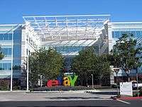
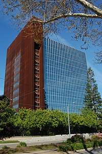
San Jose lists many companies with 1,000 employees or more, including the headquarters of Adobe, Altera, Brocade Communications Systems, Cadence Design Systems, Cisco Systems, eBay, Lee's Sandwiches, Lumileds, PayPal, Rosendin Electric, Sanmina-SCI, and Xilinx, as well as major facilities for Becton Dickinson, Ericsson, Hewlett-Packard, Hitachi, IBM, Kaiser Permanente, KLA Tencor, Lockheed Martin, Nippon Sheet Glass, Qualcomm, and AF Media Group. The North American headquarters of Samsung Semiconductor are located in San Jose.[111][112] Approximately 2000 employees will work at the new Samsung campus which opened in 2015.
Other large companies based in San Jose include Altera, Atmel, CEVA, Cypress Semiconductor, Echelon, Extreme Networks, Harmonic, Integrated Device Technology, Maxim Integrated, Micrel, Move, Netgear, Novellus Systems, Oclaro, OCZ, Quantum, SunPower, Sharks Sports and Entertainment, Supermicro, Tessera Technologies, TiVo, Ultratech, and VeriFone. Sizable government employers include the city government, Santa Clara County, and San Jose State University.[113] Acer's United States division has its offices in San Jose.[114] Prior to its closing, Netcom had its headquarters in San Jose.[115][116]
On July 31, 2015, Cupertino-based Apple Inc. purchased a 40-acre site in San Jose. The site, which is bare land, will be the site of an office and research campus where it is estimated that up to 16,000 employees will be located. Apple paid $138.2 million for the site.[117] The seller, Connecticut-based Five Mile Capital Partners, paid $40 million for the site in 2010.[118] Real estate experts expect that other tech companies currently located in Silicon Valley will also follow in Apple's path by purchasing land or property in San Jose.[119]
Silicon Valley
The large concentration of high-technology engineering, computer, and microprocessor companies around San Jose has led the area to be known as Silicon Valley. Area schools such as the University of California, Berkeley, University of California, Santa Cruz, San Jose State University, San Francisco State University, California State University, East Bay, Santa Clara University, and Stanford University pump thousands of engineering and computer science graduates into the local economy every year.
San Jose residents produce more U.S. patents than any other city.[120] On October 15, 2015, the United States Patent and Trademark Office opened a satellite office in San Jose to serve Silicon Valley and the Western United States.[121][122] Thirty-five percent of all venture capital funds in the U.S. are invested in San Jose and Silicon Valley companies.[120] By April 2018, Google was in the process of planning the "biggest tech campus in Silicon Valley" in San Jose.[123]
In January 2014, Forbes Magazine reported that Careerbliss.com had ranked San Jose-Sunnyvale-Santa Clara metro area as the happiest place to work in the United States. The report cited a large concentration of technology jobs that typically offer a high salary and opportunity for growth, in addition to companies providing "fun and innovative work environments" as some of the reasons for the ranking.[124]
High economic growth during the tech bubble caused employment, housing prices, and traffic congestion to peak in the late 1990s. As the economy slowed in the early 2000s, employment and traffic congestion was somewhat diminished.[125] In the mid-2000s, traffic along major highways again began to worsen as the economy improved. San Jose had 405,000 jobs within its city limits in 2006, and an unemployment rate of 4.6%. In 2000, San Jose residents had the highest median household income of any city in the United States with a population over 300,000, and currently has the highest median income of any U.S. city with over 280,000 people.
On March 14, 2013, San Jose implemented a public wireless connection in the downtown area.[126]
"Data". www.wickedlyfastwifi.com. Retrieved May 15, 2019. Wireless access points were placed on outdoor light posts throughout the city.[127]
Media
San Jose is served by Greater Bay Area media. Print media outlets in San Jose include the San Jose Mercury News, the weekly Metro Silicon Valley, El Observador and the Silicon Valley / San Jose Business Journal. The Bay Area's NBC O&O, KNTV 11, is based in San Jose. In total, broadcasters in the Bay Area include 34 television stations, 25 AM radio stations, and 55 FM radio stations.[128]
In April 1909, Charles David Herrold, an electronics instructor in San Jose, constructed a radio station to broadcast the human voice. The station, "San Jose Calling" (call letters FN, later FQW), was the world's first radio station with scheduled programming targeted at a general audience. The station became the first to broadcast music in 1910. Herrold's wife Sybil became the first female "disk jockey" in 1912. The station changed hands a number of times before eventually becoming today's KCBS in San Francisco.[129] Therefore, KCBS technically is the oldest radio station in the United States, and celebrated its 100th anniversary in 2009 with much fanfare.
Top employers
As of June 30, 2017, the top employers in the city were:[130]
| No. | San Jose's Top Employers | Employees |
|---|---|---|
| 1 | County of Santa Clara | 17,800 |
| 2 | Cisco Systems | 14,000 |
| 3 | City of San Jose | 6,159 |
| 4 | PayPal | 3,000 |
| 5 | Western Digital | 3,000 |
| 6 | eBay | 3,000 |
| 7 | IBM | 2,750 |
| 8 | Kaiser Permanente | 2,500 |
| 9 | Adobe Systems, Inc. | 2,200 |
| 10 | Insight Global | 1,950 |
| 11 | Good Samaritan Hospital | 1,950 |
| 12 | Brocade Communications | 1,750 |
| 13 | Cadence Design Systems | 1,700 |
| 14 | Super Micro Computer, Inc. | 1,700 |
| 15 | Regional Medical Center | 1,600 |
Culture
Architecture
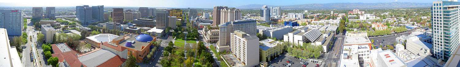
Because the downtown area is in the flight path to nearby Mineta San Jose International Airport (also evidenced in the above panoramic), there is a height limit for buildings in the downtown area, which is underneath the final approach corridor to the airport. The height limit is dictated by local ordinances, driven by the distance from the runway and a slope defined by Federal Aviation Administration regulations. Core downtown buildings are limited to approximately 300 feet (91 m) but can get taller farther from the airport.[131]
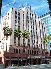
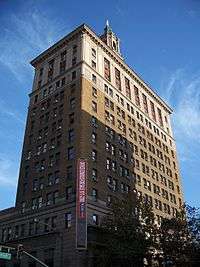
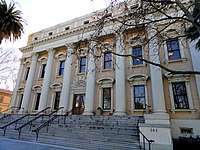
There has been broad criticism over the past few decades of the city's architecture.[132] Citizens have complained that San Jose is lacking in aesthetically pleasing architectural styles. Blame for this lack of architectural "beauty" can be assigned to the re-development of the downtown area from the 1950s onward, in which whole blocks of historic commercial and residential structures were demolished.[133] Exceptions to this include the Downtown Historic District, the Hotel De Anza, and the Hotel Sainte Claire, both of which are listed in the National Register of Historic Places for their architectural and historical significance.
.jpg)
Municipal building projects have experimented more with architectural styles than have most private enterprises.[134] The Children's Discovery Museum, Tech Museum of Innovation, and the San Jose Repertory Theater building have experimented with bold colors and unusual exteriors. The new City Hall, designed by Richard Meier & Partners, opened in 2005 and is a notable addition to the growing collection of municipal building projects.[135]
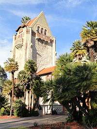
San Jose has many examples of houses with fine architecture. Late 19th century and early 20th century styles exist in neighborhoods such as Hanchett Park, Naglee Park, Rose Garden, and Willow Glen (including Palm Haven).
Styles include Craftsman, Mission Revival, Prairie style, and Queen Anne style Victorian.
Notable architects include Frank Delos Wolfe, Theodore Lenzen, Charles McKenzie,[136] and Julia Morgan.[137]
Visual arts
Public art is an evolving attraction in the city. The city was one of the first to adopt a public art ordinance at 2% of capital improvement building project budgets,[138] and as a result of this commitment a considerable number of public art projects exist in the downtown area, and a growing collection in neighborhoods including libraries, parks, and fire stations. In particular, the Mineta Airport expansion incorporated art and technology into its development.
.jpg)
Early public art included a statue of Quetzalcoatl (the plumed serpent) downtown, controversial in its planning because some called it pagan, and controversial in its implementation because many felt that the final statue by Robert Graham did not look like a winged serpent, and was more noted for its expense than its aesthetics. Locals joked that the statue resembles a pile of feces.[139]
A statue of Thomas Fallon also met strong resistance from those who called him largely responsible for the decimation of early native populations. Chicano/Latino activists protested because he had captured San Jose by military force in the Mexican–American War (1846). They also protested the perceived "repression" of historic documents detailing Fallon's orders expelling many of the city's Californio (early Spanish/Mexican/Mestizo) residents. In October 1991 protests at Columbus Day and Dia de la Raza celebrations stalled than plan, and the statue was stored in a warehouse in Oakland for more than a decade. The statue returned in 2002 to a less conspicuous location: Pellier Park, a small triangular patch at the merge of West Julian and West St. James streets.[140]
In 2001, the city sponsored SharkByte, an exhibit of decorated sharks based on the mascot of the hockey team, the San Jose Sharks, and modeled after Chicago's display of decorated cows.[141] Large models of sharks decorated in clever, colorful, or creative ways by local artists were displayed for months at dozens of locations around the city. After the exhibition the sharks were auctioned off for charity.
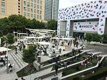
In 2006, Adobe Systems commissioned an art installation titled San Jose Semaphore by Ben Rubin,[142] at the top of its headquarters building. Semaphore is composed of four LED discs which "rotate" to transmit a message. The content remained a mystery until it was deciphered in August 2007.[143][144] The visual art installation is supplemented with an audio track, transmitted from the building on a low-power AM station. The audio track provides clues to decode the message being transmitted.
San Jose retains a number of murals in the Chicano history tradition of Diego Rivera and Jose Clemente Orozco of murals as public textbooks.[145]
Although intended to be permanent monuments to the city's heritage as a mission town founded in 1777, a number of murals have been painted over, notably Mural de la Raza, on the side of a Story Rd shoe store, and Mexicatlan at the corner of Sunset and Alum Rock. In addition, two of three murals by Mexican artist Gustavo Bernal Navarro have disappeared.[145] The third mural, La Medicina y la Comunidad at the Gardner clinic on East Virginia Street, depicts both modern and traditional healers.[145]
Surviving Chicano history murals include Nuestra Senora de Guadelupe at Our Lady of Guadalupe church and the 1970s or 1980s Virgen de Guadelupe Huelga Bird at Cal Foods east of downtown. The Guadalajara restaurant has the 1986 Guadalajara Market No. 2 by Edward Earl Tarver III and a 2013 work by Jesus Rodriguez and Empire 7, La Gran Culture Resonance.[145]
An unknown artist painted the Huelga Bird and Aztec City mural in the 1970s or 1980s on the Clyde L. Fisher Middle School. In 1995 Antonio Nava Torres painted The Aztec Calendar Handball Court at Biebrach Park, and the unknown artist of Chaco's Pachuco painted it on the former Chaco's Restaurant in the 1990s. The Jerry Hernandez mural by Frank Totres at Pop's Mini Mart on King Road dates to 2009, and another recent mural by Carlos Rodriguez on the Sidhu Market at Locust and West Virginia depicts a stern-looking warrior.[145]
Performing arts
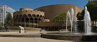
The city is home to many performing arts companies, including Opera San Jose, Symphony Silicon Valley, Ballet San Jose Silicon Valley, sjDANCEco, The San Jose Symphonic Choir, Children's Musical Theater of San Jose,[146] the San Jose Youth Symphony, the San Jose Repertory Theatre, City Lights Theatre Company, The Tabard Theatre Company, San Jose Stage Company, and the now-defunct American Musical Theatre of San Jose which was replaced by Broadway San Jose in partnership with Team San Jose. San Jose also is home to the San Jose Museum of Art,[147] one of the nation's premiere Modern Art museums. The annual Cinequest Film Festival in downtown has grown to over 60,000 attendees per year, becoming an important festival for independent films. The San Francisco Asian American Film Festival is an annual event, which is hosted in San Francisco, Berkeley, and Downtown San Jose. Approximately 30 to 40 films are screened in San Jose each year at the Camera 12 Downtown Cinemas. The San Jose Jazz Festival is another of many great events hosted throughout the year.
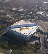
The SAP Center at San Jose is one of the most active venues for events in the world. According to Billboard Magazine and Pollstar, the arena sold the most tickets to non-sporting events of any venue in the United States, and third in the world after the Manchester Evening News Arena in Manchester, England, and the Bell Centre in Montreal, Canada, for the period from January 1 – September 30, 2004.[148] Including sporting events, the SAP Center averages 184 events a year, or roughly one event for every two days, which is significantly higher than the average for NHL arenas.
Sports
| Club | Sport | Founded | League | Venue (capacity) |
|---|---|---|---|---|
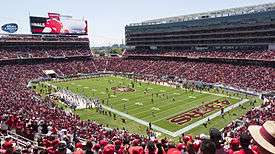
| San Francisco 49ers | Football | 1946 | National Football League | Levi's Stadium (68,500) |
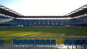
| San Jose Sharks | Hockey | 1991 | National Hockey League | SAP Center (17,562) |
| San Jose Earthquakes | Soccer | 1995 | Major League Soccer | Earthquakes Stadium (18,000) |
| San Jose Barracuda | Hockey | 2015 | American Hockey League (AAA) | SAP Center (17,562) |
| San Jose Giants | Baseball | 1988 | California League (High-A) | Excite Ballpark (4,200) |
| San Jose State Spartans | NCAA Football | 1893 | Mountain West Conference | CEFCU Stadium (21,520) |
San Jose is home to the San Jose Sharks of the NHL, the San Jose Barracuda of the AHL, and the San Jose Earthquakes of Major League Soccer. The Sharks and the Barracuda play in the SAP Center at San Jose. The Earthquakes built an 18,000 seat new stadium that opened in March 2015. San Jose was a founding member of both the California League and Pacific Coast League in minor league baseball. San Jose currently fields the San Jose Giants, a High-A affiliate of the San Francisco Giants. The NFL's San Francisco 49ers call neighboring Santa Clara home.
San Jose has "aggressively wooed" the Oakland Athletics to relocate to San Jose from nearby Oakland, and the Athletics in turn have said that San Jose is their "best option", but the San Francisco Giants have thus far exercised a veto against this proposal.[149] In 2013, the city of San Jose sued Major League Baseball for not allowing the Athletics to relocate to San Jose.[150] On October 5, 2015 the United States Supreme Court rejected San Jose's bid on the Athletics.[151]
From 2005 to 2007, the San Jose Grand Prix, an annual street circuit race in the Champ Car World Series, was held in the downtown area. Other races included the Trans-Am Series, the Toyota Atlantic Championship, the United States Touring Car Championship, the Historic Stock Car Racing Series, and the Formula D Drift racing competition.
In 2004, the San Jose Sports Authority hosted the U.S. Olympic team trials for judo, taekwondo, trampolining and rhythmic gymnastics at the San Jose State Event Center. In 2008, around 90 percent of the members of the United States Olympic team were processed at San Jose State University prior to traveling to the 2008 Summer Olympics in Beijing.[152] The 2009 Junior Olympics for trampoline were also held here.
In August 2004, the San Jose Seahawk Rugby Football Club hosted the USA All-Star Rugby Sevens Championships at Watson Bowl, east of Downtown. San Jose State hosted the 2011 American Collegiate Hockey Association (ACHA) national tournament.[153] The NCAA Division I Men's Basketball Tournament is also frequently held in San Jose.
Landmarks
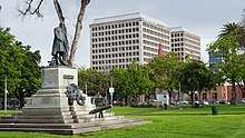
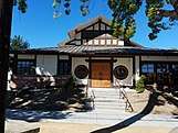
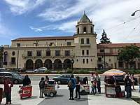
Notable landmarks in San Jose include Children's Discovery Museum of San Jose, History Park at Kelley Park, Cathedral Basilica of St. Joseph, Plaza de César Chávez, Dr. Martin Luther King, Jr. Library, Mexican Heritage Plaza, Rosicrucian Egyptian Museum, Lick Observatory, Hayes Mansion, SAP Center at San Jose, Hotel De Anza, San Jose Improv, Sikh Gurdwara of San Jose, Peralta Adobe, Excite Ballpark, Spartan Stadium, Japantown San Jose, Winchester Mystery House, Raging Waters, Circle of Palms Plaza, San Jose City Hall, San Jose Flea Market, Oak Hill Memorial Park, San Jose electric light tower, and The Tech Museum of Innovation.
- Hotel De Anza
 Santana Row
.jpg) The historic Scottish Rite Temple on St. James Park
The historic Scottish Rite Temple on St. James Park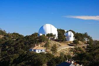 Lick Observatory on Mount Hamilton
.jpg) SAP Center at San Jose
SAP Center at San Jose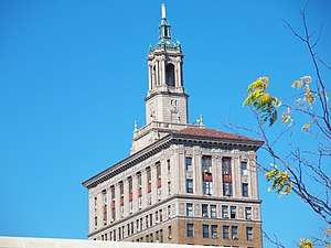 The Bank of Italy Building
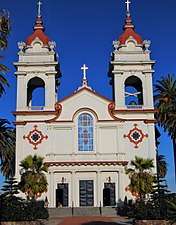 Five Wounds Portuguese National Church
.jpg) Hayes Mansion
Hayes Mansion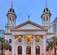 Cathedral Basilica of St. Joseph
 San Pedro Square
 The San Jose Museum of Art
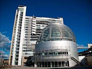 San Jose City Hall
 The Chinese Cultural Garden
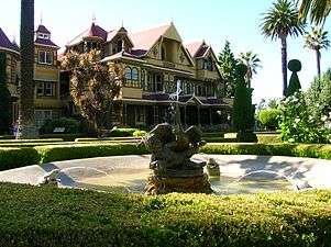
 San José State University
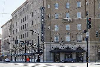 The historic Sainte Claire Hotel, today The Westin San Jose
Museums and institutions
- Children's Discovery Museum of San Jose
- History Park at Kelley Park
- Ira F. Brilliant Center for Beethoven Studies, home of the largest Beethoven collection outside Europe
- Dr. Martin Luther King, Jr. Library, the largest U.S. public library west of the Mississippi River
- Mexican Heritage Plaza, a museum and cultural center for Mexican Americans in the area
- Movimiento de Arte y Cultura Latino Americana, is an inclusive contemporary arts museum grounded in the Chicano/Latino experience
- SoFA District, a downtown arts and entertainment district
- Portuguese Historical Museum
- Rosicrucian Egyptian Museum, the largest collection of Egyptian artifacts on display in the western United States, located at Rosicrucian Park
- San Jose Museum of Art
- San Jose East Carnegie Branch Library is notable as it is the last Carnegie library still operating in San Jose, and is on the National Register of Historic Places.
- The Tech Museum of Innovation
- San Jose Steam Railroad Museum, proposed, artifacts and rolling stock are kept at the fairgrounds and Kelley Park
- History San José
- Japanese American Museum of San Jose, a museum of Japanese-American history
- Old Bank of America Building a historic landmark
- San Jose Museum of Quilts & Textiles, the first museum in America dedicated solely to quilts and textiles as an art form
- Viet Museum, a museum of Vietnamese-American history
Law and government
.jpg)
Local
San Jose is a charter city under California law, giving it the power to enact local ordinances that may conflict with state law, within the limits provided by the charter.[154] The city has a council-manager government with a city manager nominated by the mayor and elected by the city council.
The San Jose City Council is made up of ten council members elected by district, and a mayor elected by the entire city. During city council meetings, the mayor presides, and all eleven members can vote on any issue. The mayor has no veto powers. Council members and the mayor are elected to four-year terms; the even-numbered district council members beginning in 1994; the mayor and the odd-numbered district council members beginning in 1996.[155] Each council member represents approximately 100,000 constituents.
Council members and the mayor are limited to two successive terms in office, although a council member that has reached the term limit can be elected mayor, and vice versa. The council elects a vice-mayor from the members of the council at the second meeting of the year following a council election. This council member acts as mayor during the temporary absence of the mayor, but does not succeed to the mayor's office upon a vacancy.[155]
The City Manager is the chief administrative officer of the city, and must present an annual budget for approval by the city council. When the office is vacant, the Mayor proposes a candidate for City Manager, subject to council approval. The council appoints the Manager for an indefinite term, and may at any time remove the manager, or the electorate may remove the manager through a recall election. Other city officers directly appointed by the council include the City Attorney, City Auditor, City Clerk, and Independent Police Auditor.[155] Like all cities and counties in the state, San Jose has representation in the state legislature.
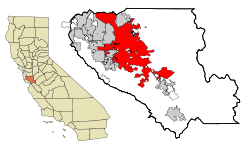
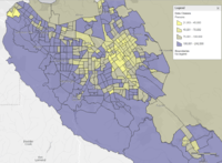
Like all California cities except San Francisco, both the levels and the boundaries of what the city government controls are determined by the Local Agency Formation Commission (LAFCO).[156] The goal of a LAFCO is to try to avoid uncontrolled urban sprawl. The Santa Clara County LAFCO has set boundaries of San Jose's "Sphere of Influence" (indicated by the blue line in the map near the top of the page) as a superset of the actual city limits (the yellow area in the map), plus parts of the surrounding unincorporated county land, where San Jose can, for example, prevent development of fringe areas to concentrate city growth closer to the city's core. The LAFCO also defines a subset of the Sphere as an 'Urban Service Area' (indicated by the red line in the map), effectively limiting development to areas where urban infrastructure (sewers, electrical service, etc.) already exists.
San Jose is the county seat of Santa Clara County.[157] Accordingly, many county government facilities are located in the city, including the office of the County Executive, the Board of Supervisors, the District Attorney's Office, eight courthouses of the Superior Court, the Sheriff's Office, and the County Clerk.[158]
State and federal
In the California State Senate, San Jose is split between the 10th, 15th, and 17th districts,[159] represented by Democrat Bob Wieckowski, Democrat Jim Beall, and Democrat Bill Monning respectively.
In the California State Assembly, San Jose is split between the 25th, 27th, 28th, and 29th districts,[4] represented by Democrat Kansen Chu, Democrat Ash Kalra, Democrat Evan Low, and Democrat Mark Stone, respectively.
Federally, San Jose is split between California's 17th, 18th, and 19th congressional districts,[160] represented by Democrat Ro Khanna, Democrat Anna Eshoo, and Democrat Zoe Lofgren, respectively.[161]
Several state and federal agencies maintain offices in San Jose. The city is the location of the Sixth District of the California Courts of Appeal.[162] It is also home to one of three courthouses of the United States District Court for the Northern District of California, the other two being in Oakland and San Francisco.[163]
Crime
The San Jose Police Department has consistently innovated in crime prevention, through programs like "CrimeReports.com", which made San Jose the first American city to make all 911 calls available via online. Crime in San Jose had been lower than in other large American cities until 2013, when crime rates in San Jose climbed above California and U.S. averages.[164] Like most large cities, crime levels had fallen significantly after rising in the 1980s.[165] Today it is no longer ranked as one of the safest cities in the country with a population over 1,000,000 people. The designation is based on crime statistics reported to the Federal Bureau of Investigation in six categories: murder, rape, robbery, aggravated assault, burglary, and auto theft.
Recently, the city had the second lowest violent crime rate of any city with 500,000 or more residents, only behind Honolulu.[165] However, homicides since 2011 have surged; there were 20 homicides in 2010, 42 in 2011, 46 in 2012, and 44 in 2013.[166]
Education


Higher education
San Jose is home to several colleges and universities. The largest is San Jose State University, which was founded by the California legislature in 1862 as the California State Normal School, and is the founding campus of the California State University (CSU) system. Located in downtown San Jose since 1870, the university enrolls approximately 30,000 students in over 130 different bachelor's and master's degree programs. The school enjoys a good academic reputation, especially in the fields of engineering, business, art and design, and journalism, and consistently ranks among the top public universities in the western region of the United States.[167] San Jose State is one of only three Bay Area schools that fields a Football Bowl Subdivision (FBS) Division I college football team; Stanford University and U.C. Berkeley are the other two.
California University of Management and Technology (CALMAT) offers many degree programs, including MBA, Computer Science, Information Technology. Most classes are offered both online and in the downtown campus. Many of the students are working professionals in the Silicon Valley.
Lincoln Law School of San Jose and University of Silicon Valley Law School offer law degrees, catering to working professionals.
National University maintains a campus in San Jose.
The San Jose campus of Golden Gate University offers business bachelor and MBA degrees.
In the San Jose metropolitan area, Stanford University is in Stanford, California, Santa Clara University is in Santa Clara, California, and U.C. Santa Cruz is in Santa Cruz, California. Within the San Francisco Bay Area, other universities include U.C. Berkeley, U.C. San Francisco, U.C. Hastings College of Law, and University of San Francisco.
San Jose's community colleges, San Jose City College, West Valley College, Mission College and Evergreen Valley College, offer associate degrees, general education units to transfer to CSU and UC schools, and adult and continuing education programs. The West campus of Palmer College of Chiropractic is also located in San Jose.
WestMed College is headquartered in San Jose and offers paramedic training, emergency medical technician training, and licensed vocational nursing programs.
The University of California operates Lick Observatory atop Mount Hamilton.
Western Seminary has one of its four campuses in San Jose, which opened on the campus of Calvary Church of Los Gatos in 1985. The campus relocated in 2010 to Santa Clara. Western is an evangelical, Christian graduate school that provides theological training for students who hope to serve in a variety of ministry roles including pastors, marriage and family therapists, educators, missionaries and lay leadership. The San Jose campus offers four master's degrees, and a variety of other graduate-level programs.[168]
National Hispanic University offered associate and bachelor's degrees and teaching credentials to its students, focusing on Hispanic students, until its closing in 2015.[169]
Primary and secondary education
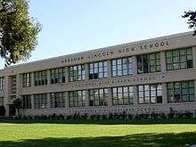
Up until the opening of Lincoln High School in 1943, San Jose students only attended San Jose High School. San Jose has 127 elementary, 47 middle, and 44 high public schools. Public education in the city is provided by four high school districts, fourteen elementary districts, and four unified school districts (which provide both elementary and high schools). In addition to the main San Jose Unified School District (SJUSD) and other Districts within San Jose such as the Alum Rock Unified School District and the East Side Union High School District, other nearby unified school districts of nearby cities are Milpitas Unified School District, Morgan Hill Unified School District, and Santa Clara Unified School District.
Private schools in San Jose are primarily run by religious groups. The Catholic Diocese of San Jose has the second largest student population in the Santa Clara County, behind only SJUSD; the diocese and its parishes operate several schools in the city, including six high schools: Archbishop Mitty High School, Bellarmine College Preparatory, Notre Dame High School, Saint Francis High School, and Presentation High School.[170] Other private high schools include two Baptist high schools, Liberty Baptist School[171] and White Road Baptist Academy, one Non-Denominational Protestant high school, Valley Christian High School (San Jose, California), one University-preparatory school, Cambrian Academy, a nonsectarian K-12 Harker School with four campuses in western San Jose, and a K-12 school of the Wisconsin Evangelical Lutheran Synod, Apostles Lutheran School.[172]
Libraries
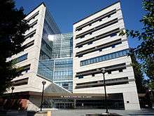
The San José Public Library system is unique in that the Dr. Martin Luther King Jr. Library combines the collections of the city's system with the San Jose State University main library. In 2003, construction of the library, which now holds more than 1.6 million items, was the largest single library construction project west of the Mississippi, with eight floors that result in more than 475,000 square feet (44,100 m2) of space with a capacity for 2 million volumes.[173]
The city has 23 neighborhood branches including the Biblioteca Latinoamericana which specializes in Spanish language works.[174] The East San Jose Carnegie Branch Library, a Carnegie library opened in 1908, is the last Carnegie library in Santa Clara County still operating as a public library and is listed in the National Register of Historic Places. As the result of a bond measure passed in November 2000, a number of brand new or completely reconstructed branches have been completed and opened. The yet-to-be-named brand new Southeast Branch is also planned, bringing the bond library project to its completion.[175]
The San Jose system (along with the University system) were jointly named as "Library of the Year" by the Library Journal in 2004.[176]
Transportation
Like other American cities built mostly after World War II, San Jose is highly automobile dependent, with 76 percent of residents driving alone to work and 12 percent carpooling in 2017.[177] The city set an ambitious goals to shift motorized trips to walking, bicycling, and public transit in 2009 with the adoption of its Envision San Jose 2040 General Plan, but has so far failed to make progress towards these goals. In 2018 the city extended these goals to 2050 with its San Jose Climate Smart plan,[178] when driving alone to work is expected to drop to just 12 percent and transit is to leap to 35 percent of commute trips and walking and bicycling (combined) also to 35 percent of commute trips.
Public transit
.jpg)
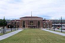
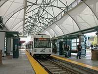
Rail service to and from San Jose is provided by Amtrak (the Sacramento–San-Jose Capitol Corridor and the Seattle–Los-Angeles Coast Starlight), Caltrain (commuter rail service between San Francisco and Gilroy), ACE (commuter rail service to Pleasanton and Stockton), and the local VTA light rail system connecting downtown to Mountain View, Milpitas, Campbell, and Almaden Valley, operated by the Santa Clara Valley Transportation Authority (VTA). Historic streetcars from History Park operate on the light rail lines in downtown during holidays.
Long-term plans call for BART to be expanded to Santa Clara through Milpitas and San Jose from the current terminal in Fremont. Originally, the extension was to be built all at once, but due to the recession, sales tax revenue has dramatically decreased. Because of this, the extension will be built in two phases. Phase 1 will extend service to a temporary terminal in north-eastern San Jose in 2019 at Berryessa station. Construction has been approved and funded and began in Summer 2012 and will connect with the Warm Springs extension to southern Fremont. In addition, San Jose will be a major stop on the future California High Speed Rail route between Los Angeles and San Francisco.[179] Diridon Station (formerly Cahill Depot, 65 Cahill Street) is the meeting point of all regional commuter rail service in the area.[180] It was built in 1935 by the Southern Pacific Railroad, and was refurbished in 1994.
VTA also operates many bus routes in San Jose and the surrounding communities, as well as offering paratransit services to local residents. Additionally, the Highway 17 Express bus line connects central San Jose with Santa Cruz. Intercity bus providers include Greyhound, BoltBus, Megabus, California Shuttle Bus, TUFESA, Intercalifornias, Hoang, and USAsia.[181]
Air
_(2).jpg)
San Jose is served by Norman Y. Mineta San Jose International Airport (IATA: SJC, ICAO: KSJC, FAA LID: SJC), two miles (3.2 km) northwest of downtown, and by Reid-Hillview Airport of Santa Clara County (ICAO: KRHV, FAA LID: RHV) a general aviation airport located in the eastern part of San Jose. San Jose residents also use San Francisco International Airport (IATA: SFO, ICAO: KSFO, FAA LID: SFO), a major international hub located 35 miles (56 km) to the northwest, and Oakland International Airport (IATA: OAK, ICAO: KOAK, FAA LID: OAK), another major international airport located 35 miles (56 km) to the north. The airport is also near the intersections of three major freeways, U.S. Route 101, Interstate 880, and State Route 87.
Highways
The San Jose area has a large freeway system, including three Interstate freeways and one U.S. Route. It is, however, the largest city in the country not served by a primary Interstate; most of the Interstate Highway Network was planned by the early 1950s well before San Jose's rapid growth decades later.
U.S. 101 runs south to the California Central Coast and Los Angeles, and then runs north up near the eastern shore of the San Francisco Peninsula to San Francisco. I-280 also heads to San Francisco, but goes along just to the west of the cities of San Francisco Peninsula. I-880 heads north to Oakland, running parallel to the southeastern shore of San Francisco Bay. I-680 parallels I-880 to Fremont, but then cuts northeast to the eastern cities of the San Francisco Bay Area.
.jpg)
Several state highways also serve San Jose: SR 17, SR 85, SR 87 and SR 237. Additionally, San Jose is served by a system of county-wide expressways, which includes the Almaden Expressway, Capitol Expressway, San Tomas Expressway, and Lawrence Expressway.
Several regional transportation projects have been undertaken in recent years to deal with congestion on San Jose freeways. This includes expansion of State Route 87 including more lanes near the downtown San Jose area.
The interchange for I-280 connecting with I-680 and U.S. 101, a rush-hour spot where the three freeways meet, has been known to have high-density traffic similar to Los Angeles County interchanges. It was constructed years before its completion. The two bridges, with no on-ramps or off-ramps stood over U.S. 101 at a 110-foot tall during the 70's, before opening in 1981. In 2010, the interchange was named the Joe Colla Interchange.[183]
Major highways:
.svg.png)
.svg.png)
.svg.png)
.svg.png)


Bicycling
Central San Jose has seen a gradual expansion of bike lanes over the past decade, which now comprise a network of car-traffic-separated and buffered bike lanes. San Jose Bike Party is a volunteer-run monthly social cycling event that attracts up to 1,000 participants during summer months to "build community through bicycling". Unfortunately, fewer than one percent of city residents ride bicycles to work[184] as their primary mode of transportation, a statistic unchanged in the past ten years. Typically, between 3 and 5 residents are struck and killed by car drivers while bicycling on San Jose streets each year.[185]
Trail network
San Jose is crossed by several major regional off-street paved trails, most notably the Guadalupe River Trail, Los Gatos Creek Trail, and Coyote Creek Trail. These trails extend from near downtown San Jose for dozens of miles to the north and south, and are connected with each other via bicycle routes of varying quality. The city is planning to construct new trail extensions in coming years including the Three Creeks Trail and San Tomas Aquino Creek Trail.
Notable people
Sister cities
San Jose has one of the oldest Sister City programs in the nation. In 1957, when the city established a relationship with Okayama, Japan, it was only the third Sister City relationship in the nation, which had begun the prior year. The Office of Economic Development coordinates the San Jose Sister City Program which is part of Sister Cities International. As of 2014, there are eight sister cities:[186][187]


See also
- Silicon Valley
- Santa Clara Valley
- Santa Clara County
- San Francisco Bay Area
- Northern California
- San Jose Police Department
- San Jose Convention Center
- List of people from San Jose, California
- List of streets in San Jose, California, with name origins
- List of tallest buildings in San Jose, California
- Northern California Megaregion
Notes
- The common name for the city is "San Jose", without the diacritical mark on the "e".
- The official name is the "City of San José", spelled with the diacritical mark on the "e".
References
- "California Cities by Incorporation Date". California Association of Local Agency Formation Commissions. Archived from the original (Word) on November 3, 2014. Retrieved August 25, 2014.
- "Government". San Jose, California. Archived from the original on March 15, 2015. Retrieved March 15, 2015.
- "City Council". San Jose, California. Archived from the original on December 16, 2014. Retrieved December 8, 2014.
- "Communities of Interest – City". California Citizens Redistricting Commission. Archived from the original on October 23, 2015. Retrieved October 10, 2014.
- "2016 U.S. Gazetteer Files". United States Census Bureau. Archived from the original on August 24, 2017. Retrieved June 28, 2017.
- "San Jose". Geographic Names Information System. United States Geological Survey. Retrieved January 11, 2015.
- "Population and Housing Unit Estimates". Archived from the original on May 4, 2018. Retrieved July 12, 2019.
- "E-1 Population Estimates for Cities, Counties, and the State". California Department of Finance. Archived from the original on July 1, 2014. Retrieved April 30, 2014.
- "ZIP Code(tm) Lookup". United States Postal Service. Archived from the original on November 16, 2014. Retrieved November 23, 2014.
- In isolation, San is pronounced Spanish pronunciation: [san].
- "U.S. Census website". U.S. Census Bureau. Retrieved December 3, 2019.
- 2012 American Community Survey Archived July 1, 2014, at the Wayback Machine
- "Richest Counties In The United States". Archived from the original on April 19, 2017. Retrieved April 18, 2017.
- Levy, Francesca (March 4, 2010). "America's 25 Richest Counties". Archived from the original on April 19, 2017. Retrieved April 18, 2017.
- "Santa Clara County has highest median household income in nation, but wealth gap widens". The Mercury News. Archived from the original on April 19, 2017. Retrieved April 18, 2017.
- "Annual Estimates of the Resident Population: April 1, 2010 to July 1, 2018". United States Census Bureau, Population Division. April 2019. Archived from the original on February 13, 2020. Retrieved May 30, 2019.
- "Metropolitan and Micropolitan Statistical Area Totals Dataset: Population and Estimated Components of Change: April 1, 2010 to July 1, 2015" (CSV). 2015 Population Estimates. United States Census Bureau, Population Division. March 2016. Retrieved April 1, 2016.
- "Combined Statistical Area Totals Dataset: Population and Estimated Components of Change: April 1, 2010 to July 1, 2015" (CSV). 2015 Population Estimates. United States Census Bureau, Population Division. March 2016. Retrieved April 1, 2016.
- "Annual Estimates of the Resident Population for Counties: April 1, 2010 to July 1, 2015". 2015 Population Estimates. United States Census Bureau, Population Division. March 2016. Archived from the original on June 6, 2016. Retrieved April 1, 2016.
- "The World According to GaWC". Archived from the original on October 10, 2013. Retrieved April 8, 2018.
- Hsu, T. (September 20, 2012). "America's richest cities: Census say San Jose, San Francisco" Archived June 29, 2013, at the Wayback Machine. Los Angeles Times. Retrieved August 16, 2013.
- Glink, I. (February 22, 2013). "America's Richest Cities in 2013." Archived March 8, 2017, at the Wayback Machine. Yahoo Finance. Retrieved August 16, 2013
- Bass, F., Homan, T. (October 18, 2011). "Beltway Earnings Make US Capital Richer Than Silicon Valley" Archived July 29, 2014, at the Wayback Machine. Bloomberg. Retrieved August 16, 2013.
- Zeveloff, J. (February 14, 2013). "The 10 Most Expensive Cities in the United States" Archived May 7, 2016, at the Wayback Machine. Daily Finance. Retrieved August 16, 2013
- "Silicon Valley Business Journal – San Jose Area has World's Third-Highest GDP Per Capita, Brookings Says". Archived from the original on March 9, 2017. Retrieved March 8, 2017.
- "America's Greediest Cities". Forbes. December 3, 2007. Archived from the original on July 29, 2017.
- "The first US city where average homes cost over $1 million". Archived from the original on March 9, 2017. Retrieved March 8, 2017.
- "13th Annual Demographia International Housing Affordability Survey: 2017" (PDF). Archived (PDF) from the original on January 23, 2013. Retrieved March 8, 2017.
- "San Jose is the most 'unaffordable' major housing market in U.S., survey says". Archived from the original on March 9, 2017. Retrieved March 8, 2017.
- Kate Springer. "The least affordable places to live in 2017". CNN. Archived from the original on May 19, 2017. Retrieved May 21, 2017.
- "The 10 most expensive cities to live in around the world in 2017". Archived from the original on March 9, 2017. Retrieved March 8, 2017.
- "The First City". California History Online. Archived from the original on February 18, 2008. Retrieved March 15, 2008.
- "California Admission Day—September 9, 1850". California State Parks. 2007. Archived from the original on March 28, 2016. Retrieved March 15, 2008.
- "1990 and 1980 Census Counts for Cities with 1990 Population Greater Than 100,000". United States Census Bureau. Archived from the original on June 29, 2014. Retrieved August 8, 2014.
1980: San Francisco = 678974, San Jose = 629400. 1990: San Jose = 782248, San Francisco = 723959
- "Silicon Valley Business Journal – San Jose has the Fastest-Growing Economy in California". Archived from the original on August 19, 2018. Retrieved September 27, 2017.
- For origin, arrival and displacement based on "linguistic evidence" in 500 CE per Levy, 1978:486, also Bean, 1994:xxi (cites Levy 1978). For Shell Mound dating, F.M. Stanger 1968:4.
- "Early History". National Register of Historic Places. Archived from the original on June 9, 2007. Retrieved June 5, 2007.
- "Pre-History". November 4, 2013. Archived from the original on November 22, 2017. Retrieved November 23, 2017.
- For events of 1795–1796, Milliken, 1995:129–134 ("Mass Migration in Winter of 1794–95"). For runaways, Milliken, 1995:97 (cites Fages, 1971).
- "Junípero Serra". California History Online. California Historical Society. 2000. Archived from the original on August 12, 2004. Retrieved June 20, 2007.
- Edward F. O'Day (October 1926). "The Founding of San Francisco". San Francisco Water. Spring Valley Water Authority. Archived from the original on July 27, 2010. Retrieved February 7, 2013.
- Clyde Arbuckle (1986). Clyde Arbuckle's History of San Jose. Smith McKay Printing. ISBN 978-9996625220.
- "Spanish Period". November 5, 2013. Archived from the original on December 1, 2017. Retrieved November 23, 2017.
- "Spanish-Mexican Records of the San José Pueblo: The Pueblo Papers". Archived from the original on December 1, 2017. Retrieved November 23, 2017.
- "Mexican Period". November 7, 2013. Archived from the original on December 1, 2017. Retrieved November 23, 2017.
- "1846–1869". November 7, 2013. Archived from the original on November 22, 2017. Retrieved November 23, 2017.
- "California Capitol Museum – California State Capitol History: Part 1". Archived from the original on November 16, 2017. Retrieved November 23, 2017.
- Clyde Arbuckle's history of San Jose (Smith & McKay, 1985), p. 27: "Therefore, unless posterity can determine the order in which the Governor signed these bills, there will always be a question as to whether San Jose, already preceded by Sacramento, was California's second, third, or fourth incorporated city."
- George R. Stewart, The California Trail: An Epic with Many Heroes (University of Nebraska Press, 1962), p. 28.
- Ken McKowen & Dahlynn McKowen, Best of California's Missions, Mansions, and Museums (Wilderness Press, 2006), pp. 77–99.
- First State Capitol Building Archived December 1, 2017, at the Wayback Machine, Historical Marker Database.
- "Our Legacy – JBT". Jbtcorporation.com. Archived from the original on June 5, 2016. Retrieved May 15, 2019.
- "Agnews Insane Asylum". National Register of Historic Places. Archived from the original on May 24, 2007. Retrieved June 7, 2007.
- "California – Race and Hispanic Origin for Selected Cities and Other Places: Earliest Census to 1990". U.S. Census Bureau. Archived from the original on August 12, 2012. Retrieved April 20, 2012.
- "PACKING IT IN: SAN JOSE'S FINAL HARVEST VESTIGE OF VALLEY'S AGRICULTURAL PAST IS LEAVING". The Mercury News. July 25, 1999. Archived from the original on May 24, 2017. Retrieved May 16, 2017.
- "Flashback: A short political history of San Jose". San Jose State University. Archived from the original on July 7, 2008. Retrieved November 9, 2013.
- "BAE Systems History". Archived from the original on February 20, 2007. Retrieved November 9, 2013.
- Winslow, Ward (editor); The Making of Silicon Valley: a One Hundred Year Renaissance; 1995; ISBN 0-9649217-0-7
- City of San Jose – Memorandum, Use of the Official City Seal and the Bicentennial Logo, April 5, 1979 (on file at the San Jose City Clerk's Office)
- City of San José Style Guide. City of San José. July 2000. p. 21. Archived from the original (PDF) on February 3, 2017. Retrieved February 5, 2017.
- "Council Memo Format Guidelines" (PDF). San José Public Works Department. August 2016. p. 15. Archived from the original (PDF) on December 29, 2016. Retrieved February 5, 2017.
- City Charter, Adopted in 1965 and as Amended by Voters through November 2018. City of San José. May 2019 [1965]. section 100. Archived from the original (PDF) on October 9, 2019. Retrieved October 15, 2019.
- "San Jose CA, Official website". Archived from the original on July 23, 2010. Retrieved February 6, 2014.
- "San Jose case study, part one: the urban-growth boundary". Thoreau Institute. Archived from the original on February 23, 2007. Retrieved June 7, 2007.
- "Building Permit History, 1980–2006". City of San Jose. Archived from the original on September 27, 2007. Retrieved June 7, 2007.
- R. E. Holdsworth; Strachan, R. A.; Magloughlin, J.; Knipe, R. J. (2001). The Nature and Tectonic Significance of Fault Zone Weakening. Geological Society of London. p. 15. ISBN 978-1-86239-090-4.
- Safford, Pat (November 17, 2010). "The legacy of Dutch Hamann plagues Cambrian residents, Annexation Background" (PDF). Campbell Express. 59 (45). p. 1. Archived (PDF) from the original on November 10, 2013. Retrieved November 9, 2013.
- Don Mccormack (July 16, 1995). "San Jose: Reality, not reputation". SFGate. Archived from the original on November 10, 2013. Retrieved July 8, 2013.
- Sachs, Aaron (January–February 1999). "Virtual Ecology – A Brief Environmental History of Silicon Valley" (PDF). World-Watch. Worldwatch.org. p. 15. Archived (PDF) from the original on November 10, 2013. Retrieved November 9, 2013.
- "Dutch Hamann – Part One". San Jose Inside. January 16, 2006. Archived from the original on November 10, 2013. Retrieved July 8, 2013.
- "Dutch Hamann – Part Two". San Jose Inside. January 16, 2006. Archived from the original on November 10, 2013. Retrieved July 8, 2013.
- David Crimp, Leda Patmore, C. Michael Hogan, Harry Seidman and Vivian Paparigian prepared by Earth Metrics Inc. (1976). Final Environmental Impact Report, Almaden Quicksilver Park (Report). Santa Clara County Parks and Recreation Department.CS1 maint: uses authors parameter (link)
- "Sinking State". San Francisco State University. April 1996. Archived from the original on April 15, 2012. Retrieved November 9, 2013.
- Eastern Region Geography, Information Services (April 29, 2005). "Elevations and Distances". Egsc.usgs.gov. Archived from the original on November 9, 2013. Retrieved October 21, 2014.
- San Jose City Council (March 1, 1983). "Outdoor lighting on private developments" (PDF). Archived from the original (PDF) on July 2, 2006. Retrieved June 18, 2007.
- "UCSC, Lick Observatory designate asteroid for the city of San Jose". University of California, Santa Cruz. May 25, 1998. Archived from the original on August 17, 2007. Retrieved June 18, 2007.
- Julie Phillips; Ryan Phillips; Neela Srinivasan; Deborah Aso; Wendy Lao; Pat Cornely (2012). Safe Passage for Coyote Valley: A Wildlife Linkage for the 101 Corridor (PDF) (Report). Cupertino, California: De Anza College. Archived from the original (PDF) on September 27, 2013. Retrieved January 26, 2019.
- Miguel Miller. "Climate of San Jose". National Weather Service. Archived from the original on December 15, 2004. Retrieved June 18, 2007.
- "San Jose Month Weather". AccuWeather. Archived from the original on November 17, 2011.
- "Station Name: CA SAN JOSE". National Oceanic and Atmospheric Administration. Archived from the original on May 24, 2017. Retrieved June 12, 2013.
- "NOWData – NOAA Online Weather Data". National Oceanic and Atmospheric Administration. Archived from the original on April 18, 2019. Retrieved February 27, 2019.
- "NOWData – NOAA Online Weather Data San Jose Monthly Climate Normals (1981–2010)". National Oceanic and Atmospheric Administration. Archived from the original on October 26, 2019. Retrieved November 12, 2019.
- "Monthly Total Snowfall (Inches)". Western Regional Climate Center. July 24, 2006. Archived from the original on June 29, 2014. Retrieved June 12, 2013.
- "Alum Rock Park" Archived March 16, 2014, at the Wayback Machine City of San Jose. Retrieved on July 9, 2013.
- "2013 ParkScore Rankings Archived July 22, 2013, at the Wayback Machine "The Trust for Public Land" Retrieved on July 9, 2013.
- "Monopoly in the Park". www.monopolyinthepark.com. Archived from the original on December 24, 2015. Retrieved December 23, 2015.
- "Emma Prusch Farm Park". Parks, Recreation & Neighborhood Services. City of San Jose. Archived from the original on March 10, 2005. Retrieved November 9, 2013.
- "Field Sports Park". sccgov.org. Archived from the original on July 21, 2014. Retrieved June 18, 2014.
- "2011 City and Neighborhood Rankings". Walk Score. 2011. Archived from the original on August 6, 2012. Retrieved August 28, 2011.
- "Network Status Table" (PDF). City of San Jose. January 30, 2008. Archived (PDF) from the original on April 8, 2008. Retrieved March 31, 2008.
- Leidy, R.A., G.S. Becker, B.N. Harvey (2005). "Historical distribution and current status of steelhead/rainbow trout (Oncorhynchus mykiss) in streams of the San Francisco Estuary, California" (PDF). Center for Ecosystem Management and Restoration, Oakland, California. Archived (PDF) from the original on July 25, 2011. Retrieved October 21, 2012.CS1 maint: multiple names: authors list (link)
- "Chinook Salmon". NOAA's National Marine Fisheries Service – Salmon Populations – Chinook. Archived from the original on September 11, 2010. Retrieved September 13, 2010.
- "Sensitive Fish Species in the Santa Cruz Mountains Bioregion". Santa Cruz Mountains Bioregional Council. 2004. Archived from the original on June 29, 2010. Retrieved October 21, 2012.
- Greg Kerekes (November 14, 2011). "Guadalupe River King Salmon Spawn under Julian Street bridge, Fall, 2011". Archived from the original on February 2, 2013. Retrieved October 21, 2012.
- Len Ramirez (January 24, 2019). "Tule Elk Make Remarkable Comeback In South San Jose Hills". Archived from the original on January 26, 2019. Retrieved January 26, 2019.
- "Coyote Valley vital as wildlife corridor". SFGate. Archived from the original on November 9, 2017. Retrieved November 9, 2017.
- Laura Hautala (January 1, 2009). "Coyote Valley Crossings". Bay Nature. Archived from the original on September 28, 2013. Retrieved January 26, 2019.
- "Census of Population and Housing". Census.gov. Retrieved June 4, 2015.
- "Annual Estimates of the Resident Population for Incorporated Places: April 1, 2010 to July 1, 2014". Archived from the original on May 23, 2015. Retrieved June 4, 2015.
- "San Jose (city), California". State & County QuickFacts. U.S. Census Bureau. Archived from the original on August 29, 2012. Retrieved April 20, 2012.
- From 15% sample
- "2010 Census Interactive Population Search: CA – San Jose city". U.S. Census Bureau. Archived from the original on July 15, 2014. Retrieved July 12, 2014.
- "San Jose (city), California". State & County QuickFacts. U.S. Census Bureau. Archived from the original on August 29, 2012. Retrieved April 20, 2012.
- "U.S. Census website". United States Census Bureau. Retrieved January 31, 2008.
- "San Jose, California: Earnings in the Past 12 Months (In 2007 Inflation-Adjusted Dollars)". U.S. Fact Finder. U.S. Census Bureau. Archived from the original on November 24, 2011.
- "The Ten Most and Least Expensive Urban Areas in the ACCRA Cost of Living Index (COLI) – Second Quarter 2004". FEDC.com. Archived from the original on September 9, 2004. Retrieved November 9, 2013.
- "San Jose – Accolades". "America's Most Livable Communities" (Partners for Livable Communities, Washington, D.C.). Archived from the original on February 26, 2011. Retrieved April 7, 2008.
- "San Jose, Capital of Silicon Valley: #1 Community for Innovators in U.S." City of San Jose. March 27, 2008. Archived from the original on March 2, 2004. Retrieved April 7, 2008.
- "San Jose, CA – Official Website – Foreign Trade Zone". www.sanjoseca.gov. Archived from the original on December 1, 2017. Retrieved November 27, 2017.
- Samsung America headquarters (DS) Archived July 17, 2013, at the Wayback Machine. NBBJ. Retrieved on July 21, 2013.
- "Samsung Semiconductor". www.samsung.com. Archived from the original on March 30, 2016. Retrieved April 2, 2016.
- "Fact Sheet: Community Profile: Employment and Employers" (PDF). City of San Jose. May 10, 2010. Archived from the original (PDF) on May 4, 2011. Retrieved March 14, 2011.
- "Acer – Contact Us". Acer America. Archived from the original on October 22, 2013. Retrieved November 10, 2013.
- "Contact netcom". Netcom. Archived from the original on April 27, 1999. Retrieved September 7, 2010.
- Helm, Leslie (March 25, 1997). "Financial Desk – Netcom to Set Time Limits on Internet Use;". Los Angeles Times. p. D1. Archived from the original on November 1, 2011. Retrieved September 7, 2010 – via PQArchiver.
Charting a new direction for money-losing Internet service providers, San Jose-based Netcom On-Line Communications Services ...
- "EXCLUSIVE: APPLE BUYS HUGE SAN JOSE DEVELOPMENT SITE". Silicon Valley Business Journal. Archived from the original on April 3, 2019. Retrieved February 2, 2019.
- "Apple sets stage for San Jose campus with 15,000 workers". www.mercurynews.com. Archived from the original on November 22, 2015. Retrieved October 23, 2015.
- Brown, Eliot. "Tech Firms Spy New Bay Area Frontier: Oakland". Wall Street Journal. ISSN 0099-9660. Archived from the original on October 22, 2015. Retrieved October 23, 2015.
- "America's most livable:San Jose, California". Archived from the original on November 6, 2006. Retrieved November 9, 2013.
- "San Jose: U.S. satellite Patent Office opens". The Mercury News. Archived from the original on May 24, 2017. Retrieved May 21, 2017.
- "Silicon Valley U.S. Patent and Trademark Office". www.uspto.gov. Archived from the original on June 2, 2016. Retrieved June 5, 2016.
- "Group Rallies At Google HQ, Makes Demands For SJ Mega-Campus". Patch. April 12, 2018. Archived from the original on April 27, 2018. Retrieved April 26, 2018.
- "The Happiest And Unhappiest Cities To Work In Right Now". Forbes. Archived from the original on January 17, 2014. Retrieved January 19, 2014.
- U.S. Bureau of Labor Statistics (January 1, 1990). "Unemployment Rate in San Jose-Sunnyvale-Santa Clara, CA (MSA)". FRED, Federal Reserve Bank of St. Louis. Retrieved December 3, 2019.
- "Archived copy". Archived from the original on December 18, 2014. Retrieved November 14, 2014.CS1 maint: archived copy as title (link)
- "Wickedly Fast Wi-Fi Network sweeps into Downtown San Jose". December 27, 2013. Archived from the original on December 19, 2014. Retrieved November 14, 2014.
- Digital/HDTV Television Channel List – SF Bay Area Archived April 16, 2010, at the Wayback Machine. Choisser.com. Retrieved on April 14, 2011.
- Marty Cheek. "KQW Radio, San Jose". Bay Area Radio Museum. Archived from the original on February 3, 2007. Retrieved June 18, 2007.
- "2016–2017 Comprehensive Annual Financial Report". Archived from the original on May 7, 2018. Retrieved May 6, 2018.
- "Staff Review Agenda" (PDF). City of San Jose. November 15, 2007. Archived from the original (PDF) on May 28, 2008. Retrieved May 5, 2008.
- "Development Services". City of San Jose. February 6, 2006. Archived from the original on April 2, 2008. Retrieved May 5, 2008.
- "San Jose Downtown Historic District". National Park Service. Archived from the original on May 12, 2008. Retrieved May 5, 2008.
- "Green Building Policy". April 10, 2007. Archived from the original on April 1, 2008. Retrieved May 5, 2008.
- Yoders, Jeff (November 1, 2005). "San Jose's Richard Meier-designed city hall: To Leed, or Not to Leed". Building Design and Construction. Archived from the original on August 10, 2009. Retrieved November 9, 2013.
- Buena Vista Neighborhood Association (February 21, 2012). "Photos of homes in San Jose, California, then and now". Archived from the original on November 10, 2014. Retrieved August 16, 2014.
- Mary Gottschalk / San Jose Mercury News (August 26, 2010). "Julia Morgan-designed mansion on The Alameda in San Jose will soon become office space". Archived from the original on June 14, 2015. Retrieved June 12, 2015.
- "2006–2007 Proposed Capital Budget" (PDF). City of San Jose. Archived from the original (PDF) on August 22, 2006. Cite journal requires
|journal=(help) - Herhold, Scott (February 2, 2011). "Herhold: I'll miss the red eyes of San Jose's plumed serpent". San Jose Mercury News. Archived from the original on January 25, 2012. Retrieved April 15, 2011.
- "Fallon statue unveiled". Silicon Valley/San Jose Business Journal. September 20, 2002. Archived from the original on March 14, 2005. Retrieved June 18, 2007.
- Jim LaFrenere. "Chicago cows on parade exhibit". Chicagotraveler.com. Archived from the original on September 24, 2010. Retrieved July 1, 2010.
- Chris Salter; Sellars, Peter (2010). Entangled: Technology and the Transformation of Performance. The MIT Press. p. 342. ISBN 978-0-262-19588-1. --via Google Books.
- "San José Semaphore – 2006 Contest – Past Contest – How the code was cracked". Adobe.com. Archived from the original on October 21, 2012. Retrieved November 10, 2013.
- "Decoding the San Jose Semaphore" (PDF). Ear Studio. August 14, 2007. Archived from the original (PDF) on March 4, 2012. Retrieved November 9, 2013.
- Leonardo Castaneda (December 16, 2018). "San Jose's Disappearing Murals: 'It's Like Wiping Away People's History'". San Jose Mercury-News. Bay Area News Group. p. A1.
- "ABOUT CMT San Jose". Cmtsj.org. Archived from the original on May 30, 2013. Retrieved July 8, 2013.
- "San Jose Museum of Art". San Jose Museum of Art. Archived from the original on September 28, 2014. Retrieved July 1, 2010.
- Weimers, Leigh (October 29, 2004). "Who needs the Sharks? HP Pavilion thriving". Archived from the original on March 9, 2005. Retrieved November 9, 2013.
- "How the A's ballpark plans stack up". San Jose Mercury News. Archived from the original on April 26, 2013. Retrieved August 18, 2013.
- "San Jose takes big swing at Major League Baseball". Archived from the original on June 24, 2013. Retrieved October 17, 2014.
- "U.S. Supreme Court rejects San Jose's bid to lure Oakland A's". San Francisco Chronicle. Archived from the original on October 6, 2015. Retrieved October 5, 2015.
- Bruce Newman (July 24, 2008). "Unseen Heroes: Olympians in 'lockdown' at SJSU on way to Beijing". San Jose Mercury News. Archived from the original on February 1, 2015. Retrieved July 29, 2008.
- "San Jose State Spartans Team History". sjsuhockey.net. 2010. Archived from the original on October 12, 2010. Retrieved May 4, 2010.
- "List of California Charter Cities". The California Planners' Book of Lists. California Governor's Office of Planning and Research. 1999. Archived from the original on February 8, 2007. Retrieved June 9, 2007.
- "San Jose City Charter". Sanjoseca.gov. Archived from the original on January 12, 2010. Retrieved July 1, 2010.
- "Local Agency Formation Commission". Santaclara.lafco.ca.gov. Archived from the original on February 12, 2018. Retrieved July 1, 2010.
- "Charter of the County of Santa Clara, Article 101" (PDF). Santa Clara County. Archived from the original (PDF) on November 6, 2007. Retrieved February 16, 2008.
- "County of Santa Clara Contacts". Archived from the original on January 21, 2013. Retrieved February 16, 2008.
- "Communities of Interest – City". California Citizens Redistricting Commission. Archived from the original on October 23, 2015. Retrieved October 10, 2014.
- "Communities of Interest – City". California Citizens Redistricting Commission. Archived from the original on September 30, 2013. Retrieved September 27, 2014.
- "California's 17th Congressional District - Representatives & District Map". Civic Impulse, LLC. Retrieved March 13, 2013.
- "Courts of Appeal: Sixth District San Jose". California State Courts. Archived from the original on July 22, 2010. Retrieved February 16, 2008.
- "Court Info: San Jose". United States District Court for the Northern California District. Archived from the original on February 11, 2008. Retrieved February 16, 2008.
- "San Jose crime rate surpasses U.S. average, arrests plummet". Archived from the original on December 18, 2013. Retrieved December 25, 2013.
- "FBI Uniform Crime Reports".
- "Gunshots, silence, grisly discovery mark San Jose's first homicide of 2014". mercurynews.com. January 3, 2014. Archived from the original on January 4, 2014. Retrieved January 4, 2014.
- "Best Colleges 2010". U.S. News and World Report. Archived from the original on March 11, 2010. Retrieved February 19, 2010.
- "Western Seminary San Jose Campus". www.westernseminary.edu. Archived from the original on December 2, 2013. Retrieved November 26, 2013.
- "National Hispanic University". National Hispanic University. Archived from the original on May 24, 2017. Retrieved May 19, 2017.
- "Schools". Roman Catholic Diocese of San Jose in California. Archived from the original on September 27, 2007. Retrieved June 18, 2007.
- "Liberty Baptist School- Christian School, San Jose, CA". Christianschoolsanjose.org. Retrieved January 19, 2014.
- "Aspire. Learn. Succeed". Retrieved April 23, 2020.
- SJ Library MLK History of the King Library Archived September 29, 2013, at the Wayback Machine (Mentions joint university/city status, collection size and size of construction project.)
- Locations page at SJ Library site Archived September 28, 2013, at the Wayback Machine (See BL article for its references.)
- "Bond Projects for Branch Libraries page at the SJ Library site". Sjlibrary.org. Archived from the original on June 13, 2010. Retrieved July 1, 2010.
- San Jose 2003–2004 Annual Report Archived May 14, 2012, at the Wayback Machine "In 2004, San José Public Library and San José State University Library were jointly named Library of the Year by the Library Journal."
- "Table S0801. Commuting Characteristics By Sex, 2013–2017 American Community Survey 5-Year Estimates (San Jose, California), U.S. Census Bureau". United States Census Bureau. 2017. Retrieved December 13, 2018.
- Deruy, Emily (February 15, 2018). "San Jose Unveils New Climate Plan". The Mercury News. Archived from the original on December 16, 2018. Retrieved December 13, 2018.
- Goll, David (March 13, 2009). "BART-San Jose planners in it for the long haul". San Jose Business Journal. Archived from the original on November 14, 2009. Retrieved March 13, 2009.
- Miguel, Ken; Lim, Dion (April 23, 2019). "Central Valley high-speed rail may help solve Bay Area housing, job crisis". ABC7 San Francisco. Archived from the original on April 23, 2019. Retrieved April 23, 2019.
- "AIBRA – Find a Station". Archived from the original on April 26, 2015. Retrieved May 2, 2015.
- "San Jose's SJC flies past SFO to the top of rankings as America's best-run airport". Silicon Valley Business Journal. Archived from the original on May 17, 2017. Retrieved November 2, 2017.
- "Assembly Concurrent Resolution No. 102 – Joe Colla Interchange". California State Legislature. August 30, 2010. Archived from the original on November 10, 2013. Retrieved November 10, 2013.
- "Table S0801, Commuting Characteristics By Sex, 2012–2017 American Community Survey for San Jose, California". U.S. Census Bureau. December 31, 2018.
- "Bay Area's dangerous roads: Fatal crashes up 43 percent from 2010 to 2016". The Mercury News. December 8, 2017. Archived from the original on January 1, 2019. Retrieved January 1, 2019.
- "Sister City Program". The City of San Jose. Archived from the original on May 24, 2017. Retrieved March 19, 2014.
- "Pacific Neighbors San Jose Sister Cities Program". Archived from the original on August 19, 2018. Retrieved February 13, 2012.
- "Archived copy". Archived from the original on October 26, 2019. Retrieved June 15, 2019.CS1 maint: archived copy as title (link)
- "San-Jose–Dublin Sister City Program". Archived from the original on July 21, 2019. Retrieved February 13, 2012.
- "Sister City, Pune, India – San Jose, California". Archived from the original on May 8, 2013. Retrieved February 17, 2013.
- "San Jose and Pune Celebrate Sister City Relationship With India National Independence Day Flag Raising". Archived from the original on May 30, 2013. Retrieved February 17, 2013.
- "San Jose Sister Cities". Archived from the original on May 5, 2013. Retrieved February 17, 2013.
Further reading
- Beilharz, Edwin A.; and DeMers Jr., Donald O.; San Jose: California's First City; 1980, ISBN 0-932986-13-7
- The California Room, the San Jose Library's collection of research materials on the history of San Jose and Santa Clara Valley.
External links
- Official website

- Visit San Jose, official tourism website
- Silicon Valley Organization, San Jose's chamber of commerce
- San Jose at Curlie
- Santa Clara County: California's Historic Silicon Valley, National Park Service
| Landmarks |
| | |||||||
|---|---|---|---|---|---|---|---|---|---|
| Economy |
| ||||||||
| Government |
| ||||||||
| Education |
| ||||||||
| Other |
| ||||||||
| |||||||||||||||||||||||||||||||||||||||||||||||||||||||||||||||||||||
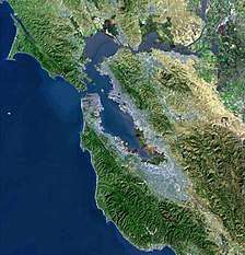
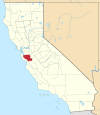
| Authority control |
|
|---|