San Rafael, California
San Rafael (/ˌsæn rəˈfɛl/ SAN rə-FEL; Spanish pronunciation: [san rafaˈel]; Spanish for '"Saint Raphael"') is a city and the county seat of Marin County, California, United States. The city is located in the North Bay region of the San Francisco Bay Area. As of the 2010 U.S. Census the city's population is 57,713.
San Rafael | |
|---|---|
City | |
| City of San Rafael | |
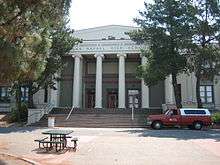
.jpg) .jpg) _at_Mission_San_Rafael_Arc%C3%A1ngel_-_panoramio_(cropped).jpg) .jpg) 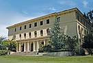 Clockwise: St. Vincent's School for Boys; Mission San Rafael Arcángel; Dominican University of California; St. Vincent's School; Saint Raphael Church. | |
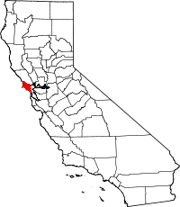
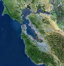
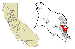 Location of San Rafael, California | |
 San Rafael Location in the United States  San Rafael San Rafael (California)  San Rafael San Rafael (the United States) | |
| Coordinates: 37°58′25″N 122°31′52″W | |
| Country | |
| State | |
| County | Marin |
| Incorporated | February 18, 1874[1] |
| Named for | Archangel Raphael |
| Government | |
| • Type | Council-manager with directly elected mayor |
| • Mayor | Gary O. Phillips[2] |
| • City Manager | Jim Schutz[3] |
| • Supervisor | District 1: Damon Connolly |
| • State Legislators[4] | Sen. Mike McGuire (D) Asm. Marc Levine (D) |
| • U. S. Rep. | Jared Huffman (D)[5] |
| Area | |
| • Total | 22.52 sq mi (58.32 km2) |
| • Land | 16.57 sq mi (42.91 km2) |
| • Water | 5.95 sq mi (15.41 km2) 26.55% |
| Elevation | 43 ft (13 m) |
| Population | |
| • Total | 57,713 |
| • Estimate (2018)[9] | 58,704 |
| • Density | 3,558.52/sq mi (1,373.95/km2) |
| • Demonym | San Rafaelino |
| Time zone | UTC-8 (PST) |
| • Summer (DST) | UTC-7 (PDT) |
| ZIP code | 94901 |
| Area codes | 415/628 |
| FIPS code | 06-68364 |
| GNIS feature IDs | 1659589, 2411804 |
| Website | www |
History
What is now San Rafael was once the site of several Coast Miwok villages: Awani-wi, near downtown San Rafael, Ewu, near Terra Linda and Shotomko-cha, in Marinwood.[10] Mission San Rafael Arcángel was founded in what is now downtown San Rafael as the 20th Spanish mission in the colonial Mexican province of Alta California by three priests—Father Narciso Durán from Mission San José, Father Abella from Mission San Francisco de Asís, Father Luis Gíl y Taboada from La Iglesia de Nuestra Señora Reina de los Angeles—on Dec. 14, 1817, four years before Mexico gained independence from Spain. Mission San Rafael Arcángel was located a donkey's day walk to the mission below it. The mission and the city are named after the Archangel Raphael, the Angel of Healing.
The mission was originally planned as a hospital site for Central Valley American Indians who had become ill at the cold San Francisco Mission Dolores. Father Luis Gil, who spoke several Native American languages, was put in charge of the facility. In part because of its ideal weather, San Rafael was later upgraded to full mission status in 1822. The mission had 300 converts within its first year, and 1,140 converts by 1828. The Mexican government took over the California missions in 1834, and Mission San Rafael was abandoned in 1844, eventually falling into ruin. The current mission was built in 1949 in the style of the original, but faces at right angles to the alignment of the original.
The San Francisco and North Pacific Railroad reached San Rafael in 1879 and was linked to the national rail network in 1888. The United States Navy operated a San Pablo Bay degaussing range from San Rafael through World War II.[11]
Geography
According to the United States Census Bureau, the city has a total area of 22.4 square miles (58 km2). 16.5 square miles (43 km2) of it is land and 6.0 square miles (16 km2) of it (26.55%) is water. South of the county is San Francisco.
Notable landmarks include:
- Mission San Rafael Arcángel, around which the city developed
- the Marin County Civic Center building, designed by Frank Lloyd Wright
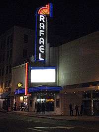
- the Rafael Film Center
- China Camp State Park, and
- Kerner Studios.
- Peacock Gap Golf Course which is open to the public.
There are several public parks in the city.
Environmental features
The San Rafael shoreline has been historically filled to a considerable extent to accommodate land development, with underlying bay mud (saturated clayed silt) of up to 90 feet (27 m) in thickness. At certain locations such as Murphys Point, the sandstone or shale rock outcrops through the mud.
San Rafael has a wide diversity of natural habitats from forests at the higher elevations to marshland and estuarine settings. Its marshes are home to the endangered species Salt Marsh Harvest Mouse. There are also riparian areas including the San Rafael Creek and Miller Creek corridors.
Climate
San Rafael has a Mediterranean climate (Köppen climate classification Csb), with mild winter lows seldom reaching the freezing mark. The National Weather Service reports that August is usually the warmest month with a high of 80.1 °F or 26.7 °C and a low of 55.0 °F or 12.8 °C. December, the coldest month, has an average high of 55.1 °F or 12.8 °C and an average low of 41.0 °F or 5.0 °C. The highest temperature on record is 110 °F (43.3 °C), recorded in June 1961. The highest temperature in recent years, 108 °F (42.2 °C), occurred on July 23, 2006.[12] The record lowest temperature was 20 °F (−6.7 °C) on December 22, 1990. There are an average of 17.9 afternoons annually with a high of 90 °F or 32.2 °C or more and 1.2 afternoons with a high of 100 °F or 37.8 °C or more. Freezing temperatures (32° or below) occur on an average of 3.6 mornings.[13]
Total annual precipitation averages 32.16 inches or 816.9 millimetres, with an average of 64.3 days with measurable rain. The rainy season is from November to early April: rain is rare outside of this period and it is normal to receive no rain in June, July, August, and September. The wettest “rain year” was from July 1994 to June 1995 with 61.45 inches (1,560.8 mm) and the driest from July 1975 to June 1976 with 13.62 inches (345.9 mm). The most rain in one month was 24.11 inches (612.4 mm) in January 1995, and the heaviest 24-hour rainfall was 8.74 inches (222.0 mm) on December 11, 1995. A trace of snow was recorded on January 30, 1976.
| Climate data for San Rafael, California (1981–2010 normals) | |||||||||||||
|---|---|---|---|---|---|---|---|---|---|---|---|---|---|
| Month | Jan | Feb | Mar | Apr | May | Jun | Jul | Aug | Sep | Oct | Nov | Dec | Year |
| Average high °F (°C) | 55 (13) |
60 (16) |
64 (18) |
67 (19) |
71 (22) |
77 (25) |
80 (27) |
80 (27) |
79 (26) |
73 (23) |
64 (18) |
55 (13) |
69 (21) |
| Average low °F (°C) | 42 (6) |
44 (7) |
45 (7) |
47 (8) |
50 (10) |
53 (12) |
55 (13) |
55 (13) |
54 (12) |
51 (11) |
46 (8) |
41 (5) |
49 (9) |
| Average precipitation inches (mm) | 6.85 (174) |
7.86 (200) |
4.16 (106) |
1.74 (44) |
.96 (24) |
.14 (3.6) |
0 (0) |
.05 (1.3) |
.13 (3.3) |
1.29 (33) |
3.02 (77) |
5.97 (152) |
32.16 (817) |
| Average precipitation days (≥ 0.01 in) | 12.2 | 10.9 | 9.7 | 5.7 | 3.4 | 1.1 | 0 | .1 | 1.0 | 3.4 | 6.4 | 10.4 | 64.3 |
| Source: NOAA [13] | |||||||||||||
Demographics
| Historical population | |||
|---|---|---|---|
| Census | Pop. | %± | |
| 1870 | 841 | — | |
| 1880 | 2,276 | 170.6% | |
| 1890 | 3,290 | 44.6% | |
| 1900 | 3,879 | 17.9% | |
| 1910 | 5,934 | 53.0% | |
| 1920 | 5,512 | −7.1% | |
| 1930 | 8,022 | 45.5% | |
| 1940 | 8,573 | 6.9% | |
| 1950 | 13,848 | 61.5% | |
| 1960 | 20,460 | 47.7% | |
| 1970 | 38,977 | 90.5% | |
| 1980 | 44,700 | 14.7% | |
| 1990 | 48,404 | 8.3% | |
| 2000 | 56,063 | 15.8% | |
| 2010 | 57,713 | 2.9% | |
| Est. 2018 | 58,704 | [9] | 1.7% |
| U.S. Decennial Census[14] | |||
2010
The 2010 United States Census[15] reported that the city of San Rafael had a population of 57,713. This figure does not, however, include portions of the Santa Venetia and Lucas Valley-Marinwood CDPs, nor various other unincorporated areas, all of which have San Rafael postal addresses; in total, according to the 2010 Census, there are 70,197 residents of San Rafael postal addresses (ZIP codes 94901 and 94903).
The following statistics refer to the incorporated limits of San Rafael only. The population density was 2,573.9 people per square mile (993.8/km²). The racial makeup of San Rafael was 40,734 (70.6%) White, 1,154 (2.0%) African American, 709 (1.2%) Native American, 3,513 (6.1%) Asian, 126 (0.2%) Pacific Islander, 8,513 (14.8%) from other races, and 2,964 (5.1%) from two or more races. Hispanic or Latino of any race were 17,302 persons (30.0%).
The Census reported that 55,594 people (96.3% of the population) lived in households, 1,314 (2.3%) lived in non-institutionalized group quarters, and 805 (1.4%) were institutionalized.
There were 22,764 households, out of which 6,358 (27.9%) had children under the age of 18 living in them, 9,845 (43.2%) were opposite-sex married couples living together, 2,004 (8.8%) had a female householder with no husband present, 1,133 (5.0%) had a male householder with no wife present. There were 1,450 (6.4%) unmarried opposite-sex partnerships, and 301 (1.3%) same-sex married couples or partnerships. 7,434 households (32.7%) were made up of individuals and 2,954 (13.0%) had someone living alone who was 65 years of age or older. The average household size was 2.44. There were 12,982 families (57.0% of all households); the average family size was 3.02.
The population was spread out with 11,132 people (19.3%) under the age of 18, 4,956 people (8.6%) aged 18 to 24, 16,915 people (29.3%) aged 25 to 44, 15,574 people (27.0%) aged 45 to 64, and 9,136 people (15.8%) who were 65 years of age or older. The median age was 40.2 years. For every 100 females, there were 99.7 males. For every 100 females age 18 and over, there were 98.1 males.
There were 24,011 housing units at an average density of 1,070.9 per square mile (413.5/km²), of which 11,909 (52.3%) were owner-occupied, and 10,855 (47.7%) were occupied by renters. The homeowner vacancy rate was 1.6%; the rental vacancy rate was 5.1%. 27,554 people (47.7% of the population) lived in owner-occupied housing units and 28,040 people (48.6%) lived in rental housing units.
2000
As of the census[16] of 2000, there were 56,063 people, 22,371 households, and 12,773 families residing in the city. The population density was 3,378.9 inhabitants per square mile (1,304.8/km²). There were 22,948 housing units at an average density of 1,383.1 per square mile (534.1/km²). The racial makeup of the city in 2010 was 59.0% non-Hispanic White, 1.8% non-Hispanic African American, 0.2% Native American, 6.0% Asian, 0.2% Pacific Islander, 0.3% from other races, and 2.6% from two or more races. 30.0% were Hispanic or Latino of any race.
There were 22,371 households out of which 25.8% had children under the age of 18, 44.3% were married couples living together, 9.0% had a female householder with no husband present, and 42.9% were non-families. 32.1% of all households were made up of individuals and 10.9% have someone living alone who is 65 or older. The average household size was 2.42 and the average family size was 2.99. The age distribution is as follows: 19.5% under the age of 18, 8.1% from 18 to 24, 33.3% from 25 to 44, 24.8% from 45 to 64, and 14.4% who were 65 years of age or older. The median age was 38 years. For every 100 females, there were 98.2 males. For every 100 females age 18 and over, there were 95.7 males.
The reported median income for a household in the city was $60,994; the median reported income for a family was $74,398 (these figures had risen to $67,789 and $85,459 respectively as of a 2007 estimate[17]). Males reported a median income of $50,650 versus $39,912 for females. The reported per capita income for the city was $35,762. About 5.6% of families and 10.2% of the population reported incomes below the poverty line, including 11.7% of those under age 18 and 5.0% of those age 65 or over.
Politics and government
San Rafael is a stronghold of the Democratic Party. According to the California Secretary of State, as of February 10, 2019, San Rafael has 31,288 registered voters. Of those, 17,566 (56.1%) are registered Democrats, 4,292 (13.7%) are registered Republicans, and 8,121 (26%) have declined to state a political party.[18]
San Rafael is governed by a city council with five members, elected at-large for four-year terms. The current members are:[2]
- Mayor Gary O. Phillips,
- Vice Mayor Kate Colin,
- Maribeth Bushey,
- John Gamblin, and
- Andrew McCullough.
Federal and state
In the United States House of Representatives, San Rafael is in California's 2nd congressional district, represented by Democrat Jared Huffman.[19] From 2008 to 2012, Huffman represented Marin County in the California State Assembly.
In the California State Legislature, San Rafael is in:
- the 10th Assembly District, represented by Democrat Marc Levine[20]
- the 2nd Senate District, represented by Democrat Mike McGuire.
Economy
BioMarin, Autodesk, In Defense of Animals, Westamerica Bank, and GIS Data Resources[21] are among the companies headquartered in San Rafael.
Entertainment industry
After the arrival of George Lucas in San Rafael in 1970 to film the movie THX 1138, the city became a center for the entertainment industry, particularly the high-tech elements of the business. Lucasfilm was founded by George Lucas in 1971, and is best known for the global hit movie series Star Wars and also for Indiana Jones. Some of the company's operations were moved to San Francisco in 2005. Portions of the Universal movie production American Graffiti were filmed in downtown San Rafael under George Lucas's direction, and portions of THX 1138 were shot at the Marin County Civic Center in San Rafael. Much of the movie Gattaca, starring Ethan Hawke, was also shot in the Marin County Civic Center. Industrial Light & Magic was founded in 1975 by Lucas to do special effects for his films and those of other filmmakers. The new-age music program Hearts of Space has been headquartered in San Rafael since 2004.
Largely because of the presence of LucasFilm, San Rafael started to attract video game developers, with several major studios located in the city.
- Brøderbund Software — Founded by Doug Carlston and Gary Carlston in 1980, the company was sold to Mindscape in 1998 and moved to Novato. Best known for the hit titles Choplifter, Lode Runner, The Print Shop, Where in the World is Carmen Sandiego? and Myst, and for being the early distributor of SimCity. After several subsequent acquisitions by various companies, in 2001 the remaining Brøderbund offices were moved to San Francisco.
- LucasArts — Founded by George Lucas in (1984) as LucasFilm Games; relocated to San Francisco in 2005. Best known for Star Wars and Indiana Jones games and innovative titles such as The Secret of Monkey Island, Grim Fandango and Full Throttle.
- Stormfront Studios — Founded by San Rafael native Don Daglow in 1988. Best known for The Lord of the Rings: The Two Towers, many EA Sports titles including NASCAR Racing, Gold Box role-playing video games and the first graphical MMORPG, Neverwinter Nights.
- Visual Concepts — Founded by Greg Thomas in 1988, the company was bought by Sega in 1999, then sold to Take Two Interactive in 2004. Best known for creating many EA Sports titles, and recently for Sega Sports and its 2K line of sports games.
- Totally Games — Founded by former LucasArts programmer Larry Holland in 1994. Best known for a series of Star Wars flight sim games.
- THX — the high-fidelity audio/visual reproduction standard which started as a spin-off from Lucasfilm Ltd., founded by Tomlinson Holman at George Lucas's company.
- Factor 5 — Founded in Germany in 1987 by Julian Eggebrecht, moved to San Rafael in 1996 to be close to publisher LucasArts. Best known for Star Wars and Indiana Jones games. In May 2009, the company's San Rafael studio closed.[22]
- Telltale Games — Founded in 2004 by former LucasArts employees. Best known for its video game adaptation of The Walking Dead and Sam & Max adventure games. The company filed for bankruptcy on November 14, 2018.[23]
- Mind Control Software — Founded in 1994 by Andrew Leker, Best known for Independent Games Festival winning game, Oasis.
Top employers
According to San Rafael's 2010 Comprehensive Annual Financial Report,[24] the top employers in the city are:
| # | Employer | # of Employees |
|---|---|---|
| 1 | BioMarin | 2,518 |
| 2 | Kaiser Permanente | 1,330 |
| 3 | Autodesk | 928 |
| 4 | Comcast | 619 |
| 5 | City of San Rafael | 592 |
| 6 | Safeway | 452 |
| 7 | Macy's | 450 |
| 8 | MHN | 350 |
| 9 | Bradley Real Estate | 350 |
| 10 | Dominican University of California | 336 |
| 11 | Guide Dogs for the Blind | 280 |
Parks
San Rafael contains a number of parks:
- There is one regional park that serves statewide users: China Camp State Park.
- One County-maintained park next to China Camp State Park this park is McNear's Beach Park and it is run by Marin County Parks. This park also has a pool that is open for public use ($5 entrance fee, Seasonal Summer Use).
- Community parks are Albert Park, Boyd Park, Gerstle Park, Pickleweed Park and the Terra Linda Recreational Center.
- Albert Park is the home of the San Rafael Pacifics Baseball Club, founded in 2012. The team played 42 home games in its inaugural season and is a member of the Pacific Association of Professional Baseball Clubs. In its five-year span, the San Rafael Pacifics have brought home 3 Championships in 2012, 2014 and 2015, being thwarted by Maui's Ace Jesse Smith of Lincoln, Nebraska in a one-game Championship game in 2013, even though The Pacifics were 7 games up on Maui leading up to the single Championship game that year.
- There are a number of neighborhood parks and mini-parks such as Bret Harte Park, Boyd Park, Sun Valley Park, Oleander Park, Victor Jones Park, Peacock Gap Park and Gerstle Park. Gerstle Park is also a historic and walkable neighborhood south of First Street in close proximity to central Downtown.
Educational institutions
San Rafael has one university, Dominican University of California.
The Ali Akbar College of Music, was founded in San Rafael by Indian musician Ali Akbar Khan to teach Indian classical music.
San Rafael is also the home to one of the two campuses of Guide Dogs for the Blind, a guide dog training school.
Most public schools in San Rafael are operated by the San Rafael City Schools district. Miller Creek Elementary School District operates some public elementary and middle schools north of San Rafael proper. All comprehensive public high schools are governed by San Rafael City Schools.
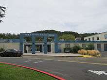
The district operates two comprehensive public high schools: San Rafael High School, Terra Linda High School and one alternative high school, Madrone.
Public schools not operated by the district include:
- Phoenix Academy is a California charter school where chemically dependent students can develop a drug- and alcohol-free lifestyle, make academic progress, address emotional issues, and make sound career and vocational decisions. The school provides a highly structured and supervised program.
Private schools:
- Mark Day School, is a K-8 independent private school in San Rafael, CA. Formally known as St. Marks School, on May 23, 2014, the Saint Mark's School would become Mark Day School effective July 1, 2014.
- Marin Academy, previously the San Rafael Military Academy, is a private high school in San Rafael. Prior to the name change students discharged two Spanish–American War cannons daily at 5:00 p.m.
- Saint Raphael School, a K-8 school with a history linked to the Mission San Raphael.
- 3R School, an early example of the nonconventional school movement, featured in Time Magazine and using McGuffey's Third Eclectic Reader among other teaching materials, operated in San Rafael from 1955 to 1983.
- Brandeis Marin, a K-8 Jewish day school, opened a Marin campus in 1978. It shares a campus with the Osher Marin JCC and Congregation Rodef Sholom.
- The Marin School is an independent, college-preparatory high school on North San Pedro Road, between the Civic Center and the Osher Marin JCC. TMS was founded in 1981 and moved to San Rafael in 2013.
Transportation
The major north-south freeway through San Rafael is U.S. Route 101, connecting the North Coast (California) and the Redwood Empire to the north, and San Francisco to the south. Interstate 580 heads across the Richmond–San Rafael Bridge to the East Bay.
The San Rafael Transit Center, located at the corner of 3rd and Hetherton Streets, is served by a number of bus agencies, including Golden Gate Transit, Marin Transit, Sonoma County Transit, Sonoma County Airport Express, and Greyhound.[25] Local bus service is provided primarily by Golden Gate Transit and Marin Transit.
Commuter rail by Sonoma–Marin Area Rail Transit (SMART) serves the city at two stations: a converted San Rafael Transit Center and a station at Marin Civic Center. The line opened to the Santa Rosa Airport in 2017 and was extended to Larkspur to make Larkspur Landing ferry connection in December 2019.[26]
In popular culture
The term "420" when used in reference to cannabis consumption is believed to have originated in San Rafael, specifically, at San Rafael High School. Since then, use of "420" has spread throughout the rest of the United States, and much of the rest of the world, in reference to cannabis consumption on April 20 or at 4:20 p.m., the time the original group gathered after school.[27]
Shel Silverstein's poem "The Smoke-Off" is about a girl named Pearly Sweetcakes who came from San Rafael.[28]
The TV show 13 Reasons Why is based in San Rafael, and many scenes from the first season were filmed downtown.
Notable people
- Isabel Allende, author[29]
- Stacey Bailey, former American football wide receiver, Atlanta Falcons
- Philip K. Dick, novelist[30]
- Justine Frischmann, lead singer of Elastica and visual artist[31]
- Brad Gilbert, professional tennis player and coach[32]
- Lauren Grandcolas, a 9/11 victim on United Flight 93[33]
- Llewellyn F. Haskell (1842-1929), United States Army officer and a Union general during the American Civil War.[34]
- James Hetfield, musician[35]
- Michael Johnson, sprinter, 1996 Atlanta Olympics gold medalist, resides in the hills above San Rafael[36]
- Christian Mortensen (1882–1998), supercentenarian, the one-time oldest living human male, aged 115 years and 252 days at death[37]
- Marin Sais, actress
- Carlos Santana, musician[38]
- Elizabeth Charleston, painter[39]
- Gladys Kathleen Parkin, wireless radio operator[40]
- Charles Dormon Robinson, painter[41]
- Dana Sabraw, U.S. District Judge
- Scott Thunes, musician
- Michael Savage, radio host, author, activist, nutritionist, conservative political commentator, host of The Savage Nation.
- Will Venable, former professional Major League Baseball player.
- Dave Archer (painter), artist
- Natu Tuatagaloa is a former professional football player in the American NFL
- Dan Green, voice actor
Neighborhoods
Although not every location in San Rafael is part of a neighborhood that has a widely accepted and widely recognized name, there are some neighborhoods that have names that are accepted and recognized by most locals. The City of San Rafael 2020 General Plan recognizes 30 distinct neighborhoods in San Rafael:
|
|
Sister cities


See also
- California Film Institute
- Marin Academy
- Marin Local Music
- Pacific Sun (newspaper)
- San Rafael City Schools
- San Rafael High School
- Terra Linda High School
References
- "California Cities by Incorporation Date". California Association of Local Agency Formation Commissions. Archived from the original (Word) on November 3, 2014. Retrieved August 25, 2014.
- "Mayor & City Council". City of San Rafael. Retrieved January 18, 2015.
- "City Manager's Office". City of San Rafael. Retrieved October 22, 2014.
- "Statewide Database". UC Regents. Archived from the original on February 1, 2015. Retrieved January 18, 2015.
- "California's 2nd Congressional District - Representatives & District Map". Civic Impulse, LLC.
- "2016 U.S. Gazetteer Files". United States Census Bureau. Retrieved June 28, 2017.
- "San Rafael". Geographic Names Information System. United States Geological Survey.
- "San Rafael (city) QuickFacts". United States Census Bureau. Retrieved January 28, 2015.
- "Population and Housing Unit Estimates". Retrieved July 18, 2019.
- Peterson, Bonnie J. (1976). Dawn of the World: Coast Miwok Myths. ISBN 0-912908-04-1
- "U.S. Naval Activities World War II by State". Patrick Clancey. Retrieved March 19, 2012.
- http://www.wrh.noaa.gov/mtr/heat.php Archived March 12, 2007, at the Wayback Machine wrh.noaa.gov
- "NowData - NOAA Online Weather Data". National Oceanic and Atmospheric Administration. Retrieved December 5, 2012.
- "Census of Population and Housing". Census.gov. Retrieved June 4, 2015.
- "2010 Census Interactive Population Search: CA - San Rafael city". U.S. Census Bureau. Archived from the original on July 15, 2014. Retrieved July 12, 2014.
- "U.S. Census website". United States Census Bureau. Retrieved January 31, 2008.
- US Census Bureau. 2005-2007 American Community Survey 3-Year Estimates
- "CA Secretary of State – Report of Registration – February 10, 2019" (PDF). ca.gov. Retrieved March 12, 2019.
- "California's 2nd Congressional District - Representatives & District Map". Civic Impulse, LLC. Retrieved March 1, 2013.
- "Members Assembly".
- GIS Data Resources, Inc. Archived September 15, 2002, at the Library of Congress Web Archives
- Bailey, Kat. (2009-05-14) San Rafael Factor 5 Studio Officially Shut Down: News from. 1UP.com. Retrieved on 2013-07-21.
- Makuch, Eddie. (2018-11-14)“Telltale Games Is Closing, Bankruptcy Proceedings Beginning”. GameSpot. Retrieved on 2018-11-20.
- City of San Rafael CAFR
- Sonoma County Airport Express Website
- Prado, Mark (March 4, 2016). "Commuter train rolls into San Rafael for the first time in 50 years". Marin Independent Journal. MediaNews Group. Retrieved March 6, 2016.
- David Mikkelson. "The Origins of 420". snopes.com.
- Shel Silverstein. "The Smoke Off". All Poetry.
- Correas Zapata, Celia (1998). Isabel Allende: Vida y espíritus, p. 223. ISBN 0553061003
- Sutin, Lawrence (2006). Divine Invasions: A Life of Philip K. Dick, p. 181.
- "Justine Frischmann | In The Make | Studio visits with West Coast artists". inthemake.com. May 2012. Retrieved June 26, 2019.
- "Brad Gilbert | Overview | ATP World Tour | Tennis". ATP World Tour. Retrieved November 21, 2016.
- Wilgoren, Jodi; Wong, Edward (September 13, 2001). "AFTER THE ATTACKS: UNITED FLIGHT 93; On Doomed Flight, Passengers Vowed To Perish Fighting". The New York Times.
- Leonard, John William; Marquis, Albert Nelson, eds. (1908). Who's Who in America. Chicago: Marquis Who's Who. p. 839. OCLC 1141571.CS1 maint: ref=harv (link)
- New trail to bypass Metallica star's land gets county environmental approval - Marin Independent Journal. Marinij.com (2010-07-19). Retrieved on 2013-07-21.
- Helena de Bertodano (July 9, 2012). "Michael Johnson: 'For eight years I was a five-time gold medallist. Then it was four-time. It's not the same'". The Telegraph. Retrieved July 17, 2012.
- "Christian Mortensen, 115, Among Oldest". The New York Times. May 3, 1998.
- San Rafael - Marin Magazine - November 2009 - Marin County, California. Marin Magazine. Retrieved on 2013-07-21.
- "San Francisco Chronicle Obituary for Elizabeth Charleston". Retrieved September 17, 2008.
- Ehat, Carla; Parkin, Kathleen (1977). Oral History: Kathleen Parkin. Anne T. Kent California Room Oral History Project.
- Lekisch, Barbara (September 2003). Embracing scenes about Lakes Tahoe & Donner: painters, illustrators & sketch artists 1855-1915. Peter Browning. pp. 152–. ISBN 978-0-944220-14-6. Retrieved January 28, 2012.
- https://www.cityofsanrafael.org/sister-cities/
Bibliography
- San Rafael Recreation Element of the General Plan, June, 1984
- U.S. Geological Survey, Topographical Map, San Quentin 7.5 Minute Quadrangle, revised 1980
External links
| Wikimedia Commons has media related to San Rafael, California. |
| Wikivoyage has a travel guide for San Rafael. |
Municipalities and communities of Marin County, California, United States | ||
|---|---|---|
| Cities and towns |
|  Marin County map |
| CDPs |
| |
| Unincorporated communities |
| |
| Ghost towns |
| |
| Bodies of water |
|  |
|---|---|---|
| Counties |
| |
| Major cities | ||
| Cities and towns 100k–250k |
| |
| Cities and towns 50k–99k |
| |
| Cities and towns 25k–50k |
| |
| Cities and towns 10k–25k |
| |
| Sub-regions |
| |
| ||
| Authority control |
|
|---|