Salinas, California
Salinas (/səˈliːnəs/) is a city in Monterey County, California, United States. With a population of 156,259 (as of 2018), Salinas is the most populous city in Monterey County, as well as its county seat.[10] Salinas is an urban area located just outside the southern portion of the Greater Bay Area and 10 miles (16 km) southeast of the mouth of the Salinas River.[11] The city is located at the mouth of the Salinas Valley, roughly eight miles from the Pacific Ocean, and it has a climate more influenced by the ocean than the interior.
Salinas, California | |
|---|---|
City | |
| City of Salinas | |
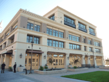
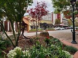 Main Street in downtown Salinas, 2019 | |
 Seal Wordmark | |
| Nickname(s): "The Salad Bowl of the World"[1] | |
| Motto(s): "Rich in Land, Rich in Values."[2] | |
 Location of Salinas, California | |
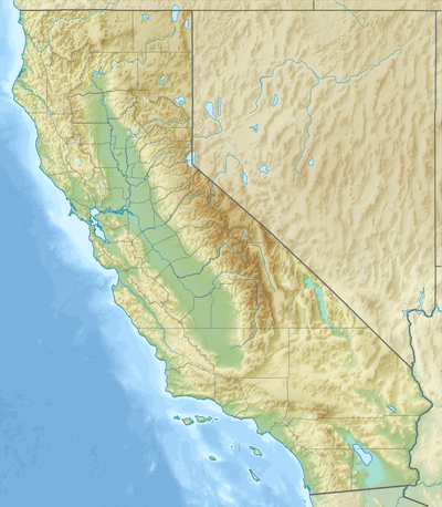 Salinas, California Location in the United States  Salinas, California Salinas, California (the United States) | |
| Coordinates: 36°40′40″N 121°39′20″W | |
| Country | United States |
| State | California |
| Region | Northern California |
| County | Monterey |
| Incorporated | March 4, 1874[3] |
| Government | |
| • Type | Council-Manager |
| • Mayor | Joe Gunter[4] |
| • State senator | Anna Caballero (D)[5] |
| • Assemblymember | Robert Rivas (D)[5] |
| • U. S. rep. | Jimmy Panetta (D)[6] |
| Area | |
| • City | 23.65 sq mi (61.25 km2) |
| • Land | 23.61 sq mi (61.15 km2) |
| • Water | 0.04 sq mi (0.10 km2) 0.16% |
| Elevation | 52 ft (16 m) |
| Population | |
| • City | 150,441 |
| • Estimate (2018)[10] | 156,259 |
| • Rank | 1st in Monterey County 35th in California 165th in the United States |
| • Density | 6,658.96/sq mi (2,570.99/km2) |
| Time zone | UTC−8 (Pacific) |
| • Summer (DST) | UTC−7 (PDT) |
| ZIP Codes | 93901–93902, 93905–93907, 93912, and 93915 |
| Area code | 831 |
| FIPS code | 06-64224 |
| GNIS feature IDs | 277589, 2411768 |
| Website | www |
Salinas serves as the main business, governmental and industrial center of the region.[12] The marine climate is ideal for the floral industry, grape vineyards, and vegetable growers. Salinas is known as the "Salad Bowl of the World" for its large, vibrant agriculture industry.
It was the hometown of writer and Nobel laureate John Steinbeck (1902–68), who set many of his stories in the Salinas Valley and Monterey.[13]
History
The land currently occupied by the city of Salinas is thought to have been settled by Native Americans known as the Esselen prior to 200 AD.[14] Between 200 and 500 AD, they were displaced by the Rumsen group of Ohlone speaking people. The Rumsen-Ohlone remained as the inhabitants of the area for approximately another 1,200 years, and in the 1700s, were the group of native inhabitants contacted and recorded by the first Spanish explorers of the Salinas area.
Upon the arrival of the Spanish, large Spanish land grants were initially issued for the Catholic Missions and also as bonuses to soldiers. Later on after Mexican independence, smaller land grants continued to be issued for ranchos where mostly cattle were grazed. One of the many land grants was the Rancho Las Salinas land grant, part of which included the area of modern-day Salinas. As a result of the many new cattle ranches, a thriving trade eventually developed in cattle hide shipments, shipping primarily out of the Port of Monterey.[15]
In 1848 California officially became a part of the United States of America. This transition followed several years of battles in the Salinas area with John Fremont flying the American flag on the highest peak of the Gabilan Mountains and claiming California for the United States. Before the transition to American administration, Monterey had been the capital of California. For a short while after the transition, California was ruled by martial law.[15] On September 9, 1850, California was admitted to the Union and became a State, celebrated as California Admission Day.
In the 1850s a junction of two main stage coach routes was located 18 miles east of Monterey and along the big bend of what is locally referred to as the Alisal Slough.[16] In 1854, six years after becoming a part of the United States, a group of American settlers living in the vicinity of this route-junction opened a post office at the junction, naming their town "Salinas," apparently a reference to the original "Rancho Las Salinas" name for the area,[11] which in turn was named in Spanish for the salt marshes of the area around the central Salinas slough, which was drained. Soon thereafter, in 1856, a traveler's inn called the Halfway House was opened at that junction in Salinas.[11] (The nearby Salinas River, was apparently only later named by an American cartographer, after the nearest town of Salinas in 1858. Previously that river had gone by the name: "Rio de Monterey."). The streets of Salinas were laid out in 1867, and the town was incorporated in 1874.[11]
The conversion of grazing land to crops and the coming of the rail road in 1868 to transport goods and people was a major turning point in the history and economic advancement of Salinas. Dry farming of wheat, barley, and other grains as well as potatoes and mustard seed was common in the 1800s. Chinese labor drained thousands of acres of swampland to become productive farmland, and as much early farm labor was done by Chinese immigrants, Salinas boasted the second largest Chinatown in the state, slightly smaller than San Francisco.[17] Irrigation changed farming in Salinas to mainly row crops of root vegetables, grapes and sugar beets. Many major vegetable producers placed their headquarters in Salinas. Driven by the profitable agricultural industry, Salinas had the highest per capita income of any city in the United States in 1924.[18]
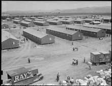
| Wikimedia Commons has media related to Salinas Assembly Center. |
During World War II, the Salinas Rodeo Grounds was one of the locations used as a temporary detention camp for citizens and immigrant residents of Japanese ancestry, before they were relocated to more permanent and remote facilities. One of seventeen such sites overseen by the Wartime Civilian Control Administration, the Salinas Assembly Center was built after President Roosevelt issued Executive Order 9066, authorizing the removal and confinement of Japanese Americans living on the West Coast. The camp opened on April 27, 1942 and held a total of 3,608 people before closing two months later on July 4.
Following World War II major urban and suburban development converted much farmland to city. The city experienced two particularly strong growth spurts in the 1950s and 1960s, and again in the 1990s and early 2000s.[19] Aerial photographic interpretation indicate such major conversion of cropland to urban uses over the time period 1956 to 1968,[20][21] while the city annexed the adjacent communities of Alisal and Santa Rita during this time.[22] The Harden Ranch, Creekbridge and Williams Ranch neighborhoods constituting much of the city's North-East were built almost exclusively between 1990 and 2004.[19]
Salinas was also the birthplace of writer and Nobel Prize laureate John Steinbeck. The historic downtown, known as Oldtown Salinas, features much fine Victorian architecture, and is home to the National Steinbeck Center, the Steinbeck House and the John Steinbeck Library.
Major development took place in the 1990s, with the construction of Creekbridge, Williams Ranch, and Harden Ranch.[23]
Ethnology

Traditionally an Anglophonic European American settlement, Salinas became home to a significant Asian minority who joined European-American immigrants in the agriculture and fishing industries at the turn of the 20th century. Meanwhile, the neighboring and, at the time, unincorporated community of Alisal became a mecca for Hispanic immigrants primarily from Mexico, drawn to opportunities in the area's agricultural industry. When annexed in 1963, Alisal was described as a large Mexican-American enclave, added to a city that was still otherwise majority European-American.[25]
Hispanic immigration peaked from the 1980s through the early 2000s. Mostly European-American neighborhoods in North Salinas, an expansion of the original city built mostly in the 1950s and 60s, became majority Latino by 2010. As Latino immigrants and their descendants became more affluent and established, the proportion of Hispanics increased in the city's more affluent South and North-East. From the time it was first built in the late 1980s, to the 2000 Census, Creekbridge – the city's highest income area, least affected by poverty - remained mostly European-American and minority Latino.[26] By 2010, however, US-born Latinos had become the largest ancestry group in the area. In South Salinas, the city's original area and most European-American section, Hispanics typically constitute over 40% of residents.[27]
Despite its key role in the city's early development and significant Filipino immigration over recent decades, the Asian-American community of Salinas remains small compared to that of California on average. The highest concentration of Asian-Americans is found in Creekbridge, where they constitute roughly 1 in 5 residents.[28]
Along with the great influx of legal immigrants was an influx of undocumented immigrants. By 2011, Salinas had one of the highest concentrations of unauthorized immigrants in the state and nationwide. Of the city's three main zip codes, two had 10%-15% of residents being unauthorized immigrants, and a third over 15%.[29]
The fear many undocumented immigrants have of government authorities has been a great obstacle faced by local law enforcement in crime investigations, community relations, and gathering information needed for effective policing. As a result, Salinas police department policy is to not verify immigration status of individuals coming into contact with city police officers.[30]
Geography
According to the United States Census Bureau, the city has a total area of 23.2 square miles (60 km2), 99.84% of it land and 0.16% of it water.
Prior to mass agricultural and urban development, much of the city consisted of rolling hills bisected by wooded creeks and interspersed with marsh land.[25] Today, the city is located mostly on leveled ground, with some rolling hills and wooded gulches with creeks remaining in the north-eastern Creekbridge and Williams Ranch neighborhoods, as well as the Laurel Heights section of East Salinas.[31] The natural ecosystems accompanying the area's topography and environment have been recreated in Natividad Creek Park and adjacent Upper Carr Lake.[32]
The city rests about 18 meters (59 feet) above sea level, and it is located roughly eight miles from the Pacific Ocean. The Gabilan and Santa Lucia mountain ranges border the Salinas Valley to the east and to the west, respectively. Both mountain ranges and the Salinas Valley run approximately 90 miles (145 km) south-east from Salinas towards King City.
The Salinas River runs the length of the Salinas Valley and empties into the Pacific Ocean at the center of the Monterey Bay. During the summer months the river flows partially underground and it is this extensive underground aquifer that allows for irrigation of cropland in an area without much annual rainfall.
Surrounding communities | ||||||||||
|---|---|---|---|---|---|---|---|---|---|---|
| ||||||||||
Climate
Salinas has cool and moderate temperatures, due to the "natural air conditioner" that conveys ocean air and fog from the Monterey Bay to Salinas, while towns to the north and south of Salinas experience hotter summers, as mountains block the ocean air. Thus, Salinas weather is closer to that of the Central Coast of California, rather than that of inland valleys, and thus has a mild Mediterranean climate with typical daily highs ranging from around 63 °F (17 °C) in the winter to around 75 °F (24 °C) in the summer. According to the Weather Channel, monthly average temperature highs range from 61 to 75 °F or 16.1 to 23.9 °C. The record highest temperature was 106 °F (41 °C) on September 14, 1971.[33] The record lowest temperature was 18 °F (−8 °C) on December 21, 1937. Annually, there are an average of 5.5 days with 90 °F (32 °C)+ highs, and an average of 11.7 days with lows reaching the freezing mark or lower.[34]
In 2015 Salinas was in the top ten American cities for cleanest air quality,[35] It is thought that the offshore marine layer generates winds that blow smog further inland.
The difference between ocean and air temperature also tends to create heavy morning fog during the summer months, known as the marine layer, driven by an onshore wind created by the local high pressure sunny portions of the Salinas Valley, which extend north and south from Salinas and the Bay.

The average annual rainfall for the city is approximately 13.26 inches or 336.8 millimetres. The wettest "rain year" since records at the present station began in 1959 was from July 1997 to June 1998 with 34.63 inches (879.6 mm) of precipitation, and the driest from July 1971 to June 1972 with 7.29 inches (185.2 mm). The most precipitation in one month was 11.10 inches (282 mm) in February 1998. The record maximum 24-hour precipitation was 2.96 inches (75 mm) on January 23, 2000.[36] Occasionally, there is snowfall on the peaks of the Gabilan and Santa Lucia mountain ranges, but snow in the city itself is extremely rare, occurring about once every 5 to 15 years on average. An inch of snow fell in Salinas on February 26, 2011.
| Climate data for Salinas (KSNS) | |||||||||||||
|---|---|---|---|---|---|---|---|---|---|---|---|---|---|
| Month | Jan | Feb | Mar | Apr | May | Jun | Jul | Aug | Sep | Oct | Nov | Dec | Year |
| Record high °F (°C) | 85 (29) |
86 (30) |
89 (32) |
100 (38) |
99 (37) |
103 (39) |
100 (38) |
102 (39) |
106 (41) |
105 (41) |
94 (34) |
82 (28) |
106 (41) |
| Average high °F (°C) | 61.1 (16.2) |
62.5 (16.9) |
63.8 (17.7) |
66.4 (19.1) |
67.9 (19.9) |
70.2 (21.2) |
71.5 (21.9) |
72.3 (22.4) |
74.3 (23.5) |
73.0 (22.8) |
64.1 (17.8) |
61.3 (16.3) |
67.5 (19.7) |
| Average low °F (°C) | 41.1 (5.1) |
42.9 (6.1) |
44.5 (6.9) |
46.0 (7.8) |
49.7 (9.8) |
52.6 (11.4) |
54.6 (12.6) |
55.3 (12.9) |
54.1 (12.3) |
50.1 (10.1) |
42.6 (5.9) |
39.8 (4.3) |
47.9 (8.8) |
| Record low °F (°C) | 18 (−8) |
25 (−4) |
27 (−3) |
29 (−2) |
34 (1) |
39 (4) |
42 (6) |
42 (6) |
36 (2) |
28 (−2) |
25 (−4) |
23 (−5) |
18 (−8) |
| Average precipitation inches (mm) | 2.64 (67) |
2.40 (61) |
2.17 (55) |
1.12 (28) |
0.32 (8.1) |
0.09 (2.3) |
0.03 (0.76) |
0.05 (1.3) |
0.12 (3.0) |
0.60 (15) |
1.38 (35) |
2.35 (60) |
13.26 (337) |
| Average precipitation days | 8.1 | 8.8 | 7.8 | 5.2 | 2.7 | 1.0 | 0.2 | 0.7 | 0.9 | 2.7 | 5.6 | 8.2 | 52.0 |
| Source #1: WRCC (temperature 1971–2000, precipitation and extremes 1906–present)[37] | |||||||||||||
| Source #2: Weather Channel[38] | |||||||||||||
Demographics
Income, poverty and education: 2012–2017
As of the 2013–2017 American Community Survey by the U.S. Census Bureau, Salinas had a median household income of $54,864 in 2017, slightly lower than the United States median of $61,372.[39]
The most affluent and educated neighborhoods in Salinas are Creekbrige (North-East), Laurelwood (Central-West) and South Salinas (South-West). Hebbron Heights and East Salinas, also known as the Alisal, had lower educational attainment and household income when compared with other parts of the city - as it has been since the Alisal area containing it was annexed by the city in 1963.[40]
While most neighborhoods saw 1 in every 4-to-6 residents live in poverty, only 1 in 25 residents lived in poverty in Creekbridge – by far the lowest rate in the city and less than a third of state and national average. Regarding educational attainment, the pattern was different. There remained a significant disparity across the city, but the city's most affluent neighborhoods failed to exceed national or statewide averages despite having significantly higher incomes and lower poverty than California or the nation as a whole.[41][42]
Thematic maps
 Median Household Income by Census Block Group as of 2014; the darker, the more affluent.[43]
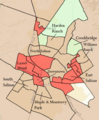 Percent of individuals falling below US Federal Poverty Line; the deeper the red, the higher the poverty rate.[43]
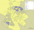 Concentration of individuals above age 25 with a master's degree by Block Group
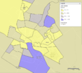 Share of households with annual incomes of $150,000 or higher across census tracts in Salinas.[44]
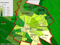 Map of income distribution in Salinas[45]
Data by area
Income, poverty and education for all neighborhoods within Salinas city limits (2008 – 2012 five-year average)[19][41][42][46]
| Census Tract | Area / Neighborhood | Median Household Income ($USD) | Households earning over 200k/year (%) | Poverty Rate (%) | Homeownership Rate (%) | High school graduate or higher (%) | Bachelor's degree or higher (%) | Graduate or professional degree (%) |
|---|---|---|---|---|---|---|---|---|
| N/A | United States | 53,004 | 4.6% | 14.9 | 65.5 | 85.7 | 28.5 | 10.6 |
| N/A | California | 61,400 | 7.1% | 15.3 | 56.0 | 81.0 | 30.5 | 11.1 |
| N/A | Salinas City | 50,587 | 2.2 | 20.8 | 43.8 | 60.0 | 13.1 | 4.1 |
| 1.02 | Harden Ranch (North-East) | 77,688 | 3.0 | 11.6 | 63.1 | 69.6 | 19 | 2.9 |
| 1.03 | Harden Ranch (North) | 54,406 | 1.1 | 7.0 | 21.1 | 72.7 | 15.9 | 5.6 |
| 1.04 | Creekbridge & Monte Vista Park (North-East) | 84,632 | 7.0 | 11.0 | 82.3 | 79.7 | 19.7 | 2.1 |
| 2 | North Salinas | 58,401 | 2.1 | 16.1 | 48.3 | 54.2 | 4.2 | 0.6 |
| 3 | North Salinas | 55,345 | 0.0 | 15.8 | 54.8 | 66.1 | 12.5 | 1.2 |
| 4 | North Salinas | 40,449 | 1.8 | 24.9 | 28.4 | 57.1 | 8.2 | 2.1 |
| 5.01 | Hebbron Heights/East Salinas | 32,125 | 0.0 | 46.6 | 7.3 | 30.8 | 2.1 | 0.0 |
| 5.02 | Laurel Heights/East Salinas | 45,855 | 0.7 | 19.4 | 44.8 | 46.4 | 8.8 | 1.3 |
| 6 | East Salinas | 48,663 | 1.3 | 29.1 | 29.5 | 36.1 | 6.1 | 0.0 |
| 7.01 | East Salinas | 36,043 | 0.0 | 40.5 | 24.5 | 29.6 | 2.4 | 0.5 |
| 7.02 | East Salinas | 40,483 | 0.0 | 40.5 | 18.4 | 22.7 | 2.0 | 1.5 |
| 8 | East Salinas | 54,685 | 0.0 | 28.3 | 48.6 | 41.0 | 1.2 | 0.0 |
| 9 | East Salinas | 42,336 | 0.0 | 27.8 | 33.8 | 39.3 | 4.5 | 0.3 |
| 12 | Maple Park (South-West) | 60,347 | 9.9 | 15.4 | 53.8 | 87.1 | 28.1 | 7.9 |
| 13 | Downtown | 21,176 | 0.0 | 43.3 | 6.4 | 55.4 | 12.3 | 7.4 |
| 14 | South Salinas | 49,726 | 2.7 | 15.8 | 41.7 | 81.2 | 28.2 | 10.4 |
| 15 | Los Olivos & Mission Park/South Salinas | 72,426 | 3.2 | 15.0 | 40.2 | 93.6 | 25.6 | 9.2 |
| 16 | South Salinas | 61,635 | 1.8 | 16.6 | 57.5 | 86.5 | 24.9 | 9.2 |
| 17 | South Salinas | 51,797 | 2.9 | 14.3 | 46.1 | 66.2 | 16.2 | 8.2 |
| 18.01 | Laurel Wood (West) | 64,525 | 0.9 | 21.5 | 52.8 | 70.6 | 18.4 | 4.9 |
| 18.02 | North Salinas | 53,813 | 2.4 | 22.5 | 26.0 | 68.6 | 16.0 | 4.2 |
| 105.4 | Santa Rita | 50,808 | 2.1 | 15.1 | 39.0 | 75.2 | 11.2 | 2.7 |
| 105.5 | Bolsa Knolls | 54,477 | 2.7 | 17.1 | 54.6 | 67.5 | 9.4 | 3.1 |
| 106.3 | Creekbridge (North-East) | 81,605 | 7.2 | 3.9 | 72.9 | 81.6 | 27.0 | 11.0 |
| 106.4 | Williams Ranch (North-East) | 68,299 | 3.7 | 13.9 | 69.5 | 49.8 | 14.0 | 6.8 |
| 106.5 | Williams Ranch (East) | 61,786 | 2.1 | 10.3 | 57.5 | 49.7 | 8.0 | 0.9 |
| 106.6 | Monte Bella & East Salinas | 58,363 | 4.6 | 13.1 | 59.3 | 58.5 | 14.2 | 4.4 |
| 106.8 | North Salinas | 53,147 | 0.0 | 14.8 | 45.0 | 32.6 | 5.5 | 1.2 |
| 145 | Monterey Park (South) | 60,833 | 4.9 | 9.5 | 48.7 | 85.9 | 26.3 | 7.9 |
| 106.7 | East Salinas | 45,156 | 0.0 | 31.0 | 37.2 | 32.6 | 5.5 | 1.2 |
Note: Census tract 9800 omitted from the table above. Although located within city limits,[46] census tract 9800 consists solely of an airport, golf course and commercial area with a population of 0.[41]
2010
| Historical population | |||
|---|---|---|---|
| Census | Pop. | %± | |
| 1870 | 599 | — | |
| 1880 | 1,854 | 209.5% | |
| 1890 | 2,339 | 26.2% | |
| 1900 | 3,304 | 41.3% | |
| 1910 | 3,736 | 13.1% | |
| 1920 | 4,308 | 15.3% | |
| 1930 | 10,263 | 138.2% | |
| 1940 | 11,586 | 12.9% | |
| 1950 | 13,917 | 20.1% | |
| 1960 | 28,957 | 108.1% | |
| 1970 | 58,896 | 103.4% | |
| 1980 | 80,479 | 36.6% | |
| 1990 | 108,777 | 35.2% | |
| 2000 | 151,060 | 38.9% | |
| 2010 | 150,441 | −0.4% | |
| Est. 2018 | 156,259 | [10] | 3.9% |
| U.S. Decennial Census[47] | |||
The 2010 United States Census[48] reported that Salinas had a population of 150,441. The population density was 6,479.8 people per square mile (2,501.9/km²). The racial makeup of Salinas was 68,973 (45.8%) White, down from 90.3% in 1970,[49] 2,993 (2.0%) African American, 1,888 (1.3%) Native American, 9,438 (6.3%) Asian, 478 (0.3%) Pacific Islander, 59,041 (39.2%) from other races, and 7,630 (5.1%) from two or more races. Hispanic or Latino of any race were 112,799 persons (75.0%).[50]
The Census reported that 147,976 people (98.4% of the population) lived in households, 658 (0.4%) lived in non-institutionalized group quarters, and 1,807 (1.2%) were institutionalized.
There were 40,387 households, out of which 21,435 (53.1%) had children under the age of 18 living in them, 21,380 (52.9%) were opposite-sex married couples living together, 6,835 (16.9%) had a female householder with no husband present, 3,300 (8.2%) had a male householder with no wife present. There were 3,271 (8.1%) unmarried opposite-sex partnerships, and 271 (0.7%) same-sex married couples or partnerships. 6,895 households (17.1%) were made up of individuals and 2,587 (6.4%) had someone living alone who was 65 years of age or older. The average household size was 3.66. There were 31,515 families (78.0% of all households); the average family size was 4.05.
The population was spread out with 47,180 people (31.4%) under the age of 18, 18,049 people (12.0%) aged 18 to 24, 44,978 people (29.9%) aged 25 to 44, 28,976 people (19.3%) aged 45 to 64, and 11,258 people (7.5%) who were 65 years of age or older. The median age was 28.8 years. For every 100 females, there were 102.1 males. For every 100 females age 18 and over, there were 100.8 males.
There were 42,651 housing units at an average density of 1,837.1 per square mile (709.3/km²), of which 18,198 (45.1%) were owner-occupied, and 22,189 (54.9%) were occupied by renters. The homeowner vacancy rate was 2.5%; the rental vacancy rate was 4.6%. 65,108 people (43.3% of the population) lived in owner-occupied housing units and 82,868 people (55.1%) lived in rental housing units. The majority of residents live in single-unit detached homes, built between 1950 and 2000, while one third of the housing stock has three or more units per structure.[19]
2000
The 2000 United States Census reported that Salinas had a population of 151,060. The population density was 7,948.4 per square mile (3,068.1/km²). There were 39,659 housing units at an average density of 2,086.8 per square mile (805.5/km²). The racial makeup of the city was 65.2% Hispanic or Latino of any race, 49.1% White, 6.2% Asian American, 3.3% African American, 1.3% Native American, 38.7% from other races, and 5.1% from two or more races. 49.2% have children under the age of 18 living with them, 57.6% were married couples living together, 14.8% had a female householder with no husband present, and 21.6% were non-families. 17.1% of all households were made up of individuals and 6.5% had someone living alone who was 65 years of age or older. The average household size was 3.69 and the average family size was 4.08
Age distribution was 33.0% under the age of 19 or younger, 11.8% from 18 to 24, 33.7% from 25 to 44, 15.5% from 45 to 64, and 7.1% who were 65 years of age or older. The median age was 28 years. For every 100 females, there were 117.7 males. For every 102 females age 18 and over, there were 117.4 males.
The median household income was $43,728, and the median family income was $44,669. Males had a median income of $35,641 versus $27,013 for females. The per capita income for the city was $14,495. About 12.8% of families and 16.7% of the population were below the poverty line, including 20.1% of those under age 18 and 9.4% of those age 65 or over.
Median household income in the city tended to be significantly higher alongside the city limits, especially in the northern Harden Ranch and Creekbridge neighborhoods. East Salinas and the downtown area suffered from a very low median household income as well as high crime rates. South and North Salinas featured roughly the same level of median households income with the latter being home to city's wealthiest newly constructed neighborhoods.[45]
Crime
Salinas has a significant, but declining problem with organized street gangs, such as Nortenos and Surenos, and associated violent crime.[51][52] According to the U.S. Bureau of Justice Statistics, the city's overall violent crime and homicide rates are above those for California and the nation overall. However, the violent crime rate in Salinas has declined by almost 75 percent since 2015.[53][54][55] Gang activity and violent crime are focused in Central and East Salinas[56] and exacerbated by the city's comparatively low tax base and consequently limited policing resources.[51][57] A hypothesis to explain the city's particularly intense problem with gang related violent crime cites the city's proximity to Salinas Valley State Prison. The prison was an early launch pad for street operations of the notorious prison gang, Nuestra Familia. This in turn, is seen as having spawned a legacy of multi-generational gang membership among the poorer and less educated residents of East Salinas.[58] In a depiction of crime and active policing within the city, since 2018, Salinas police officers have been shadowed by camera crews for broadcast on the TV show Live PD.[59][60][61][62]
Violent Crimes and Homicides per 100,000 residents (US Bureau of Justice Statistics, 2014)[53][63]
| Year | Violent Crime Rate - Salinas | Homicide Rate - Salinas | Violent Crime Rate - California | Homicide Rate - California |
|---|---|---|---|---|
| 2004 | 813.1 | 11.4 | 527.8 | 6.7 |
| 2005 | 690.5 | 4.7 | 526.0 | 6.9 |
| 2006 | 756.7 | 4.7 | 535.5 | 6.8 |
| 2007 | 794.5 | 9.6 | 524.1 | 6.2 |
| 2008 | 731.6 | 17.4 | 504.2 | 5.8 |
| 2009 | 788.7 | 20.2 | 473.3 | 5.2 |
| 2010 | 772.4 | 12.6 | 439.6 | 4.8 |
| 2011 | 732.5 | 9.9 | 411.2 | 4.8 |
| 2012 | 665.1 | 13.6 | 423.1 | 5.0 |
| 2013 | 642.7 | 15.4 | 402.6 | 4.5 |
| 2014 | 635.4 | 9.6 | 396.1 | 4.4 |
Economy
Major employers in Salinas include Taylor Farms, Tanimura & Antle, Salinas Valley Memorial Hospital, Natividad Medical Center, Mann Packing, Hilltown Packing, Newstar Fresh Foods, Matsui Nursery and Monterey County.[64]
AgTech
Salinas is known for its AgTech industry, and is known as the emerging AgTech Capital of the nation and a global hub for agricultural technology.[65] Its close proximity to Silicon Valley and large number of agricultural employers give forth to an ideal location for developing high tech agricultural innovations.[66]
Arts and culture

Salinas has an emerging arts scene led by the First Fridays Art Walk and the innovative use of non-traditional or business venues to exhibit art and host live local music. The oldest gallery in Salinas, the Valley Art Gallery, has been active for over 30 years.[69] The Hartnell College Gallery hosts world-class exhibitions of art during the school year. The National Steinbeck Center has two galleries with changing exhibits, and the city's newest @Risk Gallery features humdrum exhibitions. The Art Walk, held in the downtown area, features 50 venues.
Live theater companies in Salinas include ARIEL Theatrical located in the Karen Wilson's Children's Theater in Oldtown Salinas, and The Western Stage, based at Hartnell College.
Live local music is available at many restaurants in the downtown area, and during the First Fridays Art Walk. Concerts are held at the historic Fox California Theater, Steinbeck Institute for Arts and Culture and the Salinas Sports Complex, as well as at Hartnell College.
Salinas is home to many public murals, including work by John Cerney which can be viewed in the agricultural fields surrounding the city. Claes Oldenburg placed his sculpture, Hat in Three Stages of Landing, in Sherwood Park at the center of the city.
The city contains several art deco buildings, including the Monterey County Courthouse and the Salinas Californian Building.[70]
Cultural events

El Grito
El Grito is a free annual event held every September in the Alisal Neighborhood of Salinas. The event draws up to 50,000 people and features a parade, performances, 120 vendors, authentic Mexican cuisine, and cultural exhibits. El Grito is a celebration of the beginning of the Mexican war for Independence from Spain.[72]
Founders Day
Salinas Founders Day is an annual event held since 1869, that celebrates the history of Salinas. The 2017 event was held at the Salinas Train Station Plaza in downtown Salinas, and included tours of the First Mayor's House and the Monterey and Salinas Valley Railroad Museum, music, and historical talks.[73]
Ciclovía Salinas
Ciclovía Salinas is an annual event that has taken place in the Alisal neighborhood of Salinas since 2013, and features a 1.5 mile stretch of Alisal Street that is closed off to automobiles, and exclusively for use of pedestrians, bicyclists, and other non-motorized forms of transportation. The goal of the event is to promote youth leadership, walking, biking, and other recreational activities that promote a healthy lifestyle. The event is led entirely by Salinas youth volunteers and in 2018, it featured a 3-kilometer run, Cross Fit activities, soccer, zumba, boxing, community created murals, disc golf, folklorico dancing, and Oaxacan cultural dancing.[74]
California Rodeo Salinas
As the host of a PRCA-sanctioned rodeo, Salinas is a major stop on the professional rodeo circuit. The California Rodeo Salinas began in 1911 as a Wild West Show on the site of the old race track ground, now the Salinas Sports Complex. Every third week of July is Big Week, when cowboys and fans come for the traditional rodeo competitions, including bull riding. Rodeo-related events held in Salinas and Monterey include cowboy poetry, wine tasting, a carnival, barbecues and a gala cowboy ball.
Kiddie Kapers Parade
The Kiddie Kapers Parade began in 1930 and is an annual parade with only children in costume, held in conjunction with "Big Week" and the annual Rodeo.
Salinas Asian Festival

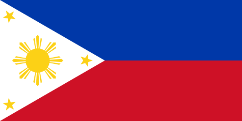
The Salinas Asian Festival is a free annual event in Salinas held since 2009 that celebrates the culture and history of Chinese, Filipino, and Japanese immigrants in Salinas. The Salinas Buddhist Temple, the Salinas Chinese Association, and the Filipino Cultural Center of Salinas are open to tour. The event includes food, demonstrations of tai chi, Filipino folk dancing, kendo, and a bonsai display. The 2017 festival the Salinas Chinatown Virtual Walking Tour.[75]
Points of interest
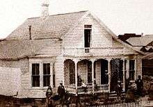
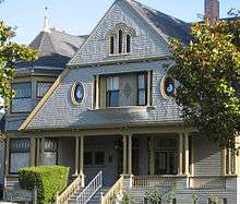
John Steinbeck House
The John Steinbeck House was the birthplace and childhood home of author John Steinbeck, and is now home to a restaurant. The house was built in 1897 and is a Queen Anne style Victorian.[76]
Boronda Adobe History Center
Just outside the official city limits, the restored adobe dwelling constructed in 1844 by José Eusebio Boronda, rests on one of the original Mexican land grants. The Boronda Adobe is a California Historical Landmark and listed in the National Register of Historic Places and holds a museum of early Salinas and California history. Other historic buildings are located here, including the Lagunita School house John Steinbeck wrote about in the Red Pony. The site also holds the official archive of Monterey County, open to researchers by appointment.
Santa Lucia Highlands American Viticultural Area
Santa Lucia Highlands AVA is nearby so the area is becoming a destination for wine tasting.[76]
Education
School districts
Salinas has seven public school districts serving the city core and adjacent unincorporated areas. The largest school district in Salinas is the Salinas Union High School District (grades 7-12) with 13,578 students enrolled in 10 campuses.[77] The Salinas City Elementary School District is the largest elementary school district in Salinas, with 13 schools and 7,954 students.[78] Other districts include Santa Rita Union Elementary School District, Graves Elementary School District, Washington Union School District, Lagunita School District, and Alisal Union School District.
Private Catholic schools in the city include the all-boys Palma School and the all-girls Notre Dame High School.
Higher education
Hartnell College, as well as a satellite campus of California State University, Monterey Bay, are located in Salinas.
Media
Local newspapers include The Salinas Californian, Monterey County Weekly and Monterey County Herald.
Local radio stations include:
- KDBV/980
- KION/1460
- KTGE/1570
- KHDC/90.9
- KPRC-FM/100.7
- KDON-FM/102.5
- KRAY-FM/103.5
- KOCN/105.1
- KSQL/99.1
- KBRG/100.3
- KVVF/105.7
Television service for the community comes from the Monterey-Salinas-Santa Cruz designated market area (DMA). KSMS-TV Channel 67, KION-TV Channel 46 and KSBW Channel 8 provide news for the area as the area's Univision, CBS, NBC and ABC affiliates.
Infrastructure
Transportation
Highways and roads
U.S. Route 101 is the major north–south highway in Salinas, linking the city to the rest of the Central Coast region, San Francisco to the north, and Los Angeles to the south. California State Route 68 heads west to Monterey, while California State Route 183 runs northwest to Castroville.
Rail

Amtrak, the national passenger rail system, serves Salinas. Its Coast Starlight train runs daily in each direction between Seattle, Washington, and Los Angeles, stopping in Salinas.
Bus
Public transportation via bus is provided by Monterey–Salinas Transit. Public buses take passengers throughout the county, as well as San Jose and Gilroy. Buses to San Jose and Gilroy connect to Caltrain and Amtrak in those cities.
Greyhound operates from the Salinas Amtrak station with service to other California cities and throughout the United States.[79]
Airport
Salinas Municipal Airport is located on the southeastern boundary of the City of Salinas, three miles (5 km) from the city center. It is a general aviation facility occupying 763 acres (3.1 km2), with three runways serving single and twin engine aircraft and helicopters, as well as an increasing number of turbopropeller and turbine-powered business jets.
The airport has an air traffic control tower in operation twelve hours a day, seven days a week. The airport terminal is located on Mortensen Avenue and houses airport office staff as well as professional offices. The city is currently accepting proposals for leasing and operation of the restaurant located within the Terminal. Salinas Airport Commissioners agreed to a proposed project that would bring a 100-room hotel, offices and hangars to a vacant lot in front of the Salinas Municipal Airport terminal. The Salinas Jet Center would include a national chain hotel, 80,000 square feet (7,000 m2) of office space, four large complexes combining more offices with airplane hangars and a 24-hour, full-service aircraft fueling station. The project would also include a taxiway to allow planes to access the new hangars.
The airport has full Instrument Landing System (ILS) and VHF omnidirectional range (VOR) located on the airport. The ILS has a Medium Intensity Approach Lighting System, with Runway Alignment Indicator Lights. The VOR approach has Runway End Identifier Lights. All but the ILS runway, RWY 31, have Visual Approach Slope Indicators (VASIs).
The airport is the site of the California International Airshow, set annually in the late summer or early autumn. The event draws thousands of visitors to Salinas over its three-day run.
Hospitals
Salinas and its surrounding towns are served by Salinas Valley Memorial Hospital and Natividad Medical Center, both located in Salinas. Natividad is one of the University of California, San Francisco's teaching hospitals and is owned and operated by Monterey County. Salinas Valley Memorial Hospital and Healthcare System is a public district hospital run by an elected board of directors.
Natividad Medical Center, through its affiliated Natividad Medical Foundation, offers trained medical interpreters for speakers of several Oaxacan languages (including Triqui, Mixteco, and Zapotec) as well as Spanish.[80]
.jpg)
Utilities
Salinas is served by the following utilities:
- Pacific Gas and Electric (electricity and natural gas)
- Alco Water Service and California Water Service (water)
- AT&T (phone)
- Monterey Regional Water Pollution Control Agency (sewer)
Notable people

- Monica Abbott, 2008 Olympic softball pitcher
- Everett Alvarez Jr., U.S. Navy pilot and prisoner of war[81]
- Jodi Arias, convicted murderer[82] of Travis Alexander, was born in Salinas[83]
- Dustin Lance Black, Academy Award-winning screenwriter[84]
- Ernie Camacho, Major League Baseball pitcher
- Doug Chandler, Hall of Fame motorcycle racer, Grand Slam winner, World Superbike champion
- Ramiro Corrales, Major League Soccer defender with San Jose Earthquakes
- Cordell Crockett, bass guitarist with band Ugly Kid Joe
- Chris Dalman, National Football League offensive lineman and coach[85]
- Harold Davis, athlete in National Track and Field Hall of Fame
- Evan Dietrich-Smith, Tampa Bay Buccaneers offensive lineman, Super Bowl XLV champion (2011 with Green Bay Packers), Salinas High School graduate, class of 2004
- David Esquer, head coach of the Stanford Cardinal baseball team, graduate of Palma High School[86]
- David Estrada, UCLA soccer player (midfield, forward), drafted in first round (11th overall) of 2010 MLS SuperDraft by Seattle Sounders FC
- Verna Felton, actress
- Michael Gasperson, NFL wide receiver
- Susan Gerbic, skeptical activist
- Brandi Glanville, fashion model, television personality in The Real Housewives of Beverly Hills
- Jackie Greene, singer-songwriter and blues musician
- Sammy Hagar, singer, former member of Van Halen, now in bands Chickenfoot and Waboritas
- Alvin and Calvin Harrison, twins, 1996 Olympic track and field athletes
- Vanessa Hudgens, singer and actress, High School Musical
- Ernie Irvan, race car driver and winner of the 1991 Daytona 500
- Joe Kapp, quarterback for University of California, Berkeley in College Football Hall of Fame, 1969 NFL champion
- Slim Keith, socialite
- Craig Kilborn, television personality
- Rick Law, Disney artist and producer
- Howard H. Leach, businessman and diplomat
- Herbert Mullin, serial killer
- Xavier Nady, Major League Baseball player, Salinas High School graduate, class of 1997
- Carl Nicks, offensive linemen, Super Bowl XLIV champion (2010), North Salinas High School graduate
- Kassim Osgood, National Football League wide receiver, Pro Bowl, North Salinas High School
- Van Partible, cartoonist
- Monty Roberts, horse tamer and author of The Man Who Listens to Horses
- Del Rodgers, NFL running back
- Gary Shipman, artist, comic book illustrator and creator of Pakkins' Land
- Brendon Small, actor, composer, musician, known as creator of the animated series Home Movies and Metalocalypse
- Edward Soriano, retired United States Army Lieutenant General[87]
- Sam Spence, NFL Films composer
- John Steinbeck, author and Nobel laureate, author of The Grapes of Wrath and Of Mice and Men, among others
- Rita Taggart, actress
- Anthony Toney, NFL running back
- Sean D. Tucker, aerobatic stunt pilot
- Elliot Vallejo, NFL offensive lineman, Palma High School
- Cain Velasquez, UFC heavyweight champion, mixed martial arts fighter and former collegiate wrestler
In popular culture
- Marilyn Monroe, actress and Twentieth Century Fox starlet, was honored as the Diamond Queen of Salinas on February 20, 1948.[88]
- Salinas is mentioned in various John Steinbeck novels, and is the setting of his monumental novel East of Eden.[89]
Sister cities
Salinas has established sister city relationships with four cities:
References
- "Community Profile - Visitors". City of Salinas, California. Archived from the original on January 21, 2015. Retrieved January 31, 2015.
- "City of Salinas - Home". City of Salinas Economic Development. Archived from the original on December 19, 2014. Retrieved December 8, 2014.
- "California Cities by Incorporation Date". California Association of Local Agency Formation Commissions. Archived from the original (Word) on November 3, 2014. Retrieved August 25, 2014.
- "City Government". City of Salinas. Archived from the original on October 10, 2014. Retrieved September 22, 2014.
- "Statewide Database". UC Regents. Archived from the original on February 1, 2015. Retrieved November 5, 2014.
- "California's 20th Congressional District - Representatives & District Map". Civic Impulse, LLC. Retrieved September 24, 2014.
- "2016 U.S. Gazetteer Files". United States Census Bureau. Archived from the original on August 24, 2017. Retrieved June 28, 2017.
- "Salinas". Geographic Names Information System. United States Geological Survey. Retrieved November 18, 2014.
- US Census Bureau. "Salinas (city) QuickFacts". State & County QuickFacts. US Census Bureau. Archived from the original on July 12, 2012. Retrieved November 26, 2014.
- "Population and Housing Unit Estimates". Archived from the original on May 29, 2017. Retrieved July 13, 2019.
- Durham, David L. (1998). California's Geographic Names: A Gazetteer of Historic and Modern Names of the State. Clovis, Calif.: Word Dancer Press. p. 948. ISBN 1-884995-14-4.
- Johnson, Jim. "Monterey County, Salinas discuss alternatives to Capital One complex buy". Monterey Herald: News. Monterey Herald. Archived from the original on December 16, 2014. Retrieved November 26, 2014.
- Nolte, Carl (June 3, 2016). "Steinbeck Country: Touring the land that inspired a legend". San Francisco Chronicle. Archived from the original on August 8, 2017. Retrieved June 25, 2019.
- "The Esselen Indians of the Big Sur Country" by Gary S. Breschini and Trudy Haversat
- "Early Salinas" by Gary S. Breschini, Mona Gudgel, & Trudy Haversat
- The Half Way House and the American Hotel Archived October 18, 2016, at the Wayback Machine Monterey County Historical Society, by G.S. Breschini, 2000, downloaded Nov. 15, 2016.
- "10,000 Years on the Salinas Plain" by Gary S. Breschini, Mona Gudgel, & Trudy Haversat
- "History of Salinas". City of Salinas: Visitors. City of Salinas. Archived from the original on October 18, 2014. Retrieved November 26, 2014.
- US Census Bureau. "SELECTED HOUSING CHARACTERISTICS". 2008-2012 American Community Survey 5-Year Estimates. US Census Bureau. Archived from the original on February 13, 2020. Retrieved November 4, 2017.
- U.S.G.S. Map May 14, 1956 ABG-6R-5, #75 1:20,000
- U.S.G.S. Map June 13, 1968 GS-VBZK-2-224, #214 1:30,000
- "Salinas Public Library History" (PDF). Archived from the original (PDF) on September 18, 2011. Retrieved October 5, 2011.
- Salad days near end in lettuce capital as development boom encroaches Archived December 30, 2011, at the Wayback Machine. The Baltimore Sun.
- "hematic Map of Total; Estimate; Speak a language other than English - Spanish or Spanish Creole Geography: by Census Tract". American Fact Finder by U.S. Census Bureau. Archived from the original on February 14, 2020. Retrieved March 23, 2016.
- Seavey, Kent. "A Short History of Salinas, California". Monterey County Historical Society. Monterey County Historical Society. Archived from the original on January 2, 2015. Retrieved November 26, 2014.
- US Census Bureau. "Census 2000 Summary File 1 (SF 1) 100-Percent Data". Profile of General Demographic Characteristics: 2000. US Census Bureau. Archived from the original on February 12, 2020. Retrieved November 26, 2014.
- US Census Bureau. "SELECTED SOCIAL CHARACTERISTICS IN THE UNITED STATES". 2008-2012 American Community Survey 5-Year Estimates. US Census Bureau. Archived from the original on February 12, 2020. Retrieved November 26, 2014.
- US Census Bureau. "ACS DEMOGRAPHIC AND HOUSING ESTIMATES". 2008-2012 American Community Survey 5-Year Estimates. US Census Bureau. Archived from the original on February 12, 2020. Retrieved November 26, 2014.
- Hill, Laura; Johnson, Hans. "Unauthorized Immigrants in California: Estimates for Counties" (PDF). Public Policy Institute of California. Public Policy Institute of California. Archived (PDF) from the original on January 11, 2015. Retrieved November 26, 2014.
- DePillis, Lydia. "First Person: Salinas could've been Ferguson. Here's why it wasn't". Washington Post: Storylines. Archived from the original on August 28, 2017. Retrieved November 26, 2014.
- "Salinas Topography Map". Google. Archived from the original on January 26, 2015. Retrieved November 26, 2014.
- Epley, Ellen. "Creeks of Salinas: Return of the Natives Work in the Creeks Important for Salinas". CSUMB. California State University, Monterey Bay. Archived from the original on March 7, 2013. Retrieved November 26, 2014.
- "SALINAS, CALIFORNIA". dri.edu. Archived from the original on July 16, 2015. Retrieved July 16, 2015.
- "SALINAS MUNICIPAL AP, CALIFORNIA". dri.edu. Archived from the original on July 16, 2015. Retrieved July 16, 2015.
- Bushwick, Sophie. "The Top 10 Cities for Air Quality". scientificamerican.com. Archived from the original on July 16, 2015. Retrieved July 16, 2015.
- "NWS San Francisco Bay Area/Monterey". Archived from the original on April 14, 2016. Retrieved May 7, 2016.
- "General Climate Summary Tables - Salinas, California". Western Regional Climate Center. Archived from the original on July 14, 2014. Retrieved July 13, 2014.
- Archived September 15, 2018, at the Wayback Machine, Weather Channel. Retrieved 2014-07-13
- "2011-2015 American Community Survey 5-Year Estimates". U.S. Census Bureau. Retrieved January 10, 2019.
- Kent, Seavey. "A Short History of Salinas, California". Monterey County Historical Society. Monterey County Historical Society. Archived from the original on January 2, 2015. Retrieved November 25, 2014.
- US Census Bureau, 2008-2012 American Community Survey 5-Year Estimates. "SELECTED ECONOMIC CHARACTERISTICS". American Fact Finder. US Census Bureau. Archived from the original on February 12, 2020. Retrieved November 25, 2014.
- US Census Bureau. "2008-2012 American Community Survey 5-Year Estimates". EDUCATIONAL ATTAINMENT. US Census Bureau. Archived from the original on February 12, 2020. Retrieved November 25, 2014.
- U.S. Census Bureau, American Fact Finder. "Thematic Map of Estimate; Median household income in the past 12 months (in 2014 inflation-adjusted dollars) Geography: by Block Group within Census Tract". American Fact Finder. US Census Bureau. Archived from the original on February 14, 2020. Retrieved March 15, 2016.
- U.S. Census Bureau. "Financial Characteristics 2010-2014 American Community Survey 5-Year Estimates". U.S. Census Bureau. Archived from the original on February 14, 2020. Retrieved June 23, 2017.
- "US Census Bureau, Income Map". Archived from the original on December 2, 2011. Retrieved November 2, 2006.
- US Census Bureau. "Monterey County 2010 Census Tract Reference Map Index". US Census Bureau. Archived from the original on November 29, 2014. Retrieved November 25, 2014.
- "Census of Population and Housing". Census.gov. Retrieved June 4, 2015.
- "2010 Census Interactive Population Search: CA - Salinas city". U.S. Census Bureau. Archived from the original on January 15, 2016. Retrieved July 12, 2014.
- "California - Race and Hispanic Origin for Selected Cities and Other Places: Earliest Census to 1990". U.S. Census Bureau. Archived from the original on August 12, 2012. Retrieved December 11, 2017.
- "Salinas (city), California". State & County QuickFacts. U.S. Census Bureau. Archived from the original on July 12, 2012. Retrieved May 7, 2012.
- Goode, Erica (January 30, 2012). "In a Gang-Ridden City, New Efforts to Fight Crime While Cutting Costs". The New York Times. Archived from the original on October 19, 2017. Retrieved November 25, 2014.
- "Salinas, California, Taco Shop Shooting Leaves 2 Dead, 5 Injured". Huffington Post. Associated Press. Archived from the original on March 20, 2015. Retrieved November 25, 2014.
- US Department of Justice. "Bureau of Justice Statistics". Crime reported by Salinas Police Dept, California. Bureau of Justice Statistics.
- US Department of Justice. "Uniformed Crime Reporting Statistics". Estimated crime in United States-Total. US Bureau of Justice Statistics. Retrieved November 25, 2014.
- Harris, Kamala. "Organized Crime in California: 2010 Report to the Legislature" (PDF). California Attorney General. State of California Department of Justice, Office of the Attorney General. Archived (PDF) from the original on November 13, 2014. Retrieved November 25, 2014.
- Robledo, Roberto (June 12, 2014). "Agents of change fan out in Alisal". The Salinas Californian. Archived from the original on September 13, 2017. Retrieved November 25, 2014.
- Arreola, Jose. "Salinas Comprehensive Strategy for Community-wide Violence Reduction 2013-2018" (PDF). City of Salinas. Community Alliance for Safety and Peace. Archived (PDF) from the original on November 14, 2014. Retrieved November 25, 2014.
- Guadalupe, Patricia. "Author Spends Ten Years Inside California's Nuestra Familia Gang". NBC News. NBC. Archived from the original on December 28, 2014. Retrieved November 25, 2014.
- Johnson, Avery (August 15, 2019). "Salinas police receive overwhelmingly positive feedback on LivePD survey". KION-TV. Archived from the original on August 23, 2019. Retrieved August 23, 2019.
- Duan, Mary (August 22, 2019). "Lights, Camera, Action Salinas renews its agreement with 'Live PD', but many take issue with how the cop-centric reality TV show portrays the city to the world". Monterey County Weekly. Archived from the original on August 23, 2019. Retrieved August 23, 2019.
- Salinas Police Department. "Live PD to Feature Salinas Police Department in Season Premiere on September 21, 2018". www.salinaspd.com. Salinas Police Department. Archived from the original on June 8, 2019. Retrieved August 23, 2019.
- Szydlowski, Joe (December 23, 2018). "LivePD with Salinas police: Top clips of cops so far this year". The Salinas Californian. Archived from the original on June 8, 2019. Retrieved August 23, 2019.
- US Department of Justics. "Estimated crime in California". Uniformed Crime Reporting Statistics. US Bureau of Justice Statistics. Retrieved November 25, 2014.
- Search Results - Salinas, California - ReferenceUSA Archived November 15, 2008, at Archive-It Current Businesses
- Communications, Forbes Corporate. "Forbes And SVG Partners Will Host "Forbes Reinventing America: The AgTech Summit," July 2015, In Salinas Valley". Forbes. Archived from the original on December 28, 2018. Retrieved December 27, 2018.
- "Ag-tech investment topped $10 billon in 2017. How much went to women?". New Food Economy. June 19, 2018. Retrieved December 27, 2018.
- Communications, Forbes Corporate. "Forbes Media Will Host Its Second AgTech Summit, July 13-14, 2016, Salinas Valley". Forbes. Archived from the original on December 28, 2018. Retrieved December 27, 2018.
- Communications, Forbes Corporate. "Forbes AgTech Summit Returns to Salinas, CA, in June 2018 And Expands with a Summit in Indianapolis in September 2018". Forbes. Archived from the original on December 28, 2018. Retrieved December 27, 2018.
- Archived March 26, 2012, at the Wayback Machine
- "Alliance of Monterey Area Preservationists". www.amap1.org. Archived from the original on November 7, 2017. Retrieved November 4, 2017.
- "Salinas' El Grito Festival celebrates Mexican heritage this weekend". The Salinas Californian. Archived from the original on December 12, 2017. Retrieved November 4, 2017.
- "Salinas' El Grito Festival celebrates Mexican heritage this weekend". The Salinas Californian. Archived from the original on December 12, 2017. Retrieved November 5, 2017.
- "Founders' Day: Salinas celebrates its 149-year journey". Archived from the original on November 7, 2017. Retrieved November 5, 2017.
- "Music, dance and community fun: Annual Ciclovía Salinas returns Sunday". The Salinas Californian. Retrieved December 27, 2018.
- Administrator. "About the Festival". www.salinasasianfestival.com. Archived from the original on November 7, 2017. Retrieved November 5, 2017.
- VORA, SHIVANI (April 6, 2017). "California's Salinas Valley: Lush fields, good wine, and Steinbeck". The Seattle Times. Archived from the original on November 7, 2017. Retrieved November 4, 2017.
- Salinas Union High in Salinas, CA Archived September 30, 2007, at the Wayback Machine. GreatSchools (2010-09-07). Retrieved on 2013-07-19.
- Salinas City Elementary in Salinas, CA Archived September 30, 2007, at the Wayback Machine. GreatSchools (2010-09-07). Retrieved on 2013-07-19.
- "Greyhound Relocates in Salinas, Calif". Greyhound.com. Archived from the original on May 20, 2015. Retrieved May 19, 2015.
- Shemesh, Denelle (November 14, 2014). "Indigenous Interpreting+ bridges language gaps to better serve the farmworker community at Natividad". Monterey County Weekly. Retrieved April 19, 2015.
- "Bio, Alvarez, Everett Jr". pownetwork.org. Archived from the original on September 24, 2015. Retrieved July 16, 2015.
- Kiefer, Michael (April 13, 2015). "Jodi Arias sentenced to natural life in prison". The Arizona Republic. Archived from the original on June 29, 2018. Retrieved June 29, 2018 – via USA TODAY.
- "Salinas native Jodi Arias faces death penalty if convicted". KSBW. March 19, 2013. Archived from the original on September 9, 2018. Retrieved June 29, 2018.
- "Dustin Lance Black's Moving Acceptance Speech". GLAAD. February 22, 2009. Archived from the original on June 29, 2018. Retrieved June 28, 2018.
- Stanford Sports - Chris Dalman Profile Archived February 26, 2009, at the Wayback Machine
- Mazeika, Vytas (June 20, 2017). "Life comes full circle at Stanford for David Esquer". The Mercury News. Archived from the original on November 17, 2018. Retrieved June 28, 2018.
- Zweigenhaft, Richard L. (2006). Diversity in the Power Elite: How it Happened, Why it Matters. Lanham, Maryland: Rowman and Littlefield. p. 92. ISBN 9780742536982.
- Monroe, Marilyn (February 20, 1948). "Diamond Queen of Salinas". The Salinas Californian.
- Michael J. Meyer, Henry Veggian. East of Eden.: New and Recent Essays.Rodopi, 2013
- "Sister Cities - Visitors". City of Salinas, California. July 15, 2016. Retrieved June 23, 2017.
External links
| Wikimedia Commons has media related to Salinas, California. |
| Wikivoyage has a travel guide for Salinas. |
Municipalities and communities of Monterey County, California, United States | ||
|---|---|---|
| Cities |  Monterey County map | |
| CDPs |
| |
| Unincorporated communities |
| |
| Ghost towns |
| |
| Footnotes | ‡This populated place also has portions in an adjacent county | |
California Central Coast | ||
|---|---|---|
| Counties |
|  |
| Cities and towns 100k-250k | ||
| Cities and towns 25k-100k |
| |
| Cities and towns 10k-25k |
| |
| Sub-regions |
| |
Counties in italics sometimes included in the definition of the Central Coast | ||
Sacramento (capital) | ||
| Topics |
|  |
| Regions |
| |
| Metro regions |
| |
| Counties |
| |
| Most populous cities | ||
| |
^* Mayor selected from city council |
| Authority control |
|
|---|