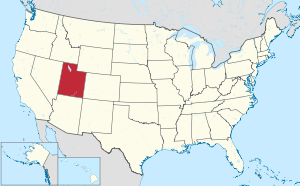
List of cities and towns in Utah
Utah is a state located in the Western United States. As of 2017, there are 246 incorporated municipalities in the U.S. state of Utah as well as three census-designated places in which the population exceeds 10,000. A municipality is called a town if the population is under 1,000 people, and a city if the population is over 1,000 people.[1][2] Incorporation means that a municipal charter has been adopted by the affected population following a referendum. In the Constitution of Utah, cities and towns are granted "the authority to exercise all powers relating to municipal affairs, and to adopt and enforce within its limits, local police, sanitary and similar regulations not in conflict with the general law"[3] They also have the power to raise and collect taxes, to provide and maintain local public services, acquire by eminent domain any property needed to make local improvements, and to raise money by bonds.[3]
On July 22, 1847, the first party of Mormon pioneers arrived in the Salt Lake Valley, where they founded Salt Lake City, the first European settlement in Utah. Over the next 22 years, more than 70,000 pioneers crossed the plains and settled in Utah.[4] Initial colonization along the Wasatch Front was mostly made by members of The Church of Jesus Christ of Latter-day Saints (LDS Church) with no direct involvement from it. Outside the Wasatch Front, most settlements were directed, planned, organized, and dispatched by leaders of the LDS Church. Settlements were also founded by the railroads, mining companies and non-Mormons.[5] Many settlements were named after leaders, history or from scriptures of the LDS Church. Natural features of the region, including rivers, mountains, lakes and flora, are also commonly used for names.
The 2017 American Community Survey estimate puts 2,792,531 of the state's 3,101,883 residents within these cities and towns, accounting for 90% of the population. Just over 75% of Utah's population is concentrated in the four Wasatch Front counties of Salt Lake, Utah, Davis, and Weber. The largest city is the state's capital of Salt Lake City with a population of 194,188, and the former coal mining town of Scofield is the smallest town with 15 people.[1]
In 2015, a new form of local government, the metro township, was created.[6] Five unincorporated townships in Salt Lake County voted to incorporate as metro townships, allowing them to elect councils and manage a budget, but they must contract with other cities for municipal services and have limited taxation powers.[7] The five metro townships are Kearns, Magna, Copperton, Emigration Canyon and White City.
Incorporated cities, towns, and metro townships
and * symbol indicates that this city or town is the county seat of its respective county.
| Name[1] |
County |
Population estimate (2017)[1] |
Area (2010)[8] |
Elevation[9] |
Year settled[10] |
Median household income (2017)[11] |
Etymology[10] |
|---|---|---|---|---|---|---|---|
| Alpine | Utah | 10,197 | 7.43 sq mi (19.2 km2) | 4,951 feet (1,509 m) | 1850 | $112,727 | Adjacent high mountains of the Wasatch Mountains and Traverse Mountains |
| Alta | Salt Lake | 351 | 4.62 sq mi (12.0 km2) | 8,560 feet (2,610 m) | 1866 | $63,750 | Spanish word for "high" due to Alta's elevation |
| Altamont | Duchesne | 186 | 0.14 sq mi (0.36 km2) | 6,388 feet (1,947 m) | [lower-alpha 1] | $73,125 | Composite name of nearby peaks Altonah and Mt. Emmons |
| Alton | Kane | 143 | 2.12 sq mi (5.5 km2) | 7,041 feet (2,146 m) | [lower-alpha 1] | $46,250 | Alton Fjord in Norway |
| Amalga | Cache | 577 | 3.57 sq mi (9.2 km2) | 4,439 feet (1,353 m) | 1860 | $56,875 | Amalgamated Sugar Company |
| American Fork | Utah | 28,507 | 9.30 sq mi (24.1 km2) | 4,606 feet (1,404 m) | 1850 | $70,926 | American Fork River, a tributary of Utah Lake |
| Annabella | Sevier | 922 | 0.70 sq mi (1.8 km2) | 5,292 feet (1,613 m) | 1871 | $57,125 | Composite name of Ann S. Roberts and Isabella Dalton, woman settlers of Annabella |
| Antimony | Garfield | 125 | 10.11 sq mi (26.2 km2) | 6,453 feet (1,967 m) | 1873 | $42,023 | The metal antimony that was mined in the area |
| Apple Valley | Washington | 946 | 40.79 sq mi (105.6 km2) | 4,941 feet (1,506 m) | [lower-alpha 1] | $66,768 | [lower-alpha 2] |
| Aurora | Sevier | 903 | 1.04 sq mi (2.7 km2) | 5,200 feet (1,600 m) | 1875 | $59,792 | Aurora, the Roman goddess of dawn |
| Ballard | Uintah | 915 | 13.92 sq mi (36.1 km2) | 5,049 feet (1,539 m) | [lower-alpha 1] | $66,250 | Melvin J. Ballard, a LDS Church Apostle |
| Bear River City | Box Elder | 839 | 1.54 sq mi (4.0 km2) | 4,258 feet (1,298 m) | 1866 | $62,917 | Bear River, a 350-mile (560 km) river and largest tributary of the Great Salt Lake |
| Beaver* | Beaver | 3,020 | 6.54 sq mi (16.9 km2) | 5,902 feet (1,799 m) | 1856 | $46,708 | Beaver River, a 242-mile (389 km) river that eventually disappears into the ground |
| Bicknell | Wayne | 230 | 0.62 sq mi (1.6 km2) | 7,123 feet (2,171 m) | 1879 | $50,000 | Thomas W. Bicknell, who donated 500 books to the library |
| Big Water | Kane | 653 | 6.16 sq mi (16.0 km2) | 4,108 feet (1,252 m) | 1958[12] | $38,879 | [lower-alpha 2] |
| Blanding | San Juan | 3,641 | 13.08 sq mi (33.9 km2) | 6,106 feet (1,861 m) | 1887 | $57,119 | Maiden name of the wife of Thomas W. Bicknell, who donated 500 books to the library |
| Bluffdale | Salt Lake | 10,869 | 10.97 sq mi (28.4 km2) | 4,436 feet (1,352 m) | 1886 | $105,391 | The bluffs along the Jordan River |
| Boulder | Garfield | 152 | 20.92 sq mi (54.2 km2) | 6,703 feet (2,043 m) | 1889 | $41,000 | Boulder Mountain, a 11,317-foot (3,449 m) mountain located in the Dixie National Forest |
| Bountiful | Davis | 43,568 | 13.47 sq mi (34.9 km2) | 4,797 feet (1,462 m) | 1847 | $69,611 | The Book of Mormon city of Bountiful |
| Brian Head | Iron | 82 | 3.72 sq mi (9.6 km2) | 9,800 feet (3,000 m) | [lower-alpha 1] | [lower-alpha 3] | William Jennings Bryan, national politician and former candidate for President of the United States |
| Brigham City* | Box Elder | 18,736 | 24.85 sq mi (64.4 km2) | 4,436 feet (1,352 m) | 1850 | $49,760 | Brigham Young, LDS Church President and first territorial Governor of Utah |
| Bryce Canyon City | Garfield | 200 | 3.45 sq mi (8.9 km2) | 7,664 feet (2,336 m) | 1875 | $40,500 | Local homsteader Ebenezer Bryce |
| Cannonville | Garfield | 272 | 1.98 sq mi (5.1 km2) | 5,886 feet (1,794 m) | 1874 | $72,500 | George Q. Cannon, a LDS Church Apostle |
| Castle Dale* | Emery | 1,631 | 2.16 sq mi (5.6 km2) | 5,676 feet (1,730 m) | 1879[13] | $45,250 | Located in the Castle Valley, but a Postal Service mistake listed town as Castle Dale instead of Castle Vale. |
| Castle Valley | Grand | 435 | 9.28 sq mi (24.0 km2) | 4,685 feet (1,428 m) | 1974[14] | $43,906 | Located in the Castle Valley |
| Cedar City | Iron | 30,232 | 36.84 sq mi (95.4 km2) | 5,846 feet (1,782 m) | 1851 | $42,216 | Large number of juniper trees, known as "cedars" |
| Cedar Fort | Utah | 329 | 21.24 sq mi (55.0 km2) | 5,085 feet (1,550 m) | 1856 | $68,250 | Large number of juniper trees in the area, known as "cedars" |
| Cedar Highlands | Iron | [15] | [15] | [15] | 1981[16][17] | [15] | Directly south of Cedar City, in the "highlands" of local mountains, originally an HOA/Subdivision's name. |
| Cedar Hills | Utah | 10,266 | 2.70 sq mi (7.0 km2) | 4,957 feet (1,511 m) | [lower-alpha 1] | $97,039 | Local juniper-covered hills |
| Centerfield | Sanpete | 1,416 | 1.80 sq mi (4.7 km2) | 5,098 feet (1,554 m) | 1869 | $51,950 | Center of the Gunnison Valley |
| Centerville | Davis | 17,013 | 6.04 sq mi (15.6 km2) | 4,377 feet (1,334 m) | 1848[18] | $84,436 | Center between Farmington and Bountiful[18] |
| Central Valley | Sevier | 669 | 2.10 sq mi (5.4 km2) | 5,305 feet (1,617 m) | [lower-alpha 1] | $56,250 | [lower-alpha 2] |
| Charleston | Wasatch | 603 | 3.04 sq mi (7.9 km2) | 5,440 feet (1,660 m) | 1852 | $69,875 | Charles Shelton, who surveyed the town |
| Circleville | Piute | 801 | 9.08 sq mi (23.5 km2) | 6,066 feet (1,849 m) | 1864 | $54,688 | Located in the Circle Valley |
| Clarkston | Cache | 712 | 0.97 sq mi (2.5 km2) | 4,879 feet (1,487 m) | 1864 | $61,932 | Justus Clark, an original settler. |
| Clawson | Emery | 215 | 0.99 sq mi (2.6 km2) | 5,942 feet (1,811 m) | 1897 | $54,375 | Rudger Clawson, a LDS Church Apostle |
| Clearfield | Davis | 30,683 | 7.68 sq mi (19.9 km2) | 4,465 feet (1,361 m) | 1877 | $52,034 | The open surroundings of the area |
| Cleveland | Emery | 527 | 0.85 sq mi (2.2 km2) | 5,722 feet (1,744 m) | 1885 | $71,105 | Grover Cleveland, President of the United States |
| Clinton | Davis | 21,353 | 5.85 sq mi (15.2 km2) | 4,393 feet (1,339 m) | 1870s | $76,378 | [lower-alpha 2] |
| Coalville* | Summit | 1,808 | 3.70 sq mi (9.6 km2) | 5,577 feet (1,700 m) | 1858 | $64,688 | Many of the miners came from Coalville, England |
| Copperton | Salt Lake | 579 | 6.40 sq mi (16.6 km2) | 1926 | $62,656 | Company town for the Utah Copper Company | |
| Corinne | Box Elder | 760 | 3.88 sq mi (10.0 km2) | 4,226 feet (1,288 m) | 1869 | $51,700 | Corinne, the first child born in the area |
| Cornish | Cache | 220 | 4.81 sq mi (12.5 km2) | 4,485 feet (1,367 m) | [lower-alpha 1] | $49,500 | William D Cornish, vice-president of the Union Pacific Railroad |
| Cottonwood Heights | Salt Lake | 34,214 | 8.74 sq mi (22.6 km2) | 4,823 feet (1,470 m) | 1848 | $86,207 | Cottonwood trees found in the area |
| Daniel | Wasatch | 1,087 | 3.27 sq mi (8.5 km2) | 5,715 feet (1,742 m) | 1874 | $77,500 | Aaron Daniels, one of the first settlers |
| Delta | Millard | 3,478 | 4.79 sq mi (12.4 km2) | 4,639 feet (1,414 m) | 1906 | $65,040 | The river delta of the Sevier River |
| Deweyville | Box Elder | 470 | 6.4 sq mi (17 km2) | 4,437 feet (1,352 m) | 1864 | $66,719 | John C. Dewey, an early settler to the area |
| Draper | Salt Lake/ Utah | 47,043 | 30.1 sq mi (78 km2) | 4,505 feet (1,373 m) | 1849 | $110,270 | William Draper, the town's first LDS Church Bishop |
| Duchesne* | Duchesne | 1,826 | 2.53 sq mi (6.6 km2) | 5,518 feet (1,682 m) | 1904 | $49,318 | Nearby Fort Duchesne |
| Dutch John | Daggett | 131 | 2.4 sq mi (6.2 km2) | 6,430 feet (1,960 m) | 1957 | [lower-alpha 3] | [lower-alpha 2] |
| Eagle Mountain | Utah | 27,773 | 44.47 sq mi (115.2 km2) | 4,882 feet (1,488 m) | [lower-alpha 1] | $74,885 | Eagle Mountain Properties, the development company of the city |
| East Carbon | Carbon | 1,475 | 8.98 sq mi (23.3 km2) | 4,987 feet (1,520 m) | 1922 | $29,000 | Coal deposits found in the area |
| Elk Ridge | Utah | 3,231 | 2.68 sq mi (6.9 km2) | 5,354 feet (1,632 m) | [lower-alpha 1] | $82,500 | [lower-alpha 2] |
| Elmo | Emery | 334 | 0.65 sq mi (1.7 km2) | 5,692 feet (1,735 m) | 1908 | $43,125 | [19]A combination of the first letters of each name from the original settlers. Erickson, Larsen, Mortensen, Oviatt |
| Elsinore | Sevier | 717 | 1.3 sq mi (3.4 km2) | 5,351 feet (1,631 m) | 1874 | $51,667 | Elsinore, Denmark |
| Elwood | Box Elder | 1,091 | 7.83 sq mi (20.3 km2) | 4,298 feet (1,310 m) | 1879 | $81,161 | Postal Service named the town |
| Emery | Emery | 357 | 1.17 sq mi (3.0 km2) | 6,253 feet (1,906 m) | 1881[20] | $41,875 | George W. Emery, territorial Governor of Utah |
| Emigration Canyon | Salt Lake | 1931 | 19 sq mi (49 km2) | ||||
| Enoch | Iron | 6,331 | 7.21 sq mi (18.7 km2) | 5,545 feet (1,690 m) | 1851 | $53,569 | Enoch, a biblical figure in the Old Testament |
| Enterprise | Washington | 1,663 | 7.74 sq mi (20.0 km2) | 5,318 feet (1,621 m) | 1902 | $57,171 | Name reflected the first settlers' ability to adjust to problem experienced by the first settlers |
| Ephraim | Sanpete | 6,858 | 3.73 sq mi (9.7 km2) | 5,541 feet (1,689 m) | 1854 | $39,626 | Tribe of Ephraim, one of the twelve Tribes of Israel. |
| Escalante | Garfield | 770 | 2.94 sq mi (7.6 km2) | 5,820 feet (1,770 m) | 1876 | $64,250 | Silvestre Vélez de Escalante, a Franciscan missionary who explored the area in 1776 |
| Eureka | Juab | 471 | 1.51 sq mi (3.9 km2) | 6,430 feet (1,960 m) | 1869 | $45,625 | Eureka is the ancient Greek name for "I have found it", relating to the gold mines found in the area |
| Fairfield | Utah | 156 | 26.74 sq mi (69.3 km2) | 4,877 feet (1,487 m) | 1855 | $85,208 | Amos Fielding, an early settler of the area |
| Fairview | Sanpete | 1,477 | 1.24 sq mi (3.2 km2) | 6,948 feet (2,118 m) | 1859 | $59,583 | The attractive surroundings of the area |
| Farmington* | Davis | 22,616 | 9.95 sq mi (25.8 km2) | 4,304 feet (1,312 m) | 1847 | $97,168 | The farms found in the area |
| Farr West | Weber | 6,671 | 6.04 sq mi (15.6 km2) | 4,265 feet (1,300 m) | 1858 | $90,217 | Located west of Farr's Fort which was named after Lorin Farr, an early LDS Church stake president of the area. |
| Fayette | Sanpete | 291 | 0.42 sq mi (1.1 km2) | 5,052 feet (1,540 m) | 1861 | $76,563 | Fayette, New York, where the LDS Church was organized |
| Ferron | Emery | 1,560 | 2.14 sq mi (5.5 km2) | 5,971 feet (1,820 m) | 1877[21] | $51,131 | A. D. Ferron, surveyor of the area |
| Fielding | Box Elder | 465 | 0.45 sq mi (1.2 km2) | 4,373 feet (1,333 m) | 1892 | $51,053 | Mother of LDS Church President Joseph Fielding Smith |
| Fillmore* | Millard | 2,484 | 6.08 sq mi (15.7 km2) | 5,135 feet (1,565 m) | 1851 | $54,901 | Millard Fillmore, President of the United States |
| Fountain Green | Sanpete | 994 | 1.41 sq mi (3.7 km2) | 5,899 feet (1,798 m) | 1850 | $51,875 | Lush meadows surrounding the area's springs |
| Francis | Summit | 1,171 | 2.49 sq mi (6.4 km2) | 6,562 feet (2,000 m) | 1869 | $75,982 | Francis M. Lyman, a LDS Church Apostle |
| Fruit Heights | Davis | 5,992 | 2.28 sq mi (5.9 km2) | 4,698 feet (1,432 m) | 1850[22] | $104,984 | Fruit orchards located above the valley floor |
| Garden City | Rich | 678 | 8.38 sq mi (21.7 km2) | 5,968 feet (1,819 m) | 1877[23] | $45,547 | Site was considered the garden spot of the valley |
| Garland | Box Elder | 2,468 | 1.89 sq mi (4.9 km2) | 4,340 feet (1,320 m) | 1890 | $56,979 | William Garland, led the construction of a canal in the area |
| Genola | Utah | 1,292 | 13.85 sq mi (35.9 km2) | 4,600 feet (1,400 m) | [lower-alpha 1] | $68,438 | [lower-alpha 2] |
| Glendale | Kane | 266 | 7.79 sq mi (20.2 km2) | 5,778 feet (1,761 m) | 1862 | $41,625 | The place being in a glen or a narrow valley with mountains all around[24] |
| Glenwood | Sevier | 618 | 0.54 sq mi (1.4 km2) | 5,272 feet (1,607 m) | 1863 | $71,711 | Robert Wilson Glenn, an early settler of the area |
| Goshen | Utah | 1,058 | 0.81 sq mi (2.1 km2) | 4,551 feet (1,387 m) | 1857 | $56,705 | Goshen, Connecticut, birthplace of Phineas W. Cooke, the first LDS Bishop of the area |
| Grantsville | Tooele | 10,170 | 19.37 sq mi (50.2 km2) | 4,304 feet (1,312 m) | 1850 | $66,726 | Colonel George D. Grant of the Nauvoo Legion |
| Green River | Emery | 978 | 12.57 sq mi (32.6 km2) | 4,078 feet (1,243 m) | [lower-alpha 1] | $44,583 | The Green River, a 730-mile (1,170 km) tributary of the Colorado River |
| Gunnison | Sanpete | 3,323 | 5.30 sq mi (13.7 km2) | 5,138 feet (1,566 m) | 1859 | $60,417 | Captain John W. Gunnison, explored and surveyed Great Salt Lake, Utah Lake and the Salt Lake Valley for the Corps of Topographical Engineers |
| Hanksville | Wayne | 210 | 1.92 sq mi (5.0 km2) | 4,291 feet (1,308 m) | 1882 | $32,917 | Ebenezer Hanks, original settler of the area |
| Harrisville | Weber | 6,182 | 3.01 sq mi (7.8 km2) | 4,291 feet (1,308 m) | 1850 | $70,849 | Marin H. Harris, a settler of the area |
| Hatch | Garfield | 123 | 0.48 sq mi (1.2 km2) | 6,919 feet (2,109 m) | 1872[25] | $44,750 | Meltiar Harch Sr., a settler of the area |
| Heber City* | Wasatch | 14,414 | 8.41 sq mi (21.8 km2) | 5,604 feet (1,708 m) | 1858 | $67,265 | Heber C. Kimball, an Apostle of the LDS Church |
| Helper | Carbon | 2,031 | 1.75 sq mi (4.5 km2) | 5,817 feet (1,773 m) | 1883 | $50,363 | The "Helper engines" or extra locomotives used to get trains over Soldier Summit from Helper to Spanish Fork |
| Henefer | Summit | 767 | 1.7 sq mi (4.4 km2) | 5,335 feet (1,626 m) | 1859 | $72,981 | Brothers James and Richard Henefer, original settlers of the area |
| Henrieville | Garfield | 205 | 1.56 sq mi (4.0 km2) | 5,997 feet (1,828 m) | 1878 | $59,107 | James Henrie, first stake president of the local LDS stake |
| Herriman | Salt Lake | 31,970 | 20.27 sq mi (52.5 km2) | 5,000 feet (1,500 m) | 1849 | $94,837 | Henry Herriman, a prominent resident of the area |
| Hideout | Wasatch | 833 | 3.87 sq mi (10.0 km2) | 6,588 feet (2,008 m) | $43,839 | Hideout Canyon | |
| Highland | Utah | 17,952 | 8.52 sq mi (22.1 km2) | 4,977 feet (1,517 m) | 1875[26] | $128,938 | Town's location on the upper bench of the Utah Valley |
| Hildale | Washington | 2,916 | 2.94 sq mi (7.6 km2) | 5,409 feet (1,649 m) | [lower-alpha 1] | $40,938 | [lower-alpha 2] |
| Hinckley | Millard | 608 | 5.05 sq mi (13.1 km2) | 4,603 feet (1,403 m) | [lower-alpha 1] | $51,964 | Ira Hinckley, LDS Church stake president of the local LDS stake |
| Holden | Millard | 404 | 0.54 sq mi (1.4 km2) | 5,102 feet (1,555 m) | 1855 | $42,361 | Elijah E. Holden, an early settler of the area |
| Holladay | Salt Lake | 30,793 | 7.92 sq mi (20.5 km2) | 4,464 feet (1,361 m) | 1848 | $81,409 | John Holladay, an early settler of the area |
| Honeyville | Box Elder | 1,372 | 11.81 sq mi (30.6 km2) | 4,298 feet (1,310 m) | 1861 | $78,333 | Profession of the local LDS Bishop |
| Hooper | Weber | 8,236 | 26.88 sq mi (69.6 km2) | 4,242 feet (1,293 m) | [lower-alpha 1] | $96,620 | William H. Hooper, Utah territorial delegate to the United States House of Representatives |
| Howell | Box Elder | 250 | 35.55 sq mi (92.1 km2) | 4,560 feet (1,390 m) | 1910 | $42,321 | Joseph Howell, president of the surveying company that laid out the area and Representative of the United States House of Representatives from Utah |
| Huntington | Emery | 1,849 | 2.04 sq mi (5.3 km2) | 5,787 feet (1,764 m) | 1877[27] | $52,473 | William Huntington, an early explorer of the area |
| Huntsville | Weber | 732 | 0.84 sq mi (2.2 km2) | 4,928 feet (1,502 m) | 1860[28] | $68,295 | Jefferson Hunt, an early settler of the area |
| Hurricane | Washington | 15,676 | 52.07 sq mi (134.9 km2) | 3,248 feet (990 m) | 1906[29] | $49,961 | LDS Church Apostle Erastus Snow's comments about the heavy wind in the area |
| Hyde Park | Cache | 4,359 | 3.37 sq mi (8.7 km2) | 4,537 feet (1,383 m) | 1860 | $76,301 | Wiliam Hyde, one of the first settlers and first LDS Church Bishop of the area |
| Hyrum | Cache | 7,926 | 4.84 sq mi (12.5 km2) | 4,698 feet (1,432 m) | 1860 | $59,453 | Hyrum Smith, brother to Joseph Smith, founder of the Latter Day Saint movement. |
| Independence | Wasatch | 183 | 30.59 sq mi (79.2 km2) | 7,073 feet (2,156 m) | [lower-alpha 1] | $123,542 | [lower-alpha 2] |
| Interlaken | Wasatch | 158 | 0.223 sq mi (0.58 km2) | 5,919 feet (1,804 m) | [lower-alpha 1] | $66,250 | [lower-alpha 2] |
| Ivins | Washington | 7,908 | 9.76 sq mi (25.3 km2) | 3,081 feet (939 m) | 1922[30] | $57,686 | Anthony W. Ivins, a LDS Church Apostle |
| Joseph | Sevier | 338 | 0.91 sq mi (2.4 km2) | 5,436 feet (1,657 m) | 1871 | $47,917 | Joseph A. Young, first LDS Church stake president of the Sevier Stake |
| Junction* | Piute | 119 | 15.0 sq mi (39 km2) | 6,007 feet (1,831 m) | 1880 | $34,167 | Located at the junction of the East Fork and the Sevier Rivers |
| Kamas | Summit | 2,126 | 3.66 sq mi (9.5 km2) | 6,486 feet (1,977 m) | 1857 | $61,000 | Derived from the Native American word for the Small Camas, an edible bulb found in the valley |
| Kanab* | Kane | 4,448 | 14.63 sq mi (37.9 km2) | 4,970 feet (1,510 m) | 1864 | $55,360 | Native American word for willow, referring to the willows growing along the area's creeks |
| Kanarraville | Iron | 299 | 0.46 sq mi (1.2 km2) | 5,541 feet (1,689 m) | 1861 | $51,500 | Chief Canarrah, local leader of the Piute tribe |
| Kanosh | Millard | 548 | 0.84 sq mi (2.2 km2) | 5,020 feet (1,530 m) | 1854 | $49,271 | Kanosh, the name for the local Native American leader |
| Kaysville | Davis | 30,328 | 10.5 sq mi (27 km2) | 4,357 feet (1,328 m) | 1849 | $91,334 | William Kay, the area's first LDS Church Bishop |
| Kearns | Salt Lake | 37,194 | 4.8 sq mi (12 km2) | 4,528 feet (1,380 m) | 1942 | $59,543 | Thomas Kearns, United States Senator from Utah |
| Kingston | Piute | 143 | 5.33 sq mi (13.8 km2) | 6,017 feet (1,834 m) | 1876 | $41,250 | Thomas R. King, the area's first settler |
| Koosharem | Sevier | 276 | 0.86 sq mi (2.2 km2) | 6,919 feet (2,109 m) | 1877 | $41,875 | Native American word for an edible tuber that grows in the area |
| La Verkin | Washington | 4,225 | 12.69 sq mi (32.9 km2) | 3,192 feet (973 m) | 1897 | $50,075 | Derived from the Spanish La Virgen, referring to the local Virgin River |
| Laketown | Rich | 173 | 2.59 sq mi (6.7 km2) | 5,974 feet (1,821 m) | 1864 | $66,250 | Town is located next to Bear Lake, a 109-square-mile (280 km2) lake on the Utah-Idaho border |
| Layton | Davis | 73,963 | 22.17 sq mi (57.4 km2) | 4,350 feet (1,330 m) | [lower-alpha 1] | $71,883 | Christopher Layton, an early LDS Bishop |
| Leamington | Millard | 315 | 1.55 sq mi (4.0 km2) | 4,731 feet (1,442 m) | 1871 | $62,083 | Leamington Hastings, a town in England |
| Leeds | Washington | 707 | 3.71 sq mi (9.6 km2) | 3,481 feet (1,061 m) | 1867 | $44,330 | Leeds, a town in England where many of the early settlers were from |
| Lehi | Utah | 58,351 | 26.68 sq mi (69.1 km2) | 4,564 feet (1,391 m) | 1850 | $85,794 | Lehi, a prophet from the Book of Mormon |
| Levan | Juab | 717 | 0.78 sq mi (2.0 km2) | 5,315 feet (1,620 m) | [lower-alpha 1] | $41,563 | [lower-alpha 2] |
| Lewiston | Cache | 2,006 | 25.65 sq mi (66.4 km2) | 4,508 feet (1,374 m) | 1870 | $53,060 | William H. Lewis, a local LDS Bishop |
| Lindon | Utah | 10,761 | 8.57 sq mi (22.2 km2) | 4,642 feet (1,415 m) | 1850 | $81,789 | Linden, a tree that grew in the center of town |
| Loa* | Wayne | 587 | 0.9 sq mi (2.3 km2) | 7,064 feet (2,153 m) | 1878 | $38,542 | Mauna Loa, a volcano in Hawaii, an early settler had served his LDS mission in Hawaii |
| Logan* | Cache | 49,957 | 18.56 sq mi (48.1 km2) | 4,534 feet (1,382 m) | 1859 | $38,412 | Ephraim Logan, a trapper with Jedediah Smith who died in the area |
| Lyman | Wayne | 395 | 1.88 sq mi (4.9 km2) | 7,182 feet (2,189 m) | [lower-alpha 1] | $53,750 | Francis M. Lyman, a LDS Church Apostle |
| Lynndyl | Millard | 89 | 3.56 sq mi (9.2 km2) | 4,787 feet (1,459 m) | 1907 | $50,000 | [lower-alpha 2] |
| Magna | Salt Lake | 28,257 | 7.4 sq mi (19 km2) | 4,278 feet (1,304 m) | 1868 | $58,137 | “Magna” comes from the Latin word meaning “great” or “superior" |
| Manila* | Daggett | 186 | 0.87 sq mi (2.3 km2) | 6,348 feet (1,935 m) | 1868 | [lower-alpha 3] | Commemorate the Spanish–American War victory over the Spanish fleet in the Philippines at Manila |
| Manti* | Sanpete | 3,420 | 2.15 sq mi (5.6 km2) | 5,610 feet (1,710 m) | 1849 | $49,188 | A city from the Book of Mormon |
| Mantua | Box Elder | 673 | 5.59 sq mi (14.5 km2) | 5,200 feet (1,600 m) | 1863 | $74,107 | LDS Church President Lorenzo Snow named it for his birthplace in Mantua, Ohio |
| Mapleton | Utah | 9,255 | 12.58 sq mi (32.6 km2) | 4,731 feet (1,442 m) | 1856 | $100,929 | For the groves of maple trees found in the area |
| Marriott-Slaterville | Weber | 1,978 | 7.39 sq mi (19.1 km2) | 4,252 feet (1,296 m) | 1849[31] | $66,705 | The towns of Marriott and Slaterville joined to form Marriott-Slaterville, they were named after early settlers John Marriott and Richard Slater |
| Marysvale | Piute | 563 | 17.63 sq mi (45.7 km2) | 5,863 feet (1,787 m) | 1863 | $35,795 | [lower-alpha 2] |
| Mayfield | Sanpete | 364 | 0.99 sq mi (2.6 km2) | 5,538 feet (1,688 m) | 1871 | $55,781 | The wild flowers that appeared in the spring |
| Meadow | Millard | 208 | 0.51 sq mi (1.3 km2) | 4,839 feet (1,475 m) | 1857 | $54,792 | The adjacent Meadow Creek |
| Mendon | Cache | 1,173 | 1.25 sq mi (3.2 km2) | 4,495 feet (1,370 m) | 1859[32] | $74,167 | LDS Church Apostle Ezra T. Benson named it after his birthplace of Mendon, Massachusetts |
| Midvale | Salt Lake | 32,249 | 5.93 sq mi (15.4 km2) | 4,383 feet (1,336 m) | [lower-alpha 1] | $54,464 | Located in the middle of the Salt Lake Valley |
| Midway | Wasatch | 4,683 | 5.24 sq mi (13.6 km2) | 5,584 feet (1,702 m) | 1859 | $78,576 | A fort was built midway between two settlements |
| Milford | Beaver | 1,594 | 3.08 sq mi (8.0 km2) | 4,967 feet (1,514 m) | 1873 | $45,724 | [lower-alpha 2] |
| Millcreek | Salt Lake | 60,297 | 13.7 sq mi (35 km2) | 4,285 feet (1,306 m) | 1848 | $61,888 | Mill Creek, site of Utah's first flour mill |
| Millville | Cache | 1,912 | 2.11 sq mi (5.5 km2) | 4,616 feet (1,407 m) | 1860 | $78,906 | The first saw mill in Cache Valley was built in the area |
| Minersville | Beaver | 888 | 0.64 sq mi (1.7 km2) | 5,282 feet (1,610 m) | 1859 | $52,434 | In honor of the miners who worked in the area |
| Moab* | Grand | 5,232 | 4.13 sq mi (10.7 km2) | 4,026 feet (1,227 m) | 1855 | $48,448 | The Biblical name Moab or the Native American word for mosquito was "Moapa" |
| Mona | Juab | 1,450 | 2.82 sq mi (7.3 km2) | 4,970 feet (1,510 m) | 1852 | $74,554 | [lower-alpha 2] |
| Monroe | Sevier | 2,537 | 3.57 sq mi (9.2 km2) | 5,394 feet (1,644 m) | 1863 | $61,146 | James Monroe, President of the United States |
| Monticello* | San Juan | 2,599 | 4.47 sq mi (11.6 km2) | 7,070 feet (2,150 m) | 1879 | $56,833 | Monticello in Virginia, the home of Thomas Jefferson, President of the United States[33] |
| Morgan* | Morgan | 4,058 | 3.21 sq mi (8.3 km2) | 5,069 feet (1,545 m) | 1860 | $76,625 | Jedediah Morgan Grant, father to LDS Church President Heber J. Grant |
| Moroni | Sanpete | 1,640 | 1.07 sq mi (2.8 km2) | 5,531 feet (1,686 m) | 1859 | $54,000 | Moroni, a prophet from the Book of Mormon |
| Mount Pleasant | Sanpete | 3,309 | 2.88 sq mi (7.5 km2) | 5,925 feet (1,806 m) | 1852 | $52,844 | Pleasant view of the surrounding mountains |
| Murray | Salt Lake | 49,038 | 12.29 sq mi (31.8 km2) | 4,301 feet (1,311 m) | 1848 | $57,662 | Eli Houston Murray, territorial Governor of Utah |
| Myton | Duchesne | 566 | 1.02 sq mi (2.6 km2) | 5,085 feet (1,550 m) | 1905[34] | $41,875 | Major H. P. Myton of the U.S. Army |
| Naples | Uintah | 2,387 | 6.6 sq mi (17 km2) | 5,230 feet (1,590 m) | 1878 | $71,750 | Naples, Italy |
| Nephi* | Juab | 5,631 | 4.58 sq mi (11.9 km2) | 5,128 feet (1,563 m) | 1851 | $56,866 | Nephi, a prophet from the Book of Mormon |
| New Harmony | Washington | 186 | 0.61 sq mi (1.6 km2) | 5,305 feet (1,617 m) | [lower-alpha 1] | $41,839 | Harmony, Pennsylvania, where Joseph Smith translated the Book of Mormon |
| Newton | Cache | 706 | 0.79 sq mi (2.0 km2) | 4,534 feet (1,382 m) | 1869 | $60,924 | Originally called New Town, but the name was shortened |
| Nibley | Cache | 6,438 | 4.03 sq mi (10.4 km2) | 4,554 feet (1,388 m) | 1855[35] | $80,125 | Charles W. Nibley, a local leader of the LDS Church |
| North Logan | Cache | 10,140 | 6.97 sq mi (18.1 km2) | 4,692 feet (1,430 m) | [lower-alpha 1] | $70,139 | Located north of Logan |
| North Ogden | Weber | 18,525 | 7.04 sq mi (18.2 km2) | 4,501 feet (1,372 m) | 1850 | $78,926 | Located north of Ogden |
| North Salt Lake | Davis | 19,413 | 8.59 sq mi (22.2 km2) | 4,334 feet (1,321 m) | [lower-alpha 1] | $77,011 | Located north of Salt Lake City |
| Oak City | Millard | 716 | 0.92 sq mi (2.4 km2) | 5,112 feet (1,558 m) | 1868 | $73,750 | Sits adjacent to Oak Creek |
| Oakley | Summit | 1,298 | 6.89 sq mi (17.8 km2) | 6,434 feet (1,961 m) | 1868 | $69,740 | The scrub oak species gambel oak found in the area |
| Ogden* | Weber | 85,497 | 27.1 sq mi (70 km2) | 4,300 feet (1,300 m) | 1847 | $43,361 | Peter Skene Ogden, a trapper for the Hudson's Bay Company |
| Ophir | Tooele | 24 | 0.14 sq mi (0.36 km2) | 6,496 feet (1,980 m) | [lower-alpha 1] | $31,875 | The Ophir Gold Mine that was located in the area |
| Orangeville | Emery | 1,540 | 1.35 sq mi (3.5 km2) | 5,778 feet (1,761 m) | 1878 | $55,714 | Orange Seely, a settler in the area |
| Orderville | Kane | 750 | 9.16 sq mi (23.7 km2) | 5,449 feet (1,661 m) | 1875 | $46,705 | The United Order, a collectivist movement of the LDS Church |
| Orem | Utah | 97,839 | 18.29 sq mi (47.4 km2) | 4,774 feet (1,455 m) | 1850 | $58,077 | Walter Orem, President of the Salt Lake and Utah Electric Interurban Railroad |
| Panguitch* | Garfield | 1,911 | 2.14 sq mi (5.5 km2) | 6,624 feet (2,019 m) | 1866 | $48,456 | A Native American name for nearby Panguitch Lake meaning "water" and "fish" |
| Paradise | Cache | 1,147 | 1.29 sq mi (3.3 km2) | 4,902 feet (1,494 m) | 1860 | $65,972 | For the beautiful scenery |
| Paragonah | Iron | 511 | 0.64 sq mi (1.7 km2) | 5,879 feet (1,792 m) | 1851 | $55,417 | Native American name for the nearby Little Salt Lake that means "marshland" |
| Park City | Summit | 8,167 | 17.57 sq mi (45.5 km2) | 7,000 feet (2,100 m) | 1869 | $104,182 | For nearby Parley's Park, a meadow atop Parley's Canyon |
| Parowan* | Iron | 2,913 | 6.66 sq mi (17.2 km2) | 6,017 feet (1,834 m) | 1851 | $40,677 | From the Native American words paragoons and pahoan, meaning "marsh people" |
| Payson | Utah | 19,647 | 8.67 sq mi (22.5 km2) | 4,700 feet (1,400 m) | 1850 | $61,098 | James Pace, an early settler of the area |
| Perry | Box Elder | 4,717 | 8.04 sq mi (20.8 km2) | 4,367 feet (1,331 m) | 1853 | $85,517 | Lorenzo Perry, first LDS Church Bishop of the town |
| Plain City | Weber | 6,343 | 11.95 sq mi (31.0 km2) | 4,242 feet (1,293 m) | 1859 | $85,290 | Originally called City on the Plains |
| Pleasant Grove | Utah | 37,439 | 9.17 sq mi (23.8 km2) | 4,623 feet (1,409 m) | 1849 | $66,881 | The grove of cottonwood trees found in the area |
| Pleasant View | Weber | 9,375 | 6.91 sq mi (17.9 km2) | 5,632 feet (1,717 m) | 1851 | $90,802 | For the beautiful view of the surrounding valley |
| Plymouth | Box Elder | 382 | 0.65 sq mi (1.7 km2) | 4,488 feet (1,368 m) | 1869 | $57,500 | A large rock in the area resembled Plymouth Rock |
| Portage | Box Elder | 280 | 2.99 sq mi (7.7 km2) | 4,367 feet (1,331 m) | 1867 | $46,563 | Portage County, Ohio, the birthplace of LDS Church President Lorenzo Snow[36] |
| Price* | Carbon | 8,337 | 5.07 sq mi (13.1 km2) | 5,627 feet (1,715 m) | 1879 | $45,388 | From the nearby Price River which got its name from a local explorer William Price |
| Providence | Cache | 7,173 | 3.79 sq mi (9.8 km2) | 4,596 feet (1,401 m) | 1859 | $73,056 | Originally Spring Creek, the town was renamed in November 1859 by Ezra T. Benson, who found the place "providential."[37] |
| Provo* | Utah | 116,199 | 47.17 sq mi (122.2 km2) | 4,551 feet (1,387 m) | 1850 | $44,314 | Étienne Provost, a trapper who visited the area |
| Randolph* | Rich | 648 | 1.04 sq mi (2.7 km2) | 6,283 feet (1,915 m) | 1870 | $55,208 | Randolph Stewart, an early settler and first LDS Church Bishop of the area |
| Redmond | Sevier | 648 | 0.98 sq mi (2.5 km2) | 5,105 feet (1,556 m) | 1875 | $53,583 | Red-colored mounds west of town |
| Richfield* | Sevier | 7,589 | 5.69 sq mi (14.7 km2) | 5,354 feet (1,632 m) | 1863 | $42,269 | After a bountiful crop of wheat that was produced in 1865 |
| Richmond | Cache | 2,580 | 3.45 sq mi (8.9 km2) | 4,610 feet (1,410 m) | 1859 | $52,232 | Rich fertile soil of the valley[38] |
| Riverdale | Weber | 8,685 | 4.57 sq mi (11.8 km2) | 4,370 feet (1,330 m) | 1850[39] | $55,428 | The city's location next to the Weber River |
| River Heights | Cache | 2,028 | 0.63 sq mi (1.6 km2) | 4,580 feet (1,400 m) | [lower-alpha 1] | $65,795 | Located above the Logan River[40] |
| Riverton | Salt Lake | 41,997 | 12.63 sq mi (32.7 km2) | 4,439 feet (1,353 m) | 1870 | $92,154 | The city's location next to the Jordan River |
| Rockville | Washington | 313 | 8.23 sq mi (21.3 km2) | 3,740 feet (1,140 m) | 1860 | $44,750 | After the rocky soil of the area |
| Rocky Ridge | Juab | 1,235 | 2.12 sq mi (5.5 km2) | 4,990 feet (1,520 m) | [lower-alpha 1] | $54,667 | [lower-alpha 2] |
| Roosevelt | Duchesne | 6,771 | 5.57 sq mi (14.4 km2) | 5,095 feet (1,553 m) | 1905 | $62,408 | Theodore Roosevelt, President of the United States |
| Roy | Weber | 38,013 | 7.92 sq mi (20.5 km2) | 4,541 feet (1,384 m) | 1876 | $66,333 | Roy C. Peebles was the name of the recently deceased son of area resident David P. Peebles |
| Rush Valley | Tooele | 517 | 18.34 sq mi (47.5 km2) | 5,043 feet (1,537 m) | 1856 | $66,875 | Nearby Rush Lake |
| St. George* | Washington | 79,995 | 70.92 sq mi (183.7 km2) | 2,860 feet (870 m) | 1861 | $36,505 | George A. Smith, a LDS Church Apostle |
| Salem | Utah | 7,504 | 10.19 sq mi (26.4 km2) | 4,610 feet (1,410 m) | 1851 | $83,833 | Salem, Massachusetts[41] |
| Salina | Sevier | 2,512 | 6.18 sq mi (16.0 km2) | 5,161 feet (1,573 m) | 1863 | $46,736 | Nearby salt deposits |
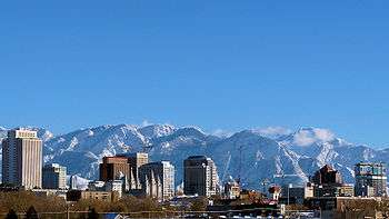
| Salt Lake City* | Salt Lake | 194,188 | 111.73 sq mi (289.4 km2) | 4,226 feet (1,288 m) | 1847 | $54,009 | Nearby Great Salt Lake |
| Sandy | Salt Lake | 94,556 | 22.88 sq mi (59.3 km2) | 4,450 feet (1,360 m) | 1871 | $87,012 | [lower-alpha 2] |
| Santa Clara | Washington | 6,835 | 5.53 sq mi (14.3 km2) | 2,762 feet (842 m) | 1854 | $84,457 | Town is located on the Santa Clara Creek |
| Santaquin | Utah | 10,740 | 10.39 sq mi (26.9 km2) | 4,984 feet (1,519 m) | 1851 | $69,712 | A local Ute Tribe leader |
| Saratoga Springs | Utah | 25,671 | 16.75 sq mi (43.4 km2) | 4,505 feet (1,373 m) | [lower-alpha 1] | $88,804 | Saratoga, New York and the local springs |
| Scipio | Millard | 378 | 0.93 sq mi (2.4 km2) | 5,315 feet (1,620 m) | 1859 | $69,375 | Scipio Kenner, a settler of the area |
| Scofield | Carbon | 15 | 0.70 sq mi (1.8 km2) | 7,739 feet (2,359 m) | 1879 | $63,750 | General Charles W. Scofield, a local mine official |
| Sigurd | Sevier | 528 | 0.98 sq mi (2.5 km2) | 5,226 feet (1,593 m) | 1874 | $57,159 | Sigurd, The Danish residents named the town after the Norse mythological hero |
| Smithfield | Cache | 10,832 | 4.98 sq mi (12.9 km2) | 4,603 feet (1,403 m) | 1859 | $62,596 | John Glover Smith, the first LDS Bishop of the area |
| Snowville | Box Elder | 133 | 1.54 sq mi (4.0 km2) | 4,547 feet (1,386 m) | 1871 | $57,083 | Lorenzo Snow, LDS Church President[42] |
| South Jordan | Salt Lake | 65,523 | 22.13 sq mi (57.3 km2) | 4,439 feet (1,353 m) | 1859 | $99,856 | The nearby Jordan River and its location south of West Jordan |
| South Ogden | Weber | 16,918 | 3.69 sq mi (9.6 km2) | 4,449 feet (1,356 m) | 1848 | $63,055 | Located south of Ogden |
| South Salt Lake | Salt Lake | 24,722 | 6.94 sq mi (18.0 km2) | 4,225 feet (1,288 m) | [lower-alpha 1] | $41,457 | Located south of Salt Lake City |
| South Weber | Davis | 6,921 | 4.72 sq mi (12.2 km2) | 4,551 feet (1,387 m) | 1851 | $95,000 | Located on the south side of the Weber River |
| Spanish Fork | Utah | 38,171 | 15.39 sq mi (39.9 km2) | 4,577 feet (1,395 m) | 1851 | $70,780 | The nearby Spanish Fork River where Spanish explorer Silvestre Vélez de Escalante entered the Utah Valley |
| Spring City | Sanpete | 995 | 1.33 sq mi (3.4 km2) | 5,823 feet (1,775 m) | 1852 | $53,625 | The nearby springs |
| Springdale | Washington | 447 | 4.63 sq mi (12.0 km2) | 3,898 feet (1,188 m) | 1862 | $46,458 | The nearby springs |
| Springville | Utah | 32,319 | 14.43 sq mi (37.4 km2) | 4,577 feet (1,395 m) | 1850 | $63,724 | The nearby springs |
| Sterling | Sanpete | 217 | 0.30 sq mi (0.78 km2) | 5,574 feet (1,699 m) | 1873 | $39,583 | The "sterling" qualities of its people |
| Stockton | Tooele | 699 | 1.63 sq mi (4.2 km2) | 5,118 feet (1,560 m) | [lower-alpha 1] | $67,833 | Stockton, California where many of the soldiers who settled the area were from |
| Sunset | Davis | 5,207 | 1.31 sq mi (3.4 km2) | 4,511 feet (1,375 m) | [lower-alpha 1] | $56,864 | Located on a ridge with views of the sunset over the Great Salt Lake |
| Syracuse | Davis | 27,444 | 9.58 sq mi (24.8 km2) | 4,285 feet (1,306 m) | 1878 | $90,778 | Named for a local resort on the Great Salt Lake which was named after Syracuse, New York |
| Tabiona | Duchesne | 141 | 0.13 sq mi (0.34 km2) | 6,516 feet (1,986 m) | 1860 | $46,250 | Originally called Tabby and Tabbyville referring to Ute tribe leader Tava whose nickname was Tabby |
| Taylorsville | Salt Lake | 60,377 | 10.85 sq mi (28.1 km2) | 4,295 feet (1,309 m) | 1848 | $59,968 | John Taylor, LDS Church President |
| Tooele* | Tooele | 33,236 | 21.46 sq mi (55.6 km2) | 5,043 feet (1,537 m) | 1851 | $58,770 | Native American Goshute tribe leader Tuilla |
| Toquerville | Washington | 1,943 | 15.13 sq mi (39.2 km2) | 3,389 feet (1,033 m) | 1858 | $73,083 | Native American Piute tribe leader Toquer |
| Torrey | Wayne | 339 | 0.51 sq mi (1.3 km2) | 6,837 feet (2,084 m) | [lower-alpha 1] | $42,000 | Colonel Torrey, a veteran of the Spanish–American War |
| Tremonton | Box Elder | 8,242 | 7.8 sq mi (20 km2) | 4,325 feet (1,318 m) | 1888 | $51,354 | Tremont, Illinois, where a group of settlers came from[43] |
| Trenton | Cache | 413 | 7.33 sq mi (19.0 km2) | 4,462 feet (1,360 m) | 1870 | $50,208 | Trenton, New Jersey, hometown of the area's first LDS Bishop |
| Tropic | Garfield | 589 | 8.39 sq mi (21.7 km2) | 6,309 feet (1,923 m) | [lower-alpha 1] | $56,458 | The area had a milder climate than where the settlers originally came from |
| Uintah | Weber | 1,520 | 1.06 sq mi (2.7 km2) | 4,537 feet (1,383 m) | 1850 | $72,614 | Uintah band of the Ute tribe |
| Vernal* | Uintah | 10,650 | 4.61 sq mi (11.9 km2) | 5,328 feet (1,624 m) | 1876 | $47,150 | Latin word vernalis for spring, for the many springs in the area[44] |
| Vernon | Tooele | 371 | 7.53 sq mi (19.5 km2) | 5,515 feet (1,681 m) | 1862 | $57,500 | Joseph Vernon, a local settler that was killed by Native Americans |
| Vineyard | Utah | 2,958 | 6.35 sq mi (16.4 km2) | 4,557 feet (1,389 m) | [lower-alpha 1] | $79,543 | The grape vines that were planted in the area |
| Virgin | Washington | 542 | 16.37 sq mi (42.4 km2) | 3,606 feet (1,099 m) | 1857 | $53,000 | The nearby Virgin River |
| Wales | Sanpete | 386 | 0.31 sq mi (0.80 km2) | 5,627 feet (1,715 m) | 1857[45] | $65,208 | Local settlers originally came from Wales |
| Wallsburg | Wasatch | 285 | 0.52 sq mi (1.3 km2) | 5,676 feet (1,730 m) | 1861[46] | $67,500 | William Madison Wall, local settler and explorer |
| Washington | Washington | 24,231 | 32.89 sq mi (85.2 km2) | 2,792 feet (851 m) | 1857 | $56,697 | George Washington, President of the United States |
| Washington Terrace | Weber | 9,122 | 1.97 sq mi (5.1 km2) | 4,610 feet (1,410 m) | 1878 | $53,070 | [lower-alpha 2] |
| Wellington | Carbon | 1,520 | 5.13 sq mi (13.3 km2) | 5,413 feet (1,650 m) | 1878 | $40,664 | Wellington Seeley Jr., Judge of the Emery County Court |
| Wellsville | Cache | 3,641 | 6.61 sq mi (17.1 km2) | 4,547 feet (1,386 m) | 1856 | $72,388 | Daniel H. Wells, LDS Church Apostle |
| Wendover | Tooele | 1,243 | 9.06 sq mi (23.5 km2) | 4,291 feet (1,308 m) | 1906 | $26,250 | [lower-alpha 2] |
| West Bountiful | Davis | 5,504 | 3.26 sq mi (8.4 km2) | 4,268 feet (1,301 m) | [lower-alpha 1] | $88,125 | Located west of Bountiful |
| West Haven | Weber | 12,109 | 10.3 sq mi (27 km2) | 4,272 feet (1,302 m) | 1854 | $73,613 | [lower-alpha 2] |
| West Jordan | Salt Lake | 111,937 | 32.46 sq mi (84.1 km2) | 4,373 feet (1,333 m) | 1848 | $72,083 | Located on the west side of the Jordan River |
| West Point | Davis | 10,258 | 7.35 sq mi (19.0 km2) | 4,314 feet (1,315 m) | 1867 | $81,750 | [lower-alpha 2] |
| West Valley City | Salt Lake | 135,546 | 35.61 sq mi (92.2 km2) | 4,304 feet (1,312 m) | 1849 | $59,954 | Located on the western side of the Salt Lake Valley |
| White City | Salt Lake | 5,270 | 0.9 sq mi (2.3 km2) | 4,583 feet (1,397 m) | 1955 | $49,103 | |
| Willard | Box Elder | 1,875 | 7.22 sq mi (18.7 km2) | 4,350 feet (1,330 m) | 1851 | $74,743 | Willard Richards, a LDS Church Apostle |
| Woodland Hills | Utah | 1,465 | 2.26 sq mi (5.9 km2) | 5,331 feet (1,625 m) | 1867 | $97,500 | Located at the base of canyon where groves of trees are located |
| Woodruff | Rich | 224 | 0.46 sq mi (1.2 km2) | 6,339 feet (1,932 m) | 1865 | $87,188 | Wilford Woodruff, LDS Church President |
| Woods Cross | Davis | 11,152 | 3.88 sq mi (10.0 km2) | 4,377 feet (1,334 m) | 1865 | $76,843 | Daniel C. Wood, an early settler |
See also
- List of census-designated places in Utah
- List of ghost towns in Utah
- Utah locations by per capita income
Notes
- No known source on when the city or town was settled
- No known source on how the city or town received its name
- Insufficient sample size for reporting
References
- "TOTAL POPULATION - American Community Survey (2017) B01003". United States Census Bureau. 2017. Retrieved July 27, 2019.
- "Utah Code, Title 10, Chapter 2, Section 301". Utah State Legislature. Retrieved January 5, 2017.
- "Utah Constitution, Article XI, Section 5". Utah State Legislature. Archived from the original on March 3, 2012. Retrieved May 11, 2010.
- Slaughter, William W.; Landon, Michael (1997). Trail of Hope – The Story of the Mormon Trail. Salt Lake City: Shadow Mountain. ISBN 1-57345-251-3.
- Arrington, Leonard J. (1994), "Colonization of Utah", in Powell, Allan Kent (ed.), Utah History Encyclopedia, Salt Lake City, Utah: University of Utah Press, ISBN 0874804256, OCLC 30473917
- "With a stroke of his pen, Utah governor gives township leaders the title of mayor". The Salt Lake Tribune. Retrieved 2019-11-07.
- "What is a Metro Township? | Magna Utah". www.magnametrotownship.org. Retrieved 2019-11-07.
- "2010 Census U.S. Gazetteer Files for Places". United States Census Bureau. June 10, 2011. Archived from the original on December 29, 2011. Retrieved January 8, 2012.
- "US Board on Geographic Names". United States Geological Survey. October 25, 2007. Retrieved May 11, 2010.
- Van Cott, John W (1990). Utah Place Names. Salt Lake City: University of Utah Press. ISBN 978-0-87480-345-7.
- "MEDIAN INCOME IN THE PAST 12 MONTHS (IN 2017 INFLATION-ADJUSTED DOLLARS) - American Community Survey (2017) S1903". United States Census Bureau. 2017. Retrieved July 27, 2019.
- "About Us". Big Water City. Archived from the original on January 20, 2012. Retrieved May 9, 2010.
- Jenson, Andrew (1919). "Origin of Western Geographic Names". The Utah Genealogical and Historical Magazine. The Genealogical Society of Utah. 10: 42. Retrieved August 1, 2010.
- "Facts and Figures". Town of Castle Valley. Retrieved May 9, 2010.
- This town will be first recognized by the 2020 Census, giving official numbers then
- "A town is born: Cedar Highlands poised to become Utah's newest municipality". Retrieved 2020-01-06.
- "About Us". www.cedarhighlands.org. Retrieved 2020-01-06.
- "Early History". Centerville City. Archived from the original on October 20, 2007. Retrieved May 10, 2010.
- "Elmo Town". www.emerycounty.com. Retrieved 2019-04-17.
- "Emery City". Emery County. Retrieved May 10, 2010.
- "Ferron City History". Ferron City. Retrieved May 10, 2010.
- "History". Fruit Heights City. Archived from the original on November 26, 2013. Retrieved May 10, 2010.
- "About Us". Garden City. Archived from the original on December 15, 2010. Retrieved May 10, 2010.
- Jenson, Andrew (1919). "Origin of Western Geographic Names". The Utah Genealogical and Historical Magazine. The Genealogical Society of Utah. 10: 182. Retrieved August 1, 2010.
- Jenson, Andrew (1919). "Origin of Western Geographic Names". The Utah Genealogical and Historical Magazine. The Genealogical Society of Utah. 10: 186. Retrieved August 1, 2010.
- "History". Highland City. Archived from the original on January 3, 2010. Retrieved May 10, 2010.
- "History of Huntington". Utah Encyclopedia. University of Utah. Archived from the original on March 4, 2012. Retrieved May 10, 2010.
- "Huntsville Town Founding history". Town of Huntville. Archived from the original on July 14, 2012. Retrieved May 10, 2010.
- "Hurricane". Utah History Encyclopedia. University of Utah. Archived from the original on April 25, 2012. Retrieved May 10, 2010.
- "Ivins City History". Ivins City. Retrieved May 10, 2010.
- Jenson, Andrew (1920). "Origin of Western Geographic Names". The Utah Genealogical and Historical Magazine. The Genealogical Society of Utah. 11: 84. Retrieved August 1, 2010.
- Jensen, Andrew (1941). Encyclopedic History of the Church. University of Wisconsin. p. 488. OCLC 3188924.
- Jenson, Andrew (1920). "Origin of Western Geographic Names". The Utah Genealogical and Historical Magazine. The Genealogical Society of Utah. 11: 88. Retrieved August 1, 2010.
- "Birth of Myton". City of Myton. Retrieved August 1, 2010.
- "Brief history of Nibley". Nibley City. Archived from the original on January 11, 2011. Retrieved August 1, 2010.
- Jenson, Andrew (1920). "Origin of Western Geographic Names". The Utah Genealogical and Historical Magazine. The Genealogical Society of Utah. 11: 176. Retrieved August 1, 2010.
- Deseret News, cited in Providence and Her People (Providence: Keith W. Watkins & Sons, 1974) pp. 15, 36.
- Jenson, Andrew (1921). "Origin of Western Geographic Names". The Utah Genealogical and Historical Magazine. The Genealogical Society of Utah. 12: 42.
- "History of Riverdale". City of Riverdale. Retrieved May 11, 2010.
- Jenson, Andrew (1921). "Origin of Western Geographic Names". The Utah Genealogical and Historical Magazine. The Genealogical Society of Utah. 12: 43.
- Jenson, Andrew (1921). "Origin of Western Geographic Names". The Utah Genealogical and Historical Magazine. The Genealogical Society of Utah. 12: 46.
- Jenson, Andrew (1921). "Origin of Western Geographic Names". The Utah Genealogical and Historical Magazine. The Genealogical Society of Utah. 12: 126.
- Huchel, Frederick M. (January 1999). A History of Box Elder County. Utah Centennial County History Series. Salt Lake City: Utah State Historical Society. pp. 408–409. ISBN 978-0-91373-816-0. Retrieved June 15, 2013.
- Jenson, Andrew (1922). "Origin of Western Geographic Names". The Utah Genealogical and Historical Magazine. The Genealogical Society of Utah. 13: 38. Retrieved August 1, 2010.
- Doelling, H. H. (1972). Central Utah coal fields: Sevier-Sanpete, Wasatch Plateau, Book Cliffs and Emery. Salt Lake City: University of Utah. p. 3. ISBN 978-1-55791-002-8. Retrieved August 1, 2010.
- Jenson, Andrew (1922). "Origin of Western Geographic Names". The Utah Genealogical and Historical Magazine. The Genealogical Society of Utah. 13: 39. Retrieved August 1, 2010.
External links

Salt Lake City (capital) | |||||||||||||
| Topics |  | ||||||||||||
| Society |
| ||||||||||||
| Regions |
| ||||||||||||
| Largest cities |
| ||||||||||||
| Counties |
| ||||||||||||
| Attractions |
| ||||||||||||