Kyoto
Kyoto (/kiˈoʊtoʊ, ˈkjoʊtoʊ/;[4] 京都 Kyōto, Japanese: [kʲoꜜːto] (![]()
![]()
Kyoto 京都市 | |
|---|---|
Designated city | |
| Kyoto City | |
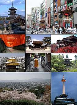 From top left: Tō-ji, Gion Matsuri in modern Kyoto, Fushimi Inari-taisha, Kyoto Imperial Palace, Kiyomizu-dera, Kinkaku-ji, Ponto-chō and Maiko, Ginkaku-ji, Cityscape from Higashiyama and Kyoto Tower | |
 Flag  | |
| |
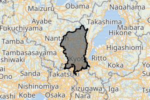
 Location of Kyoto in Kyoto Prefecture | |
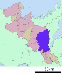
 Kyoto  Kyoto Kyoto (Asia) .svg.png) Kyoto Kyoto (Earth) | |
| Coordinates: 35°0′42″N 135°46′6″E | |
| Country | |
| Region | Kansai |
| Prefecture | Kyoto Prefecture |
| Founded | 794 |
| Government | |
| • Type | Mayor–council |
| • Body | Kyoto City Assembly |
| • Mayor | Daisaku Kadokawa |
| Area | |
| • Designated city | 827.83 km2 (319.63 sq mi) |
| Highest elevation | 971 m (3,186 ft) |
| Lowest elevation | 9 m (30 ft) |
| Population (October 1, 2015)[1] | |
| • Designated city | 1,475,183 |
| • Estimate (2018)[2] | 1,468,980 |
| • Rank | 9th, Japan |
| • Density | 1,800/km2 (4,600/sq mi) |
| • Metro [3] (2015) | 2,801,044 (JP: 4th) |
| Time zone | UTC+9 (Japan Standard Time) |
| - Tree | Weeping Willow, Japanese Maple and Katsura |
| - Flower | Camellia, Azalea and Sugar Cherry |
| Website | www |
| Kyoto | |||||||
|---|---|---|---|---|---|---|---|
"Kyoto" in kanji | |||||||
| Japanese name | |||||||
| Kanji | 京都 | ||||||
| Hiragana | きょうと | ||||||
| Katakana | キョウト | ||||||
| |||||||
In 794, Kyoto (then known as Heian-kyō) was chosen as the new seat of Japan's imperial court. The original city was arranged in accordance with traditional Chinese feng shui following the model of the ancient Chinese capital of Chang'an. The Imperial Palace faced south, resulting in Ukyō (the right sector of the capital) being on the west while Sakyō (the left sector) is on the east. The streets in the modern-day wards of Nakagyō, Shimogyō, and Kamigyō-ku still follow a grid pattern.
The Emperors of Japan ruled from Kyoto in the following eleven centuries until 1869, when the court relocated to Tokyo. The city was devastated during the Ōnin War in the 15th century and went into an extended period of decline, but gradually revived under the Tokugawa shogunate (1600–1868) and flourished as a major city in Japan. The modern municipality of Kyoto was established in 1889. The city was spared from large-scale destruction during World War II and as a result, its prewar cultural heritage has mostly been preserved.
Kyoto is considered the cultural capital of Japan and a major tourist destination. It is home to numerous Buddhist temples, Shinto shrines, palaces and gardens, many of which are listed collectively by UNESCO as a World Heritage Site. Prominent landmarks include the Kyoto Imperial Palace, Kiyomizu-dera, Kinkaku-ji, Ginkaku-ji and the Katsura Imperial Villa. Kyoto is also a center of higher learning, with Kyoto University being an institution of international renown.
Name
In Japanese, Kyoto was previously called Kyō (京), Miyako (都), or Kyō no Miyako (京の都). In the 11th century, the city was renamed "Kyōto" (京都, "capital city"), from the Middle Chinese kiang-tuo (cf. Mandarin jīngdū).[5] After the city of Edo was renamed "Tōkyō" (東京, meaning "Eastern Capital") in 1868 and the seat of the Emperor was moved there, Kyoto was for a short time known as "Saikyō" (西京, meaning "Western Capital"). Kyoto is also sometimes called the thousand-year capital (千年の都).
The National Diet never officially passed any law designating a capital.[6] Foreign spellings for the city's name have included Kioto, Miaco and Meaco, utilised mainly by Dutch cartographers. Another term commonly used to refer to the city in the pre-modern period was Keishi (京師), "capital".[7]
- Gallery
_1730.jpg) 18th-century map with the Japanese capital "Meaco"
18th-century map with the Japanese capital "Meaco"
History
Origins
Ample archaeological evidence suggests human settlement in the area of Kyoto began as early as the Paleolithic period,[8] although not much published material is retained about human activity in the region before the 6th century, around which time the Shimogamo Shrine is believed to have been established.
Heian-kyō
During the 8th century, when powerful Buddhist clergy became involved in the affairs of the Imperial government, Emperor Kanmu chose to relocate the capital in order to distance it from the clerical establishment in Nara. His last choice for the site was the village of Uda, in the Kadono district of Yamashiro Province.[9]
The new city, Heian-kyō (平安京, "tranquility and peace capital"), a scaled replica of the then Chinese Tang dynasty capital Chang'an,[10] became the seat of Japan's imperial court in 794, beginning the Heian period of Japanese history. Although military rulers established their governments either in Kyoto (Muromachi shogunate) or in other cities such as Kamakura (Kamakura shogunate) and Edo (Tokugawa shogunate), Kyoto remained Japan's capital until the transfer of the imperial court to Tokyo in 1869 at the time of the Imperial Restoration.
The city suffered extensive destruction in the Ōnin War of 1467–1477, and did not really recover until the mid-16th century. During the Ōnin War, the shugo collapsed, and power was divided among the military families.[11] Battles between samurai factions spilled into the streets, and came to involve the court nobility (kuge) and religious factions as well. Nobles' mansions were transformed into fortresses, deep trenches dug throughout the city for defense and as firebreaks, and numerous buildings burned. The city has not seen such widespread destruction since.
In the late 16th century, Toyotomi Hideyoshi reconstructed the city by building new streets to double the number of north-south streets in central Kyoto, creating rectangle blocks superseding ancient square blocks. Hideyoshi also built earthwork walls called odoi (御土居) encircling the city. Teramachi Street in central Kyoto is a Buddhist temple quarter where Hideyoshi gathered temples in the city. Throughout the Edo period, the economy of the city flourished as one of three major cities in Japan, the others being Osaka and Edo.
- Gallery
_Japanese_Map_of_Kyoto%2C_Japan_-_Geographicus_-_Kyoto-genroku9-1696.jpg) Map of Heian-kyō, 1696
Map of Heian-kyō, 1696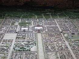 Daidairi (palace in the center) and the cityscape of Heian-kyō
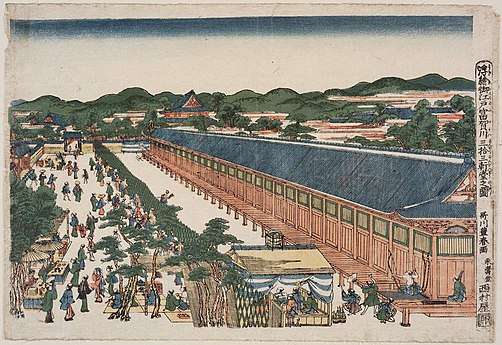 Perspective Pictures of Places in Japan: Sanjūsangen-dō in Kyoto
Toyoharu, c. 1772–1781
Modern Kyoto
The Hamaguri rebellion of 1864 burnt down 28,000 houses in the city which showed the rebels' dissatisfaction towards the Tokugawa Shogunate.[12] The subsequent move of the Emperor to Tokyo in 1869 weakened the economy. The modern city of Kyoto was formed on April 1, 1889. The construction of Lake Biwa Canal in 1890 was one measure taken to revive the city. The population of the city exceeded one million in 1932.[13]
There was some consideration by the United States of targeting Kyoto with an atomic bomb at the end of World War II because, as an intellectual center of Japan, it had a population large enough to possibly persuade the emperor to surrender.[14] In the end, at the insistence of Henry L. Stimson, Secretary of War in the Roosevelt and Truman administrations, the city was removed from the list of targets and replaced by Nagasaki. The city was largely spared from conventional bombing as well, although small-scale air raids did result in casualties.
As a result, the Imperial City (Emeritus) of Kyoto is one of the few Japanese cities that still have an abundance of prewar buildings, such as the traditional townhouses known as machiya. However, modernization is continually breaking down the traditional Kyoto in favor of newer architecture, such as the Kyōto Station complex.
Kyoto became a city designated by government ordinance on September 1, 1956. In 1997, Kyoto hosted the conference that resulted in the protocol on greenhouse gas emissions.
- Gallery
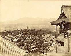 View of Kyoto from beside the Hondō of Kiyomizudera. – 1879[15]
_-1_(November_2008)_-_panoramio.jpg) Nanzenji aqueduct
Nanzenji aqueduct.jpg) Downtown Kyoto
Downtown Kyoto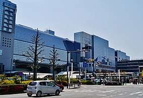 Kyōto Station
.jpg) Kyoto skyline
Kyoto skyline
| Historical population | ||
|---|---|---|
| Year | Pop. | ±% |
| 1889 | 279,165 | — |
| 1900 | 371,600 | +33.1% |
| 1910 | 470,033 | +26.5% |
| 1920 | 591,323 | +25.8% |
| 1930 | 765,142 | +29.4% |
| 1940 | 1,089,726 | +42.4% |
| 1950 | 1,101,854 | +1.1% |
| 1960 | 1,284,818 | +16.6% |
| 1970 | 1,419,165 | +10.5% |
| 1980 | 1,473,065 | +3.8% |
| 1990 | 1,461,103 | −0.8% |
| 2000 | 1,467,785 | +0.5% |
| 2010 | 1,474,015 | +0.4% |
| 2015 | 1,475,183 | +0.1% |
| Source: [13] | ||
Geography
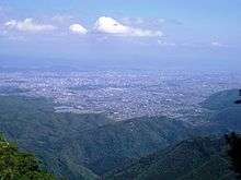
Kyoto is located in a valley, part of the Yamashiro (or Kyoto) Basin, in the eastern part of the mountainous region known as the Tamba highlands. The Yamashiro Basin is surrounded on three sides by mountains known as Higashiyama, Kitayama and Nishiyama, with a height just above 1,000 metres (3,281 ft) above sea level. This interior positioning results in hot summers and cold winters. There are three rivers in the basin, the Ujigawa to the south, the Katsuragawa to the west, and the Kamogawa to the east. Kyoto City takes up 17.9% of the land in the prefecture with an area of 827.9 square kilometres (319.7 sq mi).
Today, the main business district is located to the south of the old Imperial Palace, with the less-populated northern area retaining a far greener feel. Surrounding areas do not follow the same grid pattern as the center of the city, though streets throughout Kyoto share the distinction of having names.
Kyoto sits atop a large natural water table that provides the city with ample freshwater wells. Due to large-scale urbanization, the amount of rain draining into the table is dwindling and wells across the area are drying at an increasing rate.
Demographics
Historically, Kyoto was the largest city in Japan, later surpassed by Osaka and Edo (Tokyo) towards the end of the 16th century. In the pre-war years, Kyoto traded places with Kobe and Nagoya ranking as the 4th and 5th largest city. In 1947, it went back to being 3rd. By 1960 it had fallen to 5th again, and by 1990 it had fallen to 7th, in 2015 it is now 9th.
Climate
Kyoto has a humid subtropical climate (Köppen Cfa), featuring a marked seasonal variation in temperature and precipitation. Summers are hot and humid, but winters are relatively cold with occasional snowfall. Kyoto's rain season begins around the middle of June and lasts until the end of July, yielding to a hot and sunny latter half of the summer. Kyoto, along with most of the Pacific coast and central areas of Japan is prone to typhoons during September and October.
| Climate data for Kyoto, Kyoto | |||||||||||||
|---|---|---|---|---|---|---|---|---|---|---|---|---|---|
| Month | Jan | Feb | Mar | Apr | May | Jun | Jul | Aug | Sep | Oct | Nov | Dec | Year |
| Record high °C (°F) | 19.9 (67.8) |
22.9 (73.2) |
25.7 (78.3) |
30.7 (87.3) |
33.8 (92.8) |
36.8 (98.2) |
39.8 (103.6) |
39.8 (103.6) |
38.1 (100.6) |
32.2 (90.0) |
26.9 (80.4) |
22.8 (73.0) |
39.8 (103.6) |
| Average high °C (°F) | 8.9 (48.0) |
9.7 (49.5) |
13.4 (56.1) |
19.9 (67.8) |
24.6 (76.3) |
27.8 (82.0) |
31.5 (88.7) |
33.3 (91.9) |
28.8 (83.8) |
22.9 (73.2) |
17.0 (62.6) |
11.6 (52.9) |
20.8 (69.4) |
| Daily mean °C (°F) | 4.6 (40.3) |
5.1 (41.2) |
8.4 (47.1) |
14.2 (57.6) |
19.0 (66.2) |
23.0 (73.4) |
26.8 (80.2) |
28.2 (82.8) |
24.1 (75.4) |
17.8 (64.0) |
12.1 (53.8) |
7.0 (44.6) |
15.9 (60.6) |
| Average low °C (°F) | 1.2 (34.2) |
1.4 (34.5) |
4.0 (39.2) |
9.0 (48.2) |
14.0 (57.2) |
18.8 (65.8) |
23.2 (73.8) |
24.3 (75.7) |
20.3 (68.5) |
13.6 (56.5) |
7.8 (46.0) |
3.2 (37.8) |
11.7 (53.1) |
| Record low °C (°F) | −11.9 (10.6) |
−11.6 (11.1) |
−8.2 (17.2) |
−4.4 (24.1) |
−0.3 (31.5) |
4.9 (40.8) |
10.6 (51.1) |
12.8 (55.0) |
7.1 (44.8) |
0.2 (32.4) |
−4.4 (24.1) |
−9.4 (15.1) |
−11.9 (10.6) |
| Average precipitation mm (inches) | 50.3 (1.98) |
68.3 (2.69) |
113.3 (4.46) |
115.7 (4.56) |
160.8 (6.33) |
214.0 (8.43) |
220.4 (8.68) |
132.1 (5.20) |
176.2 (6.94) |
120.9 (4.76) |
71.3 (2.81) |
48.0 (1.89) |
1,491.3 (58.73) |
| Average snowfall cm (inches) | 5 (2.0) |
8 (3.1) |
2 (0.8) |
0 (0) |
0 (0) |
0 (0) |
0 (0) |
0 (0) |
0 (0) |
0 (0) |
0 (0) |
3 (1.2) |
18 (7.1) |
| Average precipitation days (≥ 0.5 mm) | 7.8 | 9.2 | 11.9 | 10.6 | 11.4 | 12.9 | 12.9 | 8.7 | 11.0 | 8.8 | 7.6 | 8.1 | 120.9 |
| Average snowy days | 3.1 | 3.9 | 1.0 | 0.0 | 0.0 | 0.0 | 0.0 | 0.0 | 0.0 | 0.0 | 0.0 | 1.2 | 9.2 |
| Average relative humidity (%) | 66 | 66 | 62 | 59 | 62 | 67 | 70 | 66 | 68 | 68 | 68 | 68 | 66 |
| Mean monthly sunshine hours | 123.2 | 117.4 | 146.8 | 175.4 | 180.9 | 138.3 | 142.3 | 182.7 | 136.8 | 157.4 | 138.1 | 135.8 | 1,775.1 |
| Source #1: 平年値(年・月ごとの値) | |||||||||||||
| Source #2: (record temperatures) 観測史上1~10位の値(年間を通じての値) | |||||||||||||
Politics and government

The directly elected executive mayor in Kyoto as of 2013 is Daisaku Kadokawa, an independent supported by Democratic Party of Japan, Liberal Democratic Party, New Komeito Party, Your Party and Social Democratic Party. The legislative city assembly has 69 elected members.
Kyoto City Assembly
| Political party | Number of seats[16] |
|---|---|
| Liberal Democratic Party | 22 |
| Japanese Communist Party | 14 |
| Democratic Party of Japan | 13 |
| New Komeito Party | 12 |
| Kyoto Party | 4 |
| Independent | 2 |
| Vacant | 2 |
Elections
- 2008 Kyoto mayoral election
- 2012 Kyoto mayoral election
- 2016 Kyoto mayoral election (ja:2016年京都市長選挙)
Wards
Kyoto has eleven wards (区, ku). Together, they make up the city of Kyoto. Like other cities in Japan, Kyoto has a single mayor and a city council.
| Wards of Kyoto | ||||||
|---|---|---|---|---|---|---|
| Place Name | Map of Kyoto | |||||
| Rōmaji | Kanji | Population | Land area in km2 | Pop. density
per km2 |
||
| 1 | Fushimi-ku | 伏見区 | 280,655 | 61.66 | 4,600 | 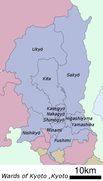 A map of Kyoto's Wards |
| 2 | Higashiyama-ku | 東山区 | 39,044 | 7.48 | 5,200 | |
| 3 | Kamigyō-ku | 上京区 | 85,113 | 7.03 | 12,000 | |
| 4 | Kita-ku | 北区 | 119,474 | 94.88 | 1,300 | |
| 5 | Minami-ku | 南区 | 99,927 | 15.81 | 6,300 | |
| 6 | Nakagyō-ku - (administrative center) | 中京区 | 110,430 | 7.41 | 15,000 | |
| 7 | Nishikyō-ku | 西京区 | 150,962 | 59.24 | 2,500 | |
| 8 | Sakyo-ku | 左京区 | 168,266 | 246.77 | 680 | |
| 9 | Shimogyō-ku | 下京区 | 82,668 | 6.78 | 12,000 | |
| 10 | Ukyō-ku | 右京区 | 204,262 | 292.07 | 700 | |
| 11 | Yamashina-ku | 山科区 | 135,471 | 28.7 | 4,700 | |
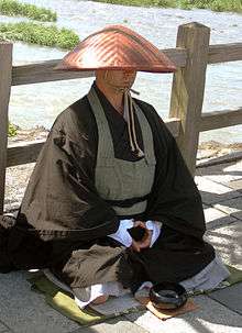
Culture
Although ravaged by wars, fires, and earthquakes during its eleven centuries as the imperial capital, Kyoto was not entirely destroyed in WWII. It was removed from the atomic bomb target list (which it had headed) by the personal intervention of Secretary of War Henry L. Stimson, as Stimson wanted to save this cultural center, which he knew from his honeymoon and later diplomatic visits.[17][18] Kyoto has been, and still remains, Japan's cultural center.[19][20] The government of Japan is relocating the Agency for Cultural Affairs to Kyoto in 2021.
With its 2,000 religious places – 1,600 Buddhist temples and 400 Shinto shrines, as well as palaces, gardens and architecture intact – it is one of the best preserved cities in Japan. Among the most famous temples in Japan are Kiyomizu-dera, a magnificent wooden temple supported by pillars off the slope of a mountain; Kinkaku-ji, the Temple of the Golden Pavilion; Ginkaku-ji, the Temple of the Silver Pavilion; and Ryōan-ji, famous for its rock garden. The Heian Jingū is a Shinto shrine, built in 1895, celebrating the Imperial family and commemorating the first and last emperors to reside in Kyoto. Three special sites have connections to the imperial family: the Kyoto Gyoen area including the Kyoto Imperial Palace and Sentō Imperial Palace, homes of the Emperors of Japan for many centuries; Katsura Imperial Villa, one of the nation's finest architectural treasures; and Shugaku-in Imperial Villa, one of its best Japanese gardens. In addition, the temple of Sennyu-ji houses the tombs of the emperors from Shijō to Kōmei.
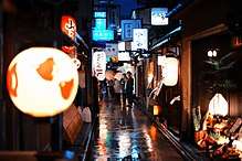
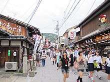
Other sites in Kyoto include Arashiyama, the Gion and Pontochō geisha quarters, the Philosopher's Walk, and the canals that line some of the older streets.
The "Historic Monuments of Ancient Kyoto" are listed by the UNESCO as a World Heritage Site. These include the Kamo Shrines (Kami and Shimo), Kyō-ō-Gokokuji (Tō-ji), Kiyomizu-dera, Daigo-ji, Ninna-ji, Saihō-ji (Kokedera), Tenryū-ji, Rokuon-ji (Kinkaku-ji), Jishō-ji (Ginkaku-ji), Ryōan-ji, Hongan-ji, Kōzan-ji and the Nijō Castle, primarily built by the Tokugawa shōguns. Other sites outside the city are also on the list.
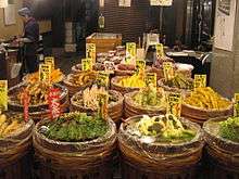
Kyoto is renowned for its abundance of delicious Japanese foods and cuisine. The special circumstances of Kyoto as a city away from the sea and home to many Buddhist temples resulted in the development of a variety of vegetables peculiar to the Kyoto area (京野菜, kyō-yasai).
Japan's television and film industry has its center in Kyoto. Many jidaigeki, action films featuring samurai, were shot at Toei Uzumasa Eigamura.[21] A film set and theme park in one, Eigamura features replicas of traditional Japanese buildings, which are used for jidaigeki. Among the sets are a replica of the old Nihonbashi (the bridge at the entry to Edo), a traditional courthouse, a Meiji Period police box and part of the former Yoshiwara red-light district. Actual film shooting takes place occasionally, and visitors are welcome to observe the action.
The dialect spoken in Kyoto is known as Kyō-kotoba or Kyōto-ben, a constituent dialect of the Kansai dialect. When Kyoto was the capital of Japan, the Kyoto dialect was the de facto standard Japanese and influenced the development of Tokyo dialect, the modern standard Japanese. Courtesans performing duties at Tokyo were referred to as "Edokko" (bourgois). Famous Kyoto expressions are a polite copula dosu, an honorific verb ending -haru, a greeting phrase okoshi-yasu "welcome", etc.
Economy


| Year | US$ |
|---|---|
| 1975 | 5,324 |
| 1980 | 9,523 |
| 1985 | 13,870 |
| 1990 | 20,413 |
| 1995 | 23,627 |
| 2000 | 26,978 |
| 2005 | 32,189 |
| 2010 | 36,306 |
| 2015 | 41,410 |
The key industry of Kyoto is information technology and electronics: the city is home to the headquarters of Nintendo, Intelligent Systems, SCREEN Holdings,[24] Tose, Hatena, Omron,[25] Kyocera, Shimadzu Corp.,[26] Rohm,[27] Horiba,[28] Nidec Corporation,[29] Nichicon,[30] Nissin Electric,[31] and GS Yuasa.
Tourists are hugely fond of Kyoto, contributing significantly to its economy. The cultural heritage sites of Kyoto are constantly visited by school groups from across Japan, and many foreign tourists also stop in Kyoto. In 2014, the city government announced that a record number of tourists had visited Kyoto,[32] and it was favoured as the world's best city by U.S. travel magazines.[33]
Traditional Japanese crafts are also major industry of Kyoto, most of which are run by artisans in their plants. Kyoto's kimono weavers are particularly renowned, and the city remains the premier center of kimono manufacturing. Such businesses, vibrant in past centuries, have declined in recent years as sales of traditional goods stagnate.
Sake brewing is Kyoto's traditional industry. Gekkeikan and Takara Holdings are major sake brewers headquartered in Kyoto.
Other notable businesses headquartered in Kyoto includes Aiful, Ishida, MK,[34] Nissen Holdings, Oh-sho, Sagawa Express, Volks and Wacoal.
The concentration of population to the capital city area is 55%, which is highest among the prefectures. The economic difference between the coastal area and inland area including Kyoto basin is significant. Encompassing ¥10.12 trillion, Kyoto MEA has the fourth-largest economy in the country in 2010.[35]
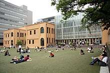
Colleges and universities
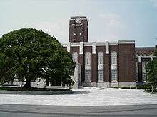
Home to 40 institutions of higher education, Kyoto is one of the academic centers in Japan.[36] Kyoto University is considered to be one of the top national universities nationwide. According to the Times Higher Education top-ranking university, Kyoto University is ranked the second university in Japan after University of Tokyo, and 25th overall in the world as of 2010.[37] The Kyoto Institute of Technology is also among the most famous universities in Japan and is considered to be one of the best universities for architecture and design in the country. Popular private universities, such as Doshisha University and Ritsumeikan University are also located in the city.
Kyoto also has a unique higher education network called the Consortium of Universities in Kyoto, which consists of three national, three public (prefectural and municipal), and 45 private universities, as well as the city and five other organizations. The combination does not offer a degree, but offers the courses as part of a degree at participating universities.[38]
In addition to Japanese universities and colleges, selected American universities, such as Stanford, also operates in the city for education and research. Kyoto Consortium for Japanese Studies (KCJS) is a combination of 14 American universities that sponsors a two-semester academic program for undergraduates who wish to do advanced work in Japanese language and cultural studies.[39]
Transportation
.jpg)
Airport

Although Kyoto does not have its own large commercial airport, travelers can get to the city via nearby Itami Airport, Kobe Airport or Kansai International Airport. The Haruka Express operated by JR West carries passengers from Kansai Airport to Kyoto Station in 73 minutes.[40]
Osaka Airport Transport buses connect Itami Airport and Kyoto Station Hachijo Gate in 50 minutes and cost 1,310 yen (as of 2017) for a one-way trip.[41] Some buses go further, make stops at major hotels and terminals in the downtown area.
Other airports located further from the city is Nagoya Airfield located 135.5 KM away from the city.
Buses
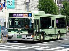
Kyoto's municipal bus network is extensive. Private carriers also operate within the city. Many tourists join commuters on the public buses, or take tour buses. Kyoto's buses have announcements in English and electronic signs with stops written in the Latin alphabet.
Most city buses have a fixed fare. A one-day bus pass and a combined unlimited train and bus pass are also available. These are especially useful for visiting many different points of interest within Kyoto. The bus information center just outside the central station handles tickets and passes. The municipal transport company publishes a very useful leaflet called "Bus Navi." It contains a route map for the bus lines to most sights and fare information. This too is available at the information center in front of the main station.
Buses operating on routes within the city, the region, and the nation stop at Kyoto Station. In addition to Kyoto Station, bus transfer is available at the intersections of Shijō Kawaramachi and Sanjō Keihan. The intersection of Karasuma Kitaōji to the north of downtown has a major bus terminal serving passengers who take the Karasuma Line running beneath Karasuma Street, Kyoto's main north–south street.
Cycling
Cycling is a very important form of personal transportation in the city. The geography and scale of the city are such that the city may be easily navigated on a bicycle. There are five bicycle rental stations and 21 EcoStations in central Kyoto. Because of the large number of cyclists, permitted bicycle parking areas can be difficult to find.[42] Bicycles parked in non-permitted areas are impounded.
Roads
Within Kyoto's ancient lanes, one-way system is prevalent and necessary for preservation of its character. The city is connected with other parts of Japan by the Meishin Expressway, which has two interchanges in the city: Kyoto Higashi (Kyoto East) in Yamashina-ku and Kyoto Minami (Kyoto South) in Fushimi-ku. The Kyoto-Jukan Expressway connects the city to northern regions of Kyoto Prefecture. The Daini Keihan Road is a new bypass (completed in 2010) to Osaka.
Although Greater Kyoto has fewer toll-highways than other comparable Japanese cities, it is served with elevated dual and even triple-carriageway national roads. As of 2018, only 10.1 kilometres (6.3 miles) of the Hanshin Expressway Kyoto Route is in operation.[43]
There are nine national highways in the city of Kyoto: Route 1, Route 8, Route 9, Route 24, Route 162, Route 171, Route 367, Route 477 and Route 478.
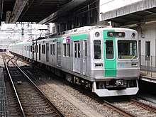
Rail
.jpg)
Just like other major cities in Japan, Kyoto is well served by rail transportation systems operated by several different companies and organizations. The city's main gateway terminal, Kyōto Station, which is one of the most popular stations in the country, connects The Tōkaidō Shinkansen bullet train Line (see below) with five JR West lines, a Kintetsu line and a municipal subway line.
The Keihan, the Hankyu, and other rail networks also offer frequent services within the city and to other cities and suburbs in the Kinki region.
There is a Railway Heritage site in Kyoto, where visitors can experience the range of Japanese railways in the JR Museum (formerly Umekoji Steam Locomotive Museum, situated about the roundhouse.
Subway
The Kyoto Municipal Transportation Bureau operates the Kyoto Municipal Subway consisting of two lines: the Karasuma Line and the Tōzai Line.
Karasuma Line
The Karasuma Line is coloured green, and its stations are given numbers following the letter "K".
The line has following stations, from north to south: Kokusaikaikan (terminal) and Matsugasaki in Sakyō-ku; Kitayama and Kitaōji in Kita-ku; Kuramaguchi and Imadegawa in Kamigyō-ku; Marutamachi and Karasuma Oike in Nakagyō-ku; Shijō, Gojō and Kyōto in Shimogyō-ku; Kujō and Jūjō in Minami-ku; and Kuinabashi and Takeda (terminal) in Fushimi-ku.
Between Kitaōji and Jūjō, trains run beneath the north-south Karasuma Street (烏丸通, Karasuma-dori), hence the name. They link to the other subway line, the Tōzai Line, at Karasuma Oike. They also connect to the JR lines at Kyoto Station and the Hankyu Kyoto Line running cross-town beneath Shijō Street at the intersection of Shijō Karasuma, Kyoto's central business district. At Shijō Karasuma, the subway station is named Shijō, whereas Hankyu's station is called Karasuma.
The Transportation Bureau and Kintetsu jointly operate through services, which continue to the Kintetsu Kyoto Line to Kintetsu Nara Station in Nara. The Karasuma Line and the Kintetsu Kyoto Line connect at Kyoto and Takeda. All the stations are located in the city proper.
Tozai Line

The Tōzai Line is coloured vermilion, and its stations are given numbers following the letter "T". This line runs from the southeastern area of the city, then east to west (i.e. tōzai in Japanese) through the Kyoto downtown area where trains run beneath the three east-west streets: Sanjō Street (三条通, Sanjō-dori), Oike Street (御池通, Oike-dori) and Oshikōji Street (押小路通, Oshikōji-dori).
The line has following stations, from east to west: Rokujizō (terminal) in Uji; Ishida and Daigo in Fushimi-ku; Ono, Nagitsuji, Higashino, Yamashina and Misasagi in Yamashina-ku; Keage, Higashiyama and Sanjō Keihan in Higashiyama-ku; Kyoto Shiyakusho-mae, Karasuma Oike, Nijōjō-mae, Nijō and Nishiōji Oike in Nakagyō-ku; and Uzumasa Tenjingawa (terminal) in Ukyō-ku.
The Keihan Keishin Line has been integrated into this line, and thus Keihan provides through services from Hamaōtsu in the neighbouring city of Ōtsu, the capital of Shiga Prefecture.
The Tōzai Line connects to the Keihan lines at Rokujizō, Yamashina, Misasagi and Sanjō Keihan, to the JR lines at Nijō, Yamashina and Rokujizō, and to the Keifuku Electric Railroad at Uzumasa Tenjingawa. All the stations except Rokujizō are located in Kyoto.
High-speed rail
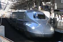
The Tōkaidō Shinkansen operated by JR Central provides high-speed rail service linking Kyoto with Nagoya, Yokohama and Tokyo to the east of Kyoto and with nearby Osaka and points west on the San'yō Shinkansen, such as Kobe, Okayama, Hiroshima, Kitakyushu, and Fukuoka. The trip from Tokyo takes about two hours and eighteen minutes. From Hakata in Fukuoka, Nozomi takes you to Kyoto in just over three hours. All trains including Nozomi stop at Kyoto Station, serving as a gateway to not only Kyoto Prefecture but also northeast Osaka, south Shiga and north Nara.
Waterways
Japanese trade and haulage traditionally took place by waterways, minimally impacting the environment up until the highway-systems built by Shogunates. There are a number of rivers, canals and other navigable waterways in Kyoto. The Seta and Uji rivers, confluence into the (Yodo River), Kamogawa and Katsura river flow through Kyoto. Lake Biwa Canal was a significant infrastructural development. In present days, however, the waterways are no longer primarily used for passenger or goods transportation, other than limited sightseeing purpose such as Hozugawa Kudari boat on the Hozu River and Jukkoku bune sightseeing tour boat in Fushimi-ku area. Lake Biwa remains a popular place for recreational boating, also the site of a Birdman Rally where contraptions and contrivances are driven from land over the waterway.
Tourism
Kyoto contains roughly 2,000 temples and shrines.[44]
UNESCO World Heritage Site
About 20% of Japan's National Treasures and 14% of Important Cultural Properties exist in the city proper. The UNESCO World Heritage Site Historic Monuments of Ancient Kyoto (Kyoto, Uji and Otsu Cities) includes 17 locations in Kyoto, Uji in Kyoto Prefecture, and Ōtsu in Shiga Prefecture. The site was designated as World Heritage in 1994.
 Kamigamo Shrine
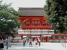 Shimogamo Shrine
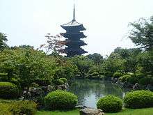 Tō-ji
Tō-ji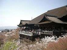 Kiyomizu-dera
 Saihō-ji
 Tenryū-ji
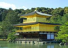 Kinkaku-ji
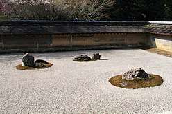 Ryōan-ji
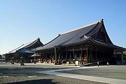 Nishi Honganji
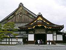 Nijō Castle
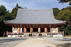 Daigo-ji
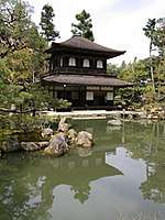 Ginkaku-ji
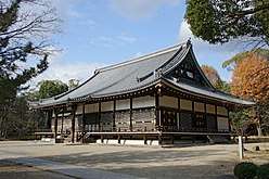 Ninna-ji
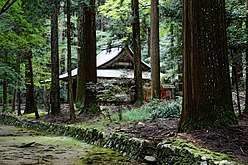 Kōzan-ji
Museums
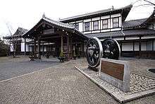
- Umekoji Steam Locomotive Museum
- Onishi Seiwemon Museum (大西清右衛門美術館)
- Kitamura Museum (北村美術館)
- The Kyoto Arashiyama Orgel Museum (京都嵐山オルゴール美術館)
- Kyoto City Heiankyo Sosei-Kan Museum (京都市平安京創生館)
- Kyoto Municipal Museum of Art
- Kyoto City Archaeological Museum (京都市考古資料館)
- Kyoto Art Center
- The Kyoto International Manga Museum
- The National Museum of Modern Art, Kyoto
- The Kyoto National Museum (京都国立博物館)
- The Kyoto University Museum (京都大学総合博物館)
- Kyoto Museum of Traditional Crafts (京都伝統産業ふれあい館)
- The Museum of Kyoto (京都府京都文化博物館)
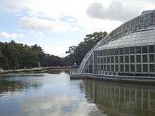
- The Kyoto Botanical Garden (京都府立植物園)
- Garden of Fine Arts, Kyoto (京都府立陶板名画の庭)
- Kyoto Prefectural Insho-Domoto Museum of Fine Arts (京都府立堂本印象美術館)
- Koryo Museum of Art (高麗美術館)
- Joutenkaku Museum (承天閣美術館)
- Ryozen Museum of History (幕末維新ミュージアム 霊山歴史館)
- Sen-oku Hakuko Kan (泉屋博古館)
- Toei Kyoto Studio Park (東映太秦映画村)
- Nomura Art Museum (野村美術館)
- Namikawa Cloisonne Museum of Kyoto (並河靖之七宝記念館)
- The Yurinkan Museum (藤井斉成会有鄰館)
- The Tin Toy Museum (ブリキのおもちゃ博物館)
- The Hosomi Museum (細見美術館)
- Hakusasonso Hashimoto Kansetsu Garden and Museum (白沙村荘 橋本関雪記念館)
- The Raku Museum (楽美術館)
- Kyoto Museum for World Peace of Ritsumeikan University (立命館大学国際平和ミュージアム)
- Ōkōchi Sansō (大河内山荘)
- The Kyoto Kaleidoscope Museum (京都万華鏡ミュージアム)
- Shigureden
- Kyoto Railway Museum
Festivals
Kyoto is well known for its traditional festivals which have been held for over 1,000 years and are a major tourist attraction.[45] The first is the Aoi Matsuri on May 15. Two months later (July 1 to 31) is the Gion Matsuri known as one of the 3 great festivals of Japan, culminating in a massive parade on July 17. Kyoto marks the Bon Festival with the Gozan no Okuribi, lighting fires on mountains to guide the spirits home (August 16). The October 22 Jidai Matsuri, Festival of the Ages, celebrates Kyoto's illustrious past.
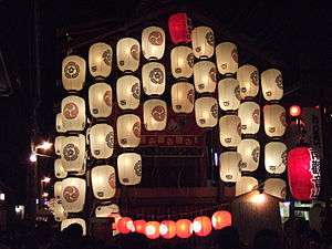 Gion Matsuri
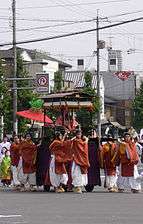 Aoi Matsuri
 Jidai Matsuri
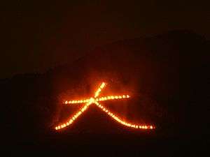 Gozan Okuribi
Sports
Football
In football, Kyoto is represented by Kyoto Sanga FC who won the Emperor's Cup in 2002, and rose to J. League's Division 1 in 2005. Kyoto Sanga has a long history as an amateur non-company club, although it was only with the advent of professionalization that it was able to compete in the Japanese top division. Sanga Stadium by Kyocera is its home stadium.
Amateur football clubs such as F.C. Kyoto BAMB 1993 and Kyoto Shiko Club (both breakaway factions of the original Kyoto Shiko club that became Kyoto Sanga) as well as unrelated AS Laranja Kyoto and Ococias Kyoto AC compete in the regional Kansai soccer league.
Baseball
Between 1951 and 1952 the Central League team Shochiku Robins played their franchised games at Kinugasa Ballpark (ja:衣笠球場, Kinugasa Kyujo) in Kita-ku. In 2010, Nishikyogoku Stadium in Ukyo-ku became the home of a newly formed girls professional baseball team, the Kyoto Asto Dreams.
Additionally, Kyoto's high school baseball teams are strong, with Heian and Toba in particular making strong showings recently at the annual tournament held in Koshien Stadium, Nishinomiya, near Osaka.
Horse racing
Kyoto Racecourse in Fushimi-ku is one of ten racecourses operated by the Japan Racing Association. It hosts notable horse races including the Kikuka-shō, Spring Tenno Sho, and Queen Elizabeth II Commemorative Cup.
International relations
Kyoto, having been the capital city of Japan, a seat of learning and culture, has long-established ties with other great cities around the world. Many foreign scholars, artists and writers have stayed in Kyoto over the centuries.
Twin towns and sister cities
The city of Kyoto has sister-city relationships with the following cities:[46]


Partner cities
In addition to its sister city arrangements which involve multi-faceted cooperation, Kyoto has created a system of "partner cities" which focus on cooperation based on a particular topic. At present, Kyoto has partner-city arrangements with the following cities:[49]
See also
- List of bridges in Kyoto
- List of Buddhist temples in Kyoto
- List of Kyoto's fires
- List of Shinto shrines in Kyoto
- Outline of Kyoto
References
Notes
- Communications, Statistics Bureau, Ministry of Internal Affairs and. "Statistics Bureau Home Page/2015 Summary of the results and statistical tables". www.stat.go.jp.
- 京都市総合企画局情報化推進室. 京都市統計ポータル/京都市の人口. www2.city.kyoto.lg.jp.
- "UEA Code Tables". Center for Spatial Information Science, University of Tokyo. Retrieved January 26, 2019.
- "Kyoto or Kioto". Collins Dictionary. n.d. Retrieved 24 September 2014.
- Lowe, John. (2000). Old Kyoto: A short Social History, p. x.
- 首都を定める法律. Legislative Bureau of the House of Councillors.
- 京師内外地図 [Edo era map of Kyoto labelled]. Retrieved November 16, 2015.
- Nakagaawa, Kazuya (November 2006). 旧石器時代の京都 [Kyoto in Paleolithic period] (PDF). 京都府埋蔵文化財情報 (in Japanese). 京都府埋蔵文化財調查研究センター. 101: 1. ISSN 0286-5424.
- Kyoto Exhibitors' Association (1910) Kyoto Kyoto Exhibitors' Association of the Japan-British exhibition, Kyoto, p. 3 OCLC 1244391
- Ebrey, Walthall & Palais 2006, p. 103.
- Stephen, Morillo (1995). "Guns and Government: A Comparative Study of Europe and Japan*" (PDF). Archived from the original (PDF) on 2013-09-13.
- Ponsonby-Fane, Richard (1931). Kyoto; its History and Vicissitudes Since its Foundation in 792 to 1868. p. 241.
- 人口・世帯の時系列データ (XLSX). City of Kyoto. Retrieved April 15, 2018.
- "The Atomic Bomb and the End of World War II: A Collection of Primary Sources". nsarchive2.gwu.edu. Retrieved 2017-09-25.
- Tom (2015-08-25). "Beautiful Kiyomizu-dera Temple in Kyoto, Japan c. 1879". Cool Old Photos. Retrieved 2019-03-03.
- 京都市会 会派名簿. Retrieved June 16, 2013.
- The Manhattan Project, Department of Energy at mbe.doe.gov Archived 2006-09-28 at the Wayback Machine
- HyperHistory.net Dec. 22, 2009. Retrieved August 7, 2010 Archived June 11, 2010, at the Wayback Machine
- Shinzō Abe (February 5, 2018). Committee on Budget. The 190th Ordinary Diet session (in Japanese). 8. House of Representatives. Archived from the original on December 14, 2017. Retrieved November 18, 2018.
京都というのは文化的な中心
- Kyoto | History, Geography, & Points of Interest | Britannica.com
- "Welcome to Kyoto — Toei Uzumasa Eigamura Movie Museum". Pref.kyoto.jp. Archived from the original on 2010-03-11. Retrieved 2010-03-07.
- 県民経済計算 (in Japanese). Cabinet Office (Japan). Retrieved 2017-10-16.
- "Purchasing power parities (PPP)". OECD. Retrieved 2017-10-16.
- "Dainippon Screen corporate profile". Retrieved March 6, 2014.
- "OMRON corporate data". Retrieved September 13, 2014.
- "Shimadzu corporate profile". Retrieved April 16, 2014.
- "Rohm corporate data". Retrieved September 13, 2014.
- "Horiba company outline". Retrieved September 13, 2014.
- "Nidec company profile". Retrieved February 3, 2014.
- "Nichicon company profile". Retrieved June 12, 2015.
- "Nissin Electric company outline". Archived from the original on December 30, 2017. Retrieved January 30, 2015.
- "Releasing the Overall Kyoto Tourism Research Result of 2013" (Press release). City of Kyoto. June 18, 2014. Retrieved July 17, 2014.
- "20 beautiful photos show why Kyoto is a treasure". CNN travel. 15 September 2017. Retrieved 12 November 2017.
- "MK Taxi Kyoto official site". Retrieved March 6, 2014.
- Yoshitsugu Kanemoto. "Metropolitan Employment Area (MEA) Data". Center for Spatial Information Science of the University of Tokyo.
- "Kyoto Uses Its Many Charms to Attract Foreign Students". The New York Times. June 29, 2014.
- "The Times Higher Education Supplement World University Rankings". Retrieved 2010-02-10.
- "English". Consortium of Universities in Kyoto. Archived from the original on July 20, 2014. Retrieved July 15, 2014.
- "Stanford Japan Center". Stanford-jc.or.jp. 1999-02-22. Archived from the original on January 9, 2011. Retrieved 2010-03-07.
- JR-WEST: Travel Information > Access to Kansai Airport Archived 2006-04-07 at the Wayback Machine
- "Timetable, Bus Stop & Fare". Osaka Airport Limousine. Archived from the original on 2017-09-14. Retrieved September 17, 2017.
- "Community Cycle | Cycle Kyoto". www.cyclekyoto.com. Retrieved 2017-09-25.
- Hanshin Expressway. 8号京都線 (in Japanese). Archived from the original on July 13, 2013. Retrieved April 15, 2018.
- Scott, David (1996). Exploring Japan. Fodor's Travel Publications, Inc. ISBN 0-679-03011-5.
- Kyoto Visitors Guide (1998). Kyoto Tourist Office, Kyoto City Council.
- "Sister Cities of Kyoto City". City of Kyoto. Retrieved 2015-12-06.
- "Partnerská města HMP" [Prague - Twin Cities HMP]. Portál „Zahraniční vztahy“ [Portal "Foreign Affairs"] (in Czech). 2013-07-18. Archived from the original on 2013-06-25. Retrieved 2013-08-05.
- "Sister Cities, Public Relations". Guadalajara municipal government. Archived from the original on March 2, 2012. Retrieved March 12, 2013.
- "Partner Cities of Kyoto City". City of Kyoto. Retrieved 2018-04-15.
- Paris et Kyoto célèbrent leurs soixante ans d’amitié
- MoUs with Japan
Bibliography
- Fiévé, Nicolas (ed.) (2008) Atlas historique de Kyôto. Analyse spatiale des systèmes de mémoire d’une ville, de son architecture et de ses paysages urbains. Foreword Kôichirô Matsuura, Preface Jacques Gernet, Paris, Éditions de l’UNESCO / Éditions de l’Amateur, 528 pages, 207 maps et 210 ill. ISBN 978-2-85917-486-6.
- Fiévé, Nicolas and Waley, Paul. (2003). Japanese Capitals in Historical Perspective: Place, Power and Memory in Kyoto, Edo and Tokyo. London: Routledge. 417 pages + 75 ill. ISBN 978-0-7007-1409-4
- Lone, John. (2000). Old Kyoto: A Short Social History. Oxford: Oxford University Press. ISBN 0-19-590940-2.
- Ponsonby-Fane, Richard A. B. (1956). Kyoto: The Old Capital of Japan, 794–1869. Kyoto: The Ponsonby Memorial Society.
- Ropke, Ian Martin. Historical Dictionary of Osaka and Kyoto. 273pp Scarecrow Press (July 22, 1999) ISBN 978-0810836228.
- Stewart, Harold. (1981). By the Old Walls of Kyoto: A Year's Cycle of Landscape Poems with Prose Commentaries. New York: Weatherhill. ISBN 0-8348-0154-X.
- Titsingh, Isaac. (1834). [Siyun-sai Rin-siyo/Hayashi Gahō, 1652], Nihon Ōdai Ichiran; ou, Annales des empereurs du Japon. Paris: Oriental Translation Fund of Great Britain and Ireland. ...Click link for digitized, full-text copy of this book (in French)
- Wyden, Peter. (1984). Day One: Before Hiroshima and After. Simon & Schuster, Inc. ISBN 0-671-46142-7.
External links
| Wikivoyage has a travel guide for Kyoto. |
| Look up 京都 or Kyōto in Wiktionary, the free dictionary. |
| Wikimedia Commons has media related to: |
- Kyoto Travel Guide — City of Kyoto and Kyoto Tourism Council
- Kyoto City Local Government
- Kyoto Guide including map with 300+ points of interest
- Photos of Kyoto, mostly temples and shrines
- Kyoto Prefectural Domoto-Insho Museum of Fine Arts at Google Cultural Institute

| |||||||||||||||||||||||||||||||||||||||||||||||||||||||
| Authority control |
|
|---|