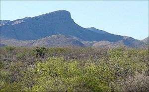
Whetstone Mountains
The Whetstone Mountains is a mountain range in Cochise County, southeastern Arizona.[1]
| Whetstone Mountains | |
|---|---|
 | |
| Highest point | |
| Peak | Apache Peak |
| Elevation | 7,711 ft (2,350 m) |
| Dimensions | |
| Length | 14 mi (23 km) N-S |
| Width | 9 mi (14 km) E-W |
| Geography | |
| Country | United States |
| State | Arizona |
| Region | Northwestern Chihuahuan Desert |
| Municipalities | Benson and Sierra Vista |
| Range coordinates | 31°48′41″N 110°25′07″W |
| Borders on | |
Geography
The range is located south of Interstate 10, between the Santa Rita Mountains to the west, and the Dragoon Mountains to the east. Higher elevations of the major ranges in the region are in the Madrean Sky Islands ecoregion, with sky island habitats.
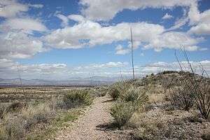
Located within the Coronado National Forest, the Whetstone Mountains are in its Sierra Vista Recreation Area, with access via hiking trails.[2]
Kartchner Caverns State Park is in the eastern foothills of the Whetstone Mountains, on Arizona State Route 90. The trailhead for the Foothills Loop Trail is in the park.
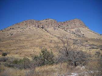
Peaks
Peaks in the range include:
- Apache Peak, 7711 ft
- French Peak, 7675 ft;
- Granite Peak, 7420 ft — southern section.
- Cottonwood Peak, 7100 ft — northeast section.
- East Peak, at 6681 ft — eastern section.
History
At Iron Springs, within the Whetstones is where Wyatt Earp fought in a gunfight during the Earp Vendetta Ride, 1882.
References
- Bulletin - United States Geological Survey By Geological Survey (U.S.) Published by The Survey., 1909 Item notes: no. 380 Original from Harvard University
- Coronado National Forest: Sierra Vista Recreation Area
| Wikimedia Commons has media related to Whetstone Mountains, Arizona. |