Wang Hin District
Wang Hin (Thai: วังหิน, pronounced [wāŋ hǐn]) is a district (amphoe) in the central part of Sisaket Province, northeastern Thailand.
Wang Hin วังหิน | |
|---|---|
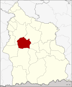 District location in Sisaket Province | |
| Coordinates: 14°56′54″N 104°13′48″E | |
| Country | Thailand |
| Province | Sisaket |
| Seat | Bu Sung |
| Area | |
| • Total | 237.619 km2 (91.745 sq mi) |
| Population (2005) | |
| • Total | 46,888 |
| • Density | 197.3/km2 (511/sq mi) |
| Time zone | UTC+7 (ICT) |
| Postal code | 33270 |
| Geocode | 3316 |
Geography
Neighboring districts are (from the north clockwise): Mueang Sisaket, Phayu, Phrai Bueng, Khukhan, Prang Ku, and Uthumphon Phisai.
History
The minor district (king amphoe) was created on 9 March 1987, when the five tambons, Bu Sung, That, Duan Yai, Bo Kaeo, and Si Samran were split off from Mueang Sisaket District.[1] It was upgraded to a full district on 20 October 1993.[2]
Administration
The district is divided into eight sub-districts (tambons), which are further subdivided into 126 villages (mubans). Bu Sung is a sub-district municipality (thesaban tambon) which covers the same-named sub-district and seven tambon administrative organizations (TAO).
| No. | Name | Thai name | Villages | Pop. | |
|---|---|---|---|---|---|
| 1. | Bu Sung | บุสูง | 22 | 9,676 | |
| 2. | That | ธาตุ | 16 | 6,614 | |
| 3. | Duan Yai | ดวนใหญ่ | 18 | 7,139 | |
| 4. | Bo Kaeo | บ่อแก้ว | 19 | 5,388 | |
| 5. | Si Samran | ศรีสำราญ | 13 | 4,088 | |
| 6. | Thung Sawang | ทุ่งสว่าง | 15 | 4,440 | |
| 7. | Wang Hin | วังหิน | 11 | 4,399 | |
| 8. | Phon Yang | โพนยาง | 12 | 5,144 |
References
- ประกาศกระทรวงมหาดไทย เรื่อง แบ่งเขตท้องที่อำเภอเมืองศรีสะเกษ จังหวัดศรีสะเกษ ตั้งเป็นกิ่งอำเภอวังหิน (PDF). Royal Gazette (in Thai). 104 (45 ง): 1752. 12 March 1987.
- พระราชกฤษฎีกาตั้งอำเภอลำทับ อำเภอร่องคำ อำเภอเวียงแหง อำเภอนาโยง อำเภอแก้งสนามนาง อำเภอโนนแดง อำเภอบ้านหลวง อำเภอกะพ้อ อำเภอศรีบรรพต อำเภอแก่งกระจาน อำเภอหนองสูง อำเภอสบเมย อำเภอเมยวดี อำเภอโคกเจริญ อำเภอทุ่งหัวช้าง อำเภอผาขาว อำเภอวังหิน อำเภอดอนพุด อำเภอบึงโขงหลง และอำเภอห้วยคต พ.ศ. ๒๕๓๖ (PDF). Royal Gazette (in Thai). 110 (179 ก special): 1–3. 3 November 1993.