Phayu District
Phayu (Thai: พยุห์, pronounced [pʰā.júʔ]) is a district (amphoe) in the central part of Sisaket Province, northeastern Thailand.
Phayu พยุห์ | |
|---|---|
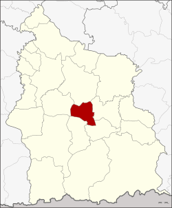 District location in Sisaket Province | |
| Coordinates: 14°54′12″N 104°23′30″E | |
| Country | Thailand |
| Province | Sisaket |
| Seat | Phayu |
| Area | |
| • Total | 225.485 km2 (87.060 sq mi) |
| Population (2005) | |
| • Total | 36,325 |
| • Density | 161.1/km2 (417/sq mi) |
| Time zone | ICT |
| Postal code | 33230 |
| Geocode | 3320 |
History
The minor district (king amphoe) was created on 30 April 1994, when five tambons were split off from Mueang Sisaket District.[1] On 11 October 1997 it was upgraded to a full district.[2]
Geography
Neighboring districts are (from the north clockwise): Mueang Sisaket, Nam Kliang, Si Rattana, Phrai Bueng, and Wang Hin.
Administration
The district is divided into five sub-districts (tambons), which are further subdivided into 65 villages (mubans). Phayu is a township (thesaban tambon) which covers parts of tambon Phayu. There are a further five tambon administrative organizations (TAO).
| No. | Name | Thai name | Villages | Pop. | |
|---|---|---|---|---|---|
| 1. | Phayu | พยุห์ | 12 | 9,002 | |
| 2. | Phrom Sawat | พรหมสวัสดิ์ | 20 | 9,457 | |
| 3. | Tamyae | ตำแย | 15 | 7,718 | |
| 4. | Non Phek | โนนเพ็ก | 11 | 6,109 | |
| 5. | Nong Kha | หนองค้า | 7 | 4,039 |
References
- ประกาศกระทรวงมหาดไทย เรื่อง แบ่งเขตท้องที่อำเภอเมืองศรีสะเกษ จังหวัดศรีสะเกษ ตั้งเป็นกิ่งอำเภอพยุห์ (PDF). Royal Gazette (in Thai). 111 (42 ง): 21. 26 May 1994.
- พระราชกฤษฎีกาตั้งอำเภอหนองปรือ อำเภอห้วยกระเจา อำเภอทรายทองวัฒนา อำเภอปางศิลาทอง อำเภอเนินสง่า อำเภอนาทม อำเภอพระพรหม อำเภอแม่วงก์ อำเภอสองแคว อำเภอบ้านใหม่ไชยพจน์ อำเภอไทยเจริญ อำเภอกาบัง อำเภอพยุห์ อำเภอเมืองจันทร์ อำเภอภูพาน อำเภอคลองหอยโข่ง อำเภอเขาฉกรรจ์ อำเภอนาวัง อำเภอพิบูลย์รักษ์ และอำเภอทุ่งศรีอุดม พ.ศ. ๒๕๔๐ (PDF). Royal Gazette (in Thai). 114 (50 ก): 24–27. 26 September 1997.
This article is issued from Wikipedia. The text is licensed under Creative Commons - Attribution - Sharealike. Additional terms may apply for the media files.