Virginia Wildlife Management Areas
Virginia Wildlife Management Areas (WMAs) are state-managed protected areas that exist primarily for the benefit of wildlife. Within the Commonwealth of Virginia, 41 tracts of land have been protected as WMAs, covering a total of over 203,000 acres (317 sq mi; 820 km2). They are managed and maintained by the Virginia Department of Game and Inland Fisheries.[1]

Purpose
WMAs in Virginia differ from other state-managed protected areas in that they are solely intended to preserve and improve wildlife habitat, with a particular focus on game animals, and to provide public space for hunting and fishing activities. Other protected areas in the state, such as state parks, state forests, and natural area preserves, may protect habitat but are also expressly managed to provide space for public recreation, research, timber production, and/or rare species conservation.[2]
Land acquisition and maintenance funds for WMAs are ultimately provided by hunters and anglers, through license fees and taxes levied on gear. These fees are collected on a national level through the Pittman–Robertson Federal Aid in Wildlife Restoration Act, and distributed proportionally to individual states. Some WMA lands were originally donated to the state for wildlife purposes, rather than purchased.[2]
Public use and access
Although maintained for the primary benefit of hunters and anglers, other recreational pursuits are permitted within Virginia's WMAs. Hiking, primitive camping, horseback riding, and bird-watching is allowed on many WMA properties. Prohibited activities include swimming, mountain biking, organized sports, and ATV use. Boats, when permitted, must typically be non-motorized.[2]
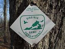
To utilize WMA land for any purpose, visitors ages 17 or older must possess a valid hunting or fishing permit, or a current Virginia boat registration. In the absence of these documents, visitors must obtain a daily or annual WMA Access Permit that allows entry to WMA lands.[3]
List of Virginia Wildlife Management Areas
The following table lists Virginia's 41 WMAs, as of 2016.[1]
| WMA name | City, county or counties[4] | Area[4] | Major waterbodies[4] | Notes[4] |
|---|---|---|---|---|
| Amelia | Amelia | 2,217 acres (8.97 km2) | Appomattox River | |
| Big Survey | Wythe | 7,500 acres (30 km2) | ||
| Big Woods | Sussex | 4,173 acres (16.89 km2)[5] | Contiguous with Big Woods State Forest. | |
| Briery Creek | Prince Edward | 3,164 acres (12.80 km2) | Briery Creek Lake | |
| Chester F. Phelps | Fauquier, Culpeper | 4,539 acres (18.37 km2) | Rappahannock River | |
| Cavalier | Chesapeake | 4,550 acres (18.4 km2) | Comprises two separate tracts, one of which is contiguous with Great Dismal Swamp National Wildlife Refuge. | |
| Chickahominy | Charles City | 5,217 acres (21.11 km2) | Chickahominy River | |
| Clinch Mountain | Smyth, Washington, Russell, Tazewell | 25,477 acres (103.10 km2) | Laurel Bed Lake | |
| Crooked Creek | Carroll | 1,796 acres (7.27 km2) | ||
| Dick Cross | Mecklenburg | 1,400 acres (5.7 km2) | Roanoke River | Formerly known as the Elm Hill Wildlife Management Area. |
| Doe Creek | Accomack | 447 acres (1.81 km2) | ||
| Fairystone Farms | Patrick, Henry | 5,321 acres (21.53 km2) | Philpott Reservoir | Contiguous with Fairy Stone State Park. |
| Featherfin | Prince Edward, Appomattox, Buckingham | 2,800 acres (11 km2) | Appomattox River | |
| G. Richard Thompson | Fauquier | 4,000 acres (16 km2) | Thompson Lake | |
| Game Farm Marsh | New Kent | 429 acres (1.74 km2) | Chickahominy Lake | |
| Goshen and Little North Mountain | Augusta, Rockbridge | 33,697 acres (136.37 km2) | Maury River | Contiguous with George Washington National Forest and Goshen Pass Natural Area Preserve. |
| Hardware River | Fluvanna | 1,034 acres (4.18 km2) | James River, Hardware River | |
| Havens | Roanoke | 7,190 acres (29.1 km2) | The first VDGIF-managed property, initially purchased in 1930. | |
| Hidden Valley | Washington | 6,400 acres (26 km2) | Hidden Valley Lake | |
| Highland | Highland | 14,283 acres (57.80 km2) | Bullpasture River | |
| Hog Island | Surry, Isle of Wight | 3,908 acres (15.82 km2) | James River | |
| Horsepen Lake | Buckingham | 2,910 acres (11.8 km2) | Horsepen Lake | |
| James River | Nelson | 1,213 acres (4.91 km2) | James River | |
| Land's End | King George | 462 acres (1.87 km2) | Rappahannock River | Managed as a waterfowl refuge; hunting not permitted. |
| Mattaponi | Caroline | 2,542 acres (10.29 km2)[6] | Mattaponi River, South River | |
| Merrimac Farm | Prince William | 301 acres (1.22 km2) | Adjacent to Marine Corps Base Quantico. | |
| Mockhorn Island | Northampton | 7,365 acres (29.81 km2) | Extent of the WMA's tidal marshland is greatly reduced at high tide. | |
| Pettigrew | Caroline | 934 acres (3.78 km2) | ||
| Powhatan | Powhatan | 4,462 acres (18.06 km2) | ||
| Princess Anne | Virginia Beach | 1,546 acres (6.26 km2) | Atlantic Ocean (Back Bay) | |
| Ragged Island | Isle of Wight | 1,537 acres (6.22 km2) | James River | |
| Rapidan | Madison Greene | 10,326 acres (41.79 km2) | Rapidan River, Conway River, South River | Contiguous with Shenandoah National Park. |
| Saxis | Accomack | 5,678 acres (22.98 km2) | Atlantic Ocean | Primarily protects tidal marshland on Virginia's eastern shore. |
| Short Hills | Rockbridge, Botetourt | 4,232 acres (17.13 km2) | Includes examples of karst topography. | |
| Smith Mountain Cooperative | Bedford, Pittsylvania | 4,996 acres (20.22 km2) | Smith Mountain Lake | Owned by Appalachian Power and managed by VDGIF. |
| Stewarts Creek | Carroll | 1,087 acres (4.40 km2) | ||
| Turkeycock | Franklin, Henry | 2,679 acres (10.84 km2) | ||
| T. M. Gathright | Bath | 13,428 acres (54.34 km2) | Lake Moomaw | |
| Ware Creek | New Kent | 2,600 acres (11 km2) | York River | |
| Weston | Fauquier | 271 acres (1.10 km2) | ||
| White Oak Mountain | Pittsylvania | 2,748 acres (11.12 km2) | Banister River |
References
- "Wildlife Management Areas". Virginia Department of Game and Inland Fisheries. Retrieved December 30, 2016.
- Gooch, Bob (2000). Enjoying Virginia Outdoors: A Guide to Wildlife Management Areas. Charlottesville: University Press of Virginia. pp. 1–5. ISBN 0813919614.
- "Access Permit". Virginia Department of Game and Inland Fisheries. Retrieved December 30, 2016.
- Unless otherwise noted, information included in this column is sourced from individual pages listed at: "Wildlife Management Areas". Virginia Department of Game and Inland Fisheries. Retrieved December 20, 2016.
- Clarkson, Tee (November 17, 2016). "VDGIF purchases Parker's Branch". Richmond Times-Dispatch. Retrieved January 18, 2017.
- "Mattaponi Wildlife Management Area". For the Love of the Land - 100 Conservation Stories from Across Virginia (PDF). Piedmont Environmental Council. p. 21. Retrieved January 17, 2017.