Vabres-l'Abbaye
Vabres-l'Abbaye is a commune in the Aveyron department in southern France.
Vabres-l'Abbaye | |
|---|---|
_Cath%C3%A9drale_01.JPG) Cathedral | |
 Coat of arms | |
Location of Vabres-l'Abbaye 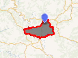
| |
 Vabres-l'Abbaye  Vabres-l'Abbaye | |
| Coordinates: 43°56′N 2°50′E | |
| Country | France |
| Region | Occitanie |
| Department | Aveyron |
| Arrondissement | Millau |
| Canton | Saint-Affrique |
| Intercommunality | Saint Affricain, Roquefort, Sept Vallons |
| Government | |
| • Mayor (2014-2020) | Michel Bernat |
| Area 1 | 41.36 km2 (15.97 sq mi) |
| Population (2017-01-01)[1] | 1,200 |
| • Density | 29/km2 (75/sq mi) |
| Time zone | UTC+01:00 (CET) |
| • Summer (DST) | UTC+02:00 (CEST) |
| INSEE/Postal code | 12286 /12400 |
| Elevation | 299–730 m (981–2,395 ft) (avg. 310 m or 1,020 ft) |
| 1 French Land Register data, which excludes lakes, ponds, glaciers > 1 km2 (0.386 sq mi or 247 acres) and river estuaries. | |
Geography
The village lies in the northern part of the commune, on the right bank of the Dourdou de Camarès, which flows north through the middle of the commune and forms part of its northern border, where it is joined by the Sorgues.
Population
| Historical population | ||
|---|---|---|
| Year | Pop. | ±% |
| 2006 | 1,104 | — |
| 2007 | 1,106 | +0.2% |
| 2008 | 1,106 | +0.0% |
| 2009 | 1,113 | +0.6% |
| 2010 | 1,128 | +1.3% |
| 2011 | 1,143 | +1.3% |
| 2012 | 1,158 | +1.3% |
| 2013 | 1,168 | +0.9% |
| 2014 | 1,170 | +0.2% |
| 2015 | 1,181 | +0.9% |
| 2016 | 1,190 | +0.8% |
References
- "Populations légales 2017". INSEE. Retrieved 6 January 2020.
| Wikimedia Commons has media related to Vabres-l'Abbaye. |
| Authority control |
|
|---|
This article is issued from Wikipedia. The text is licensed under Creative Commons - Attribution - Sharealike. Additional terms may apply for the media files.