Marnhagues-et-Latour
Marnhagues-et-Latour is a commune in the Aveyron department in southern France.
Marnhagues-et-Latour | |
|---|---|
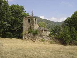 The Chapel of Manhargues | |
Location of Marnhagues-et-Latour 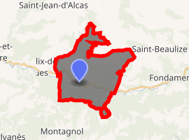
| |
 Marnhagues-et-Latour  Marnhagues-et-Latour | |
| Coordinates: 43°52′24″N 3°01′50″E | |
| Country | France |
| Region | Occitanie |
| Department | Aveyron |
| Arrondissement | Millau |
| Canton | Causses-Rougiers |
| Intercommunality | Larzac-Templier Causses et Vallées |
| Government | |
| • Mayor (2001–2008) | Jérôme Thibault-Laurent |
| Area 1 | 21.92 km2 (8.46 sq mi) |
| Population (2017-01-01)[1] | 139 |
| • Density | 6.3/km2 (16/sq mi) |
| Time zone | UTC+01:00 (CET) |
| • Summer (DST) | UTC+02:00 (CEST) |
| INSEE/Postal code | 12139 /12540 |
| Elevation | 396–762 m (1,299–2,500 ft) (avg. 422 m or 1,385 ft) |
| 1 French Land Register data, which excludes lakes, ponds, glaciers > 1 km2 (0.386 sq mi or 247 acres) and river estuaries. | |
Geography
The Sorgues flows west-northwest through the commune; the Latour hamlet lies on its right bank. The Marnhagues hamlet lies in the valley of the Matas brook, a tributary of the Sorgues. The third hamlet in the commune, Laroquaubel, lies in the valley of the Annou, another tributary of the Sorgues.
Population
| Historical population | ||
|---|---|---|
| Year | Pop. | ±% |
| 1962 | 128 | — |
| 1968 | 144 | +12.5% |
| 1975 | 146 | +1.4% |
| 1982 | 132 | −9.6% |
| 1990 | 102 | −22.7% |
| 1999 | 132 | +29.4% |
| 2008 | 146 | +10.6% |
Sights
- The Nonenque Charterhouse (French: Chartreuse Notre-Dame du Précieux Sang or Chartreuse de Nonenque) lies north of Laroquaubel, in the same valley.
See also
External links
| Wikimedia Commons has media related to Marnhagues-et-Latour. |
| Authority control |
|
|---|
This article is issued from Wikipedia. The text is licensed under Creative Commons - Attribution - Sharealike. Additional terms may apply for the media files.