Montlaur, Aveyron
Montlaur is a commune in the Aveyron department in southern France.
Montlaur | |
|---|---|
Location of Montlaur 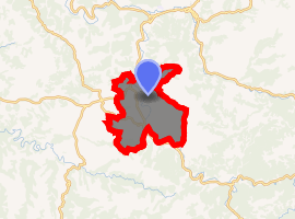
| |
 Montlaur  Montlaur | |
| Coordinates: 43°52′48″N 2°50′04″E | |
| Country | France |
| Region | Occitanie |
| Department | Aveyron |
| Arrondissement | Millau |
| Canton | Causses-Rougiers |
| Intercommunality | Rougier de Camarès |
| Government | |
| • Mayor (2008–2014) | Francis Castan |
| Area 1 | 41.57 km2 (16.05 sq mi) |
| Population (2017-01-01)[1] | 626 |
| • Density | 15/km2 (39/sq mi) |
| Time zone | UTC+01:00 (CET) |
| • Summer (DST) | UTC+02:00 (CEST) |
| INSEE/Postal code | 12154 /12400 |
| Elevation | 330–681 m (1,083–2,234 ft) (avg. 350 m or 1,150 ft) |
| 1 French Land Register data, which excludes lakes, ponds, glaciers > 1 km2 (0.386 sq mi or 247 acres) and river estuaries. | |
Geography
The Dourdou de Camarès forms part of the commune's southeastern border, flows northwestward through the middle of the commune, then forms part of its northwestern border.
The village lies in the northern part of the commune, on the left bank of the Dourdou de Camarès.
Population
| Historical population | ||
|---|---|---|
| Year | Pop. | ±% |
| 1793 | 575 | — |
| 1800 | 558 | −3.0% |
| 1821 | 1,420 | +154.5% |
| 1831 | 1,324 | −6.8% |
| 1836 | 793 | −40.1% |
| 1841 | 749 | −5.5% |
| 1846 | 857 | +14.4% |
| 1851 | 882 | +2.9% |
| 1856 | 829 | −6.0% |
| 1861 | 870 | +4.9% |
| 1866 | 913 | +4.9% |
| 1872 | 911 | −0.2% |
| 1876 | 960 | +5.4% |
| 1881 | 1,074 | +11.9% |
| 1886 | 1,085 | +1.0% |
| 1891 | 1,082 | −0.3% |
| 1896 | 1,056 | −2.4% |
| 1901 | 1,014 | −4.0% |
| 1906 | 1,015 | +0.1% |
| 1911 | 1,022 | +0.7% |
| 1921 | 919 | −10.1% |
| 1926 | 878 | −4.5% |
| 1931 | 846 | −3.6% |
| 1936 | 799 | −5.6% |
| 1946 | 764 | −4.4% |
| 1954 | 753 | −1.4% |
| 1962 | 761 | +1.1% |
| 1968 | 657 | −13.7% |
| 1975 | 608 | −7.5% |
| 1982 | 557 | −8.4% |
| 1990 | 556 | −0.2% |
| 1999 | 581 | +4.5% |
| 2008 | 680 | +17.0% |
See also
References
- "Populations légales 2017". INSEE. Retrieved 6 January 2020.
| Wikimedia Commons has media related to Montlaur (Aveyron). |
| Authority control |
|
|---|
This article is issued from Wikipedia. The text is licensed under Creative Commons - Attribution - Sharealike. Additional terms may apply for the media files.