Thérondels
Thérondels is a commune in the Aveyron department in southern France.
Thérondels | |
|---|---|
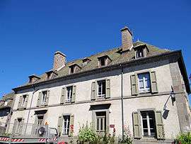 The town hall in Thérondels | |
Location of Thérondels 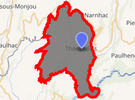
| |
 Thérondels  Thérondels | |
| Coordinates: 44°53′47″N 2°45′33″E | |
| Country | France |
| Region | Occitanie |
| Department | Aveyron |
| Arrondissement | Rodez |
| Canton | Aubrac et Carladez |
| Intercommunality | Carladez |
| Government | |
| • Mayor (2008–2014) | Paul Mestre |
| Area 1 | 38.47 km2 (14.85 sq mi) |
| Population (2017-01-01)[1] | 406 |
| • Density | 11/km2 (27/sq mi) |
| Time zone | UTC+01:00 (CET) |
| • Summer (DST) | UTC+02:00 (CEST) |
| INSEE/Postal code | 12280 /12600 |
| Elevation | 646–1,023 m (2,119–3,356 ft) (avg. 960 m or 3,150 ft) |
| 1 French Land Register data, which excludes lakes, ponds, glaciers > 1 km2 (0.386 sq mi or 247 acres) and river estuaries. | |
Villages
Apart from Thérondels itself, the commune includes several other villages and hamlets: Le Bousquet, Campheyt, Casternac, Douzalbats, Faliès, Fieux, Frons, Gorse, Jou, Ladignac, Laussac, Longvieux, Mandilhac, Le Meyniel, Nigresserre, and Pervilhergues.[2] Laussac is situated on a peninsula in Lake Sarrans (a reservoir). South of Douzalbats there is an airstrip for ultralight aircraft.
Population
| Historical population | ||
|---|---|---|
| Year | Pop. | ±% |
| 1962 | 803 | — |
| 1968 | 804 | +0.1% |
| 1975 | 683 | −15.0% |
| 1982 | 606 | −11.3% |
| 1990 | 505 | −16.7% |
| 1999 | 478 | −5.3% |
| 2008 | 478 | +0.0% |
See also
References
- "Populations légales 2017". INSEE. Retrieved 6 January 2020.
- http://www.geoportail.fr/visu2D.do?ter=metropole
| Wikimedia Commons has media related to Thérondels. |
| Authority control |
|
|---|
This article is issued from Wikipedia. The text is licensed under Creative Commons - Attribution - Sharealike. Additional terms may apply for the media files.