White Butte
White Butte is the highest natural point in the U.S. state of North Dakota. At an elevation of 3,506 ft (1,069 m), it is a prominent butte in Slope County, in the Badlands of the southwestern part of the state. It is located 3 miles (5 kilometers) east of U.S. 85 and about 6.5 mi (10 km) south of Amidon.
| White Butte | |
|---|---|
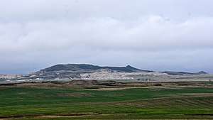 White Butte, the highest point in North Dakota, viewed from 140th Avenue SW, May 2018. | |
| Highest point | |
| Elevation | 3,508 ft (1,069 m) NAVD 88[1] |
| Prominence | 546 ft (166 m) [1] |
| Listing | U.S. state high point 30th |
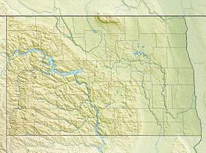
| Coordinates | 46°23′12″N 103°18′09″W [2] |
| Geography | |
 White Butte | |
| Topo map | USGS Amidon |
| Climbing | |
| Easiest route | Hike (cattle trail) |
The nearest town is Amidon, about seven miles to the northwest. The summit is located within the boundaries of the Little Missouri National Grassland and is about 35 miles (56 km) south of Theodore Roosevelt National Park. It is on private property, owned by the Dennis family who live nearby. At the parking area, one mile due north of the trailhead, the family maintains a small mailbox-like receptacle for donations to help maintain the area, and requests a $5 contribution from visitors. From the trailhead, the trail itself is a 4-mile round trip.[3]
The Killdeer Mountains,[4] 75 miles (121 km) to the north, rise roughly 1,000 feet (300 m) from their foothills, but are 225 feet (69 m) shorter than White Butte.
.JPG)
.JPG)
See also
- Outline of North Dakota
- Index of North Dakota-related articles
- List of U.S. states by elevation
References
- "White Butte, North Dakota". Peakbagger.com. Retrieved 2012-11-10.
- "White Butte". Geographic Names Information System. United States Geological Survey. Retrieved 2012-11-10.
- "Highpointers e-news of September 23, 2010". Retrieved 2012-11-10.
- "Killdeer Mountains, North Dakota". Peakbagger.com.
External links
- "White Butte". SummitPost.org.
- "White Butte, North Dakota". AmericasRoof.com.
- "White Butte". ListsOfJohn.com.
Highest natural points of U.S. states and additional U.S. areas | ||
|---|---|---|
| ||
| Additional U.S. areas | ||