Tuburan, Cebu
Tuburan, officially the Municipality of Tuburan (Cebuano: Lungsod sa Tuburan; Tagalog: Bayan ng Tuburan), is a 2nd class municipality in the province of Cebu, Philippines. According to the 2015 census, it has a population of 63,866 people.[3]
Tuburan | |
|---|---|
| Municipality of Tuburan | |
 Map of Cebu with Tuburan highlighted | |
| |
.svg.png) Tuburan Location within the Philippines | |
| Coordinates: 10°44′N 123°50′E | |
| Country | |
| Region | Central Visayas (Region VII) |
| Province | Cebu |
| District | 3rd district of Cebu |
| Founded | 1851 |
| Barangays | 54 (see Barangays) |
| Government | |
| • Type | Sangguniang Bayan |
| • Mayor | Danilo M. Diamante |
| • Vice Mayor | Democrito M. Diamante |
| • Congressman | Pablo John F. Garcia |
| • Electorate | 47,382 voters (2019) |
| Area | |
| • Total | 233.56 km2 (90.18 sq mi) |
| Elevation | 0.10 m (0.33 ft) |
| Population (2015 census)[3] | |
| • Total | 63,866 |
| • Density | 270/km2 (710/sq mi) |
| • Households | 14,974 |
| Economy | |
| • Income class | 2nd municipal income class |
| • Poverty incidence | 36.76% (2015)[4] |
| • Revenue (₱) | 150,746,533.48 (2016) |
| Time zone | UTC+8 (PST) |
| ZIP code | 6043 |
| PSGC | |
| IDD : area code | +63 (0)32 |
| Climate type | tropical climate |
| Native languages | Cebuano Tagalog |
| Website | www |
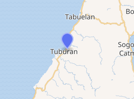
Tuburan is bordered to the north by the town of Tabuelan, to the west is the Tañon Strait, to the east are the towns of Carmen, Catmon and Sogod, and to the south is the town of Asturias.
Tuburan was the hometown of the revolutionary leader Arcadio Maxilom.[5] And is also known for its crystal-clear springs, beaches, creeks, rivers, caves and natural attractions.
Industrial and domestic products include decorative apparel and fashion accessories made of seashells and coconut shells, wood and other indigenous products. Tubod Festival is held in honor of the parish patron, Saint Anthony of Padua.[6]
Tuburan is the largest municipality in Cebu in terms of land area. It also has the most number of barangays for a municipality in Cebu. And it is also the only municipality in Cebu to have numerous barangays with very small population count. Most of these barangays are located in the mountains. The barangay with the lowest population count is Barangay Kanlunsing with 210 people as of 2016, though the barangay with the lowest recorded population count on Cebu Island is located in the nearby municipality of Catmon, which is the Barangay of Amancion, with 190 people in 2016.
History
Foundation
Tuburan was founded in the 1851 by Don Mariano Montebon who came from the town of Sogod. The townsite was first located at Daan Lungsod which is just across the Adela River, north of the present poblacion. Tuburan got its name from the prevalence of springs, which are the sources of potable water for household use of the early settlers. "Tuburan" evolved from the Cebuano word Tubod, meaning "spring".
Philippine revolution
General Arcadio Maxilom y Molero was a hero of the Philippine Revolution. He was born in Tuburan where his family were members of the local gentry, or principalía. He worked as a public school teacher but later joined the Katipunan, whose activities in Cebu were led by León Kilat.
After Kilat's execution, Maxilom continued the revolution in Cebu as second in command. The Katipunan regrouped in the then impenetrable, mountainous central part of Cebu island which now part of the central highlands. On 16 December 1898, Maxilom wrote a letter to the Spanish authorities in Cebu, demanding the latter to surrender. The Spaniards quickly responded, weary after incessant fighting and on the impending defeat of the Spanish forces by the Americans overseas, on Christmas Eve of the same year, the Spaniards had left, leaving behind only three Catholic clerics.[7]
Their newfound liberty short lived, when the Treaty of Paris took effect on April 10, 1898, Spain had to sell the fate of their former subjects to the United States for twenty million dollars.
Maxilom is best remembered for stubbornly refusing to surrender to the American occupying forces even as his fellow revolutionaries in Manila and Cebu were starting to capitulate or collaborate with the new colonial power. He finally surrendered on 27 October 1901. Virtually forgotten after the revolution, Maxilom died in his hometown of Tuburan, after a long period of time with paralysis. Decades later, the then, Mango Avenue of Cebu City, the second most historic road of the City was renamed after the late general.
Tuburan as Cebu's Largest Municipality
Tuburan is still the largest municipality in Cebu. But before the 1950s it was even bigger than the land area of Cebu City. The town's land area decreased in size when the former barangay Tabuelan separated form the Mother Town to become the Municipality of Tabuelan in 1953.
Barangays
Tuburan comprises 54 barangays:
| PSGC | Barangay | Population | ±% p.a. | |||
|---|---|---|---|---|---|---|
| 2015[3] | 2010[8] | |||||
| 072252001 | Alegria | 1.5% | 958 | 962 | −0.08% | |
| 072252002 | Amatugan | 1.3% | 816 | 922 | −2.30% | |
| 072252003 | Antipolo | 2.0% | 1,246 | 1,120 | 2.05% | |
| 072252004 | Apalan | 2.6% | 1,665 | 1,387 | 3.54% | |
| 072252005 | Bagasawe | 2.8% | 1,812 | 1,564 | 2.84% | |
| 072252006 | Bakyawan | 1.4% | 880 | 890 | −0.21% | |
| 072252007 | Bangkito | 0.5% | 296 | 273 | 1.55% | |
| 072252047 | Barangay I (Poblacion) | 2.4% | 1,512 | 1,585 | −0.89% | |
| 072252048 | Barangay II (Poblacion) | 3.0% | 1,928 | 1,665 | 2.83% | |
| 072252049 | Barangay III (Poblacion) | 0.5% | 299 | 269 | 2.03% | |
| 072252050 | Barangay IV (Poblacion) | 0.4% | 254 | 294 | −2.75% | |
| 072252051 | Barangay V (Poblacion) | 1.6% | 1,011 | 843 | 3.52% | |
| 072252052 | Barangay VI (Poblacion) | 3.3% | 2,084 | 1,820 | 2.61% | |
| 072252053 | Barangay VII (Poblacion) | 2.1% | 1,373 | 1,116 | 4.02% | |
| 072252054 | Barangay VIII (Poblacion) | 3.9% | 2,488 | 1,980 | 4.44% | |
| 072252008 | Bulwang | 1.1% | 674 | 808 | −3.39% | |
| 072252015 | Caridad | 2.5% | 1,604 | 1,576 | 0.34% | |
| 072252016 | Carmelo | 3.4% | 2,168 | 2,164 | 0.04% | |
| 072252017 | Cogon | 5.4% | 3,451 | 3,125 | 1.91% | |
| 072252018 | Colonia | 4.1% | 2,615 | 2,255 | 2.86% | |
| 072252019 | Daan Lungsod | 4.1% | 2,591 | 2,132 | 3.78% | |
| 072252020 | Fortaliza | 2.1% | 1,353 | 1,161 | 2.96% | |
| 072252021 | Ga‑ang | 1.0% | 657 | 538 | 3.88% | |
| 072252022 | Gimama‑a | 2.3% | 1,442 | 1,379 | 0.85% | |
| 072252023 | Jagbuaya | 2.2% | 1,397 | 1,361 | 0.50% | |
| 072252009 | Kabangkalan | 1.3% | 818 | 730 | 2.19% | |
| 072252024 | Kabkaban | 0.8% | 503 | 446 | 2.32% | |
| 072252025 | Kagba‑o | 0.8% | 510 | 558 | −1.70% | |
| 072252010 | Kalangahan | 2.4% | 1,554 | 1,467 | 1.10% | |
| 072252011 | Kamansi | 0.8% | 539 | 480 | 2.23% | |
| 072252026 | Kampoot | 0.9% | 573 | 435 | 5.39% | |
| 072252012 | Kan‑an | 0.5% | 315 | 279 | 2.34% | |
| 072252013 | Kanlunsing | 0.3% | 204 | 365 | −10.49% | |
| 072252014 | Kansi | 2.0% | 1,250 | 991 | 4.52% | |
| 072252027 | Kaorasan | 0.6% | 375 | 333 | 2.29% | |
| 072252028 | Libo | 0.5% | 301 | 255 | 3.21% | |
| 072252029 | Lusong | 1.5% | 962 | 801 | 3.55% | |
| 072252030 | Macupa | 0.6% | 364 | 343 | 1.14% | |
| 072252031 | Mag‑alwa | 1.1% | 726 | 698 | 0.75% | |
| 072252032 | Mag‑antoy | 1.1% | 724 | 675 | 1.34% | |
| 072252033 | Mag‑atubang | 1.4% | 921 | 1,096 | −3.26% | |
| 072252034 | Maghan‑ay | 1.0% | 620 | 644 | −0.72% | |
| 072252035 | Mangga | 4.8% | 3,042 | 2,804 | 1.56% | |
| 072252036 | Marmol | 2.3% | 1,461 | 1,416 | 0.60% | |
| 072252037 | Molobolo | 1.0% | 655 | 538 | 3.82% | |
| 072252038 | Montealegre | 2.6% | 1,664 | 1,741 | −0.86% | |
| 072252039 | Putat | 6.5% | 4,171 | 4,001 | 0.80% | |
| 072252040 | San Juan | 1.5% | 974 | 841 | 2.83% | |
| 072252041 | Sandayong | 1.6% | 1,025 | 801 | 4.81% | |
| 072252042 | Santo Niño | 0.7% | 450 | 377 | 3.43% | |
| 072252043 | Siotes | 0.7% | 452 | 450 | 0.08% | |
| 072252044 | Sumon | 1.4% | 907 | 1,041 | −2.59% | |
| 072252045 | Tominjao | 1.5% | 951 | 806 | 3.20% | |
| 072252046 | Tomugpa | 0.4% | 281 | 313 | −2.03% | |
| Total | 63,866 | 58,914 | 1.55% | |||
Climate
| Climate data for Tuburan, Cebu | |||||||||||||
|---|---|---|---|---|---|---|---|---|---|---|---|---|---|
| Month | Jan | Feb | Mar | Apr | May | Jun | Jul | Aug | Sep | Oct | Nov | Dec | Year |
| Average high °C (°F) | 28 (82) |
29 (84) |
30 (86) |
31 (88) |
31 (88) |
30 (86) |
30 (86) |
30 (86) |
30 (86) |
29 (84) |
29 (84) |
28 (82) |
30 (85) |
| Average low °C (°F) | 23 (73) |
23 (73) |
23 (73) |
24 (75) |
25 (77) |
25 (77) |
25 (77) |
25 (77) |
25 (77) |
25 (77) |
24 (75) |
23 (73) |
24 (75) |
| Average precipitation mm (inches) | 70 (2.8) |
49 (1.9) |
62 (2.4) |
78 (3.1) |
138 (5.4) |
201 (7.9) |
192 (7.6) |
185 (7.3) |
192 (7.6) |
205 (8.1) |
156 (6.1) |
111 (4.4) |
1,639 (64.6) |
| Average rainy days | 13.4 | 10.6 | 13.1 | 14.5 | 24.2 | 27.9 | 28.4 | 27.7 | 27.1 | 27.4 | 22.5 | 15.9 | 252.7 |
| Source: Meteoblue [9] | |||||||||||||
Demographics
| Population census of Tuburan | ||
|---|---|---|
| Year | Pop. | ±% p.a. |
| 1903 | 19,158 | — |
| 1918 | 30,568 | +3.16% |
| 1939 | 45,750 | +1.94% |
| 1948 | 53,654 | +1.79% |
| 1960 | 37,720 | −2.89% |
| 1970 | 41,071 | +0.85% |
| 1975 | 38,600 | −1.24% |
| 1980 | 42,968 | +2.17% |
| 1990 | 43,078 | +0.03% |
| 1995 | 47,818 | +1.98% |
| 2000 | 51,845 | +1.75% |
| 2007 | 53,663 | +0.48% |
| 2010 | 58,914 | +3.46% |
| 2015 | 63,866 | +1.55% |
| Source: Philippine Statistics Authority[3][8][10][11] | ||
Transportation
Ceres Liner and Corominas Bros. are among the bus companies going to the town. But riding a V-Hire is the quickest way of going to the town. There are three ways of getting to the town:
- V-Hire - Via Transcentral Highway (Balamban) - 80 km
- Ceres Liner - Via Lugo (Tabuelan) - 100 km
- Corominas Bros. - Via Toledo City - 110 km
Economy
There is a 2,000 hectares (4,900 acres) coffee farm which has the capacity to produce 4.3 million kilograms (9.5 million pounds), which if when roasted can be sold at the (2017) prevailing price of ₱600 per kilogram (₱270/lb), and the farm could earn ₱2 billion annually. This farm is located within the mountain barangay of Kabangkalan.
In addition, the coffee farm is gaining ground as a tourist attraction in an ecotourism niche.[12]
Culture and tourism
- Scenic spots
Among the scenic spots are:
- Springs of:
- Molobolo
- Mantawihan
- Little Baguio
- Marmol cliff and cave
- Lantawan Lookout
- White beaches of:
- Friendship
- Daan Lungsod
- Apalan
- Eco-tourism
- Adela River Eco Tourism Adventure
- Molobolo Nature Spring
References
- "Municipality". Quezon City, Philippines: Department of the Interior and Local Government. Retrieved 31 May 2013.
- "Province: Cebu". PSGC Interactive. Quezon City, Philippines: Philippine Statistics Authority. Retrieved 12 November 2016.
- Census of Population (2015). "Region VII (Central Visayas)". Total Population by Province, City, Municipality and Barangay. PSA. Retrieved 20 June 2016.
- "PSA releases the 2015 Municipal and City Level Poverty Estimates". Quezon City, Philippines. Retrieved 12 October 2019.
- Cebu Daily News 2008.
- Parish church
- The Freeman 1998.
- Census of Population and Housing (2010). "Region VII (Central Visayas)". Total Population by Province, City, Municipality and Barangay. NSO. Retrieved 29 June 2016.
- "Tuburan: Average Temperatures and Rainfall". Meteoblue. Retrieved 10 May 2020.
- Censuses of Population (1903–2007). "Region VII (Central Visayas)". Table 1. Population Enumerated in Various Censuses by Province/Highly Urbanized City: 1903 to 2007. NSO.
- "Province of Cebu". Municipality Population Data. Local Water Utilities Administration Research Division. Retrieved 17 December 2016.
- The Freeman 2017.
Sources
- Cebu Daily News, Joeber Bersales (4 October 2008). "Museum for Tuburan, more gold in Boljoon". Archived from the original on 25 December 2014.CS1 maint: ref=harv (link) CS1 maint: unfit url (link)
- The Freeman, Emil Justimbaste (1 June 1998). "Recruitment and Beginnings". León Kilat and Cebu's Revolution. Archived from the original on 7 October 2009.CS1 maint: ref=harv (link) CS1 maint: unfit url (link)
- The Freeman, Ehda M. Dagooc (10 March 2017). "Coffee farm emerges as new tourist magnet". Archived from the original on 22 March 2017.CS1 maint: ref=harv (link)
External links
Places adjacent to Tuburan, Cebu | ||||||||||
|---|---|---|---|---|---|---|---|---|---|---|
| ||||||||||
Cebu City (capital) | |
| Municipalities |
|
| Component cities | |
| Highly urbanized cities | (Administratively independent from the province but grouped under Cebu by the Philippine Statistics Authority. However, qualified voters in Mandaue are allowed to vote in elections for Cebu provincial officials by virtue of Republic Act No. 6641, in accordance with Section 452-c of the Local Government Code of 1991.) |
| Authority control |
|
|---|