Argao
Argao, officially the Municipality of Argao, (Cebuano: Lungsod sa Argao; Tagalog: Bayan ng Argao), is a 1st class municipality in the province of Cebu, Philippines. According to the 2015 census, it has a population of 72,366 people.[4]
Argao | |
|---|---|
| Municipality of Argao | |
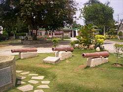 Old cannons of Argao | |
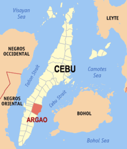 Map of Cebu with Argao highlighted | |
OpenStreetMap 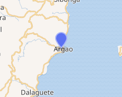
| |
.svg.png) Argao Location within the Philippines | |
| Coordinates: 9°53′N 123°36′E | |
| Country | |
| Region | Central Visayas (Region VII) |
| Province | Cebu |
| District | 2nd district of Cebu |
| Founded | 1608 [1] |
| Barangays | 45 (see Barangays) |
| Government | |
| • Type | Sangguniang Bayan |
| • Mayor | Allan M. Sesaldo |
| • Vice Mayor | Jessa Mae S. Flores-Mier |
| • Congressman | Wilfredo S. Caminero |
| • Electorate | 49,794 voters (2019) |
| Area | |
| • Total | 191.50 km2 (73.94 sq mi) |
| Elevation | 7.3 m (24.0 ft) |
| Population (2015 census)[4] | |
| • Total | 72,366 |
| • Density | 380/km2 (980/sq mi) |
| • Households | 16,504 |
| Economy | |
| • Income class | 1st municipal income class |
| • Poverty incidence | 25.25% (2015)[5] |
| • Revenue (₱) | 160,648,091.03 (2016) |
| Time zone | UTC+8 (PST) |
| ZIP code | 6021 |
| PSGC | |
| IDD : area code | +63 (0)32 |
| Climate type | tropical rainforest climate |
| Native languages | Cebuano Tagalog |
Geography
The municipality of Argao is located in the southeast of the province of Cebu, 68 km (42 mi) from Cebu City.
Argao is bordered to the north by the town of Sibonga, to the west are the towns of Ronda, Alcantara and Moalboal, to the east is the Cebu Strait, and to the south is the town of Dalaguete.
Barangays
Argao comprises 45 barangays:
| PSGC | Barangay | Population | ±% p.a. | |||
|---|---|---|---|---|---|---|
| 2015[4] | 2010[6] | |||||
| 072205001 | Alambijud | 2.1% | 1,542 | 1,514 | 0.35% | |
| 072205002 | Anajao | 1.0% | 742 | 907 | −3.75% | |
| 072205003 | Apo | 1.0% | 692 | 664 | 0.79% | |
| 072205004 | Balaas | 1.1% | 789 | 985 | −4.14% | |
| 072205005 | Balisong | 2.9% | 2,105 | 1,944 | 1.53% | |
| 072205006 | Binlod | 4.7% | 3,386 | 3,343 | 0.24% | |
| 072205007 | Bogo | 4.9% | 3,557 | 3,505 | 0.28% | |
| 072205009 | Bug‑ot | 1.2% | 884 | 837 | 1.05% | |
| 072205010 | Bulasa | 5.0% | 3,648 | 3,523 | 0.67% | |
| 072205008 | Butong | 1.3% | 966 | 924 | 0.85% | |
| 072205012 | Calagasan | 1.5% | 1,062 | 875 | 3.76% | |
| 072205013 | Canbantug | 1.2% | 844 | 843 | 0.02% | |
| 072205014 | Canbanua | 3.5% | 2,507 | 2,179 | 2.71% | |
| 072205015 | Cansuje | 3.2% | 2,327 | 2,206 | 1.02% | |
| 072205016 | Capio‑an | 1.5% | 1,098 | 1,192 | −1.55% | |
| 072205017 | Casay | 1.2% | 883 | 788 | 2.19% | |
| 072205018 | Catang | 0.8% | 614 | 651 | −1.11% | |
| 072205019 | Colawin | 1.3% | 961 | 943 | 0.36% | |
| 072205020 | Conalum | 0.8% | 585 | 615 | −0.95% | |
| 072205021 | Guiwanon | 2.6% | 1,856 | 1,726 | 1.39% | |
| 072205022 | Gutlang | 1.2% | 856 | 770 | 2.04% | |
| 072205023 | Jampang | 3.5% | 2,499 | 2,217 | 2.31% | |
| 072205024 | Jomgao | 1.5% | 1,111 | 1,102 | 0.15% | |
| 072205025 | Lamacan | 3.7% | 2,654 | 2,256 | 3.14% | |
| 072205026 | Langtad | 4.3% | 3,145 | 2,887 | 1.64% | |
| 072205027 | Langub | 1.0% | 745 | 804 | −1.44% | |
| 072205028 | Lapay | 0.9% | 683 | 677 | 0.17% | |
| 072205029 | Lengigon | 1.5% | 1,080 | 989 | 1.69% | |
| 072205030 | Linut‑od | 1.4% | 1,026 | 1,024 | 0.04% | |
| 072205031 | Mabasa | 1.8% | 1,267 | 1,281 | −0.21% | |
| 072205032 | Mandilikit | 0.9% | 664 | 645 | 0.55% | |
| 072205033 | Mompeller | 1.2% | 857 | 753 | 2.49% | |
| 072205034 | Panadtaran | 0.8% | 586 | 524 | 2.15% | |
| 072205035 | Poblacion | 7.5% | 5,454 | 5,570 | −0.40% | |
| 072205036 | Sua | 1.2% | 899 | 755 | 3.38% | |
| 072205037 | Sumaguan | 1.3% | 964 | 883 | 1.69% | |
| 072205038 | Tabayag | 1.2% | 894 | 999 | −2.09% | |
| 072205039 | Talaga | 4.9% | 3,510 | 3,485 | 0.14% | |
| 072205040 | Talaytay | 2.3% | 1,686 | 1,438 | 3.08% | |
| 072205041 | Talo‑ot | 5.5% | 3,990 | 3,683 | 1.54% | |
| 072205042 | Tiguib | 1.2% | 866 | 1,202 | −6.05% | |
| 072205043 | Tulang | 1.2% | 856 | 869 | −0.29% | |
| 072205044 | Tulic | 3.9% | 2,805 | 2,494 | 2.26% | |
| 072205045 | Ubaub | 1.5% | 1,083 | 968 | 2.16% | |
| 072205046 | Usmad | 1.6% | 1,138 | 1,064 | 1.29% | |
| Total | 72,366 | 69,503 | 0.77% | |||
Climate
| Climate data for Argao, Cebu | |||||||||||||
|---|---|---|---|---|---|---|---|---|---|---|---|---|---|
| Month | Jan | Feb | Mar | Apr | May | Jun | Jul | Aug | Sep | Oct | Nov | Dec | Year |
| Average high °C (°F) | 29 (84) |
30 (86) |
31 (88) |
32 (90) |
31 (88) |
30 (86) |
30 (86) |
30 (86) |
30 (86) |
29 (84) |
29 (84) |
29 (84) |
30 (86) |
| Average low °C (°F) | 23 (73) |
22 (72) |
23 (73) |
24 (75) |
25 (77) |
25 (77) |
24 (75) |
24 (75) |
24 (75) |
24 (75) |
24 (75) |
23 (73) |
24 (75) |
| Average precipitation mm (inches) | 42 (1.7) |
34 (1.3) |
40 (1.6) |
61 (2.4) |
124 (4.9) |
188 (7.4) |
190 (7.5) |
191 (7.5) |
189 (7.4) |
186 (7.3) |
124 (4.9) |
73 (2.9) |
1,442 (56.8) |
| Average rainy days | 10.0 | 8.5 | 9.5 | 12.8 | 22.3 | 26.8 | 28.4 | 27.9 | 27.3 | 27.6 | 20.5 | 13.1 | 234.7 |
| Source: Meteoblue (Use with caution: this is modeled/calculated data, not measured locally.)[7] | |||||||||||||
Demographics
| Population census of Argao | |||||||||||||||||||||||||||||||||||||||||||||||||
|---|---|---|---|---|---|---|---|---|---|---|---|---|---|---|---|---|---|---|---|---|---|---|---|---|---|---|---|---|---|---|---|---|---|---|---|---|---|---|---|---|---|---|---|---|---|---|---|---|---|
|
| ||||||||||||||||||||||||||||||||||||||||||||||||
| Source: Philippine Statistics Authority[4][6][8] | |||||||||||||||||||||||||||||||||||||||||||||||||
Tourism
La Torta Festival replaced the Pitlagong Festival in 2011. La Torta Festival happens every 28–29 September to celebrate Argao's cultural heritage from the Spanish period tradition of making the torta, which is a popular cake in Argao.
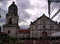 Saint Michael Parish Church
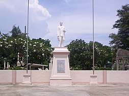 Rizal statue at Municipal plaza
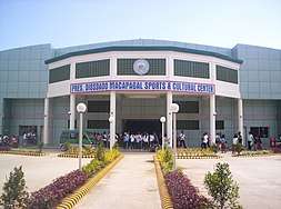 Pres. Diosdado Macapagal Sports & Cultural Center
 Argao Public Market
References
- Encyclopædia Britannica (1911). "Argao". Encyclopædia Britannica. 2 (11th ed.). p. 457.CS1 maint: ref=harv (link)
- "Municipality". Quezon City, Philippines: Department of the Interior and Local Government. Retrieved 31 May 2013.
- "Province: Cebu". PSGC Interactive. Quezon City, Philippines: Philippine Statistics Authority. Retrieved 12 November 2016.
- Census of Population (2015). "Region VII (Central Visayas)". Total Population by Province, City, Municipality and Barangay. PSA. Retrieved 20 June 2016.
- "PSA releases the 2015 Municipal and City Level Poverty Estimates". Quezon City, Philippines. Retrieved 12 October 2019.
- Census of Population and Housing (2010). "Region VII (Central Visayas)". Total Population by Province, City, Municipality and Barangay. NSO. Retrieved 29 June 2016.
- "Argao: Average Temperatures and Rainfall". Meteoblue. Retrieved 9 May 2020.
- Censuses of Population (1903–2007). "Region VII (Central Visayas)". Table 1. Population Enumerated in Various Censuses by Province/Highly Urbanized City: 1903 to 2007. NSO.
External links
| Wikisource has the text of the 1911 Encyclopædia Britannica article Argao. |

- Argao Profile at PhilAtlas.com
Cebu City (capital) | |
| Municipalities |
|
| Component cities | |
| Highly urbanized cities | (Administratively independent from the province but grouped under Cebu by the Philippine Statistics Authority. However, qualified voters in Mandaue are allowed to vote in elections for Cebu provincial officials by virtue of Republic Act No. 6641, in accordance with Section 452-c of the Local Government Code of 1991.) |
| Authority control |
|
|---|