Sulaiman Mountains
The Sulaiman Mountains or Kōh-e Sulaymān (Pashto: د كسي غرونه; Balochi/Urdu/Persian: کوه سليمان; "Mountains of Solomon"), are the southern extension of the Hindu Kush mountain system and rise to form the eastern edge of the Iranian Plateau, and the northeastern edge of the Balochistan Plateau.[1] They are located in the Zabul, Kandahar and Loya Paktia regions of Afghanistan, and in Pakistan they extend over the northern part of Balochistan province, and some parts of southwestern Khyber Pakhtunkhwa and Punjab. Bordering the Sulaimans to the north are the arid highlands of Central Hindu Kush whose heights extend up to 3,383 metres (11,099 ft), and to the east are the Indus plains.[2] Together with the Kirthar Mountains in southern Pakistan, they form what is known as the Sulaiman-Kirthar geologic province.[3]
| Sulaiman Range | |
|---|---|
| د كسي غرونه / کوه سليمان | |
 Satellite image of a part of the Sulaiman Range. | |
| Highest point | |
| Elevation | 3,487 m (11,440 ft) |
| Coordinates | 30°30′N 70°10′E |
| Geography | |
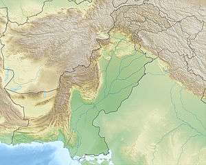 Sulaiman Range Location | |
| Location | Zabul, Kandahar and Loya Paktia, Afghanistan Balochistan, and Khyber Pakhtunkhwa, Pakistan |
| Parent range | Hindu Kush |
The most well known peak of the Sulaimans is the Takht-e-Sulaiman or "Throne of Solomon" at 3,487 metres (11,440 ft), located near Dera Ismail Khan in Pakistan, close to the border with both South Waziristan and Zhob District of neighboring Balochistan province. The highest peak, however, is Zarghun Ghar at 3,578 metres (11,739 ft) near Quetta. The next highest peak in Balochistan province is Khilafat Hill at 3,475 metres (11,401 ft), which is located in Ziarat district, and is famous for the Ziarat Juniper Forest where juniperus macropoda trees grow.[4]
Geography
The Sulaiman range runs north in Loya Paktia and meets the Spin Ghar range northeast of Gardez in Paktia province. To the northwest, the Sulaimans merge beyond Loya Paktia into the Koh-i-Baba range. To the east, the Sulaimans enter the districts of Dera Ghazi Khan in Punjab and Dera Ismail Khan in Khyber Pakhtunkhwa, and approaches the Indus River near Mithankot in the Rajanpur District of Punjab. The eastern slopes drop very quickly to the Indus River, but towards west, the mountain range drops gradually in Kandahar southwest into Helmand and the Sistan Basin.
Along the western edge of the Sulaimans runs the Ornach Nal-Ghazaband-Chaman Fault. The Sulaiman range formed as a fold and thrust belt, involving the sedimentary cover of the Indian Plate.[5] Rivers that drain the Sulaimans include the Gomal River which flows eastward into the Indus River, and the Dori River and other small tributaries of the Arghandab River, which flow southwestward into the Helmand River.
The Sulaiman Range, and the high plateaus to the west of it, helps form a natural barrier against the humid winds that blow from the Indian Ocean, creating arid conditions across southern and central Afghanistan to the west and north. In contrast, the relatively flat and low-lying Indus delta is situated due east and south of the Sulaimans. This lush delta is prone to heavy flooding and is mostly uncultivated wilderness.
Legends about Takht-e-Sulaiman
One of the highest peaks of the Sulaimans, the Takht-i Sulaiman ("Throne of Solomon") at 3,382 metres (11,096 ft) high, was recorded by Ibn Battuta as the Koh-i Sulaiman.[6] In Pashtun legend, it is associated with Prophet Solomon. According to the legend, Prophet Solomon climbed this mountain and looked out over the land of South Asia, which was then covered with darkness, and so turned back without descending into this new frontier, and left only the mountain which is named after him (as told by Ibn Battuta).[7] According to another legend, Noah's Ark alighted in the Takht-i Sulaiman after the Deluge.
Another legend says that Qais Abdur Rashid, said to be the legendary ancestor of the Pashtun nation, is buried atop Takht-e-Sulaiman, and so it is also locally known as Da Kasī Ghar (د کسي غر, "Mount of Qais"). According to this legend, his descendants migrated west, north, and south from here. Some people visit the place and make animal sacrifices, usually a sheep or a goat, at the tomb of Qais to help feed the poor. Trips to the mountain is undertaken mostly in summer, since from late November until March the snowfall makes it difficult to climb.[8]Al-Biruni, who himself lived a large part of his life in Ghazni located just northwest of the Sulaimans, writes of the mountains in his memoirs as being the western frontier mountains of Asia and the homeland of an Ajami ("non-Arab") tribe known as the Pashtuns.
See also
- Wadani
- Spin Ghar
- Hindu Kush
- List of mountain ranges of the world
- Fort Munro
References
- Akroyd, Clarissa (2014-11-17). Pakistan. Simon and Schuster. ISBN 978-1-63355-947-9.
- Khan, Fazle Karim (1991). A Geography of Pakistan: Environment, People and Economy. Oxford University Press. ISBN 978-0-19-577411-5.
- "USGS Bulletin 2208-C: Sembar Goru/Ghazij Composite Total Petroleum System, Indus and Sulaiman-Kirthar Geologic Provinces, Pakistan and India". pubs.usgs.gov. Retrieved 2020-04-20.
- Shah, Syed Ali (10 July 2013). "In Balochistan, an ancient forest battles for survival". Dawn. Retrieved 28 December 2014.
- Park, Graham (2017-11-09). Mountains: The origins of the Earth's mountain systems. Dunedin Academic Press Ltd. ISBN 978-1-78046-579-1.
- "NASA Earth Observatory - Newsroom". Earthobservatory.nasa.gov. 6 February 2019. Retrieved 6 February 2019.
- Battutah, Ibn (2002). The Travels of Ibn Battutah. London: Picador. p. 147. ISBN 9780330418799.
- "SHARIAT AND TASAWWUF". Books.themajlis.net. Retrieved 6 February 2019.
External links
Punjab geography | ||
|---|---|---|
| ||