Shenfield
Shenfield is an affluent commuter suburb of Brentwood in the borough of Brentwood, Essex, England.
| Shenfield | |
|---|---|
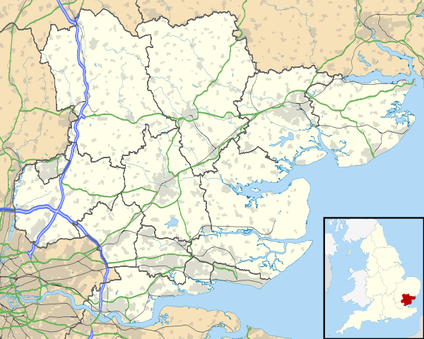 Shenfield Location within Essex | |
| Population | 5,432 (Commuter Suburb)[1] |
| OS grid reference | TQ614950 |
| District |
|
| Shire county | |
| Region | |
| Country | England |
| Sovereign state | United Kingdom |
| Post town | BRENTWOOD |
| Postcode district | CM15 |
| Dialling code | 01277 |
| Police | Essex |
| Fire | Essex |
| Ambulance | East of England |
| UK Parliament | |
History
The old village (now town), by the church and Green Dragon pub, lies along the original Roman road (now the A1023) which linked London and Colchester.
Nathaniel Ward, a Puritan clergyman and author, was made minister of the Shenfield church in 1648 and held that office until his death in 1652.
In 1870-72, John Marius Wilson's Imperial Gazetteer of England and Wales described Shenfield like this[2]:
SHENFIELD, a village and a parish in Billericay district, Essex. The village stands near the Eastern Counties railway, 1 mile NE of Brentwood; and dates from at least the time of Edward the Confessor. The parish comprises 2,397 acres. Post town, Brentwood. Rated property, £7,316. Pop. in 1851, 938; in 1861, 1,149 Houses, 229. The property is much subdivided. The manor of Fitzwalters was formerly held on the tenure of presenting gilt spurs at the king's coronation. Roman antiquities have been found. The living is a rectory in the diocese of Rochester. Value, £580.* Patron, Countess Cowper. The church is very ancient; was restored in 1863, and enlarged in 1867. National schools were built in 1865. Charities, £3.
Geography
Shenfield, with Hutton, is part of the conurbation of Brentwood. The original town centre[3] is located one mile (1.6 km) north-east of the centre of Brentwood. Apart from some small industrial areas and a modest but busy shopping area, Shenfield serves predominantly as a dormitory town for commuters to London and surrounding towns such as Romford and Basildon. This is facilitated by easy access to the A12 and the M25 and rail services.
The parish church is dedicated to St Mary the Virgin[4] and St Mary's primary school[5] is located nearby.
Shenfield's recreational areas include the Courage playing fields on the Chelmsford Road and playing fields on Alexander Lane, next to Shenfield High School. The Courage playing fields contain a play area and a cricket pitch used by the third team of Shenfield Cricket Club.[6] Next door to the Courage playing fields is the cricket club itself. The land was granted by the Courage brewing family for use by the cricket club. The club's badge is a cockerel, which echoes both the trade mark of the Courage brand and the weathervane on St Mary's church. The Courage Playing Fields are supposed to be upgraded by Brentwood Borough Council.
The town of Hutton, to the east of Shenfield, is now largely part of the built-up area.
Transport
Shenfield railway station is on the Great Eastern Main Line and is a junction for services for the Southend (and the Southminster line which is accessed by changing at Wickford). Services are operated by Abellio Greater Anglia. Shenfield is also the terminus for the all stops service to London Liverpool Street operated by TfL Rail, with off-peak frequencies of 6 trains per hour. The station is at the eastern end of the high street.
Shenfield's significance in the London commuter belt will increase as the Crossrail project proceeds, since it is intended to remain the eastern terminus.
Currently, fast train services reach Liverpool Street in between 20–25 minutes. Slow train services, currently operating as TfL Rail before becoming part of the Elizabeth Line under the Crossrail project, take 40 minutes to reach Liverpool Street.
The building of Crossrail has led to significant disruption to the train operations running through Shenfield in the last few years, particularly at weekends and bank holidays. Journey times are significantly impacted due to rail replacement services being in operation. Fast train services are most often replaced with a bus to Newbury Park station, where passengers can connect to the Central Line.
Bus routes in Shenfield 9A 9 81 X81 339 351 251 608 (TFL Operated)
Schools
There are two state secondary schools and two state primary schools. These are Shenfield High School and St Martins School, Shenfield St Mary's, Church of England school, and Long Ridings just on the edge of town between Shenfield and Hutton.
Retail and shopping
The shopping area in Shenfield is very suburban and was built in the 1930s. The shops include many bespoke local shops and business and some national chains.
Community spaces
Shenfield has a library, but it is at risk of closure as part of the Essex future library services strategy, in which it was designated a Tier 3 library.[7]
Development
With CrossRail arriving in Shenfield in the near future the town centre, especially Hutton Road, is being redeveloped. The station forecourt will be changed drastically. The busy congested taxi rank will be relocated as well as the road being cobbled and new trees being planted and an information point added. Street lights in Hutton Road are being upgraded.
References
- http://www.ukcensusdata.com/shenfield-e05004078. Missing or empty
|title=(help) - GB Historical GIS / University of Portsmouth, History of Shenfield, in Brentwood and Essex | Map and description, A Vision of Britain through Time. URL: http://www.visionofbritain.org.uk/place/6899 Date accessed: 21st June 2020
- Historical notes on Shenfield: British History Online
- St Mary's church
- St Mary's CEVA Primary School
- Shenfield Cricket Club
- https://www.essexlive.news/news/essex-news/future-every-library-essex-revealed-2221093
| Unitary authorities | |
|---|---|
| Boroughs or districts | |
| Major settlements |
|
| Rivers |
|
| Topics | |
| |