Epping, Essex
Epping is a market town and civil parish in the Epping Forest district of the County of Essex, England. The town is 17 miles (30 km) north-east from the centre of London, is surrounded by the northern end of Epping Forest, and on a ridge of land between the River Roding and River Lea valleys.
| Epping | |
|---|---|
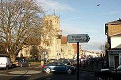 High street, and church of Saint John the Baptist | |
 Epping Location within Essex | |
| Area | 7.73 km2 (2.98 sq mi) |
| Population | 11,047 (civil parish, 2001)[1] 11,461 (civil parish 2011)[2] |
| • Density | 1,429/km2 (3,700/sq mi) |
| OS grid reference | TL455025 |
| • London | 17 mi (27 km) SW |
| Civil parish |
|
| District |
|
| Shire county | |
| Region | |
| Country | England |
| Sovereign state | United Kingdom |
| Post town | EPPING |
| Postcode district | CM16 |
| Dialling code | 01992 |
| Police | Essex |
| Fire | Essex |
| Ambulance | East of England |
| UK Parliament | |
| Website | Epping Town Council |
Epping is the terminus for London Underground's Central line. The town has a number of historic Grade I and II listed buildings. The weekly market, which dates to 1253, is held each Monday.[3] In 2001 the parish had a population of 11,047[1] which increased to 11,461 at the 2011 Census.[2]
Epping became twinned with the German town of Eppingen in north-west Baden-Württemberg in 1981.[4]
History

"Epinga", a small community of a few scattered farms and a chapel on the edge of the forest, is mentioned in the Domesday Book of 1086. However, the settlement referred to is known today as Epping Upland. It is not known for certain when the present-day Epping was first settled. By the mid-12th century a settlement known as Epping Heath (later named Epping Street), had developed south of Epping Upland as a result of the clearing of forest for cultivation. In 1253 King Henry III conveyed the right to hold a weekly market in Epping Street which helped to establish the town as a centre of trade and has continued to the present day (the sale of cattle in the High Street continued until 1961).[5]
The linear village of Epping Heath developed into a small main-road town and by the early 19th century development had taken place along what is now High Street and Hemnall Street. Hemnall Street was until 1894 in the parish of Theydon Garnon, as was the railway station.[6] Up to 25 stagecoaches and mailcoaches a day passed through the town from London en route to Norwich, Cambridge and Bury St. Edmunds. In the early 19th century, 26 coaching inns lined the High Street.[7] Two survive today as public houses: The George and Dragon and The Black Lion. The advent of the railways ended coach traffic and the town declined, but it revived after the extension of a railway branch line from Loughton in 1865 and the advent of the motor car.
A number of listed buildings, most dating from the 18th century, line both sides of the High Street although many were substantially altered internally during the 19th century. Some of the oldest buildings in the town are at each end of the Conservation Area, such as Beulah Lodge in Lindsey Street (17th century), and a group of 17th- and early 18th-century cottages numbered 98–110 on High Street.[8]
The original parish church, first mentioned in 1177, was All Saints' in Epping Upland, the nave and chancel of which date from the 13th Century.[9] In 1833, the 14th-century chapel of St John the Baptist in the High Road was rebuilt in the Gothic Revival style. It became the parish church of Epping in 1888 and was again rebuilt. A large tower was added in 1909.[10]
The town is significant for the Epping sausage, and, in the 18th and 19th centuries, for Epping butter.
In 2008 a plan to build 132 homes on the site of St Margaret's Hospital was opposed by Epping Town Council, who stated that Epping would not be able to cope with any new housing estates for at least 10 years.[11]
Governance
Epping is part of the Epping Forest parliamentary constituency, represented by Conservative MP Eleanor Laing. From 1924 to 1945, the old Epping division of Essex (which included Woodford, Chingford, Harlow and Loughton as well as Epping) was represented by Winston Churchill. It now sits in the Epping and Theydon Bois division of Essex County Council which is Liberal Democrat held. The town is divided into two district council wards. Epping Hemnall encompasses most of the town south-east of Epping High Street (B1393) including Ivy Chimneys, Fiddlers Hamlet, Coopersale and Coopersale Street. The rest of Epping lies in Epping Lindsey and Thornwood ward, as does Thornwood in the adjacent parish of North Weald Bassett. Both wards elect three councillors each.
As well as the county and district councils, Epping has a town council consisting of 12 councillors, six each elected from Epping Hemnall and Epping Lindsey wards, one of which is elected Mayor of Epping and acts as Chairman of Council, as well as a civic and ceremonial head of the local community. Epping is a successor parish, created in 1974 when the Epping Urban District was abolished.
Epping Forest District Council's headquarters are located in the High Street, Epping.[12]
Geography
Epping is 17 miles (30 km) north-east of the centre of London, and towards the northern end of Epping Forest on a ridge of land between the River Roding and River Lea valleys. It is 3 miles (5 km) north-east of Loughton, 10 miles (16 km) north of Ilford, 5 miles (8 km) south of Harlow and 11 miles (20 km) north-west of Brentwood. Epping is north of the village of Theydon Bois.
The Town lies north-east of junction 26 (Waltham Abbey, Loughton A121) of the M25 motorway and south-west of junction 7 (Harlow) of the M11 motorway.
Community
Most of the population live in the built up area centred on and around the High Street (B1393) and Station Road. About a thousand people live in the village of Coopersale which, while physically separated from Epping by forest land, is still part of the civil parish. A few dozen households make up the hamlets of Coopersale Street and Fiddlers Hamlet. Much of the eastern part of the present parish was until 1895 in the parish of Theydon Garnon.[6]
Epping market attracts shoppers from surrounding villages and towns every Monday. A prominent building in Epping is the District Council's office with its clock tower, designed to bring balance to the High Street with the old Gothic Revival water tower at the southern end, built in 1872, and St John's Church tower in the centre. The centre of Epping on and around the High Street is a designated conservation area.[13]
Transport
.jpg)
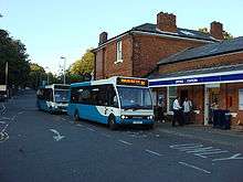
Epping is served by a number of bus routes, serving many surrounding towns and villages including; Thornwood Common, Harlow, Abridge, Waltham Abbey, Ongar and Brentwood. The bus services are either commercial services, or operated under contract to Essex County Council.
Epping is served by Transport for London rail services, and is the eastern terminus of the Central line of the London Underground. The Central line now terminates at Epping. However until 30 September 1994, it used to serve stations at North Weald, Blake Hall (until 1981) and Ongar where services terminated. The station has a car park with 508 spaces (the second largest car park on the London Underground network),[14] a toilet, a ticket machine, a pay phone as well as seats for sitting outside of the station to wait for buses. The Epping Ongar Railway intends to eventually restart the service between Ongar and Epping in the future.[15]
The closest main line stations to Epping are Roydon, Harlow and Waltham Cross. These services are operated by Greater Anglia.
Education
- St John's Church of England Voluntary Controlled School, the only secondary school in Epping, is now designated as a specialist Engineering College. The school has an active charity fundraising group led by a Student Executive team. In 2006 two students were awarded the Rotary Prize for 'Service to School' by the local Epping Rotary Club.
- Coopersale Hall School, a prep school at the end of Flux's Lane, Epping.[16]
- Ivy Chimneys Primary School, a primary school located in Ivy Chimneys, Epping.
- Epping Primary School.
- Coopersale and Theydon Garnon C.E. (Vol.Cont.) Primary School. A primary school located in Coopersale village.
Sport
Epping Town played in the Isthmian League until folding during the 1984–85 season. Epping FC currently play in the Essex Olympian League. Both have played at Stonards Hill. There are two cricket clubs at the south of the town: Epping Cricket Club at Lower Bury Lane, and Epping Foresters Cricket Club at Bell Common which is partly in the neighbouring parish of Epping Upland.
Notable people
- Jill Barklem, writer and illustrator
- Nick Berry, actor
- James Buckley, actor
- David Byron, former lead singer of rock band Uriah Heep
- Winston Churchill, Member of Parliament for the town and the larger constituency named after it from 1924–1945, including his tenure as Prime Minister during World War II
- Dodie Clark, singer and youtuber
- Crass, band
- Sidney Godley, first private soldier awarded the Victoria Cross during the Great War
- Dave Gahan, singer, Depeche Mode frontman
- Philip Hammond, Former Chancellor of the Exchequer
- Glenn Hoddle, former professional football player and manager
- Griff Rhys Jones, TV presenter and comedian
- Jason Merrells, actor
- Julian Mitchell, screenwriter and novelist
- Dennis Rofe, former professional footballer
- Ben Shephard, television presenter
- Sheridan Smith, actress
- Lisa Snowdon, model
- Rod Stewart, singer
- Jessie Wallace, actress
- Bradley Walsh, actor and television presenter
- Adrian Whitbread, football coach for Puerto Rico FC
See also
.jpg)
Location grid
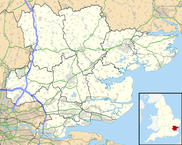
Places adjacent to Epping, Essex | ||||||||||
|---|---|---|---|---|---|---|---|---|---|---|
| ||||||||||
References
- Parish Profile : Epping Archived 13 November 2004 at the Wayback Machine
- "Civil Parish population 2011". Neighbourhood Statistics. Office for National Statistics. Retrieved 2 September 2016.
- Archived 28 August 2008 at the Wayback Machine
- "Epping Town Guide". Eppingtowncouncil.gov.uk. Archived from the original on 18 August 2013. Retrieved 26 March 2013.
- "Epping – Economic history and local government | A History of the County of Essex: Volume 5 (pp. 127–132)". British-history.ac.uk. 22 June 2003. Retrieved 26 March 2013.
- "Theydon Garnon: Introduction | British History Online". www.british-history.ac.uk. Retrieved 4 January 2018.
- "Epping – Introduction and manors | A History of the County of Essex: Volume 5 (pp. 114–127)". British-history.ac.uk. Retrieved 26 March 2013.
- EPPING Archived 23 November 2007 at the Wayback Machine
- "History of the Church". Eppinguplandchurch.org.uk. Retrieved 26 March 2013.
- "Epping – Churches, schools and charities | A History of the County of Essex: Volume 5 (pp. 132–140)". British-history.ac.uk. 25 June 1912. Retrieved 26 March 2013.
- "EPPING: "Decade until town is ready for development" (From East London and West Essex Guardian Series)". Guardian-series.co.uk. 4 August 2008. Retrieved 5 January 2010.
- information@eppingforestdc.gov.uk. "Epping Forest District Council Home Page". Eppingforestdc.gov.uk. Retrieved 5 January 2010.
- "Epping Conservation Area" (PDF). Archived from the original (PDF) on 27 March 2009. Retrieved 27 May 2008.
- "Epping station to be refurbished and improved". Transport for London. Retrieved 17 October 2016.
- "A Brief History of the Epping Ongar Railway". www.eorailway.co.uk. Retrieved 13 April 2020.
- "Coopersale Hall School". Retrieved 14 April 2016.
Further reading
- Epping Forest District Council (2005). Key Facts: 2001 Census (PDF). Archived from the original (PDF) on 17 February 2006.
- Epping Town Guide. Plus Publishing Services (on behalf of Epping Town Council. 2002.
- Jenkins (2001). Churchill. Macmillan. pp. 391–392. ISBN 0-330-48805-8.
- Parish Profile: Epping – information about Epping from the 2001 census (PDF file)
External links
| Wikimedia Commons has media related to Epping. |
| Unitary authorities | |
|---|---|
| Boroughs or districts | |
| Major settlements |
|
| Rivers |
|
| Topics | |
| |
| Authority control |
|
|---|