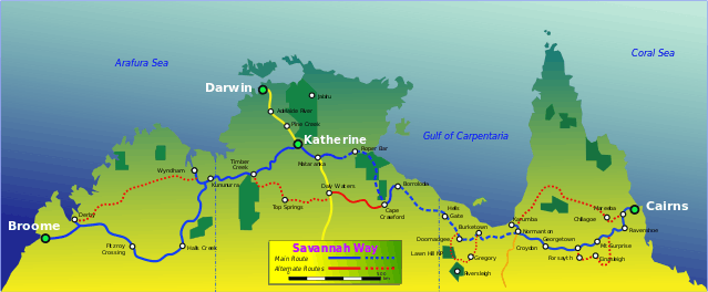
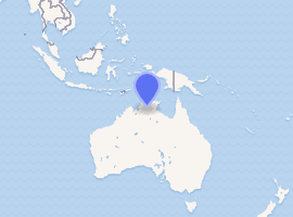
Savannah Way
The Savannah Way is a route of highways and major roads across the tropical savannahs of northern Australia, linking Cairns in Queensland with Broome in Western Australia. Promoted as a self-drive tourist route, it joins Cairns, Normanton, Borroloola, Katherine, Kununurra, Fitzroy Crossing, Derby and Broome.[1] It has been designated by the Queensland Government as a State Strategic Touring Route.[2]
Savannah Way –Western Australia | |
|---|---|
 | |
Savannah Way, Queensland | |
| |
| General information | |
| Type | Highway |
| Length | 3,501 km (2,175 mi) |
| Route number(s) | |
| Major junctions | |
| East end | |
| West end | |
| Location(s) | |
| Major settlements | Katherine, Borroloola, Burketown, Normanton, Croydon, Georgetown |
| Highway system | |
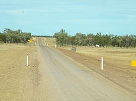
Much of the route is Highway 1; however, much of it is on unsealed roads. It runs for a distance of 3,501 kilometres (2,175 mi). Parts of Savannah Way form part of the National Highway network.
Alternate routes are signposted along the way allowing travellers different options from the main Savannah Way. From Cairns they include travel via Chillagoe and the Burke Developmental Road to Karumba; via Einasleigh and Forsayth to Georgetown; via Gregory Downs to Lawn Hill National Park and Bowthorn station; via Daly Waters and Top Springs to Timber Creek; or via the Gibb River Road to Derby.[1]
See also
![]()
- Highways in Australia
- List of highways in Queensland
- List of highways in the Northern Territory
- List of highways in Western Australia

References
- Hema, Maps (2007). Australia Road and 4WD Atlas (Map). Eight Mile Plains Queensland: Hema Maps. pp. 11–12. ISBN 978-1-86500-456-3.
- "Driving Experiences (State Strategic Touring Routes and Tourist Drives)" (PDF). Department of Transport and Main Roads. Queensland Government. February 2016. Archived (PDF) from the original on 1 May 2017. Retrieved 27 May 2017. Licensed as CC-BY.
External links
| Wikimedia Commons has media related to Savannah Way. |
Road infrastructure in Northern Territory | ||
|---|---|---|
| National highways | ||
| Highways | ||
| Major urban roads | ||
| Outback tracks and numbered state routes | ||