Sarpourenx
Sarpourenx (Béarnese: Sarporens) is a commune in the Pyrénées-Atlantiques department in south-western France, notable for once having forbidden death by mayoral decree. The demonym is Sarpourenois.[2]
Sarpourenx | |
|---|---|
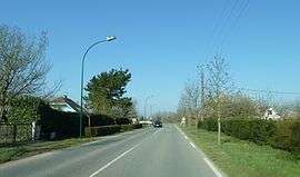 The road through Sarpourenx | |
Location of Sarpourenx 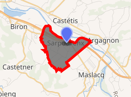
| |
 Sarpourenx  Sarpourenx | |
| Coordinates: 43°27′27″N 0°42′39″W | |
| Country | France |
| Region | Nouvelle-Aquitaine |
| Department | Pyrénées-Atlantiques |
| Arrondissement | Pau |
| Canton | Le Cœur de Béarn |
| Intercommunality | Lacq-Orthez |
| Government | |
| • Mayor (2008–2014) | Emmanuelle Lacroix Chague |
| Area 1 | 3.35 km2 (1.29 sq mi) |
| Population (2017-01-01)[1] | 338 |
| • Density | 100/km2 (260/sq mi) |
| Time zone | UTC+01:00 (CET) |
| • Summer (DST) | UTC+02:00 (CEST) |
| INSEE/Postal code | 64505 /64300 |
| Elevation | 59–78 m (194–256 ft) (avg. 71 m or 233 ft) |
| 1 French Land Register data, which excludes lakes, ponds, glaciers > 1 km2 (0.386 sq mi or 247 acres) and river estuaries. | |
History
Never a large community, the population of Sarpourenx was reported as 25 households in 1385. The town was then part of the bailiwick of Larbaig.
French historian and archivist Paul Raymond (1833–1878) recorded the existence in Sarpourenx of an abbaye laïque (a small, independent parish operated for the profit of an influential local), administered by the viscounts of Béarn.[3]
The name "Sarpourenx" is also historically attested in the variant forms "Sarporencx" (1385 Béarn census), "Sarporencxs", and "Sarporenxs" (from the 1538 and 1546 redistrictings of Béarn, respectively).[3]
Geography
Sarpourenx is located in the historic former province of Béarn, on the left bank of the river Gave de Pau. Its territory includes at least one small hamlet, Le Gave, and a tributary stream of the Gave de Pau, Géu Mort.[4] Neighboring communes include Castétis (north), Argagnon (east), Biron (west), Castetner (west), Maslacq (south), and Orthez (southeast). Via road, Sarpourenx is accessible by Departmental Route 9, near exit 8 of Autoroute A64.
| Historical population | ||
|---|---|---|
| Year | Pop. | ±% |
| 1793 | 241 | — |
| 1800 | 229 | −5.0% |
| 1806 | 258 | +12.7% |
| 1821 | 313 | +21.3% |
| 1831 | 327 | +4.5% |
| 1836 | 319 | −2.4% |
| 1841 | 303 | −5.0% |
| 1846 | 302 | −0.3% |
| 1851 | 310 | +2.6% |
| 1856 | 298 | −3.9% |
| 1861 | 287 | −3.7% |
| 1866 | 257 | −10.5% |
| 1872 | 236 | −8.2% |
| 1876 | 255 | +8.1% |
| 1881 | 228 | −10.6% |
| 1886 | 215 | −5.7% |
| 1891 | 220 | +2.3% |
| 1896 | 207 | −5.9% |
| 1901 | 206 | −0.5% |
| 1906 | 214 | +3.9% |
| 1911 | 203 | −5.1% |
| 1921 | 173 | −14.8% |
| 1926 | 168 | −2.9% |
| 1931 | 157 | −6.5% |
| 1936 | 150 | −4.5% |
| 1946 | 151 | +0.7% |
| 1954 | 156 | +3.3% |
| 1962 | 199 | +27.6% |
| 1968 | 205 | +3.0% |
| 1975 | 199 | −2.9% |
| 1982 | 208 | +4.5% |
| 1990 | 220 | +5.8% |
| 1999 | 240 | +9.1% |
| 2006 | 270 | +12.5% |
| 2007 | 269 | −0.4% |
Economy
Sarpourenx is part of the appellation zone for production of Ossau-Iraty, a sheep's milk cheese.
Government
| Term | Name |
|---|---|
| 1971–2008 | Gérard Lalanne |
| 2008– | Emmanuelle Lacroix Chague (term ending 2014) |
| This list is not yet complete. |
On 13 February 2008, then-mayor Gérard Lalanne issued a municipal order forbidding death within the commune's jurisdiction, threatening severe punishment for offenders. His action was a symbolic protest — Sarpourenx's small cemetery was becoming crowded, and a judge's decision had rejected the commune's request to expropriate private farmland for burial ground.[5] Lalanne himself died ten months later.
See also
- Communes of the Pyrénées-Atlantiques department
- Cugnaux — another French commune with an anti-death ordinance
References
- "Populations légales 2017". INSEE. Retrieved 6 January 2020.
- "Le Nom Des Habitants Des Pyrénées-Atlantiques" (in French). Patagos. Retrieved 27 February 2012.
- Raymond, Paul (1863). Pyremonde (ed.). Dictionnaire topographique Béarn Pays Basque (in French) (1999 ed.). p. 240. ISBN 2-84618-230-2.
- "Fiche cours d'eau Gave de Pau" (in French). Sandre. Retrieved 27 February 2012.
- Dobbie, Andrew (5 March 2008). "Cemetery full, mayor tells locals not to die". Reuters. Retrieved 27 February 2012.
External links
| Wikimedia Commons has media related to Sarpourenx. |
- http://www.sarpourenx.fr/ — Official site (in French)
| Authority control |
|
|---|