Rural Municipality of Grahamdale
Grahamdale is a rural municipality in the province of Manitoba in Western Canada. It was incorporated as a Local Government District (LGD) on 1 January 1945, and became a Rural Municipality in 1997.
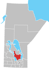
The municipality exists in two sections that are separated by a part of the Fairford 50 Indian reserve. It extends from Gypsumville to Mulvihill and incorporates the former RM of Woodlea (51°02′15″N 98°05′32″W) within its present boundaries.[1]
Communities
- Camper
- Faulkner
- Grahamdale
- Gypsumville
- Hilbre
- Moosehorn
- Mulvihill
- St. Martin
- St. Martin Junction
- Spearhill
- Steep Rock
External links
References
- Geographic Names of Manitoba (pg. 97) - the Millennium Bureau of Canada
- Manitoba Historical Society - Manitoba Municipalities: Rural Municipality of Grahamdale
- Map of Grahamdale R.M. at Statcan
Places adjacent to Rural Municipality of Grahamdale | |
|---|---|
Division No. 18, Manitoba (North Interlake Area) | ||||
|---|---|---|---|---|
| Towns |
|  | ||
| Villages |
| |||
| Rural municipalities |
| |||
| First Nations | ||||
| Indian reserves | ||||
| Unorganized areas | ||||
| Unincorporated communities |
| |||
This article is issued from Wikipedia. The text is licensed under Creative Commons - Attribution - Sharealike. Additional terms may apply for the media files.