Rural Municipality of Cartier
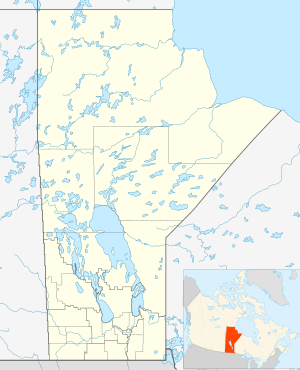
Rural Municipality of Cartier is part of the Central Plains Region in the province of Manitoba, Canada. It is named after Sir George-Étienne Cartier who was a leader in bringing Quebec into Confederation.
Cartier | |
|---|---|
Rural Municipality | |
 Cartier | |
| Coordinates: 49°54′58″N 97°42′00″W | |
| Country | |
| Province | |
| Region | Central Plains |
| Government | |
| • Reeve | Dale Fossay |
| Area | |
| • Total | 553.40 km2 (213.67 sq mi) |
| Elevation | 239 m (784 ft) |
| Population (2016)[2] | |
| • Total | 3,368 |
| • Density | 6.1/km2 (16/sq mi) |
| Time zone | UTC−6 (CST) |
| • Summer (DST) | UTC−5 (CDT) |
| Postal Code | R4K |
| Area codes | 204, 431 |
| Website | www |
It was part of a larger municipality, St. François Xavier, until 1914.
The municipality is bordered on the west by the R.M of Portage la Prairie, to the east by the R.M of Headingley and to the north by the Assiniboine River. It is mainly flat rich farmland. Its main town is Elie.
Water
The Cartier Regional Water Co-op manages the water supply in the R.M. as well as other nearby R.M.'s such as Headingley, Rosser, and Macdonald. The Cartier Water Treatment Plant brings in water from the Assiniboine River where it is cleaned of silt and debris and other toxins and distributed within the R.M. and also sent out to other nearby communities.[3]
Communities
- Dacotah
- Elie
- St. Eustache
- Springstein
- White Plains
References
- Manitoba Historical Society - Rural Municipality of Cartier
- Community Profile - Statistics Canada
- Map of Cartier R.M. at Statcan
- "2016 Census Profile - RM of Cartier". statcan.gc.ca. November 29, 2017. Retrieved December 25, 2019.
- "Cartier Regional Water Co-op: Public Water System: Annual Report 2018" (PDF). cwrc.ca. March 28, 2019. pp. 3–4, 7–8.
External links
Places adjacent to Rural Municipality of Cartier | |
|---|---|
Division No. 10, Manitoba (Whitehorse Plains) | ||
|---|---|---|
| Rural municipalities | 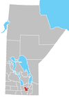 | |
| Unincorporated communities | ||