Pasarel Island
Pasarel Island (Bulgarian: остров Пасарел, romanized: ostrov Pasarel, IPA: [ˈɔstrof pɐsɐˈrɛɫ]) is an ice-free island in the Aitcho group on the west side of English Strait in the South Shetland Islands, Antarctica. The island is situated 900 m (980 yd) northwest of Barrientos Island, 1.35 km (0.84 mi) northeast of Sierra Island and 650 m (710 yd) southeast of Emeline Island. Extending 450 by 260 m (490 by 280 yd). The area was visited by early 19th century sealers.
 Location of Aitcho Islands in the South Shetland Islands. | |
 Pasarel Island Location of Pasarel Island  Pasarel Island Pasarel Island (Antarctic Peninsula) | |
| Geography | |
|---|---|
| Location | Antarctica |
| Coordinates | 62°23′50″S 59°46′30″W |
| Archipelago | Aitcho group |
| Length | 0.45 km (0.28 mi) |
| Width | 0.26 km (0.162 mi) |
| Administration | |
| Administered under the Antarctic Treaty System | |
| Demographics | |
| Population | Uninhabited |
Named after the settlement of Dolni (Lower) Pasarel in western Bulgaria.
Location
Pasarel Island is located at 62°23′50″S 59°46′30″W. Bulgarian mapping in 2009.
See also
- Composite Gazetteer of Antarctica
- List of Antarctic islands south of 60° S
- SCAR
- Territorial claims in Antarctica
Map
- L.L. Ivanov. Antarctica: Livingston Island and Greenwich, Robert, Snow and Smith Islands. Scale 1:120000 topographic map. Troyan: Manfred Wörner Foundation, 2010. ISBN 978-954-92032-9-5 (First edition 2009. ISBN 978-954-92032-6-4)
- Antarctic Digital Database (ADD). Scale 1:250000 topographic map of Antarctica. Scientific Committee on Antarctic Research (SCAR). Since 1993, regularly upgraded and updated.
- L.L. Ivanov. Antarctica: Livingston Island and Smith Island. Scale 1:100000 topographic map. Manfred Wörner Foundation, 2017. ISBN 978-619-90008-3-0
References
- Bulgarian Antarctic Gazetteer. Antarctic Place-names Commission. (details in Bulgarian, basic data in English)
- Pasarel Island. SCAR Composite Antarctic Gazetteer.
External links
- Pasarel Island. Copernix satellite image
This article includes information from the Antarctic Place-names Commission of Bulgaria which is used with permission.
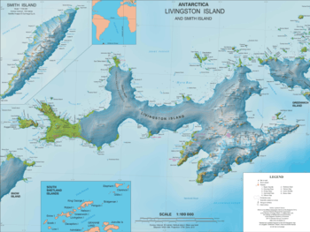
Topographic map of Livingston Island and Smith Island featuring nearby minor islands including Pasarel Island
| General |
| .svg.png) |
|---|---|---|
| Geographic regions | ||
| Waterways | ||
| Famous explorers | ||
This article is issued from Wikipedia. The text is licensed under Creative Commons - Attribution - Sharealike. Additional terms may apply for the media files.