Ocate Peak
Ocate Peak or the older name Ocate Crater is a volcano in Mora County, northeastern New Mexico. It was a landmark on the old Santa Fe Trail before the development of the Cimarron Cutoff.
| Ocate Peak | |
|---|---|
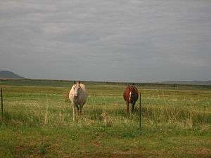 Horses graze adjacent to the post office at Ocate, New Mexico, in the shadow of Ocate Peak. | |
| Highest point | |
| Elevation | 7,788 ft (2,374 m) NGVD 29[1] |
| Coordinates | 36°09′56″N 105°02′17″W [2] |
| Geography | |
 Ocate Peak Location in New Mexico | |
| Location | Mora County, New Mexico U.S. |
| Topo map | USGS Ocate |
Ocate Peak is located just southeast of the community of Ocate, and State Road 120 passes just north of it. Originally, due to the heightened chance of meeting marauding Indians on the plains, the Santa Fe Trail kept as close to the Sangre de Cristo Mountains as possible, passing through Rayado to the community of Ocate and passing west of Ocate Peak. After Fort Union was established in 1851, the trail took the easier route east of Ocate Peak, but still west of the Turkey Mountains.
References
- "Ocate Peak". ListsOfJohn.com. Retrieved 2014-02-13.
- "Ocate Peak". Geographic Names Information System. United States Geological Survey. Retrieved 2010-06-18.
- Pearce, T. M. (1965). New Mexico place names; a geographical dictionary. Albuquerque, NM: University of New Mexico Press. p. 111. OCLC 420847.
This article is issued from Wikipedia. The text is licensed under Creative Commons - Attribution - Sharealike. Additional terms may apply for the media files.