Big Burro Mountains
The Big Burro Mountains are a moderate length 35-mile (56 km) long, mountain range located in central Grant County, New Mexico. The range's northwest-southeast 'ridgeline' is located 15 mi southwest of Silver City.
| Big Burro Mountains | |
|---|---|
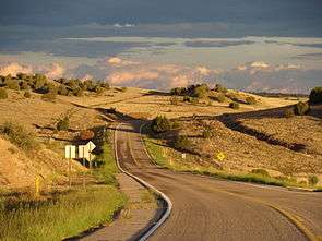 Foothills at northeast Big Burro Mtns (north Little Burro Mountains, US Route 180 in New Mexico) | |
| Highest point | |
| Peak | Burro Peak |
| Elevation | 8,035 ft (2,449 m) |
| Coordinates | 32°35′26″N 108°25′58″W |
| Dimensions | |
| Length | 35 mi (56 km) NW-SE |
| Width | 15 mi (24 km) |
| Geography | |
 Big Burro Mountains in New Mexico | |
| Country | United States |
| State | New Mexico |
| Regions | Chihuahuan Desert and Continental Divide of the Americas |
| County | Grant |
| Communities | List
|
| Range coordinates | 32°42′32″N 108°32′17″W |
| Borders on | List
|
| Rivers | Gila River-(range's northwest quadrant) |
The southeast end of the range has the Continental Divide of the Americas crossing the range over Burro Peak and traversing from Silver City, the Pinos Altos Range, and then the adjacent Little Burro Mountains attached to the Big Burro's on the southeast.
The northwest region of the range has the Gila River traversing on a course from the Gila Wilderness, north of Silver City, and the Gila on its excursion towards Arizona, being one of the major regional river basins of the arid Sonoran Desert of central and southern Arizona. On the other hand, the Big Burro Mountains are on the northwest perimeter of the Chihuahuan Desert as it extends into southern New Mexico through the Playas and Animas Valleys.
Description
The Big Burro Mountains are 35 mi long with various widths up to 12–18 mi. The range is in a transitional point between the Gila Wilderness area north of Silver City, and the northern headlands of the two north-south valleys to the southwest, the Animas and Playas Valleys.
The adjacent region northwest at the Arizona border is the White Mountains and Mogollon Rim region, and the east of the Arizona transition zone-(Arizona Highlands); the transition zone effectively continues into western New Mexico, and has an eastern perimeter as it borders the western and southwestern area of the Plains of San Agustin, about 70 mi north of the Big Burro Mountains. Many mountain ranges in this region are not easily defined with mountain range perimeters.
Peaks
The highest peak in the Big Burro Mountains is Burro Peak, at 8,035 feet (2,449 m).[1] It is located at 32.590635°N 108.432827°W.[2] Bullard Peak, 7,064 feet (2,153 m), is the approximate center of the range.
Access
The Big Burro Mountains have easy access being surrounded by various population centers: Cliff–Gila at the north; Red Rock at the west; Silver City–Tyrone at the east; and White Signal at the southeast.
Continental Divide
The Continental Divide starts to leave the forested mountain regions as it goes southwest from Silver City. It passes from the southern Little Burro Mountains, crosses the Big Burro's, then on a circuitous route after skirting the northeast region of the Cedar Mountain Range, it passes across the water divide of the north Playas Valley, west of Hachita. It finally enters a series of north-south ranges, including the Pyramid and Animas Mountains, and traverses south into northwest Chihuahua, Mexico.
References
- New Mexico, DeLorme Atlas & Gazetteer, p. 44-45.
- Burro Peak Summit, mountainzone.com
External links
Range highpoint, Burro Peak–(Continental Divide)
Big Burro Mountains