Nikolassee
![]()
Nikolassee | |
|---|---|
Quarter of Berlin | |
 | |
Location of Nikolassee in Steglitz-Zehlendorf and Berlin 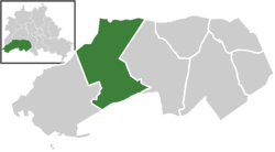 | |
 Nikolassee  Nikolassee | |
| Coordinates: 52°26′00″N 13°12′00″E | |
| Country | Germany |
| State | Berlin |
| City | Berlin |
| Borough | Steglitz-Zehlendorf |
| Founded | 1901 |
| Area | |
| • Total | 19.6 km2 (7.6 sq mi) |
| Elevation | 105 m (344 ft) |
| Population (2008-06-30) | |
| • Total | 15,899 |
| • Density | 810/km2 (2,100/sq mi) |
| Time zone | CET/CEST (UTC+1/+2) |
| Postal codes | (nr. 0606) 14129, 14163, 14193 |
| Vehicle registration | B |
Geography
Nikolassee is located on the Bundesstraße 1 road from the Berlin city centre to Potsdam, south of the extended Grunewald forest. The river Havel separates it from Kladow and Gatow in the Spandau brorugh. Other localities bordering with Nikolassee are Wannsee, Zehlendorf and Grunewald (this one in Charlottenburg-Wilmersdorf district [4]). Its southern neighbour Kleinmachnow is a municipality in the Potsdam-Mittelmark district of Brandenburg. The residential areas of Nikolassee and Grunewald are separated by the Grunewald forest.
History
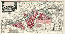
Once part of the Düppel manor, from 1901 onwards the area was developed as a mansion colony (Villenkolonie Nikolassee). One year later, the settlement received connection to the Berlin-Blankenheim and Wannsee Railway lines with the opening of Berlin-Nikolassee station.[5]
Originally an independent Brandenburg municipality, Nikolassee was incorporated into Berlin with the Greater Berlin Act of 1920. Part of West Berlin during the "Cold War", its southern border with the municipality of Kleinmachnow, at the same time the border between the American Sector and what was to be the East Germany, was fortified by the Berlin Wall between 1961 and 1989. Located on the present A 115 motorway was the US Checkpoint Bravo (Drewitz-Dreilinden), built in 1969.[6]
Transport
Nikolassee is served by the S-Bahn lines S1, S5 [7] and S7, at the homonymous station. The locality is also crossed by the motorway A 115 (the former AVUS, exit "Spanischer Allee"), and by the federal highway B1.
Photogallery
 Town Hall Nikolassee
 View of Schwanenwerder island
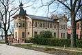 Restaurant and lake port Schloss Wannsee
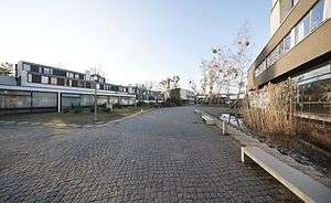 Student Village Schlachtensee (Central Square)
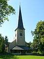 Nikolassee Church
References
- The word See, in German, stands for lake
- Source: "ADAC StadtAtlas - Berlin-Potsdam". ed. 2007 - pages 192, 193, 228, 229 - ISBN 3-8264-1348-2
- Source: "ADAC StadtAtlas - Berlin-Potsdam". ed. 2007 - page 193 - ISBN 3-8264-1348-2
- Source: "ADAC StadtAtlas - Berlin-Potsdam". ed. 2007 - pages 193, 194 - ISBN 3-8264-1348-2
- (in German) History of Nikolassee Archived 2010-09-08 at the Wayback Machine
- Checkpoint Bravo location on Google Maps
- On Friday and Saturday nights only
External links
![]()
- (in German) History and culture of Nikolassee
| |
| |
| Authority control |
|
|---|