Wartenberg (Berlin)
![]()
Wartenberg | |
|---|---|
Quarter of Berlin | |
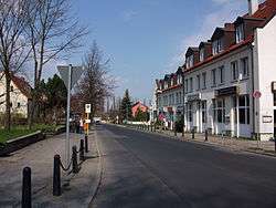 Linderberger Straße | |
Location of Wartenberg in Lichtenberg district and Berlin 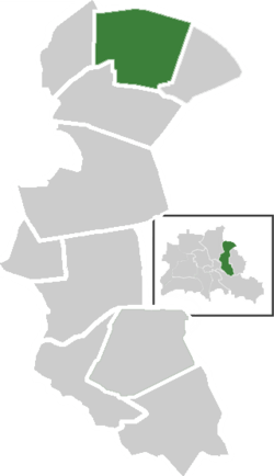 | |
 Wartenberg  Wartenberg | |
| Coordinates: 52°34′29″N 13°31′05″E | |
| Country | Germany |
| State | Berlin |
| City | Berlin |
| Borough | Lichtenberg |
| Founded | 1270 |
| Subdivisions | 4 zones |
| Area | |
| • Total | 6.92 km2 (2.67 sq mi) |
| Elevation | 60 m (200 ft) |
| Population (2008-06-30) | |
| • Total | 2,433 |
| • Density | 350/km2 (910/sq mi) |
| Time zone | CET/CEST (UTC+1/+2) |
| Postal codes | (nr. 1107) 13059 |
| Vehicle registration | B |
History
The locality was established in the course of the German Ostsiedlung after the establishment of the Margraviate of Brandenburg by Albert the Bear in 1157. It was first mentioned in a 1270 margravial deed as Wardenberge and again in the 1375 domesday book of Emperor Charles IV. The estates of Wartenberg manor were acquired by the City of Berlin in 1882. Until 1920, it was a municipality in the former Niederbarnim district of the Prussian Brandenburg Province, then merged into Berlin with the "Greater Berlin Act".[1]
Geography
Overview
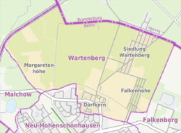
Wartenberg is located in the north-eastern suburb of Berlin and borders with the Brandenburger village of Lindenberg (part of Ahrensfelde municipality), in Barnim district. It borders with the Berliner localities of Falkenberg, Neu-Hohenschönhausen, Malchow and Stadtrandsiedlung Malchow (in Pankow).
Subdivision
Wartenberg is divided into 4 zones (Ortslagen):
- Dorfkern (centre)
- Falkenhöhe
- Margaretenhöhe
- Siedlung Wartenberg
Transport
The locality is served by the S-Bahn line S75 at Wartenberg station, located in Neu-Hohenschönhausen. The tramway terminal stop "Falkenberg" (lines M4 and M17) is not too far from Dorfkern and Falkenhöhe and the bus lines 256, 359 and 893 cross the settlement.
Photogallery
 New village church
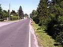 Siedlung Wartenberg
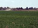 Fields between Dorfkern and Siedlung Wartenberg
References
- (in German) Historical infos about Wartenberg
External links
![]()
- (in German) Wartenberg page on www.berlin.de
| |
| |