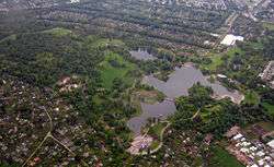
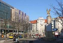
Neukölln
Neukölln[1] (German pronunciation: [nɔʏˈkœln]) is one of the twelve boroughs of Berlin. It is located in the southeastern part from the city centre towards Berlin Schönefeld Airport. It was part of the former American sector under the Four-Power occupation of the city. It features many Gründerzeit buildings and is characterized by having one of the highest percentage of immigrants in Berlin. In recent years an influx of students and creative types has led to gentrification.[2]
Neukölln | |
|---|---|
Borough of Berlin | |
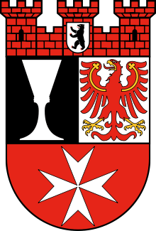 Coat of arms | |
Location of Neukölln in Berlin .svg.png) | |
 Neukölln 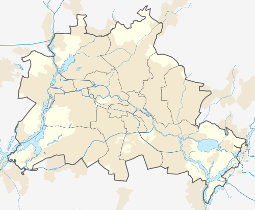 Neukölln | |
| Coordinates: 52°29′N 13°27′E | |
| Country | Germany |
| State | Berlin |
| City | Berlin |
| Subdivisions | 5 localities |
| Government | |
| • Mayor | Martin Hikel (SPD) |
| Area | |
| • Total | 44.93 km2 (17.35 sq mi) |
| Population (2012-11-30) | |
| • Total | 322,931 |
| • Density | 7,200/km2 (19,000/sq mi) |
| Time zone | CET/CEST (UTC+1/+2) |
| Vehicle registration | B |
| Website | Official homepage |
History
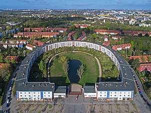
Neukölln's independence ended in 1920 when it was incorporated into Berlin. In September 1929, Goebbels led his men into Neukölln, a KPD stronghold, and the two warring parties exchanged pistol and revolver fire. From 1966 to 1975 the Gropiusstadt was built, a "Trabantenstadt" or city-within-a-city housing estate, designed by architect Walter Gropius.
Localility subdivisions
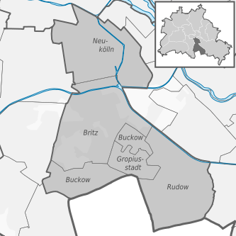
Neukölln is subdivided into five localities:
| Locality |
Area (km2) |
Inhabitants |
Density (Inhabitants/km2) |
| 0801 Neukölln |
11.71 | 155,950 | 13,318 |
| 0802 Britz |
12.40 | 39,029 | 3,148 |
| 0803 Buckow |
6.35 | 38,219 | 6,019 |
| 0804 Rudow |
11.81 | 40,733 | 3,449 |
| 0805 Gropiusstadt |
2.67 | 35,751 | 13,390 |
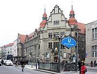
Public transport
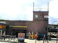
Neukölln is served by three operational sections of urban rail.
- U7: Rathaus Spandau ↔ Rudow (running North West ↔ South East)
- U8: Wittenau ↔ Hermannstraße (running North ↔ South)
Part of each of the following S-Bahn routes share an East ↔ West running section of Ringbahn track through Neukölln:
- S41[3]/S42:[4] Südkreuz → Gesundbrunnen → Südkreuz (clockwise ↔ anti clockwise circular)
- S45:[5] Südkreuz ↔ Berlin Schönefeld Flughafen (only from Monday till Friday). An extension of the S45 is projected to run beyond the current terminus at Schönefeld Airport to the under construction Berlin Brandenburg Airport.[6]
- S46:[7] Westend ↔ Königs Wusterhausen
- S47:[8] Spindlersfeld ↔ Hermannstraße
Among the numerous rail stations in Neukölln three act as interchanges:
- Hermannplatz - U7 / U8
- Hermannstraße - U8 / S-Bahn
- Berlin-Neukölln - U7 / S-bahn
Demographics
As of 2010, the borough had a population of 310,283, of whom 121,000 (38.9%) were of non-German ethnicity. The percentage is significantly higher in the same-named locality of Neukölln.[9] The borough is known for its large Turkish, Arab and Kurdish communities, which together make up roughly 18% of the borough's population. Recently, there has been an influx of Romani people and Sub-Saharan Africans.[10]
| Population by migration background[11] | |
|---|---|
| Ethnic Germans | 60% (189,000) |
| Middle Eastern origin | 18% (55,000) |
| non-German European origin | 11% (33,000) |
| Afro-Germans | 4% (12,400) |
| Others (East Asians, Americans, etc.) | 6.5% (21,000) |
Gentrification
A trend is the rapid gentrification of certain neighborhoods within the borough. There has been an influx of students, creatives and other young professionals of mostly Western origin avoiding higher rents charged in other parts of Berlin. This has caused a knock on effect of rents to rise in some parts of Neukölln.[2] Northern Neukölln, just to the south of the Kreuzberg area has become informally referred to as "Kreuzkölln" as the area becomes increasingly fashionable.[12]
Politics
.svg.png)
At the 2016 elections for the parliament of the borough (Bezirksverordnetenversammlung) the following parties were elected:
- SPD 19
- CDU 10
- Alliance '90/The Greens 9
- Alternative for Germany 8
- The Left 7
- Free Democratic Party 2
Personalities
.jpg)
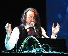
- Edgar Froese (1944–2015), musician, founder of the electronic music group Tangerine Dream
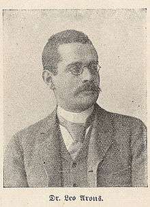
- Leo Arons (1860–1919), physicist, social democrat and supporter of the trade union movement
- Sebastian Blomberg (born 1972), actor
- Horst Buchholz, actor (1933–2003)
- Heinz Buschkowsky (born 1948), politician (SPD), former district mayor of Neukölln
- Christiane F. (born 1962), author of the book Wir Kinder vom Bahnhof Zoo
- Ursula Goetze, anti-Nazi activist (1916–1943)
- Alexander Hacke, musician, born 1965 in Neukölln
- Kirsten Heisig (1961–2010), juvenile magistrate in Neukölln, created the Neuköllner Modell, applying rapid intervention procedures to deal with juvenile offenders before they embarked on a criminal lifestyle
- Kurt Krömer (born 1974), presenter, actor and entertainer
- Jutta Limbach (1934–2016), legal academic
- Will Meisel (1897–1967), composer and publisher
- Inge Meysel, actress (1910–2004), Seevetal
- Gunnar Möller (born 1928), actor
- Mady Rahl (1915–2009), actress
- Antonio Rüdiger (born 1993), footballer[13]
- Werner Seelenbinder (1904–1944), wrestler, politician (KPD) and resistance fighter
- Katharina Szelinski-Singer (1918–2010), sculptor
- Elsa Thiemann (1910–1981), Bauhaus educated photographer, who took many photographs of Neukölln where she lived
- Lotte Ulbricht (1903–2002), wife of East German leader Walter Ulbricht
- Emil Wutzky (1871–1963), trade unionist and local politician (SPD)
- Engelbert Zaschka (1895–1955), inventor and helicopter pioneer
References in popular culture
- "Neuköln" (deliberately spelt with one 'l') is an instrumental piece by David Bowie, the ninth track on his 1977 album "Heroes".
- The last track of Miss Kittin's first solo album I Com is called "Neukölln 2".
- The German film Knallhart is set in the northern part of Neukölln.
- The German documentary Neukölln Unlimited tells the story of three Lebanese teenagers based in Neukölln, who fight their deportation out of Germany.
- Electronic music producer Kobosil is a native of the city. With a Bachelor of Arts in audio production, he has released music on the Ostgut Ton and MDT labels.[14]
- The series 4 Blocks is set in Neukölln and Kreuzberg.
Photo gallery
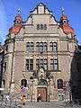 Country Court
 City hall
_Buddy_B%C3%A4r.jpg) Buddy Bear Neukölln in front of the City hall
Buddy Bear Neukölln in front of the City hall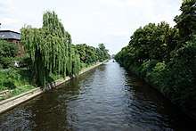 Landwehrkanal
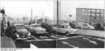 Border crossing at Sonnenallee, 1964
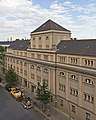 Stadtbad Neukölln
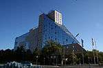 Europe's largest hotel: The Estrel near Sonnenallee train station, 2012
Twin Cities


See also
- Berlin Neukölln (electoral district)
References
- Translated "New Cölln", and etymologically "New Colony" from lat. [nova] colonia.
- http://www.spiegel.de/international/germany/neukoelln-nasties-foreigners-feel-accused-in-berlin-gentrification-row-a-750297.html
- S41 "Bahnhofs- und Linieninformationssystem" s-bahn-berlin.de accessed 19 March 2018
- S42 "Bahnhofs- und Linieninformationssystem" s-bahn-berlin.de accessed 19 March 2018
- S45 "Bahnhofs- und Linieninformationssystem" s-bahn-berlin.de accessed 91 march 2018
- "2020 vision for Berlin's long-overdue Brandenburg Airport" Travel weekly, 9 January 2018
- S45 "Bahnhofs- und Linieninformationssystem" s-bahn-berlin.de accessed 19 March 2018
- S47 "Bahnhofs- und Linieninformationssystem" s-bahn-berlin.de accessed 19 March 2018
- http://www.statistik-berlin-brandenburg.de/Publikationen/Stat_Berichte/2011/SB_A1-5_hj02-10_BE.pdf
- https://www.welt.de/die-welt/politik/article9920445/Die-Roma-von-Berlin-Neukoelln.html
- http://www.statistik-berlin-brandenburg.de/Publikationen/Stat_Berichte/201gnm1/SB_A1-5_hj02-10_BE.pdf%5B%5D
- "Sagt endlich Kreuzkölln!" 12 April 2016 Der Tagesspiegel
- Roma, A. S. (9 June 2016). "Antonio Rudiger: This is the story of my life". forza roma. Retrieved 17 July 2017.
- "Kobosil". Resident Advisor. Resident Advisor Ltd. 2014. Retrieved 4 June 2014.
External links
| Wikimedia Commons has media related to Neukölln. |
| Wikivoyage has a travel guide for Neukölln. |
- (in German) Official homepage
- (in German) WebTV from Berlin, Neukoelln
| |
| |
| West boroughs (1920–2000) | 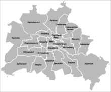 | |
|---|---|---|
| East boroughs (1920–2000) |
| |