Rummelsburg
![]()
Rummelsburg | |
|---|---|
Quarter of Berlin | |
 Tuchollaplatz (Victoriastadt) | |
Location of Rummelsburg in Lichtenberg district and Berlin  | |
 Rummelsburg 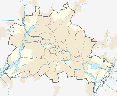 Rummelsburg | |
| Coordinates: 52°30′00″N 13°29′33″E | |
| Country | Germany |
| State | Berlin |
| City | Berlin |
| Borough | Lichtenberg |
| Founded | 1669 |
| Subdivisions | 1 zone |
| Area | |
| • Total | 4.52 km2 (1.75 sq mi) |
| Elevation | 50 m (160 ft) |
| Population (2008-06-30) | |
| • Total | 17,567 |
| • Density | 3,900/km2 (10,000/sq mi) |
| Time zone | CET/CEST (UTC+1/+2) |
| Postal codes | (nr. 1112) 10317 |
| Vehicle registration | B |
History
Rummelsburg was founded in 1669 and on January 30, 1889 became a rural municipality, with the name of Boxhagen-Rummelsburg. Merged in 1912 in the town of Lichtenberg, in 1920 it was incorporated in Berlin with the Greater Berlin Act.[1]
Geography
Overview
Located in the eastern side of the city and crossed by Spree river in the western corner, Rummelsburg borders with Lichtenberg, Friedrichsfelde, Karlshorst, Friedrichshain (in Friedrichshain-Kreuzberg district), Plänterwald and Oberschöneweide (both in Treptow-Köpenick district). The lake Rummelsburger See belongs to the locality and separates it from Stralau, a zone of Friedrichshain.
Subdivision
Rummelsburg counts 1 zone (Ortslage):
- Victoriastadt
Transport
The locality is served by several urban rail lines of S-Bahn and U-Bahn. The stations serving the locality are Rummelsburg (S3 line), Betriebsbahnhof Rummelsburg (S3), Nöldnerplatz (S5, S7, S75), partly Ostkreuz (S3, S4, S5, S7, S75, S8, S85, S9) and part of the DB station of Lichtenberg (S5, S7, S75, U5, Tram).
Personalities
- Adolph Schlicht (1840–1910)
- Heinrich Zille (1858–1929)
- Margarete Steffin (1908–1941)
Photogallery
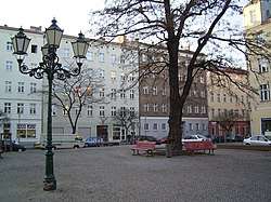
 Nöldnerplatz
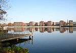 The Rummelsburger See
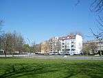
 Münsterlandplatz
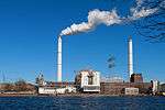 Klingenberg power station
References
- (in German) Historical infos about Rummelsburg
External links
![]()
- (in German) Rummelsburg page on www.berlin.de
| |
| |