Plänterwald
Plänterwald is a German locality (Ortsteil) within the Berlin borough (Bezirk) of Treptow-Köpenick. Until 2001 it was part of the former borough of Treptow and the site of its former town hall.[1]
Plänterwald | |
|---|---|
Quarter of Berlin | |
Location of Plänterwald in Treptow-Köpenick and Berlin  | |
 Plänterwald 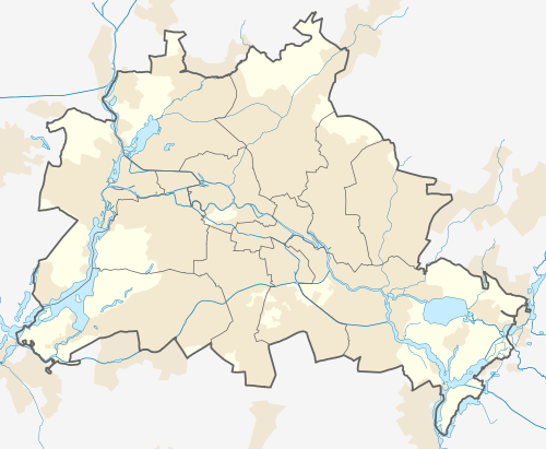 Plänterwald | |
| Coordinates: 52°28′47″N 13°28′31″E | |
| Country | Germany |
| State | Berlin |
| City | Berlin |
| Borough | Treptow-Köpenick |
| Founded | 1760 |
| Area | |
| • Total | 3.01 km2 (1.16 sq mi) |
| Elevation | 34 m (112 ft) |
| Population (2008-06-30) | |
| • Total | 10,618 |
| • Density | 3,500/km2 (9,100/sq mi) |
| Time zone | CET/CEST (UTC+1/+2) |
| Postal codes | (nr. 0902) 12435, 12437 |
| Vehicle registration | B |
History
The name Plänterwald derives from the German word Plenterwald, referred to a timber forest. The 89 hectares of the forest were first economically used in 1760, and in 1969 the northern side became part of the Spreepark (better known as Cultural Park Plänterwald [2]). In 1920, as part of the former municipality of Treptow, it merged into Berlin with the "Greater Berlin Act". Crossed by the "Berlin Wall" on its borders with Neukölln from 1961 to 1989, the locality became autonomous in 1997, separated from Alt-Treptow and Baumschulenweg.[3]
Geography
Located in south-east Berlin and crossed by the river Spree, Plänterwald borders with the localities of Alt-Treptow, Oberschöneweide (separated by the Spree), Baumschulenweg and Neukölln. The Spree also divides it from the peninsula of Stralau (a zone of Friedrichshain, in Friedrichshain-Kreuzberg district) and Rummelsburg (in Lichtenberg).
Transport
The locality is served by the S-Bahn lines S8, S85 and S9 at the homonymous railway station. It is also served by several bus lines.
Photogallery
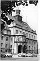 Treptow town hall in 1978
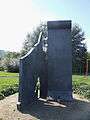 Monument to 15 victims from Treptow, killed at the Berlin Wall
 The Eierhäuschen in 1960
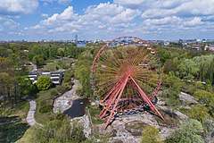 Abandoned Spreepark
References
- (in German) "Rathaus Treptow" on www.berlin.de
- (in German) Infos on the Spreepark site
- (in German) Historical infos about Plänterwald
External links
![]()
- (in German) Plänterwald page on www.berlin.de
| |
| |