Hellersdorf
Hellersdorf is a locality in the borough of Marzahn-Hellersdorf in Berlin. Between 1986 and Berlin's 2001 administrative reform, it was a borough in its own right, consisting of the current area of Hellersdorf as well as Kaulsdorf and Mahlsdorf.
Hellersdorf | |
|---|---|
Quarter of Berlin | |
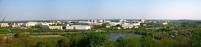 Hellersdorf from Kienberg | |
 Coat of arms | |
Location of Hellersdorf in Marzahn-Hellersdorf and Berlin  | |
 Hellersdorf 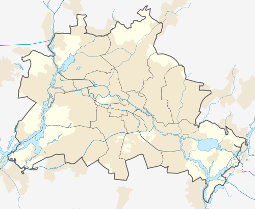 Hellersdorf | |
| Coordinates: 52°32′21″N 13°35′32″E | |
| Country | Germany |
| State | Berlin |
| City | Berlin |
| Borough | Marzahn-Hellersdorf |
| Founded | 1375 |
| Subdivisions | 3 zones |
| Area | |
| • Total | 8.1 km2 (3.1 sq mi) |
| Elevation | 52 m (171 ft) |
| Population (June 30, 2008) | |
| • Total | 72,602 |
| • Density | 9,000/km2 (23,000/sq mi) |
| Time zone | CET/CEST (UTC+1/+2) |
| Postal codes | (nr. 1005) 12619, 12627, 12629, 12683 |
| Vehicle registration | B |
History
Before German reunification in 1989 it was part of East Berlin. Situated at the eastern part of Berlin, the area is mainly a large housing estate from the 1980s, made up of Plattenbau (concrete slab) buildings.
The historic village of Helwichstorpp was first mentioned in a 1375 land registry of Emperor Charles IV, then also Margrave of Brandenburg. The city of Berlin acquired the former Hellersdorf manor in 1886; it was finally incorporated by the 1920 Greater Berlin Act as a part of the Lichtenberg borough. During German reunification on October 3, 1990, a small part of Honow (primarily around the last two stations of U5) was annexed by this borough.
Geography
Subdivision
Hellersdorf is divided into 3 zones (Ortslagen):
- Hellersdorf-Nord
- Hellersdorf-Ost
- Hellersdorf-Süd
Transportation
Hellersdorf is served by the U5 line of the Berlin U-Bahn at the stations Kaulsdorf-Nord, Neue Grottkauer Straße, Cottbusser Platz, Hellersdorf, Louis-Lewin-Straße and Hönow.
Points of interest
- Gründerzeit Museum, founded by Charlotte von Mahlsdorf and situated in the building Gutshaus Mahlsdorf. This museum is dedicated to life around the 20th century Berlin Hellersdorf
External links
![]()
- (in German) Hellersdorf page on info-marzahn-hellersdorf.de
| |
| |
| West boroughs (1920–2000) | 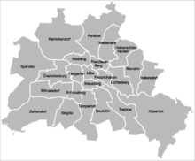 | |
|---|---|---|
| East boroughs (1920–2000) |
| |
| Authority control |
|
|---|