National Register of Historic Places listings in Newport County, Rhode Island
This is a list of the National Register of Historic Places listings in Newport County, Rhode Island.

Location of Newport County in Rhode Island
This is intended to be a complete list of the properties and districts on the National Register of Historic Places in Newport County, Rhode Island, United States. Latitude and longitude coordinates are provided for many National Register properties and districts; these locations may be seen together in a map.[1]
There are 123 properties and districts listed on the National Register in the county, including 24 National Historic Landmarks.
- This National Park Service list is complete through NPS recent listings posted June 26, 2020.[2]
Current listings
| [3] | Name on the Register[4] | Image | Date listed[5] | Location | City or town | Description |
|---|---|---|---|---|---|---|
| 1 | Army and Navy YMCA | 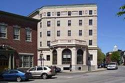 Army and Navy YMCA |
December 29, 1988 (#88003073) |
50 Washington Sq. 41°29′26″N 71°18′51″W |
Newport | |
| 2 | Artillery Park | 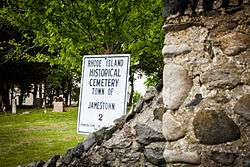 Artillery Park |
March 7, 1973 (#73000054) |
North Rd. and Narragansett Ave. 41°29′47″N 71°22′29″W |
Jamestown | |
| 3 | Bailey Farm | 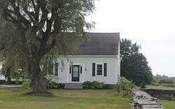 Bailey Farm |
June 4, 1984 (#84001887) |
373 Wyatt Rd. 41°31′14″N 71°16′09″W |
Middletown | |
| 4 | Charles H. Baldwin House |  Charles H. Baldwin House |
May 6, 1971 (#71000018) |
Bellevue Ave., opposite Perry St. 41°28′44″N 71°18′31″W |
Newport | |
| 5 | Benjamin Barker House | 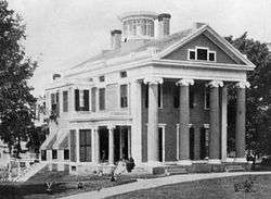 Benjamin Barker House |
October 31, 1980 (#80000081) |
1229 Main Rd. 41°38′30″N 71°12′19″W |
Tiverton | Destroyed by fire in 1981.[6] |
| 6 | Battle of Rhode Island Site | 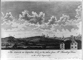 Battle of Rhode Island Site |
May 30, 1974 (#74002054) |
Lehigh Hill and both sides of RI 24 between Medley and Dexter Sts. 41°36′12″N 71°15′31″W |
Portsmouth | Successful defense against British in 1778. Only Revolutionary War battle in which a segregated African-American unit fought (support logistics, 2 killed). |
| 7 | Beavertail Light | 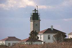 Beavertail Light |
December 12, 1977 (#77000024) |
Beavertail Rd. 41°26′58″N 71°23′59″W |
Jamestown | Continuously operating gateway to Narragansett Bay since 1749; part of the Lighthouses of Rhode Island Thematic Resource (TR) |
| 8 | Isaac Bell House |  Isaac Bell House |
January 13, 1972 (#72000022) |
70 Perry St. 41°28′46″N 71°18′35″W |
Newport | First major Shingle-style house |
| 9 | Bellevue Avenue Historic District |  Bellevue Avenue Historic District |
December 8, 1972 (#72000023) |
Roughly bounded Atlantic Ocean, Easton Bay, Coggeshall Ave., Spring St., and Memorial Blvd. 41°28′23″N 71°18′28″W |
Newport | Home to summer mansions and houses built by wealthy vacationers in Newport in late 19th and early 20th centuries |
| 10 | Bellevue Avenue/Casino Historic District | .jpg) Bellevue Avenue/Casino Historic District |
December 8, 1972 (#72000024) |
170-230 Bellvue Avenue 41°28′57″N 71°18′28″W |
Newport | |
| 11 | The Bird's Nest | 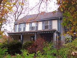 The Bird's Nest |
June 7, 1982 (#82000130) |
526 Broadway at One Mile Corner 41°30′21″N 71°18′09″W |
Newport | |
| 12 | Borden Farm | 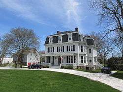 Borden Farm |
June 5, 2007 (#07000528) |
2951 and 2967 E. Main Rd. 41°36′32″N 71°14′45″W |
Portsmouth | |
| 13 | Bourne Mill |  Bourne Mill |
December 22, 2006 (#06001189) |
844 State Ave. 41°40′12″N 71°10′41″W |
Tiverton | Often grouped with the mills of nearby Fall River, Mass., but entirely within Rhode Island |
| 14 | Boyd's Windmill | 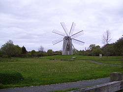 Boyd's Windmill |
January 26, 2001 (#01000018) |
Prospect Ave. 41°30′03″N 71°16′09″W |
Middletown | |
| 15 | The Breakers | 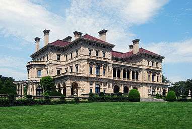 The Breakers |
September 10, 1971 (#71000019) |
Ochre Point Ave. 41°28′11″N 71°17′56″W |
Newport | Advanced and costly mansion built by Cornelius Vanderbilt II in 1895. Considered the city's premier mansion then and now. |
| 16 | Brick Market | 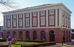 Brick Market |
October 15, 1966 (#66000019) |
Thames St. & Washington Sq. 41°29′23″N 71°18′58″W |
Newport | Sophisticated late Georgian building with many classical elements. Now used as Museum of Newport History |
| 17 | Thomas Carr Farmstead Site (Keeler Site RI-707) | November 1, 1984 (#84000356) |
Address Restricted |
Jamestown | ||
| 18 | Castle Hill Lighthouse | 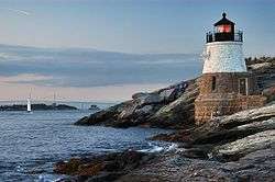 Castle Hill Lighthouse |
March 30, 1988 (#88000277) |
Off Ocean Ave. on Castle Hill at the western end of Newport Neck 41°27′43″N 71°21′48″W |
Newport | 1890 lighthouse still in active use; part of the Lighthouses of Rhode Island TR |
| 19 | Chateau-sur-Mer |  Chateau-sur-Mer |
November 8, 1968 (#68000002) |
424 Bellevue Ave. 41°28′10″N 71°18′20″W |
Newport | Considered the first of the great Newport mansions. |
| 20 | Clambake Club of Newport | 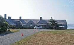 Clambake Club of Newport |
November 7, 1995 (#95001267) |
353 Tuckerman Ave. 41°28′47″N 71°16′32″W |
Middletown | |
| 21 | Clarke Street Meeting House | 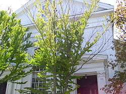 Clarke Street Meeting House |
January 25, 1971 (#71000020) |
Clarke St. 41°29′22″N 71°18′51″W |
Newport | |
| 22 | Commandant's Residence, Quarters Number One, Fort Adams | .jpg) Commandant's Residence, Quarters Number One, Fort Adams |
May 8, 1974 (#74000043) |
Harrison Ave., Fort Adams 41°28′17″N 71°20′33″W |
Newport | |
| 23 | Common Burying Ground and Island Cemetery | 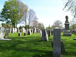 Common Burying Ground and Island Cemetery |
May 1, 1974 (#74000044) |
Farwell and Warner Sts. 41°29′50″N 71°18′55″W |
Newport | |
| 24 | Conanicut Battery | July 2, 1973 (#73000055) |
West of Beaver Tail Rd. 41°28′49″N 71°23′38″W |
Jamestown | ||
| 25 | Conanicut Island Lighthouse | 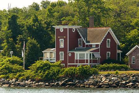 Conanicut Island Lighthouse |
February 25, 1988 (#87001698) |
64 N. Bay View Ave. 41°34′24″N 71°22′21″W |
Jamestown | part of the Lighthouses of Rhode Island TR |
| 26 | Cook–Bateman Farm |  Cook–Bateman Farm |
October 11, 1979 (#79003775) |
Fogland and Puncatest Neck Rds. 41°33′23″N 71°12′07″W |
Tiverton | |
| 27 | CORONET (Wooden Hull Schooner Yacht) | (Detroit-Publishing_Co_1894-LOC).jpg) CORONET (Wooden Hull Schooner Yacht) |
June 3, 2004 (#04000571) |
449 Thames 41°28′54″N 71°19′00″W |
Newport | |
| 28 | Dr. Charles Cotton House | 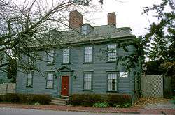 Dr. Charles Cotton House |
January 13, 1972 (#72000026) |
5 Cotton's Court 41°29′18″N 71°18′53″W |
Newport | |
| 29 | William King Covell III | 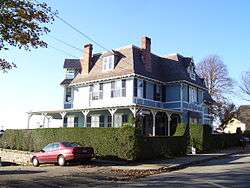 William King Covell III |
May 31, 1972 (#72000027) |
72 Washington St. 41°29′39″N 71°19′19″W |
Newport | |
| 30 | Dutch Island Lighthouse | 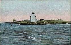 Dutch Island Lighthouse |
February 25, 1988 (#87001701) |
Southern end of Dutch Island 41°29′44″N 71°24′16″W |
Jamestown | part of the Lighthouses of Rhode Island TR |
| 31 | The Elms | 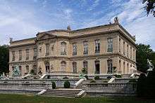 The Elms |
September 10, 1971 (#71000021) |
Bellevue Ave. 41°28′38″N 71°18′38″W |
Newport | One of the last and most modern of the great Newport mansions |
| 32 | Emmanuel Church | 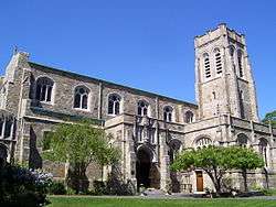 Emmanuel Church |
May 16, 1996 (#96000574) |
42 Dearborn St. 41°28′47″N 71°18′47″W |
Newport | |
| 33 | Farnham Farm | February 2, 2006 (#05001617) |
113 Mount Pleasant Ave. 41°35′52″N 71°19′22″W |
Portsmouth | ||
| 34 | First Baptist Church of Tiverton |  First Baptist Church of Tiverton |
July 30, 2013 (#13000569) |
7 Old Stone Church Rd. 41°33′42″N 71°08′34″W |
Tiverton | |
| 35 | Fort Adams | 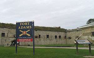 Fort Adams |
July 28, 1970 (#70000014) |
West of Newport at Fort Adams Rd. and Harrison Ave. 41°28′30″N 71°20′28″W |
Newport | |
| 36 | Fort Barton Site |  Fort Barton Site |
March 7, 1973 (#73000056) |
Lawton and Highland Aves. 41°37′47″N 71°12′37″W |
Tiverton | |
| 37 | Fort Dumpling Site |  Fort Dumpling Site |
March 16, 1972 (#72000021) |
Fort Wetherill 41°28′38″N 71°21′28″W |
Jamestown | Fort Wetherill was built on the site of Fort Dumpling. |
| 38 | Fort Hamilton Historic District | 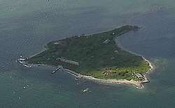 Fort Hamilton Historic District |
October 22, 2001 (#01001158) |
Rose Island 41°29′47″N 71°20′30″W |
Newport | part of the Lighthouses of Rhode Island TR |
| 39 | Friends Meeting House and Cemetery |  Friends Meeting House and Cemetery |
March 6, 2007 (#07000124) |
234 W. Main Rd. 41°31′33″N 71°11′38″W |
Little Compton | |
| 40 | Friends Meetinghouse |  Friends Meetinghouse |
March 7, 1973 (#73000276) |
North Rd. and Weeden Lane 41°30′52″N 71°22′31″W |
Jamestown | |
| 41 | Levi H. Gale House | 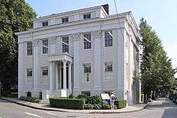 Levi H. Gale House |
May 6, 1971 (#71000022) |
89 Touro St. 41°29′21″N 71°18′45″W |
Newport | |
| 42 | Gardiner Pond Shell Midden | 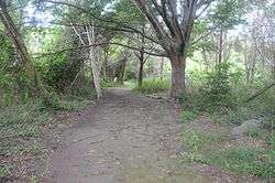 Gardiner Pond Shell Midden |
April 12, 1985 (#85000718) |
On the grounds of the Norman Bird Sanctuary[7] 41°29′47″N 71°15′18″W |
Middletown | |
| 43 | Greenvale Farm | 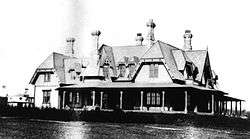 Greenvale Farm |
January 4, 1980 (#80000082) |
582 Wapping Rd. 41°32′05″N 71°14′18″W |
Portsmouth | 19th century estate house on the water below Greenvale Vineyard. |
| 44 | John Griswold House | 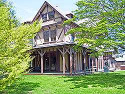 John Griswold House |
November 5, 1971 (#71000023) |
76 Bellevue Ave 41°29′09″N 71°18′32″W |
Newport | |
| 45 | Hazard Farmstead (Joyner Site RI-706) | November 1, 1984 (#84000365) |
Address Restricted |
Jamestown | ||
| 46 | Joseph Hicks House | September 10, 1979 (#79000053) |
494 Main Rd. 41°39′36″N 71°11′26″W |
Tiverton | ||
| 47 | Hog Island Shoal Lighthouse | 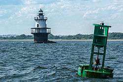 Hog Island Shoal Lighthouse |
March 30, 1988 (#88000282) |
S of Hog Island, E passage, Narrangansett Bay 41°37′56″N 71°16′25″W |
Portsmouth | |
| 48 | Hamilton Hoppin House | 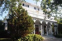 Hamilton Hoppin House |
August 16, 1996 (#96000905) |
120 Miantonomi Ave. 41°30′23″N 71°17′52″W |
Middletown | |
| 49 | Horsehead-Marbella |  Horsehead-Marbella |
June 16, 1999 (#99000675) |
240 Highland Dr. 41°28′34″N 71°22′32″W |
Jamestown | |
| 50 | Hunter House | 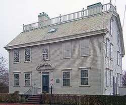 Hunter House |
November 24, 1968 (#68000003) |
54 Washington St. 41°29′33″N 71°19′18″W |
Newport | Excellent example of Georgian frame house, with many interior features and original furnishings |
| 51 | Ida Lewis Rock Lighthouse | 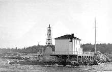 Ida Lewis Rock Lighthouse |
February 25, 1988 (#87001700) |
On Lime Rock in Newport Harbor off Wellington Ave. 41°28′40″N 71°19′35″W |
Newport | part of the Lighthouses of Rhode Island TR |
| 52 | Jamestown Archeological District | December 10, 1989 (#83004869) |
Address Restricted |
Jamestown | ||
| 53 | Jamestown Windmill | 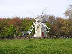 Jamestown Windmill |
March 14, 1973 (#73000057) |
North Rd., north of Weeden Lane 41°30′59″N 71°22′28″W |
Jamestown | |
| 54 | Lyman C. Josephs House | 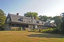 Lyman C. Josephs House |
May 2, 1975 (#75000054) |
438 Walcott Ave. 41°29′12″N 71°16′34″W |
Middletown | Incorrectly listed as "Lyman C. Joseph House". |
| 55 | Kay Street–Catherine Street–Old Beach Road Historic District |  Kay Street–Catherine Street–Old Beach Road Historic District |
May 22, 1973 (#73000052) |
Roughly bounded by Broadway, Memorial Blvd., Whitfield Pl., Champlin & Sherman Sts., Rhode Island, Prairie & Gibbs Ave., 41°29′23″N 71°18′19″W |
Newport | Boundary decrease approved March 12, 2018 |
| 56 | Edward King House |  Edward King House |
October 15, 1970 (#70000024) |
Aquidneck Park, Spring St. 41°28′56″N 71°18′41″W |
Newport | Richard Upjohn-designed Italian villa house for local merchant was the largest in the city at time of its 1847 completion. |
| 57 | Kingscote |  Kingscote |
May 17, 1973 (#73000058) |
Bellevue Ave. and Bowery St. 41°28′54″N 71°18′34″W |
Newport | 1839 Gothic Revival house by Richard Upjohn was the first summer residence in Newport. |
| 58 | Lawton–Almy–Hall Farm |  Lawton–Almy–Hall Farm |
October 11, 1978 (#78000068) |
559 Union St. 41°33′35″N 71°16′31″W |
Portsmouth | |
| 59 | Little Compton Common Historic District |  Little Compton Common Historic District |
May 3, 1974 (#74000041) |
Little Compton 41°30′33″N 71°10′21″W |
Little Compton | |
| 60 | Lucas–Johnston House |  Lucas–Johnston House |
May 6, 1971 (#71000024) |
40 Division St. 41°29′19″N 71°18′45″W |
Newport | |
| 61 | Luce Hall | Luce Hall |
September 22, 1972 (#72001439) |
US Naval War College and Torpedo School, Coasters Harbor Island 41°30′24″N 71°19′44″W |
Newport | |
| 62 | Malbone |  Malbone |
October 22, 1976 (#76000039) |
Malbone Rd. 41°30′18″N 71°18′38″W |
Newport | |
| 63 | Francis Malbone House | 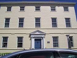 Francis Malbone House |
April 28, 1975 (#75000055) |
392 Thames St. 41°28′58″N 71°18′54″W |
Newport | |
| 64 | Marble House |  Marble House |
September 10, 1971 (#71000025) |
596 Bellevue Ave. 41°27′44″N 71°18′24″W |
Newport | Richard Morris Hunt-designed mansion for William Kissam Vanderbilt |
| 65 | Capt. John Mawdsley House | 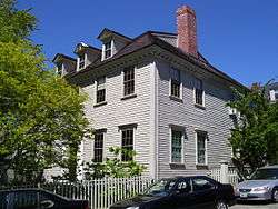 Capt. John Mawdsley House |
July 2, 1983 (#83000180) |
228 Spring St. 41°29′03″N 71°18′44″W |
Newport | |
| 66 | Miantonomi Memorial Park | 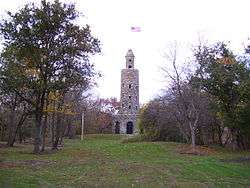 Miantonomi Memorial Park |
June 23, 1969 (#69000003) |
Between Hillside and Girard Aves. 41°30′32″N 71°18′37″W |
Newport | |
| 67 | Mount Hope Bridge | 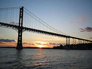 Mount Hope Bridge |
January 31, 1976 (#76000038) |
RI 114 over Narragansett Bay 41°38′25″N 71°15′32″W |
Portsmouth | Longest bridge in New England for over 40 years |
| 68 | Dennis J. Murphy House at Ogden Farm | 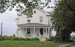 Dennis J. Murphy House at Ogden Farm |
December 13, 2007 (#07001269) |
641 Mitchell's Ln. 41°31′20″N 71°15′44″W |
Middletown | |
| 69 | Newport Artillery Company Armory | 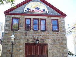 Newport Artillery Company Armory |
June 30, 1972 (#72000029) |
23 Clarke St. 41°29′22″N 71°18′51″W |
Newport | |
| 70 | Newport Casino |  Newport Casino |
December 2, 1970 (#70000083) |
194 Bellevue Ave. 41°28′56″N 71°18′27″W |
Newport | Early McKim, Mead and White Shingle Style building; also first social club in U.S. to include recreational facilities. Home to International Tennis Hall of Fame. |
| 71 | Newport Harbor Lighthouse | .jpg) Newport Harbor Lighthouse |
March 30, 1988 (#88000276) |
N. end of Goat Island, Newport Harbor 41°29′36″N 71°19′39″W |
Newport | part of the Lighthouses of Rhode Island TR |
| 72 | Newport Historic District | 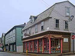 Newport Historic District |
November 24, 1968 (#68000001) |
Bounded roughly by Van Zandt Ave., Newport Harbor, Thames, Pope, William Sts., Bellevue Ave., Bull, Broadway, Kingston 41°29′21″N 71°18′58″W |
Newport | Well-preserved collection of Georgian and colonial buildings, many showing sophistication and coordination |
| 73 | Newport Steam Factory | 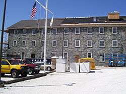 Newport Steam Factory |
January 20, 1972 (#72000030) |
449 Thames St. 41°29′03″N 71°18′58″W |
Newport | |
| 74 | Oak Glen | 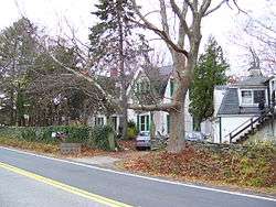 Oak Glen |
March 29, 1978 (#78003444) |
745 Union St. 41°33′33″N 71°16′53″W |
Portsmouth | |
| 75 | Ocean Drive Historic District |  Ocean Drive Historic District |
May 11, 1976 (#76000048) |
Ocean Dr. 41°27′40″N 71°20′03″W |
Newport | Long road along Newport's southern shore with many summer homes and ocean views |
| 76 | Ochre Point–Cliffs Historic District |  Ochre Point–Cliffs Historic District |
March 18, 1975 (#75000211) |
Roughly bounded by Bellevue Ave. and Coastland as far north as Memorial Boulevard and south to Sheep Point Cove 41°28′27″N 71°18′08″W |
Newport | |
| 77 | Old State House |  Old State House |
October 15, 1966 (#66000014) |
Washington Sq. 41°29′27″N 71°18′48″W |
Newport | Meeting place of colonial and state legislatures until 20th century; intact Georgian public building |
| 78 | Old Friends Archeological Site | November 7, 1995 (#95001269) |
Address Restricted |
Jamestown | ||
| 79 | Osborn–Bennett Historic District | 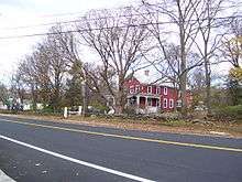 Osborn–Bennett Historic District |
December 22, 2005 (#05001460) |
1137, 1148, 1168, 1188 Main Rd. 41°38′35″N 71°11′55″W |
Tiverton | |
| 80 | Paradise School |  Paradise School |
May 5, 1978 (#78000069) |
Paradise and Prospect Aves. 41°30′06″N 71°16′08″W |
Middletown | |
| 81 | Perry Mill |  Perry Mill |
January 13, 1972 (#72000020) |
337 Thames St. 41°29′02″N 71°18′55″W |
Newport | |
| 82 | Pine Hill Archeological Site, RI-655 | November 3, 1983 (#83003803) |
Address Restricted |
Portsmouth | ||
| 83 | Portsmouth Friends Meetinghouse Parsonage and Cemetery | 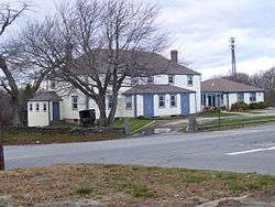 Portsmouth Friends Meetinghouse Parsonage and Cemetery |
March 7, 1973 (#73000053) |
11 Middle Rd. and 2232 E. Main Rd. 41°35′27″N 71°15′14″W |
Portsmouth | |
| 84 | President's House, Naval War College |  President's House, Naval War College |
September 18, 1989 (#89001219) |
Naval Education and Training Center on Coasters Harbor Island 41°30′28″N 71°19′40″W |
Newport | |
| 85 | Prudence Island Lighthouse |  Prudence Island Lighthouse |
March 30, 1988 (#88000270) |
Eastern end of Sandy Pt. on Prudence Island 41°36′20″N 71°18′11″W |
Portsmouth | part of the Lighthouses of Rhode Island TR |
| 86 | Redwood Library |  Redwood Library |
October 15, 1966 (#66000015) |
50 Bellevue Ave. 41°29′12″N 71°18′34″W |
Newport | |
| 87 | Rhode Island Red |  Rhode Island Red |
October 19, 2001 (#01000465) |
Junction of Adamsville, Westport Harbor, Main and Stone Church Rds. 41°33′13″N 71°07′44″W |
Little Compton | part of the Outdoor Sculpture of Rhode Island Multiple Property Submission (MPS) |
| 88 | Joseph Rogers House | 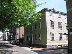 Joseph Rogers House |
February 23, 1972 (#72000031) |
37 Touro St. 41°29′23″N 71°18′51″W |
Newport | |
| 89 | Rose Island Lighthouse | 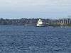 Rose Island Lighthouse |
April 10, 1987 (#87000033) |
Southwestern point of Rose Island 41°29′44″N 71°20′35″W |
Newport | part of the Lighthouses of Rhode Island TR |
| 90 | Rosecliff | .jpg) Rosecliff |
February 6, 1973 (#73000059) |
Bellevue Ave. 41°27′55″N 71°18′20″W |
Newport | |
| 91 | Sakonnet Light Station | 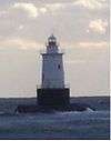 Sakonnet Light Station |
February 10, 1983 (#83000179) |
South of Little Compton on Little Cormorant Rock 41°27′11″N 71°12′11″W |
Little Compton | part of the Lighthouses of Rhode Island TR |
| 92 | Seamen's Church Institute of Newport |  Seamen's Church Institute of Newport |
August 4, 1983 (#83000178) |
18 Market Square 41°29′14″N 71°19′01″W |
Newport | |
| 93 | William Watts Sherman House | _-_from_southwest.jpg) William Watts Sherman House |
December 30, 1970 (#70000015) |
2 Shepard Ave. 41°28′12″N 71°18′18″W |
Newport | |
| 94 | Shiloh Church |  Shiloh Church |
August 12, 1971 (#71000026) |
25 School St. 41°29′19″N 71°18′44″W |
Newport | |
| 95 | Shoreby Hill Historic District[8] |  Shoreby Hill Historic District |
September 15, 2011 (#11000674) |
Roughly bounded by Whittier Rd., Prudence Ln., Emerson Rd., Conanicus Ave., Knowles Ct., Coronado St. & Longfellow Rd. 41°29′57″N 71°22′08″W |
Jamestown | |
| 96 | Smith–Gardiner–Norman Farm Historic District |  Smith–Gardiner–Norman Farm Historic District |
June 16, 2008 (#08000234) |
583 Third Beach Rd. 41°29′58″N 71°15′00″W |
Middletown | Centerpiece of the Norman Bird Sanctuary. |
| 97 | Southern Thames Historic District |  Southern Thames Historic District |
June 26, 2008 (#08000314) |
Thames St. from Memorial Blvd. to Morton Ave. 41°29′09″N 71°18′53″W |
Newport | |
| 98 | St. George's School–Church of St. George, Little Chapel, and Memorial Schoolhouse |  St. George's School–Church of St. George, Little Chapel, and Memorial Schoolhouse |
November 12, 2004 (#04001235) |
372 Purgatory Rd. 41°29′27″N 71°16′06″W |
Middletown | |
| 99 | St. Mary's Church Complex | 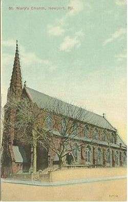 St. Mary's Church Complex |
March 6, 2008 (#08000153) |
14 William St. 41°29′02″N 71°18′45″W |
Newport | |
| 100 | Ezra Stiles House | 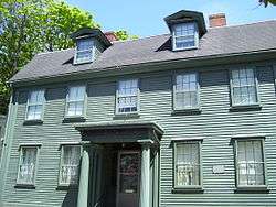 Ezra Stiles House |
March 16, 1972 (#72000116) |
14 Clarke St. 41°29′23″N 71°18′50″W |
Newport | |
| 101 | Stone House Inn |  Stone House Inn |
April 2, 2008 (#08000255) |
122 Sakonnet Rd. 41°27′58″N 71°11′11″W |
Little Compton | |
| 102 | Stonybrook Estate Historic District |  Stonybrook Estate Historic District |
September 1, 2009 (#09000708) |
501-521 Indian Ave. and 75 Vaucluse Ave. 41°30′23″N 71°14′31″W |
Middletown | |
| 103 | Taylor–Chase–Smythe House | 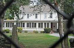 Taylor–Chase–Smythe House |
August 30, 1989 (#89001220) |
Chase Ln., Naval Education and Training Center 41°31′30″N 71°19′07″W |
Middletown | |
| 104 | Charles Tillinghast House | 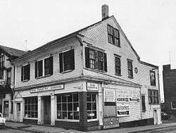 Charles Tillinghast House |
January 20, 1972 (#72001576) |
243-245 Thames St. 41°29′19″N 71°18′54″W |
Newport | Demolished c. 1973[9] |
| 105 | John Tillinghast House |  John Tillinghast House |
April 11, 1973 (#73000060) |
142 Mill St. 41°29′11″N 71°18′37″W |
Newport | |
| 106 | Tiverton Four Corners Historic District |  Tiverton Four Corners Historic District |
June 20, 1974 (#74000042) |
Roughly bounded by Main, West and East Rds. 41°34′17″N 71°11′18″W |
Tiverton | |
| 107 | Touro Synagogue National Historic Site | Touro Synagogue National Historic Site |
October 15, 1966 (#66000927) |
85 Touro St. 41°29′23″N 71°18′45″W |
Newport | Only surviving synagogue from colonial era |
| 108 | Trinity Church | 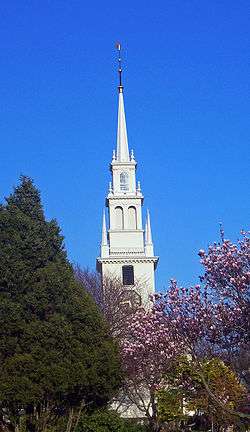 Trinity Church |
November 24, 1968 (#68000004) |
Spring and Church Sts. 41°29′15″N 71°18′50″W |
Newport | Oldest parish church in Rhode Island; early 18th-century design modeled on Boston's Old North Church |
| 109 | Union Church |  Union Church |
June 13, 1974 (#74000045) |
Union St. and E. Main Rd. 41°33′30″N 71°15′22″W |
Portsmouth | |
| 110 | United Congregational Church | 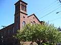 United Congregational Church |
November 19, 1971 (#71000027) |
Spring and Pelham Sts. 41°29′09″N 71°18′49″W |
Newport | National Historic Landmark designation October 16, 2012 |
| 111 | US Naval War College | 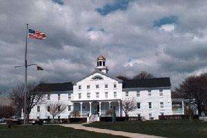 US Naval War College |
October 15, 1966 (#66000876) |
Coaster's Harbor Island 41°30′24″N 71°19′44″W |
Newport | |
| 112 | Alexander Van Rensselaer House | June 4, 2018 (#100002524) |
1 Ichabod Ln. 41°30′23″N 71°17′47″W |
Middletown | ||
| 113 | Vernon House |  Vernon House |
November 24, 1968 (#68000005) |
46 Clarke St. 41°29′19″N 71°18′50″W |
Newport | Sophisticated Georgian frame house used as headquarters by Rochambeau after end of British occupation during Revolutionary War |
| 114 | Wanton–Lyman–Hazard House | 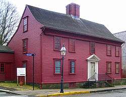 Wanton–Lyman–Hazard House |
October 15, 1966 (#66000016) |
17 Broadway 41°29′27″N 71°18′48″W |
Newport | Oldest house in Newport, built in 1697. |
| 115 | Weatherly (sloop) | August 28, 2012 (#12000585) |
49 America's Cup Blvd. 41°29′15″N 71°18′59″W |
Newport | ||
| 116 | William Whalley Homestead | 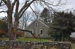 William Whalley Homestead |
August 3, 1988 (#88001127) |
33 Burchard Ave. 41°32′37″N 71°10′09″W |
Little Compton | |
| 117 | White Horse Tavern | 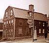 White Horse Tavern |
February 23, 1972 (#72000032) |
26 Marlborough St. 41°29′30″N 71°18′51″W |
Newport | One of the oldest tavern buildings in the U.S., built in 1673 |
| 118 | Whitehall | 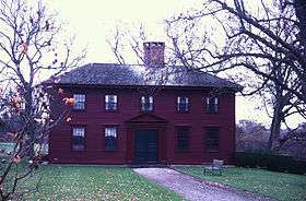 Whitehall |
April 28, 1970 (#70000016) |
Berkeley Ave. 41°30′50″N 71°16′20″W |
Middletown | |
| 119 | Samuel Whitehorne House | 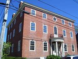 Samuel Whitehorne House |
May 6, 1971 (#71000028) |
414 Thames St. 41°28′55″N 71°18′53″W |
Newport | |
| 120 | Wilbor House |  Wilbor House |
March 6, 2007 (#07000125) |
548 W. Main Rd. 41°29′43″N 71°11′11″W |
Little Compton | |
| 121 | Windmill Hill Historic District | Windmill Hill Historic District |
October 2, 1978 (#78000067) |
Eldred Ave. and N. Main Rd. 41°31′04″N 71°22′44″W |
Jamestown | |
| 122 | Witherbee School |  Witherbee School |
November 27, 1989 (#89002036) |
Green End Ave. 41°30′23″N 71°17′21″W |
Middletown | part of the Middletown MPS |
| 123 | Wreck Sites of H.M.S. Cerberus and H.M.S. Lark |  Wreck Sites of H.M.S. Cerberus and H.M.S. Lark |
April 26, 1973 (#73000061) |
Waters of Narragansett Bay adjacent to Aquidneck Island 41°35′04″N 71°18′19″W |
South Portsmouth |
Former listings
| [3] | Name on the Register | Image | Date listed | Date removed | Location | City or town | Summary |
|---|---|---|---|---|---|---|---|
| 1 | Building at 295 Thames Street | 1972 (#72001578) | Unknown | 295 Thames St. |
Newport | Demolished for construction of America's Cup Ave. | |
| 2 | Building at 319 Thames Street (rear) | 1972 (#72001573) | Unknown | 319 Thames St. (rear) |
Newport | Demolished for construction of America's Cup Ave. | |
| 3 | Sherman Clark House | January 13, 1972 (#72000025) | Unknown | 279 Thames St. |
Newport | Demolished for construction of America's Cup Ave. | |
| 4 | Clark Cook House | .jpg) Clark Cook House |
January 13, 1972 (#72000025) | 1973 | 285 Thames St. |
Newport | Relocated in 1973 to Bannister's Wharf to allow construction of America's Cup Ave. |
| 5 | Industrial National Bank | Industrial National Bank |
1971 (#71001087) | 1972 | 303 Thames St. |
Newport | Demolished for construction of America's Cup Ave.[10] |
| 6 | Jacob Mott House | 1973 (#73002264) | Unknown | S of Cory's Lane on W. Main Rd. |
Portsmouth | Dismantled and relocated in 1973.[11] | |
| 7 | Sayer Building | 1972 (#72001574) | Unknown | 281-283 Thames St. |
Newport | Demolished for construction of America's Cup Ave. | |
| 8 | Robert Stevens House |  Robert Stevens House |
1971 (#71001088) | 1972 | 261-265 Thames St. |
Newport | Demolished for construction of America's Cup Ave. |
See also
| Wikimedia Commons has media related to National Register of Historic Places in Newport County, Rhode Island. |
References
- The latitude and longitude information provided in this table was derived originally from the National Register Information System, which has been found to be fairly accurate for about 99% of listings. Some locations in this table may have been corrected to current GPS standards.
- "National Register of Historic Places: Weekly List Actions". National Park Service, United States Department of the Interior. Retrieved on June 26, 2020.
- Numbers represent an ordering by significant words. Various colorings, defined here, differentiate National Historic Landmarks and historic districts from other NRHP buildings, structures, sites or objects.
- "National Register Information System". National Register of Historic Places. National Park Service. March 13, 2009.
- The eight-digit number below each date is the number assigned to each location in the National Register Information System database, which can be viewed by clicking the number.
- "Survey of Tiverton, RI" (PDF). State of Rhode Island. Retrieved 2013-12-19.
- "Norman Bird Sanctuary Trail Map" (PDF). Norman Bird Sanctuary. Retrieved 2014-10-20.
- "Weekly list of actions taken on properties: 9/12/11 through 9/16/11". National Park Service. September 16, 2011. Retrieved September 18, 2012.
- "List of Resources/Resource Inventory: Washington-Rochambeau Revolutionary Route in the State of Rhode Island and Providence Plantations" (PDF). Hudson River Valley Institute. Archived from the original (PDF) on June 27, 2016. Retrieved September 6, 2016.
| Topics | _(extra_close)_(US48).svg.png) | ||||||||||
|---|---|---|---|---|---|---|---|---|---|---|---|
| Lists by county | |||||||||||
| Lists by city |
| ||||||||||
| |||||||||||
Municipalities and communities of Newport County, Rhode Island, United States | ||
|---|---|---|
| City | Map of Rhode Island highlighting Newport County | |
| Towns | ||
| CDPs | ||
| Other villages | ||
This article is issued from Wikipedia. The text is licensed under Creative Commons - Attribution - Sharealike. Additional terms may apply for the media files.