National Register of Historic Places listings in St. Lucie County, Florida
This is a list of the National Register of Historic Places listings in St. Lucie County, Florida.
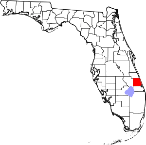
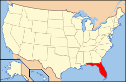
Location of St. Lucie County in Florida
This is intended to be a complete list of the properties and districts on the National Register of Historic Places in St. Lucie County, Florida, United States. The locations of National Register properties and districts for which the latitude and longitude coordinates are included below, may be seen in a map.[1]
There are 16 properties and districts listed on the National Register in the county, including 1 National Historic Landmark.
- This National Park Service list is complete through NPS recent listings posted June 19, 2020.[2]
| Alachua - Baker - Bay - Bradford - Brevard - Broward - Calhoun - Charlotte - Citrus - Clay - Collier - Columbia - DeSoto - Dixie - Duval - Escambia - Flagler - Franklin - Gadsden - Gilchrist - Glades - Gulf - Hamilton - Hardee - Hendry - Hernando - Highlands - Hillsborough (Tampa) - Holmes - Indian River - Jackson - Jefferson - Lafayette - Lake - Lee - Leon - Levy - Liberty - Madison - Manatee - Marion - Martin - Miami-Dade (Miami) - Monroe - Nassau - Okaloosa - Okeechobee - Orange - Osceola - Palm Beach - Pasco - Pinellas - Polk - Putnam - St. Johns - St. Lucie - Santa Rosa - Sarasota - Seminole - Sumter - Suwannee - Taylor - Union - Volusia - Wakulla - Walton - Washington |
Current listings
| [3] | Name on the Register[4] | Image | Date listed[5] | Location | City or town | Description |
|---|---|---|---|---|---|---|
| 1 | Arcade Building | 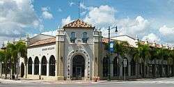 Arcade Building |
October 12, 2001 (#01001085) |
101 U.S. Route 1, North 27°26′49″N 80°19′37″W |
Fort Pierce | |
| 2 | Casa Caprona | 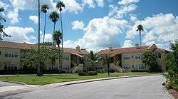 Casa Caprona |
June 2, 1984 (#84000955) |
2605 St. Lucie Boulevard 27°28′59″N 80°21′06″W |
Fort Pierce | |
| 3 | Cresthaven | 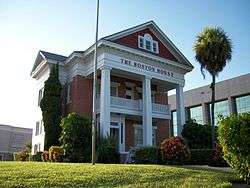 Cresthaven |
April 11, 1985 (#85000770) |
239 South Indian River Drive (CR 707) 27°26′44″N 80°19′25″W |
Fort Pierce | |
| 4 | Fort Pierce Old Post Office | 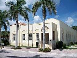 Fort Pierce Old Post Office |
February 11, 2002 (#01000567) |
500 Orange Avenue 27°26′49″N 80°19′39″W |
Fort Pierce | |
| 5 | Fort Pierce Site | 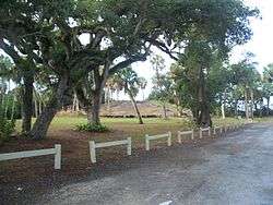 Fort Pierce Site |
January 11, 1974 (#74002181) |
South Indian River Drive 27°26′11″N 80°19′14″W |
Fort Pierce | |
| 6 | Jules Frere House | 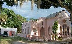 Jules Frere House |
April 20, 1995 (#95000467) |
2404 Sunrise Boulevard 27°25′27″N 80°20′06″W |
Fort Pierce | |
| 7 | Captain Hammond House | 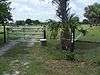 Captain Hammond House |
February 23, 1990 (#90000310) |
5775 Citrus Avenue 27°21′49″N 80°20′34″W |
White City | |
| 8 | Zora Neale Hurston House | 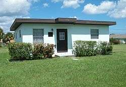 Zora Neale Hurston House |
December 4, 1991 (#91002047) |
1734 School Court 27°27′38″N 80°20′37″W |
Fort Pierce | |
| 9 | Immokolee | 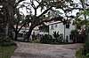 Immokolee |
July 29, 1994 (#93001450) |
8431 Immokolee Road 27°28′53″N 80°24′35″W |
Fort Pierce | |
| 10 | Moores Creek Bridge | 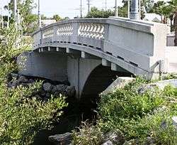 Moores Creek Bridge |
August 17, 2001 (#01000890) |
North 2nd Street between Avenues B and C 27°27′02″N 80°19′32″W |
Fort Pierce | |
| 11 | Old Fort Pierce City Hall |  Old Fort Pierce City Hall |
December 7, 2001 (#01001338) |
315 Avenue A 27°26′52″N 80°19′35″W |
Fort Pierce | |
| 12 | Old St. Anastasia Catholic School | 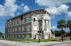 Old St. Anastasia Catholic School |
August 10, 2000 (#00000941) |
910 Orange Avenue 27°26′49″N 80°19′59″W |
Fort Pierce | |
| 13 | St. Lucie High School | 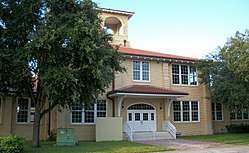 St. Lucie High School |
January 26, 1984 (#84000956) |
1100 Delaware Avenue 27°26′36″N 80°20′01″W |
Fort Pierce | |
| 14 | St. Lucie Village Historic District | 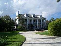 St. Lucie Village Historic District |
December 1, 1989 (#89002062) |
2505-3305 North Indian River Drive 27°29′17″N 80°20′10″W |
St. Lucie Village | |
| 15 | Sunrise Theatre | 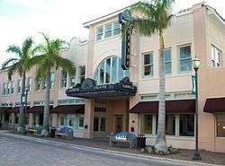 Sunrise Theatre |
December 7, 2001 (#01001339) |
117 South 2nd Street 27°26′46″N 80°19′26″W |
Fort Pierce | |
| 16 | URCA DE LIMA (shipwreck) | May 31, 2001 (#01000529) |
200 yards offshore of Jack Island Park, north of Ft. Pierce Inlet 27°30′11″N 80°17′54″W |
Fort Pierce |
See also
| Wikimedia Commons has media related to National Register of Historic Places in St. Lucie County, Florida. |
References
- The latitude and longitude information provided in this table was derived originally from the National Register Information System, which has been found to be fairly accurate for about 99% of listings. Some locations in this table may have been corrected to current GPS standards.
- "National Register of Historic Places: Weekly List Actions". National Park Service, United States Department of the Interior. Retrieved on June 19, 2020.
- Numbers represent an ordering by significant words. Various colorings, defined here, differentiate National Historic Landmarks and historic districts from other NRHP buildings, structures, sites or objects.
- "National Register Information System". National Register of Historic Places. National Park Service. March 13, 2009.
- The eight-digit number below each date is the number assigned to each location in the National Register Information System database, which can be viewed by clicking the number.
Municipalities and communities of St. Lucie County, Florida, United States | ||
|---|---|---|
| Cities | | |
| Towns | ||
| CDPs | ||
| Unincorporated community | ||
This article is issued from Wikipedia. The text is licensed under Creative Commons - Attribution - Sharealike. Additional terms may apply for the media files.