National Register of Historic Places listings in St. Johns County, Florida
This is a list of the National Register of Historic Places listings in St. Johns County, Florida.
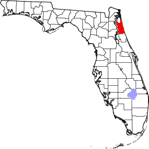
Location of St. Johns County in Florida
This is intended to be a complete list of the properties and districts on the National Register of Historic Places in St. Johns County, Florida, United States. The locations of National Register properties and districts for which the latitude and longitude coordinates are included below, may be seen in a map.[1]
There are 53 properties and districts listed on the National Register in the county, including 6 National Historic Landmarks.
- This National Park Service list is complete through NPS recent listings posted June 19, 2020.[2]
| Alachua - Baker - Bay - Bradford - Brevard - Broward - Calhoun - Charlotte - Citrus - Clay - Collier - Columbia - DeSoto - Dixie - Duval - Escambia - Flagler - Franklin - Gadsden - Gilchrist - Glades - Gulf - Hamilton - Hardee - Hendry - Hernando - Highlands - Hillsborough (Tampa) - Holmes - Indian River - Jackson - Jefferson - Lafayette - Lake - Lee - Leon - Levy - Liberty - Madison - Manatee - Marion - Martin - Miami-Dade (Miami) - Monroe - Nassau - Okaloosa - Okeechobee - Orange - Osceola - Palm Beach - Pasco - Pinellas - Polk - Putnam - St. Johns - St. Lucie - Santa Rosa - Sarasota - Seminole - Sumter - Suwannee - Taylor - Union - Volusia - Wakulla - Walton - Washington |
Current listings
| [3] | Name on the Register[4] | Image | Date listed[5] | Location | City or town | Description |
|---|---|---|---|---|---|---|
| 1 | Abbott Tract Historic District | 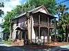 Abbott Tract Historic District |
July 21, 1983 (#83001438) |
Roughly bounded by Matanzas Bay and Pine, San Marco, and Shenandoah Aves. 29°54′04″N 81°18′50″W |
St. Augustine | |
| 2 | Alcazar Hotel | 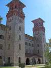 Alcazar Hotel |
February 24, 1971 (#71001013) |
79 King St. 29°53′30″N 81°18′51″W |
St. Augustine | |
| 3 | Avero House | 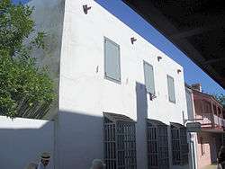 Avero House |
June 13, 1972 (#72001459) |
39 St. George St. 29°58′44″N 81°18′48″W |
St. Augustine | |
| 4 | Bridge of Lions | 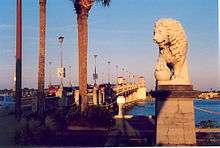 Bridge of Lions |
November 19, 1982 (#82001040) |
King St. 29°53′33″N 81°18′27″W |
St. Augustine | |
| 5 | Castillo de San Marcos National Monument | 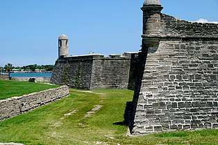 Castillo de San Marcos National Monument |
October 15, 1966 (#66000062) |
1 Castillo Dr. 29°53′52″N 81°18′41″W |
St. Augustine | A National Monument |
| 6 | Cathedral of St. Augustine | 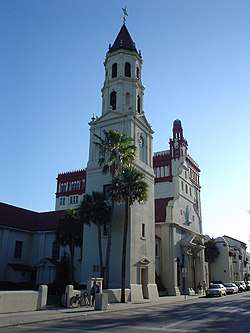 Cathedral of St. Augustine |
April 15, 1970 (#70000844) |
Cathedral St. between Charlotte and St. George Sts. 29°53′34″N 81°18′45″W |
St. Augustine | |
| 7 | City of St. Augustine Miniature Golf Course | 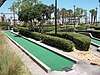 City of St. Augustine Miniature Golf Course |
November 19, 2014 (#14000953) |
111 Avenida Menendez 29°53′30″N 81°18′37″W |
St. Augustine | |
| 8 | Constitution Obelisk | 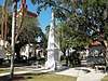 Constitution Obelisk |
December 18, 2012 (#12000364) |
Plaza de la Constitution 29°53′33″N 81°18′45″W |
St. Augustine | |
| 9 | Dixie Highway-Hastings, Espanola and Bunnell Road |  Dixie Highway-Hastings, Espanola and Bunnell Road |
April 20, 2005 (#05000311) |
Roughly Espanola in Flagler County to County Route 204 in St. Johns County 29°34′49″N 81°20′35″W |
Espanola | Extends into Flagler County |
| 10 | Fish Island Site | June 13, 1972 (#72001460) |
Address Restricted |
St. Augustine | ||
| 11 | Fort Matanzas National Monument | 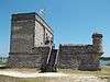 Fort Matanzas National Monument |
October 15, 1966 (#66000098) |
15 miles south of St. Augustine 29°42′55″N 81°14′21″W |
St. Augustine | A National Monument |
| 12 | Fort Matanzas National Monument Headquarters and Visitor Center | 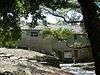 Fort Matanzas National Monument Headquarters and Visitor Center |
December 31, 2008 (#08001245) |
8635 State Road A1A, South 29°42′42″N 81°14′07″W |
St. Augustine | |
| 13 | Fountain of Youth Archeological Park | 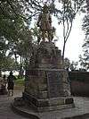 Fountain of Youth Archeological Park |
June 13, 2016 (#16000361) |
11 Magnolia Ave. 29°54′26″N 81°18′58″W |
St. Augustine | |
| 14 | Fullerwood Park Residential Historic District | 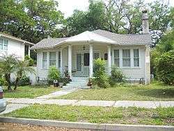 Fullerwood Park Residential Historic District |
September 24, 2010 (#10000767) |
Roughly bounded by San Marcos, Macaris, Hildreth & Hospital Creek 29°54′59″N 81°19′14″W |
St. Augustine | |
| 15 | Gonzalez-Alvarez House | 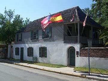 Gonzalez-Alvarez House |
April 15, 1970 (#70000845) |
14 St. Francis St. 29°53′17″N 81°18′36″W |
St. Augustine | |
| 16 | Government House | 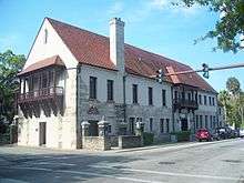 Government House |
January 7, 2014 (#13000812) |
48 King St. 29°53′32″N 81°18′47″W |
St. Augustine | part of the Florida's New Deal Resources MPS |
| 17 | Grace United Methodist Church |  Grace United Methodist Church |
November 29, 1979 (#79003132) |
8 Carrera St. 29°53′42″N 81°18′54″W |
St. Augustine | |
| 18 | Hastings Community Center | 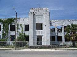 Hastings Community Center |
February 21, 2007 (#07000057) |
401 N. Main St. 29°43′06″N 81°30′31″W |
Hastings | |
| 19 | Hastings High School | 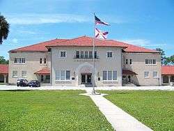 Hastings High School |
June 14, 2006 (#06000502) |
6195 S. Main St. 29°42′40″N 81°30′18″W |
Hastings | |
| 20 | Hotel Ponce De Leon | 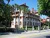 Hotel Ponce De Leon |
May 6, 1975 (#75002067) |
74 King St., bounded by King, Valencia, Sevilla, and Cordova Sts. 29°53′32″N 81°18′54″W |
St. Augustine | |
| 21 | Lincolnville Historic District | 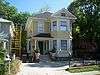 Lincolnville Historic District |
November 29, 1991 (#91000979) |
Bounded by Cedar, Riberia, Cerro, and Washington Sts. and DeSoto Pl. 29°53′05″N 81°18′52″W |
St. Augustine | |
| 22 | Lindsley House | 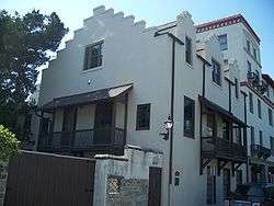 Lindsley House |
September 10, 1971 (#71001014) |
214 St. George St. 29°53′30″N 81°18′48″W |
St. Augustine | |
| 23 | Llambias House | 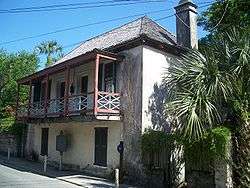 Llambias House |
April 15, 1970 (#70000846) |
31 St. Francis St. 29°53′15″N 81°18′39″W |
St. Augustine | |
| 24 | Father Francisco Lopez Statue | 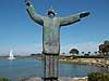 Father Francisco Lopez Statue |
June 5, 2012 (#12000317) |
27 Ocean Avenue 29°54′15″N 81°19′00″W |
St. Augustine | |
| 25 | Xavier Lopez House | 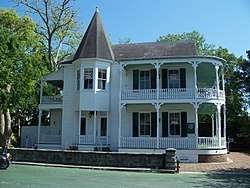 Xavier Lopez House |
July 1, 1993 (#93000579) |
93½ King St. 29°53′29″N 81°18′58″W |
St. Augustine | |
| 26 | Markland | 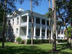 Markland |
December 6, 1978 (#78003080) |
102 King St. 29°53′31″N 81°19′02″W |
St. Augustine | |
| 27 | Menendez Encampment Site | September 27, 2016 (#16000295) |
21 Magnolia Ave. 29°54′27″N 81°18′59″W |
St. Augustine | On the grounds of the Fountain of Youth Archaeological Park. | |
| 28 | Arthur Milam House | .jpg) Arthur Milam House |
June 7, 2016 (#16000323) |
1033 Ponte Vedra Blvd. 30°10′25″N 81°21′37″W |
Ponte Vedra Beach | |
| 29 | Model Land Company Historic District |  Model Land Company Historic District |
August 2, 1983 (#83001439) |
Roughly bounded by Ponce de Leon Boulevard and King, Cordova, and Orange Sts. 29°53′39″N 81°19′06″W |
St. Augustine | |
| 30 | Moultrie Church | 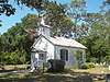 Moultrie Church |
September 8, 2014 (#14000553) |
480 Wildwood Dr. 29°48′55″N 81°20′10″W |
St. Augustine | |
| 31 | Nelmar Terrace Historic District | 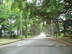 Nelmar Terrace Historic District |
March 28, 2011 (#11000145) |
Alfred St., San Carlos Ave., San Marcos Ave., Hospital Creek 29°54′39″N 81°19′06″W |
St. Augustine | |
| 32 | North City Historic District | 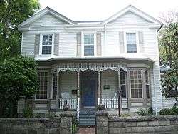 North City Historic District |
October 1, 2009 (#09000778) |
Roughly bounded by Castillo Drive, San Marcos Avenue, Old Mission Avenue, and U.S. Route 1 29°54′07″N 81°19′05″W |
St. Augustine | |
| 33 | O'Reilly House |  O'Reilly House |
October 15, 1974 (#74002192) |
131 Aviles St. 29°53′24″N 81°18′41″W |
St. Augustine | |
| 34 | Old St. Johns County Jail | 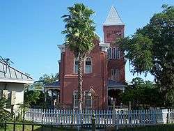 Old St. Johns County Jail |
August 27, 1987 (#87001427) |
167 San Marco Ave. 29°54′28″N 81°19′08″W |
St. Augustine | |
| 35 | Record Building | 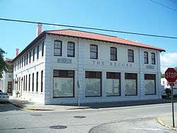 Record Building |
April 26, 2006 (#06000315) |
154 Cordova St. 29°53′20″N 81°18′47″W |
St. Augustine | |
| 36 | Rodriguez-Avero-Sanchez House | 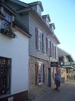 Rodriguez-Avero-Sanchez House |
April 16, 1971 (#71001015) |
52 St. George St. 29°53′46″N 81°18′49″W |
St. Augustine | |
| 37 | St. Augustine Alligator Farm Historic District | 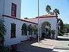 St. Augustine Alligator Farm Historic District |
September 10, 1992 (#92001232) |
999 Anastasia Boulevard 29°52′53″N 81°17′18″W |
St. Augustine | |
| 38 | St. Augustine Civic Center |  St. Augustine Civic Center |
April 21, 2005 (#05000316) |
10 Castillo Dr. 29°53′55″N 81°18′53″W |
St. Augustine | Part of the Florida's New Deal Resources MPS |
| 39 | St. Augustine Lighthouse and Keeper's Quarters | 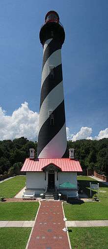 St. Augustine Lighthouse and Keeper's Quarters |
March 19, 1981 (#81000668) |
Old Beach Rd. 29°53′08″N 81°17′19″W |
St. Augustine | |
| 40 | St. Augustine National Cemetery | 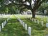 St. Augustine National Cemetery |
May 16, 2016 (#16000271) |
104 Marine St. 29°53′11″N 81°18′34″W |
St. Augustine | |
| 41 | St. Augustine Town Plan Historic District | 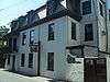 St. Augustine Town Plan Historic District |
April 15, 1970 (#70000847) |
Roughly bounded by Grove Ave., the Matanzas River, and South and Washington Sts. 29°53′36″N 81°18′38″W |
St. Augustine | |
| 42 | St. Augustine Water Works | 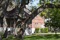 St. Augustine Water Works |
February 5, 2014 (#13001134) |
184 San Marco Ave. 29°54′38″N 81°19′14″W |
St. Augustine | |
| 43 | Sanchez Homestead | 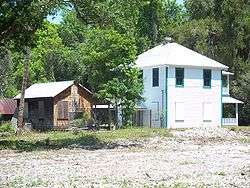 Sanchez Homestead |
October 12, 2001 (#01001083) |
7270 Old State Road 207 29°44′16″N 81°28′43″W |
Elkton | |
| 44 | Sanchez Powder House Site | 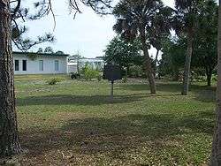 Sanchez Powder House Site |
April 14, 1972 (#72001461) |
Marine St. 29°52′53″N 81°18′29″W |
St. Augustine | |
| 45 | Second Fort Mose Site | 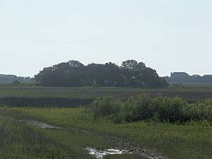 Second Fort Mose Site |
October 12, 1994 (#94001645) |
Address Restricted 29°55′40″N 81°19′31″W |
St. Augustine | First free African settlement in the United States[6] |
| 46 | Shell Bluff Landing (8SJ32) | April 25, 1991 (#91000455) |
Address Restricted |
Ponte Vedra Beach | ||
| 47 | Solla-Carcaba Cigar Factory | 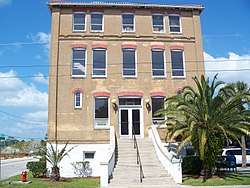 Solla-Carcaba Cigar Factory |
May 6, 1993 (#93000374) |
88 Riberia St. 29°53′27″N 81°19′08″W |
St. Augustine | |
| 48 | Spanish Coquina Quarries | 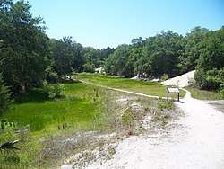 Spanish Coquina Quarries |
February 23, 1972 (#72001462) |
State Road A1A in Anastasia State Park 29°52′14″N 81°16′31″W |
St. Augustine Beach | |
| 49 | Stanbury Cottage | 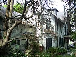 Stanbury Cottage |
October 8, 2008 (#08000966) |
232 St. George Street 29°53′27″N 81°18′44″W |
St. Augustine | |
| 50 | Storm Wreck | October 2, 2017 (#100001671) |
Address Restricted |
St. Augustine vicinity | ||
| 51 | Villa Zorayda |  Villa Zorayda |
September 23, 1993 (#93001002) |
83 King St. 29°53′27″N 81°18′53″W |
St. Augustine | |
| 52 | Horace Walker House | 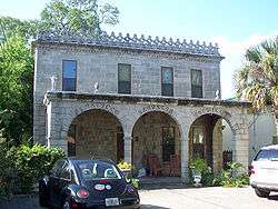 Horace Walker House |
January 30, 1998 (#98000026) |
33 Old Mission Ave. 29°54′12″N 81°19′14″W |
St. Augustine | |
| 53 | Ximenez-Fatio House | 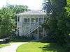 Ximenez-Fatio House |
July 25, 1973 (#73002135) |
20 Aviles St. 29°53′28″N 81°18′41″W |
St. Augustine |
See also
| Wikimedia Commons has media related to National Register of Historic Places in St. Johns County, Florida. |
References
- The latitude and longitude information provided in this table was derived originally from the National Register Information System, which has been found to be fairly accurate for about 99% of listings. Some locations in this table may have been corrected to current GPS standards.
- "National Register of Historic Places: Weekly List Actions". National Park Service, United States Department of the Interior. Retrieved on June 19, 2020.
- Numbers represent an ordering by significant words. Various colorings, defined here, differentiate National Historic Landmarks and historic districts from other NRHP buildings, structures, sites or objects.
- "National Register Information System". National Register of Historic Places. National Park Service. March 13, 2009.
- The eight-digit number below each date is the number assigned to each location in the National Register Information System database, which can be viewed by clicking the number.
- Griffin, Justine (January 30, 2011). "Locals hope to keep parks". St. Augustine Record. St. Augustine, Florida. Retrieved January 30, 2011.
Municipalities and communities of St. Johns County, Florida, United States | ||
|---|---|---|
| Cities | | |
| Town | ||
| CDPs | ||
| Other unincorporated communities | ||
| Footnotes | ‡This populated place also has portions in an adjacent county or counties | |
This article is issued from Wikipedia. The text is licensed under Creative Commons - Attribution - Sharealike. Additional terms may apply for the media files.