National Register of Historic Places listings in Glades County, Florida
This is a list of the National Register of Historic Places listings in Glades County, Florida.
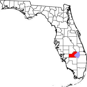
Location of Glades County in Florida
This is intended to be a complete list of the properties and districts on the National Register of Historic Places in Glades County, Florida, United States. The locations of National Register properties and districts for which the latitude and longitude coordinates are included below, may be seen in a map.[1]
There are 3 properties and districts listed on the National Register in the county.
- This National Park Service list is complete through NPS recent listings posted June 19, 2020.[2]
| Alachua - Baker - Bay - Bradford - Brevard - Broward - Calhoun - Charlotte - Citrus - Clay - Collier - Columbia - DeSoto - Dixie - Duval - Escambia - Flagler - Franklin - Gadsden - Gilchrist - Glades - Gulf - Hamilton - Hardee - Hendry - Hernando - Highlands - Hillsborough (Tampa) - Holmes - Indian River - Jackson - Jefferson - Lafayette - Lake - Lee - Leon - Levy - Liberty - Madison - Manatee - Marion - Martin - Miami-Dade (Miami) - Monroe - Nassau - Okaloosa - Okeechobee - Orange - Osceola - Palm Beach - Pasco - Pinellas - Polk - Putnam - St. Johns - St. Lucie - Santa Rosa - Sarasota - Seminole - Sumter - Suwannee - Taylor - Union - Volusia - Wakulla - Walton - Washington |
Current listings
| [3] | Name on the Register[4] | Image | Date listed[5] | Location | City or town | Description |
|---|---|---|---|---|---|---|
| 1 | Moore Haven Downtown Historic District |  Moore Haven Downtown Historic District |
October 12, 1995 (#95001166) |
3-99 Avenue J., 100 First Street, and Lone Cypress Park 26°49′57″N 81°05′26″W |
Moore Haven | |
| 2 | Moore Haven Residential Historic District |  Moore Haven Residential Historic District |
June 26, 1998 (#98000714) |
Roughly bounded by Avenue J to Avenue M and 1st to 5th Streets 26°49′51″N 81°05′41″W |
Moore Haven | |
| 3 | Red Barn |  Red Barn |
December 24, 2008 (#08001243) |
3 miles west of County Road 721 on County Road 721A 27°04′25″N 81°06′50″W |
Okeechobee |
See also
| Wikimedia Commons has media related to National Register of Historic Places in Glades County, Florida. |
References
- The latitude and longitude information provided in this table was derived originally from the National Register Information System, which has been found to be fairly accurate for about 99% of listings. Some locations in this table may have been corrected to current GPS standards.
- "National Register of Historic Places: Weekly List Actions". National Park Service, United States Department of the Interior. Retrieved on June 19, 2020.
- Numbers represent an ordering by significant words. Various colorings, defined here, differentiate National Historic Landmarks and historic districts from other NRHP buildings, structures, sites or objects.
- "National Register Information System". National Register of Historic Places. National Park Service. March 13, 2009.
- The eight-digit number below each date is the number assigned to each location in the National Register Information System database, which can be viewed by clicking the number.
Municipalities and communities of Glades County, Florida, United States | ||
|---|---|---|
| City | | |
| CDP | ||
| Indian reservation | ||
| Unincorporated communities |
| |
This article is issued from Wikipedia. The text is licensed under Creative Commons - Attribution - Sharealike. Additional terms may apply for the media files.