National Register of Historic Places listings in Duval County, Florida
This is a list of the National Register of Historic Places listings in Duval County, Florida.
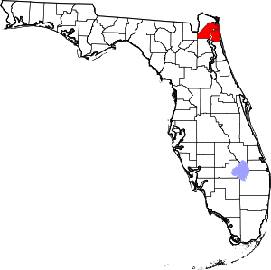
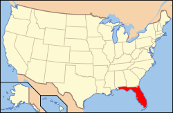
Location of Duval County in Florida
This is intended to be a complete list of the properties and districts on the National Register of Historic Places in Duval County, Florida, United States. The locations of National Register properties and districts for which the latitude and longitude coordinates are included below, may be seen in a map.[1]
There are 101 properties and districts listed on the National Register in the county, including 2 National Historic Landmark.
- This National Park Service list is complete through NPS recent listings posted June 19, 2020.[2]
| Alachua - Baker - Bay - Bradford - Brevard - Broward - Calhoun - Charlotte - Citrus - Clay - Collier - Columbia - DeSoto - Dixie - Duval - Escambia - Flagler - Franklin - Gadsden - Gilchrist - Glades - Gulf - Hamilton - Hardee - Hendry - Hernando - Highlands - Hillsborough (Tampa) - Holmes - Indian River - Jackson - Jefferson - Lafayette - Lake - Lee - Leon - Levy - Liberty - Madison - Manatee - Marion - Martin - Miami-Dade (Miami) - Monroe - Nassau - Okaloosa - Okeechobee - Orange - Osceola - Palm Beach - Pasco - Pinellas - Polk - Putnam - St. Johns - St. Lucie - Santa Rosa - Sarasota - Seminole - Sumter - Suwannee - Taylor - Union - Volusia - Wakulla - Walton - Washington |
Current listings
| [3] | Name on the Register[4] | Image | Date listed[5] | Location | City or town | Description |
|---|---|---|---|---|---|---|
| 1 | 310 West Church Street Apartments |  310 West Church Street Apartments |
April 7, 1983 (#83001421) |
420 North Julia Street 30°19′50″N 81°39′41″W |
Jacksonville | Formerly the Ambassador Hotel |
| 2 | American Red Cross Volunteer Life Saving Corps Station |  American Red Cross Volunteer Life Saving Corps Station |
May 5, 2014 (#14000187) |
2 Ocean Front North 30°17′22″N 81°23′23″W |
Jacksonville Beach | |
| 3 | Henry C. Arpen House | August 26, 2019 (#100004347) |
3318 O'Connor Road 30°08′50″N 81°37′07″W |
Jacksonville | ||
| 4 | Atlantic Coast Line Railroad Locomotive No. 1504 |  Atlantic Coast Line Railroad Locomotive No. 1504 |
January 23, 2018 (#100001388) |
1000 West Bay St. 30°19′43″N 81°40′17″W |
Jacksonville | |
| 5 | Atlantic National Bank Annex |  Atlantic National Bank Annex |
November 7, 1997 (#97001328) |
118 West Adams Street 30°19′40″N 81°39′36″W |
Jacksonville | Part of the Downtown Jacksonville Multiple Property Submission |
| 6 | Avondale Historic District | 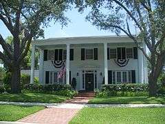 Avondale Historic District |
July 6, 1989 (#89000494) |
Roughly bounded by Roosevelt Boulevard, Belvedere Avenue, Seminole Road, the St. Johns River, and Talbot Avenue 30°18′11″N 81°42′19″W |
Jacksonville | |
| 7 | Bethel Baptist Institutional Church |  Bethel Baptist Institutional Church |
April 6, 1978 (#78000938) |
1058 Hogan Street 30°20′09″N 81°39′30″W |
Jacksonville | |
| 8 | Brewster Hospital |  Brewster Hospital |
May 13, 1976 (#76000588) |
915 West Monroe Street 30°19′52″N 81°40′08″W |
Jacksonville | |
| 9 | Napoleon Bonaparte Broward House | 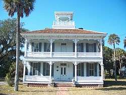 Napoleon Bonaparte Broward House |
December 27, 1972 (#72000308) |
9953 Hecksher Drive 30°24′09″N 81°25′58″W |
Jacksonville | |
| 10 | Buckman and Ulmer Building |  Buckman and Ulmer Building |
December 30, 1992 (#92001694) |
29-33 West Monroe Street 30°19′43″N 81°39′10″W |
Jacksonville | Part of the Downtown Jacksonville Multiple Property Submission |
| 11 | Carling Hotel |  Carling Hotel |
February 28, 1991 (#91000225) |
33 West Adams Street 30°19′42″N 81°39′29″W |
Jacksonville | |
| 12 | Casa Marina Hotel |  Casa Marina Hotel |
September 2, 1993 (#93000893) |
12 Sixth Avenue, North 30°17′40″N 81°23′26″W |
Jacksonville Beach | |
| 13 | Catherine Street Fire Station |  Catherine Street Fire Station |
June 13, 1972 (#72000309) |
14 Catherine Street 30°19′30″N 81°39′02″W |
Jacksonville | |
| 14 | Centennial Hall at Edward Waters College | 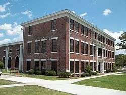 Centennial Hall at Edward Waters College |
May 4, 1976 (#76000589) |
1715 Kings Road[6] 30°20′40″N 81°41′04″W |
Jacksonville | |
| 15 | Church of the Immaculate Conception | 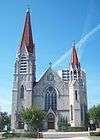 Church of the Immaculate Conception |
December 30, 1992 (#92001695) |
121 East Duval Street 30°19′44″N 81°39′19″W |
Jacksonville | Part of the Downtown Jacksonville Multiple Property Submission |
| 16 | Cummer Gardens |  Cummer Gardens |
January 25, 2010 (#09000345) |
829 Riverside Ave. 30°18′54″N 81°40′37″W |
Jacksonville | |
| 17 | Downtown Jacksonville Historic District | 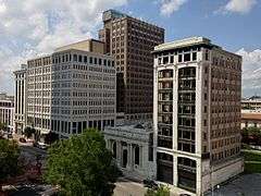 Downtown Jacksonville Historic District |
May 2, 2016 (#16000212) |
Roughly bounded by North Pearl, Beaver, and North Catherine Streets, and Independent/Courthouse Drives 30°19′45″N 81°39′26″W |
Jacksonville | |
| 18 | Durkee Gardens Historic District | March 16, 2020 (#100005088) |
Bound by Myrtle Ave., 13th St. West, Payne Ave, Wilcox St. and 8th St. West 30°20′56″N 81°40′23″W |
Jacksonville | ||
| 19 | Joseph H. Durkee Athletic Field |  Joseph H. Durkee Athletic Field |
July 11, 2013 (#13000484) |
1701 Myrtle Avenue 30°20′47″N 81°40′30″W |
Jacksonville | |
| 20 | Dyal-Upchurch Building | 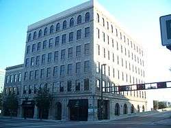 Dyal-Upchurch Building |
April 17, 1980 (#80000947) |
4 East Bay Street 30°19′33″N 81°39′27″W |
Jacksonville | |
| 21 | El Modelo Block |  El Modelo Block |
October 16, 1980 (#80000948) |
513 West Bay Street 30°19′38″N 81°39′53″W |
Jacksonville | |
| 22 | Elks Club Building |  Elks Club Building |
March 9, 2000 (#00000151) |
201-213 North Laura Street 30°19′41″N 81°39′32″W |
Jacksonville | Part of the Downtown Jacksonville Multiple Property Submission |
| 23 | Epping Forest |  Epping Forest |
May 9, 1973 (#73000576) |
Christopher Point, off San Jose Boulevard 30°14′54″N 81°38′26″W |
Jacksonville | |
| 24 | Evergreen Cemetery |  Evergreen Cemetery |
April 8, 2011 (#11000157) |
4535 N Main St 30°22′01″N 81°39′03″W |
Jacksonville | |
| 25 | Florida Baptist Building |  Florida Baptist Building |
January 12, 1984 (#84000844) |
218 West Church Street 30°19′49″N 81°39′37″W |
Jacksonville | |
| 26 | Florida Theater | 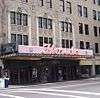 Florida Theater |
November 4, 1982 (#82001034) |
128-134 East Forsyth Street 30°19′35″N 81°39′20″W |
Jacksonville | |
| 27 | Fort Caroline National Memorial |  Fort Caroline National Memorial |
October 15, 1966 (#66000061) |
10 miles east of downtown Jacksonville 30°23′13″N 81°30′02″W |
Jacksonville | |
| 28 | Grand Site |  Grand Site |
June 20, 1975 (#75000551) |
Address Restricted |
Jacksonville | |
| 29 | Groover-Stewart Drug Company Building | 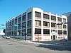 Groover-Stewart Drug Company Building |
December 30, 1992 (#92001696) |
25 North Market Street 30°19′33″N 81°38′08″W |
Jacksonville | Part of the Downtown Jacksonville Multiple Property Submission |
| 30 | House at 3325 Via de la Reina |  House at 3325 Via de la Reina |
April 10, 1985 (#85000739) |
3325 Via de la Reina 30°14′42″N 81°37′41″W |
Jacksonville | Part of the San Jose Estates TR |
| 31 | House at 3335 Via de la Reina |  House at 3335 Via de la Reina |
April 10, 1985 (#85000740) |
3335 Via de la Reina 30°14′42″N 81°37′40″W |
Jacksonville | Part of the San Jose Estates TR |
| 32 | House at 3500 Via de la Reina |  House at 3500 Via de la Reina |
April 10, 1985 (#85000741) |
3500 Via de la Reina 30°14′39″N 81°37′32″W |
Jacksonville | Part of the San Jose Estates TR |
| 33 | House at 3609 Via de la Reina |  House at 3609 Via de la Reina |
April 10, 1985 (#85000742) |
3609 Via de la Reina 30°14′39″N 81°37′28″W |
Jacksonville | Part of the San Jose Estates TR |
| 34 | House at 3685 Via de la Reina |  House at 3685 Via de la Reina |
April 10, 1985 (#85000743) |
3685 Via de la Reina 30°14′34″N 81°37′14″W |
Jacksonville | Part of the San Jose Estates TR |
| 35 | House at 3703 Via de la Reina |  House at 3703 Via de la Reina |
April 10, 1985 (#85000744) |
3703 Via de la Reina 30°14′32″N 81°37′06″W |
Jacksonville | Part of the San Jose Estates TR |
| 36 | House at 3764 Ponce de Leon Avenue |  House at 3764 Ponce de Leon Avenue |
April 10, 1985 (#85000745) |
3764 Ponce de Leon Avenue 30°14′38″N 81°37′13″W |
Jacksonville | Part of the San Jose Estates TR |
| 37 | House at 7144 Madrid Avenue |  House at 7144 Madrid Avenue |
April 10, 1985 (#85000746) |
7144 Madrid Avenue 30°14′53″N 81°37′54″W |
Jacksonville | Part of the San Jose Estates TR |
| 38 | House at 7207 Ventura Avenue |  House at 7207 Ventura Avenue |
April 10, 1985 (#85000747) |
7207 Ventura Avenue 30°14′48″N 81°37′36″W |
Jacksonville | Part of the San Jose Estates TR |
| 39 | House at 7217 Ventura Avenue |  House at 7217 Ventura Avenue |
April 10, 1985 (#85000748) |
7217 Ventura Avenue 30°14′46″N 81°37′36″W |
Jacksonville | Part of the San Jose Estates TR |
| 40 | House at 7227 San Pedro |  House at 7227 San Pedro |
April 10, 1985 (#85000749) |
7227 San Pedro Road 30°14′41″N 81°37′57″W |
Jacksonville | Part of the San Jose Estates TR |
| 41 | House at 7245 San Jose Boulevard |  House at 7245 San Jose Boulevard |
April 10, 1985 (#85000750) |
7245 San Jose Boulevard 30°14′45″N 81°37′48″W |
Jacksonville | Part of the San Jose Estates TR |
| 42 | House at 7246 San Carlos | 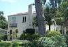 House at 7246 San Carlos |
April 10, 1985 (#85000751) |
7246 San Carlos 30°14′42″N 81°37′56″W |
Jacksonville | Part of the San Jose Estates TR |
| 43 | House at 7246 St. Augustine Road |  House at 7246 St. Augustine Road |
April 10, 1985 (#85000752) |
7246 St. Augustine Road 30°14′45″N 81°37′34″W |
Jacksonville | Part of the San Jose Estates TR |
| 44 | House at 7249 San Pedro |  House at 7249 San Pedro |
April 10, 1985 (#85000753) |
7249 San Pedro Road 30°14′40″N 81°37′56″W |
Jacksonville | Part of the San Jose Estates TR |
| 45 | House at 7288 San Jose Boulevard |  House at 7288 San Jose Boulevard |
April 10, 1985 (#85000754) |
7288 San Jose Boulevard 30°14′42″N 81°37′47″W |
Jacksonville | Part of the San Jose Estates TR |
| 46 | House at 7306 St. Augustine Road |  House at 7306 St. Augustine Road |
April 10, 1985 (#85000755) |
7306 St. Augustine Road 30°14′41″N 81°37′34″W |
Jacksonville | Part of the San Jose Estates TR |
| 47 | House at 7317 San Jose Boulevard | 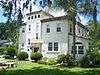 House at 7317 San Jose Boulevard |
April 10, 1985 (#85000756) |
7317 San Jose Boulevard 30°14′43″N 81°37′44″W |
Jacksonville | Part of the San Jose Estates TR |
| 48 | House at 7330 Ventura Avenue |  House at 7330 Ventura Avenue |
April 10, 1985 (#85000757) |
7330 Ventura Avenue 30°14′42″N 81°37′40″W |
Jacksonville | Part of the San Jose Estates TR |
| 49 | House at 7356 San Jose Boulevard |  House at 7356 San Jose Boulevard |
April 10, 1985 (#85000758) |
7356 San Jose Boulevard 30°14′40″N 81°37′43″W |
Jacksonville | Part of the San Jose Estates TR |
| 50 | House at 7400 San Jose Boulevard |  House at 7400 San Jose Boulevard |
April 10, 1985 (#85000759) |
7400 San Jose Boulevard 30°14′38″N 81°37′44″W |
Jacksonville | Part of the San Jose Estates TR |
| 51 | Hutchinson-Suddath Building |  Hutchinson-Suddath Building |
October 3, 2007 (#07001029) |
315-319 East Bay Street 30°19′31″N 81°39′15″W |
Jacksonville | Part of the Downtown Jacksonville Multiple Property Submission |
| 52 | Jacksonville Terminal Complex |  Jacksonville Terminal Complex |
October 22, 1976 (#76000590) |
1000 West Bay Street 30°19′40″N 81°40′17″W |
Jacksonville | Now the Prime F. Osborn III Convention Center |
| 53 | Kingsley Plantation | Kingsley Plantation |
September 29, 1970 (#70000182) |
Northern tip of Fort George Island at Fort George Inlet 30°26′18″N 81°26′17″W |
Jacksonville | |
| 54 | Henry John Klutho House | 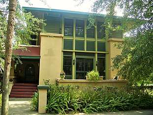 Henry John Klutho House |
December 19, 1978 (#78000939) |
28-30 West 9th Street 30°20′48″N 81°39′18″W |
Jacksonville | |
| 55 | W. A. Knight Building |  W. A. Knight Building |
March 15, 2005 (#05000139) |
113 West Adams Street 30°19′42″N 81°39′33″W |
Jacksonville | Also known as the Greenleaf & Crosby Annex and the Peninsular Building. Part of the Downtown Jacksonville Multiple Property Submission |
| 56 | Lane-Towers House |  Lane-Towers House |
November 10, 1982 (#82001035) |
3730 Richmond Street 30°17′29″N 81°42′17″W |
Jacksonville | |
| 57 | Lewis Mausoleum |  Lewis Mausoleum |
October 24, 1997 (#97001225) |
Memorial Cemetery at the junction of Edgewood Avenue and Moncreif Road 30°22′52″N 81°41′47″W |
Jacksonville | |
| 58 | Little Theatre |  Little Theatre |
July 12, 1991 (#91000895) |
2032 San Marco Boulevard 30°18′11″N 81°39′10″W |
Jacksonville | |
| 59 | Lynch Building | 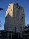 Lynch Building |
December 23, 2003 (#03001310) |
11 Forsyth Street 30°19′37″N 81°39′27″W |
Jacksonville | Part of the Downtown Jacksonville Multiple Property Submission |
| 60 | Mandarin Store and Post Office |  Mandarin Store and Post Office |
October 1, 2001 (#01001056) |
12471 Mandarin Road 30°09′39″N 81°39′35″W |
Jacksonville | |
| 61 | Maple Leaf (Shipwreck Site) |  Maple Leaf (Shipwreck Site) |
October 12, 1994 (#94001650) |
In the middle of the St. Johns River, 12 miles (19 km) south of downtown Jacksonville[7] 30°09′30″N 81°40′48″W |
Jacksonville | |
| 62 | Marabanong |  Marabanong |
December 11, 2013 (#13000899) |
4747 River Point Rd. 30°18′50″N 81°37′04″W |
Jacksonville | |
| 63 | Masonic Temple | 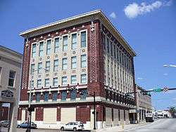 Masonic Temple |
September 22, 1980 (#80000949) |
410 Broad Street 30°19′51″N 81°39′52″W |
Jacksonville | |
| 64 | Memorial Cemetery |  Memorial Cemetery |
February 5, 2020 (#100004973) |
Moncrief Rd. and Edgewood Ave. West 30°22′52″N 81°41′47″W |
Jacksonville | Memorial Cemetery (Jacksonville, Florida) |
| 65 | Memorial Park |  Memorial Park |
October 25, 2017 (#100001389) |
Memorial Park Dr. 30°18′38″N 81°40′47″W |
Jacksonville | |
| 66 | Mission of San Juan del Puerto Archeological Site |  Mission of San Juan del Puerto Archeological Site |
March 25, 1986 (#86000595) |
Address Restricted |
Jacksonville | |
| 67 | Morocco Temple |  Morocco Temple |
November 29, 1979 (#79000668) |
219 Newnan St. 30°19′40″N 81°39′17″W |
Jacksonville | |
| 68 | Mt. Calvary Baptist Church | March 16, 2020 (#100005087) |
301 Spruce St. 30°19′30″N 81°40′34″W |
Jacksonville | ||
| 69 | Mount Zion AME Church | 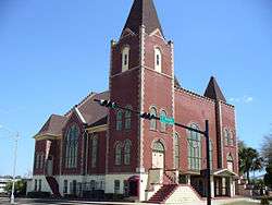 Mount Zion AME Church |
December 30, 1992 (#92001697) |
201 East Beaver Street 30°19′51″N 81°38′09″W |
Jacksonville | Part of the Downtown Jacksonville Multiple Property Submission |
| 70 | Norman Film Studios |  Norman Film Studios |
December 29, 2014 (#14001084) |
6337 Arlington Rd. 30°20′02″N 81°35′37″W |
Jacksonville | Designated a National Historic Landmark October 31, 2016. |
| 71 | Old Jacksonville Free Public Library |  Old Jacksonville Free Public Library |
January 22, 1987 (#86003679) |
101 East Adams Street 30°19′39″N 81°39′22″W |
Jacksonville | Now the Bedell Building |
| 72 | Old Ortega Historic District |  Old Ortega Historic District |
July 14, 2004 (#04000682) |
Bounded by Roosevelt Boulevard, Verona Avenue, and the St. Johns and Ortega Rivers 30°16′27″N 81°42′18″W |
Jacksonville | |
| 73 | Old St. Luke's Hospital |  Old St. Luke's Hospital |
July 24, 1972 (#72000310) |
314 North Palmetto Street 30°19′33″N 81°38′49″W |
Jacksonville | |
| 74 | Plaza Hotel |  Plaza Hotel |
December 30, 1992 (#92001698) |
353 East Forsyth Street 30°19′33″N 81°38′13″W |
Jacksonville | Part of the Downtown Jacksonville Multiple Property Submission |
| 75 | Thomas V. Porter House |  Thomas V. Porter House |
May 13, 1976 (#76000592) |
510 Julia Street 30°19′52″N 81°39′39″W |
Jacksonville | |
| 76 | Red Bank Plantation | 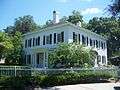 Red Bank Plantation |
October 18, 1972 (#72000311) |
1230 Greenridge Road 30°17′02″N 81°39′09″W |
Jacksonville | |
| 77 | Ribault Inn Club |  Ribault Inn Club |
May 11, 2000 (#00000470) |
Ft. George Road 30°25′41″N 81°25′28″W |
Jacksonville | |
| 78 | Riverside Baptist Church |  Riverside Baptist Church |
September 22, 1972 (#72000312) |
2650 Park Street 30°18′37″N 81°41′35″W |
Jacksonville | |
| 79 | Riverside Historic District |  Riverside Historic District |
March 22, 1985 (#85000689) |
Roughly bounded by the former Seaboard Coast Line railroad line, Riverside and Memorial Parks, the St. Johns River, and Seminole 30°18′39″N 81°41′32″W |
Jacksonville | |
| 80 | St. Andrew's Episcopal Church | 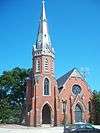 St. Andrew's Episcopal Church |
May 4, 1976 (#76000593) |
317 Florida Avenue 30°19′32″N 81°38′37″W |
Jacksonville | |
| 81 | St. George Episcopal Church |  St. George Episcopal Church |
August 9, 2002 (#02000839) |
10560 Ft. George Road, E. 30°24′48″N 81°25′48″W |
Jacksonville | Part of the Florida's Carpenter Gothic Churches MPS |
| 82 | St. James Building | 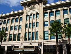 St. James Building |
May 3, 1976 (#76000594) |
117 West Duval Street 30°19′48″N 81°39′34″W |
Jacksonville | |
| 83 | St. Johns Light |  St. Johns Light |
March 20, 2018 (#100002224) |
500 ft. NE of jct. of Baltimore St. & Naval Station St. 7 30°23′10″N 81°23′53″W |
Jacksonville | In Naval Station Mayport |
| 84 | St. John's Lighthouse |  St. John's Lighthouse |
June 3, 1976 (#76002237) |
U.S. Naval Station 30°23′36″N 81°25′35″W |
Naval Station Mayport | |
| 85 | John S. Sammis House |  John S. Sammis House |
July 10, 1979 (#79000669) |
207 Noble Circle West 30°19′19″N 81°36′44″W |
Jacksonville | |
| 86 | San Jose Administration Building |  San Jose Administration Building |
April 10, 1985 (#85000760) |
7423 San Jose Boulevard 30°14′37″N 81°37′35″W |
Jacksonville | Part of the San Jose Estates TR |
| 87 | San Jose Country Club |  San Jose Country Club |
April 10, 1985 (#85000761) |
7529 San Jose Boulevard 30°14′30″N 81°37′29″W |
Jacksonville | Part of the San Jose Estates TR |
| 88 | San Jose Estates Gatehouse |  San Jose Estates Gatehouse |
December 20, 1988 (#88002808) |
1873 Christopher Point Road, North 30°15′17″N 81°38′33″W |
Jacksonville | Part of the San Jose Estates TR |
| 89 | San Jose Hotel |  San Jose Hotel |
April 10, 1985 (#85000762) |
7400 San Jose Boulevard 30°14′30″N 81°37′47″W |
Jacksonville | Part of the San Jose Estates TR |
| 90 | Snyder Memorial Methodist Episcopal Church |  Snyder Memorial Methodist Episcopal Church |
March 13, 2013 (#13000065) |
226 N. Laura St. 30°19′43″N 81°39′32″W |
Jacksonville | |
| 91 | South Atlantic Investment Corporation Building |  South Atlantic Investment Corporation Building |
December 30, 1992 (#92001699) |
35-39 West Monroe Street 30°19′43″N 81°39′08″W |
Jacksonville | Part of the Downtown Jacksonville Multiple Property Submission |
| 92 | South Jacksonville Grammar School |  South Jacksonville Grammar School |
April 15, 2004 (#04000278) |
1450 Flagler Avenue 30°18′39″N 81°39′28″W |
Jacksonville | |
| 93 | Springfield Historic District |  Springfield Historic District |
January 22, 1987 (#86003640) |
Roughly bounded by Twelfth, Clark, and First Streets, Hogans Creek, and Boulevard 30°20′35″N 81°39′12″W |
Jacksonville | |
| 94 | Edwin M. Stanton School |  Edwin M. Stanton School |
September 29, 1983 (#83001446) |
521 West Ashley Street 30°19′56″N 81°39′48″W |
Jacksonville | |
| 95 | Timucuan Ecological and Historic Preserve |  Timucuan Ecological and Historic Preserve |
February 16, 1988 (#01000283) |
13165 Mt. Pleasant Road 30°22′08″N 81°29′09″W |
Jacksonville | |
| 96 | Title & Trust Company of Florida Building |  Title & Trust Company of Florida Building |
February 23, 1990 (#90000312) |
200 East Forsyth Street 30°19′34″N 81°39′19″W |
Jacksonville | |
| 97 | Unitarian Universalist Church of Jacksonville |  Unitarian Universalist Church of Jacksonville |
October 15, 2019 (#100004516) |
7405 Arlington Expressway 30°19′40″N 81°34′51″W |
Jacksonville | |
| 98 | Village Store |  Village Store |
September 29, 1988 (#88001700) |
4216, 4212, and 4208 Oxford Avenue and 2906 and 2902 Corinthian Avenue 30°16′19″N 81°42′18″W |
Jacksonville | |
| 99 | Woman's Club of Jacksonville |  Woman's Club of Jacksonville |
November 3, 1992 (#92001505) |
861 Riverside Avenue 30°18′52″N 81°40′37″W |
Jacksonville | Scheduled to be demolished because of termite damage |
| 100 | Yellow Bluff Fort |  Yellow Bluff Fort |
September 29, 1970 (#70000183) |
1 mile south of State Road 105 on New Berlin Road 30°23′58″N 81°33′22″W |
Jacksonville | |
| 101 | Young Men's Hebrew Association |  Young Men's Hebrew Association |
October 29, 1992 (#92001486) |
712 West Duval Street 30°19′50″N 81°40′01″W |
Jacksonville |
Former listing
| [3] | Name on the Register | Image | Date listed | Date removed | Location | City or town | Summary |
|---|---|---|---|---|---|---|---|
| 1 | La Villa Boarding Houses | June 21, 1976 (#76000591) | February 24, 1981 | 830, 832, 836 Houston St. |
Jacksonville |
See also
| Wikimedia Commons has media related to National Register of Historic Places in Duval County, Florida. |
References
- The latitude and longitude information provided in this table was derived originally from the National Register Information System, which has been found to be fairly accurate for about 99% of listings. Some locations in this table may have been corrected to current GPS standards.
- "National Register of Historic Places: Weekly List Actions". National Park Service, United States Department of the Interior. Retrieved on June 19, 2020.
- Numbers represent an ordering by significant words. Various colorings, defined here, differentiate National Historic Landmarks and historic districts from other NRHP buildings, structures, sites or objects.
- "National Register Information System". National Register of Historic Places. National Park Service. March 13, 2009.
- The eight-digit number below each date is the number assigned to each location in the National Register Information System database, which can be viewed by clicking the number.
- City of Jacksonville Community Planning
- Location derived from this National Park Service webpage and from this map from a shipwreck-related website; the NRIS lists the site as "Address restricted"
Municipalities and communities of Duval County, Florida, United States | ||
|---|---|---|
| Cities | | |
| Town | ||
| Neighborhoods of Jacksonville | ||
This article is issued from Wikipedia. The text is licensed under Creative Commons - Attribution - Sharealike. Additional terms may apply for the media files.