Mottingham
Mottingham is a district of south-east London, England, in the London Boroughs of Bromley and Greenwich. It is located south of Eltham, 9 miles (14.5 km) southeast of Charing Cross. It is within the historic county of Kent.
Mottingham
| |
|---|---|
 Mottingham Road, the main road through the village | |
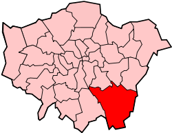
 Mottingham Location within Greater London | |
| Population | 9,987 (2011 Census. Mottingham and Chislehurst North Ward)[1] |
| OS grid reference | TQ415725 |
| • Charing Cross | 9 mi (14.5 km) NW |
| London borough | |
| Ceremonial county | Greater London |
| Region | |
| Country | England |
| Sovereign state | United Kingdom |
| Post town | LONDON |
| Postcode district | SE9 |
| Dialling code | 020 |
| Police | Metropolitan |
| Fire | London |
| Ambulance | London |
| UK Parliament | |
| London Assembly | |
History
Toponymy
The earliest records of Mottingham are from 862 AD when it was recorded as Modingahema, which means the land of Moda's people and is commonly interpreted as "the proud place". In William Henry Ireland's 1830 work England's Topographer: Or A New and Complete History of the County of Kent Volume 4,[2] he writes
Mottingham is a hamlet, lying partly in this parish (referring to Eltham), and partly in that of Chesilhurst, at about a mile southward from Eltham church. It was anciently called Modingham, from the Saxon words modig, proud or lofty, and ham, a dwelling. In King Edward the Confessor's confirmation of the gift of Elthruda, King Alfred's niece, of the manor of Lewisham and its appendages, to the abbey of St. Peter's, at Ghent, in Flanders, in 1044, Modingsham is mentioned as one of them belonging to that manor; but the succeeding grants of Lewisham manor make no mention of this place. In the reign of Edward I., it passed as an apendage to the manor of Eltham, in the grant made by that king to John de Vesci; since, which, it has always been considered as part of the same, which at this time claims over the whole of this hamlet. The bounds and extent of the hamlet of Modyngham are thus described in an ancient MS. remaining among registers of the bishop of Rochester:
Memorandum, That the lordship of Modyngham begins at Readhilde, and extends to the wood of the lord bishop called Elmystediswood, towards the south; and to the field, called Charlesfield, towards the west; and to the woods and lands of the king in Eltham, towards the north-east." At the beginning of the reign of King William Rufus, Ansgotus, of Chesilhurst, the king's chamberlain was possessed of the fee of this hamlet, and gave the tithes of it to the priory of St. Andrew's in Rochester. At the beginning of the reign of Edward III., a family of the name of Legh was possessed of certain tenements, with the land and appurtenances belonging thereto, in Modingham and Chesilhurst; from one of that name it passed to Thomas de Bankwell, at whose decease in the 35th year of the same reign, it was found to be possessed of them and held of the king in gavelkind, as one of his manor of Eltham by service of 14s. 11d. per annum rent and performing service to the king's court at Eltham.
In the 14th of Henry VI,. these premises were in the possession of Robert Cheeseman, of Lewisham and East Greenwich, who by marriage with Joane, daughter of Bernard Cavell of Chesilhurst, had considerably increased his property in this place. The family of Cavell was possessed of lands in that part of Modyngham which lies in Chesilhurst, as early as the reign of Edward I., for John Mayo, jun, by his deed in the 18th of Edward I. conveyed several premises in that part of the hamlet to Bernard Cavell sen. of Chesilhurst. The late Cheesman's who held this estate was Thomas Cheesman, whose heir Alice carried it in marriage to Robert Stoddard and his son George Stoddard, and Anne his wife in 1560 built the present mansion-house called Mottingham place, which with the lands belonging thereto, continued in their descendant till Nicholas Stoddard esq., dying in 1765 unmarried and intestate, there appeared many claimants to the inheritance. After a long litigation in the court of Chancery, this seat with the estate was adjudged to an heir by the female line, to William Bowereman esq. of Newport in the Isle of Wight, who passed away his interest therein to Mr. Dyneley, and he nearly rebuilt the seat and resided there. In the old house were the following dates and coats of arms; on the inside of a turret, 1560; on a chimney, 1561; and on an outward gate, 1635.
In the seventeenth century Thomas Fuller recorded in The Worthies of England a curious incident that happened on 4 August 1585:
...in the Hamlet of Mottingham (pertaining to Eltham in this county) in a Field which belongeth to Sir Percival Hart. Betimes in the morning the ground began to sink, so much that three great Elm trees were suddenly swallowed into the Pit; the tops falling downward into the hole; and before ten of the clock they were so overwhelmed, that no part of them might be discovered, the Concave being suddenly filled with Water. The compasse of the hole was about eighty yards, and so profound, that a sounding line of fifty fathoms could hardly find or feel the bottom.

The cause of the incident, referred to as a "marvellous accident" at the time, was then unknown, and it is likely that a sinkhole had developed. The area is well coursed with streams, both above and below ground, and the collapse or shifting of subsoil might be attributed to them. The site of the sinkhole is now unknown, and the incident is also largely unknown. The only body of standing water that is in the area today is a lake at The Tarn Bird Sanctuary.
In the NW corner of The Tarn opposite Mottingham Station is an ice well dating from about 1760 that supplied Eltham Lodge (now the clubhouse of the Royal Blackheath Golf Course).
Much of Mottingham was farmland until the mid-19th century and in the absence of a significant settlement, Mottingham station was at first called Eltham when it opened in 1866. Cottages were built on what is now Mottingham Road, with the shops of the Terrace. The West Park estate was laid out with houses for the middle classes in the 1880s and St Andrew's church[3] was built in the fields between the station and the village. The Royal Naval School moved from New Cross to Fairy Hall in 1889. The hall was acquired by the School for the Sons of Missionaries to form Eltham College in 1912. In that same year the Ironmongers’ Company built Sir Robert Geffrye’s almshouses on Mottingham Road to replace the homes in Hoxton that have since become the Geffrye Museum.
Mottingham detached from Eltham and became a separate parish in 1866, the same year the railway opened, in anticipation of the growth in population that would surely follow. When the County of London was created in 1889, Mottingham was excluded, remaining in Kent as a peninsula of that county poking into the capital. At first it was administrated as a ‘detached part’ of Bromley Rural District, then in 1934 transferred to Chislehurst and Sidcup Urban District.
Suburban development began after the Sidcup arterial road opened in 1923. The London County Council acquired Court Farm and began to lay out the Mottingham estate. Schools and shops were provided and the first of the estate's 2,000 homes were occupied in 1935. In the same year, north of the railway line, the Metropolitan Borough of Woolwich acquired a surviving fragment of the landscape of Eltham Lodge, with woodland and a lake that are now the Tarn bird sanctuary. The capacious King and Queen public house opened in 1937 at the corner of Kimmeridge Road and St Keverne Road. The King and Queen pub had poor reputation, and features on the album artwork for 1970's pub entertainment recording Live at the Montague Arms – Volume Four.[4]
The Greater London Council acquired the Geffrye almshouses in 1971, remodelled them and built new housing in the grounds. The estate is now managed by Affinity Sutton. More housing replaced the King and Queen pub in 1992 – in and around King and Queen Close.
The South East London Green Chain Walk passes through Mottingham at various points, including Wayside Gardens,[5] a small stretch of land which once housed pre-fabs[6] erected to house bombed out Londoners following the Blitz.
In January 2019, Bromley council approved the borough's Local Plan, a document outlining how and where Bromley will be developed up to 2030. Policy 18 details the commitment to improve the vitality and viability of the Mottingham Local Centre and Kimmeridge Cross Neighbourhood Centre, and to enhance links to other areas of Bromley and adjoining boroughs, particularly in relation to centres of employment.
Local government
Mottingham was originally a hamlet in Eltham parish, in the Blackheath hundred of Kent. In 1840 it was included in the Metropolitan Police District by the Metropolitan Police Act 1839. A key year in the history of Mottingham was 1866, when the area became connected to the railway system with the construction of Mottingham station (then known as Eltham station). Also in 1866, Mottingham received separate civil parish status,[7] thus separating itself from Eltham. In 1881 the parish had a population of 779 and covered an area of 642 acres (2.60 km2).
When the County of London was created in 1889, Mottingham was excluded from the new county and now formed a protrusion of Kent, bordering London to the west, north and east. From 1894 to 1934 it formed a detached part of the Bromley Rural District and had its own parish council.[8] In 1931 the parish had a population of 2,120. In 1934 the rural district and the Mottingham civil parish were abolished and the area was transferred to Chislehurst and Sidcup Urban District.[9] In 1965 the urban district was abolished and the area was transferred from Kent to Greater London, to form part of the London Borough of Bromley. The boundary between Bromley and Greenwich,[10] and between Bromley and Lewisham,[11] around Mottingham was adjusted in 1994. Most of Mottingham is contained within the Mottingham and Chislehurst North ward of Bromley constituency, but the area around Mottingham Station is in the Coldharbour and New Eltham ward of Eltham constituency.[12]
Landmarks

The first church in Mottingham was St Andrew's Church on Court Road, which was established in 1884, and which further helped establish Mottingham as separate from Eltham.
A local landmark is Eltham College, a private school founded in 1842 as the London Missionary Society's School for the Sons of Missionaries, which moved to its present site in Mottingham in 1912. The famous cricketer Dr W. G. Grace lived in retirement for some years in Mottingham – a blue plaque marks his residence, 'Fairmount' in Mottingham Lane[13] where he died on 23 October 1915. He was buried in Beckenham Crematorium.
To the north of Mottingham village is a war memorial, styled as a stone rotunda in the centre of a mini roundabout.[14] Inside the rotunda is a plinth with bronze plaques topped with a stone Latin cross. Unveiled in March 1920, this unusual temple style memorial was designed by local resident George Hubbard. Costing £620, it is an impressive structure for what was then a relatively small community.
Martins Bank had a branch in Mottingham village, on corner of Mottingham Road facing the war memorial. The branch was suffered air raid damage during the war, and temporarily relocated to 282 Court Road whilst repairs were undertaken. The branch became a Barclays following their 1969 takeover of Martins, and eventually closed about 1990. The building is now a restaurant. The Mottingham Martins Bank branch had the unenviable distinction of being the first Martins branch to endure an armed raid which used a van backed up to the corner front entrance in 1967 [15].
Also by the war memorial stood the Porcupine Inn public house. Licensed as long ago as 1688, the premises dated from about 1800 and were replaced in 1922. The pub closed in 2013 and was acquired by German global discount supermarket chain Lidl who have tried and failed to obtain permission to develop the site [16].
There is a riding school on Mottingham Lane which was historically one of the many farms in Mottingham. One such farm was Fairy Farm on Court Farm Road, which was a childhood home [17] of English physicist Sir John Bertram Adams, best known for his work at CERN.
There is a branch of the fraternal order Independent Order of Oddfellows Manchester Unity, which traces its ideology back to the Glorious Revolution, located on Beaconsfield Road, Mottingham [18].
Mottingham village contains a sign [19] depicting Eltham College within the branches of a tree, a cricket bat and ball (making reference to W G Grace) and the date AD 862.
Mottingham and some of its landmarks feature [20] as part of filmaker Dewayne Lindsay's mini-documentary series London Districts [21].
Education
Geography
Mottingham borders Eltham to the north, New Eltham to the east, Chislehurst to the south, Elmstead to the south west, Lewisham to the west and Lee to the north west. Since 2010 Mottingham has fallen within with the Mottingham and Chislehurst North polling [25] and policing [26] districts.
Mottingham Estate
| Estate name | Area | No of dwellings | Population 1938 | Population density |
|---|---|---|---|---|
| Pre-1914 | ||||
| Norbury | 11 | 218 | 867 | 19.8 per acre (49/ha) |
| Old Oak | 32 | 736 | 3519 | 23 per acre (57/ha) |
| Totterdown Fields | 39 | 1262 | — | 32.4 per acre (80/ha) |
| Tower Gardens White Hart Lane | 98 | 783 | 5936 | 8 per acre (20/ha) |
| 1919–1923 | ||||
| Becontree | 2770 | 25769[lower-alpha 1] | 115652 | 9.3 per acre (23/ha) |
| Bellingham | 252 | 2673 | 12004 | 10.6 per acre (26/ha) |
| Castelnau | 51 | 644 | 2851 | 12.6 per acre (31/ha) |
| Dover House Estate Roehampton Estate | 147 | 1212 | 5383 | 8.2 per acre (20/ha) |
| 1924–1933 | ||||
| Downham | 600 | 7096 | 30032 | 11.8 per acre (29/ha) |
| Mottingham | 202 | 2337 | 9009 | 11.6 per acre (29/ha) |
| St Helier | 825 | 9068 | 39877 | 11 per acre (27/ha) |
| Watling | 386 | 4034 | 19110 | 10.5 per acre (26/ha) |
| Wormholt | 68 | 783 | 4078 | 11.5 per acre (28/ha) |
| 1934–1939 | ||||
| Chingford[lower-alpha 2] | 217 | 1540 | — | 7.1 per acre (18/ha) |
| Hanwell (Ealing) | 140 | 1587 | 6732 | 11.3 per acre (28/ha) |
| Headstone Lane | 142 | n.a | 5000 | |
| Kenmore Park | 58 | 654 | 2078 | 11.3 per acre (28/ha) |
| Thornhill (Royal Borough of Greenwich) | 21 | 380 | 1598 | 18.1 per acre (45/ha) |
| Whitefoot Lane (Downham) | 49 | n.a | n.a. | |
| Source:*Yelling, J.A. (1995). "Banishing London's slums: The interwar cottage estates" (PDF). Transactions. London and Middlesex Archeological Society. 46: 167–173. Retrieved 19 December 2016. Quotes: Rubinstein, 1991, Just like the country. |
|
London County Council bought the Court Farm estate in the early 1930s and planned a 2000 home cottage estate. The first houses were to the west of Mottingham Road and completed in 1935. The estate was fairly self-contained; the community facilities included a shopping centre and several schools.
The estate can be seen in the music video for 'Fallout'[27] by Catfish and the Bottlemen, which was filmed entirely within the area.
The British gangster film Piggy was filmed around North Kent, Mottingham and London and a notable scene was filmed [28] in The Prince of Wales pub on Mottingham Road. The Prince of Wales was once [29] the training quarters of African American boxer Frank Craig, where he trained for the bout he ultimately lost to Australian Dan Creedon in 1895.
Coldharbour Estate
In 1946 Woolwich Council built to the east of Mottingham Road. The Coldharbour estate was created primarily to provide accommodation for local people made homeless by the blitz. This completed the use of the LCC land.[30]
Quaggy
The River Quaggy is an urban river, and a tributary known as the Little Quaggy flows through Mottingham; rising in the borders of Chislehurst and Mottingham, it flows through The Tarn and emerges alongside the Sidcup bypass to join the Quaggy. The Quaggy runs through and joins Mottingham playing fields (colloquially known as 'Foxes').
In a 2014 post,[31] south-east London historical blogger Running Past details the route of underground Quaggy tributary the Fairy Hall Flow, which ran through the farmland the Mottingham estate was built upon, and which fed the lakes at Fairy Hall, now Eltham College.
Transport
Rail
Mottingham railway station serves the district with Southeastern services to London Charing Cross, London Cannon Street via both Lewisham and Woolwich Arsenal, and to Dartford.
Bus
- 124 to Eltham and to Catford via Grove Park
- 126 to Eltham and to Bromley via Grove Park
- 161 to North Greenwich via Eltham & Woolwich and to Chislehurst
- 273 to Lewisham Tesco and to Petts Wood
- 624 to Woolwich and to Grove Park (school bus)
- 638 to Kemnal College and to Coney Hall (school bus)
Notable residents
- W. G. Grace, cricketer [32]
- Eric Liddell, athlete and missionary
- Denis Healey, politician [33]
- Rob Beckett, stand up comedian [34]
- Sir John Bertram Adams, physicist [35]
- Stephen ‘Sketch’ Porter, tattooist of Tattoo Fixers, owns Reppin Ink tattoo shop on Court Road, Mottingham [36]
References
- "Bromley Ward population 2011". Neighbourhood Statistics. Office for National Statistics. Archived from the original on 10 May 2017. Retrieved 10 October 2016.
- Ireland, William Henry (28 August 2018). "England's Topographer: Or A New and Complete History of the County of Kent; from the Earliest Records to the Present Time, Including Every Modern Improvement. Embellished with a Series of Views from Original Drawings by Geo. Shepherd, H. Gastineau, &c. with Historical, Topographical, Critical, & Biographical Delineations". G. Virtue – via Google Books.
- "Mottingham: St Andrew with St Alban - The Diocese of Southwark". southwark.anglican.org.
- "Transpontine". transpont.blogspot.co.uk.
- "Google Maps". Google Maps.
- "Prefabs Mottingham - a nostalgic memory of Mottingham". www.francisfrith.com.
- Vision of Britain - Mottingham CP (historic map)
- Vision of Britain - Bromley RD (historic map)
- Vision of Britain - Chislehurst and Sidcup UD (historic map)
- Office of Public Sector Information - Bromley and Greenwich (London Borough Boundaries) Order 1993
- Office of Public Sector Information - Bromley and Lewisham (London Borough Boundaries) Order 1993
- http://londondatastore-upload.s3.amazonaws.com/instant-atlas/ward-atlas-2014/atlas.html
- "W. G. Grace (1848-1915) cricketer lived here". openplaques.org. Retrieved 13 February 2013.
- https://www.google.co.uk/maps/place/War+Memorial/@51.4374787,0.0429795,3a,75y,6.38h,83.8t/data=!3m7!1e1!3m5!1sz7-B9WSlCqTxMibt7ITXwQ!2e0!6s%2F%2Fgeo0.ggpht.com%2Fcbk%3Fpanoid%3Dz7-B9WSlCqTxMibt7ITXwQ%26output%3Dthumbnail%26cb_client%3Dsearch.TACTILE.gps%26thumb%3D2%26w%3D86%26h%3D86%26yaw%3D344.62076%26pitch%3D0%26thumbfov%3D100!7i13312!8i6656!4m5!3m4!1s0x0:0x437abdc33ddc5577!8m2!3d51.437554!4d0.042965
- http://www.martinsbank.co.uk/11-20-60%20London%20Mottingham%20SE9.htm
- https://www.newsshopper.co.uk/news/18178256.lids-plans-much-loved-mottingham-pub-decided-week/
- https://books.google.co.uk/books?id=gUJVz23HY7cC&pg=PA1&lpg=PA1&dq=%22fairy+farm%22+mottingham&source=bl&ots=7pwMXJ81oa&sig=ACfU3U0JG-hRLZaq799YO_XhzCw3ladCDw&hl=en&sa=X&ved=2ahUKEwjU9trVi_LnAhU5QEEAHbrCDtYQ6AEwAXoECAkQAQ#v=onepage&q=%22fairy%20farm%22%20mottingham&f=false
- https://www.oddfellows.co.uk/events/fcde9e32-8637-4ac3-ad38-fa46d4190aa4/Branch-Meeting---Star-of-Mottingham-Mottingham/
- https://www.geograph.org.uk/photo/2607768
- https://www.youtube.com/watch?v=7sWPmRNVx-M
- https://www.newsshopper.co.uk/news/17743789.filmmaker-has-made-40-mini-docs-about-london-districts/
- "Ofstead report".
- "Ofstead report".
- "Ofstead report".
- https://www.bromley.gov.uk/downloads/file/2032/mottingham_and_chislehurst_north_ward_polling_district_map
- https://www.met.police.uk/a/your-area/met/bromley/mottingham-and-chislehurst-north/
- https://www.youtube.com/watch?v=cyLTRjMSX6k
- http://www.newsshopper.co.uk/leisure/latest/9715067.Pub_regulars_go_from_pork_scratchings_to_Piggy_film_fame/
- http://www.dover-kent.com/2014-project-c/Prince-of-Wales-Mottingham.html
- "Mottingham". Ideal Homes: History of South-East London Suburbs. Retrieved 13 January 2016.
- https://runner500.wordpress.com/2015/07/09/going-with-the-flow-in-search-of-fairy-hall-flow/
- https://www.english-heritage.org.uk/visit/blue-plaques/w-g-grace/
- Hookham, Mark (3 December 2008). "Denis Healey: 'The best Prime Minister we never had'". Yorkshire Evening Post. Archived from the original on 5 December 2008. Retrieved 26 April 2010.
- https://www.newsshopper.co.uk/news/10657646.mottingham-comedian-rob-beckett-chats-to-vibe-ahead-of-uk-tour/
- https://www.nytimes.com/1984/03/08/obituaries/sir-john-bertram-adams-63-led-european-atomic-center.html
- https://www.mylondon.news/news/9-london-tattoo-artists-you-16988985.amp
| Districts | 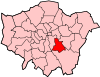 | |
|---|---|---|
| Attractions |
| |
| Parks and open spaces |
| |
| Constituencies | ||
| Rail stations | ||
| Other topics | ||
| ||
| Districts |  | |
|---|---|---|
| Attractions |
| |
| Street markets |
| |
| Parks and open spaces |
| |
| Constituencies | ||
| Bridges and tunnels | ||
| Rail stations | ||
| Other topics | ||
| ||