Montclus, Hautes-Alpes
Montclus is a commune in the Hautes-Alpes department in southeastern France.
Montclus | |
|---|---|
A flock of sheep being herded on the D994 road, at the entrance to Montclus | |
 Coat of arms | |
Location of Montclus 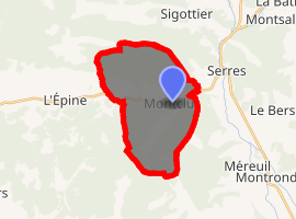
| |
 Montclus  Montclus | |
| Coordinates: 44°24′57″N 5°41′00″E | |
| Country | France |
| Region | Provence-Alpes-Côte d'Azur |
| Department | Hautes-Alpes |
| Arrondissement | Gap |
| Canton | Serres |
| Intercommunality | Serres |
| Government | |
| • Mayor (2008–2014) | Antoine Segretain |
| Area 1 | 21.25 km2 (8.20 sq mi) |
| Population (2017-01-01)[1] | 57 |
| • Density | 2.7/km2 (6.9/sq mi) |
| Time zone | UTC+01:00 (CET) |
| • Summer (DST) | UTC+02:00 (CEST) |
| INSEE/Postal code | 05081 /05700 |
| Elevation | 680–1,546 m (2,231–5,072 ft) (avg. 719 m or 2,359 ft) |
| 1 French Land Register data, which excludes lakes, ponds, glaciers > 1 km2 (0.386 sq mi or 247 acres) and river estuaries. | |
Population
| Historical population | ||
|---|---|---|
| Year | Pop. | ±% |
| 1962 | 22 | — |
| 1968 | 47 | +113.6% |
| 1975 | 40 | −14.9% |
| 1982 | 46 | +15.0% |
| 1990 | 45 | −2.2% |
| 1999 | 48 | +6.7% |
| 2008 | 50 | +4.2% |
References
- "Populations légales 2017". INSEE. Retrieved 6 January 2020.
| Wikimedia Commons has media related to Montclus, Hautes-Alpes. |
This article is issued from Wikipedia. The text is licensed under Creative Commons - Attribution - Sharealike. Additional terms may apply for the media files.