La Bâtie-Montsaléon
La Bâtie-Montsaléon is a commune in the Hautes-Alpes department in southeastern France.
La Bâtie-Montsaléon | |
|---|---|
.jpg) | |
 Coat of arms | |
Location of La Bâtie-Montsaléon 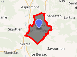
| |
 La Bâtie-Montsaléon  La Bâtie-Montsaléon | |
| Coordinates: 44°27′25″N 5°45′00″E | |
| Country | France |
| Region | Provence-Alpes-Côte d'Azur |
| Department | Hautes-Alpes |
| Arrondissement | Gap |
| Canton | Serres |
| Intercommunality | Serres |
| Government | |
| • Mayor (2008–2014) | Alain d'Heilly |
| Area 1 | 15.08 km2 (5.82 sq mi) |
| Population (2017-01-01)[1] | 254 |
| • Density | 17/km2 (44/sq mi) |
| Time zone | UTC+01:00 (CET) |
| • Summer (DST) | UTC+02:00 (CEST) |
| INSEE/Postal code | 05016 /05700 |
| Elevation | 671–1,431 m (2,201–4,695 ft) (avg. 760 m or 2,490 ft) |
| 1 French Land Register data, which excludes lakes, ponds, glaciers > 1 km2 (0.386 sq mi or 247 acres) and river estuaries. | |
It is notable for being the location of the Battle of Mons Seleucus in 353, when Constantius II defeated the usurper Magnentius.
Population
| Historical population | ||
|---|---|---|
| Year | Pop. | ±% |
| 1962 | 114 | — |
| 1968 | 134 | +17.5% |
| 1975 | 132 | −1.5% |
| 1982 | 134 | +1.5% |
| 1990 | 137 | +2.2% |
| 1999 | 136 | −0.7% |
| 2008 | 200 | +47.1% |
References
- "Populations légales 2017". INSEE. Retrieved 6 January 2020.
| Wikimedia Commons has media related to La Bâtie-Montsaléon. |
This article is issued from Wikipedia. The text is licensed under Creative Commons - Attribution - Sharealike. Additional terms may apply for the media files.