Le Noyer, Hautes-Alpes
Le Noyer is a commune in the Hautes-Alpes department in southeastern France. With its neighbouring hamlets of Le Serre, Le Martouret and Le Villard, it lies on the banks of the river Drac, close to the Écrins National Park.
Le Noyer | |
|---|---|
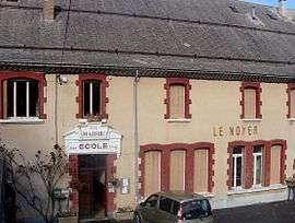 The town hall and former school of Le Noyer | |
 Coat of arms | |
Location of Le Noyer 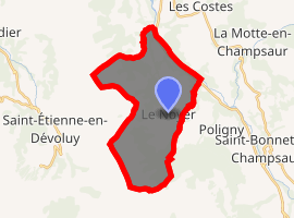
| |
 Le Noyer  Le Noyer | |
| Coordinates: 44°41′57″N 6°00′47″E | |
| Country | France |
| Region | Provence-Alpes-Côte d'Azur |
| Department | Hautes-Alpes |
| Arrondissement | Gap |
| Canton | Saint-Bonnet-en-Champsaur |
| Intercommunality | Champsaur |
| Government | |
| • Mayor (2014–2020) | Renée Nouguier[1] |
| Area 1 | 21.5 km2 (8.3 sq mi) |
| Population (2017-01-01)[2] | 292 |
| • Density | 14/km2 (35/sq mi) |
| Time zone | UTC+01:00 (CET) |
| • Summer (DST) | UTC+02:00 (CEST) |
| INSEE/Postal code | 05095 /05500 |
| Elevation | 839–2,563 m (2,753–8,409 ft) (avg. 1,120 m or 3,670 ft) |
| 1 French Land Register data, which excludes lakes, ponds, glaciers > 1 km2 (0.386 sq mi or 247 acres) and river estuaries. | |
Administration
List of mayors
- 2008–2014: Jacques Fougairolle
- 2014–2020: Renée Nouguier[1]
Population
| Historical population | ||
|---|---|---|
| Year | Pop. | ±% |
| 1962 | 289 | — |
| 1968 | 263 | −9.0% |
| 1975 | 219 | −16.7% |
| 1982 | 215 | −1.8% |
| 1990 | 243 | +13.0% |
| 1999 | 222 | −8.6% |
| 2008 | 257 | +15.8% |
| 2012 | 271 | +5.4% |
References
- "List of mayors of the Hautes-Alpes department". Prefecture of Hautes-Alpes (in French). 3 June 2014. Archived from the original on 10 January 2015. Retrieved 20 March 2015.
- "Populations légales 2017". INSEE. Retrieved 6 January 2020.
| Wikimedia Commons has media related to Le Noyer (Hautes-Alpes). |
This article is issued from Wikipedia. The text is licensed under Creative Commons - Attribution - Sharealike. Additional terms may apply for the media files.