Luhansk Oblast
Luhansk Oblast (Ukrainian: Луганська область, translit. Luhanśka oblastj, Russian: Луганская область, translit. Luganskaja oblastj; also referred to as Luhanshchyna, Ukrainian: Луганщина, romanized: Luhanščyna) is the easternmost oblast (province) of Ukraine. Its administrative center is Luhansk. The oblast was established in 1938 and bore the name Voroshilovgrad Oblast (until 1958 and again 1970 to 1990) in honor of Kliment Voroshilov. Its population is 2,239,500 (as of September 1, 2014).[8]
Luhansk Oblast Луганська область Luhans’ka oblast’ | |
|---|---|
 Flag  Coat of arms | |
| Nickname(s): | |
.svg.png) | |
| Coordinates: 48.92°N 39.02°E | |
| Country | |
| Established | June 3, 1938 |
| Administrative center | Luhansk (de jure) Sievierodonetsk (de facto, due to war in Donbass) |
| Government | |
| • Governor | Serhiy Haidai[6] |
| • Oblast council | 124 seats |
| • Chairperson | Valerij Holenko (Party of Regions[7]) |
| Area | |
| • Total | 26,684 km2 (10,303 sq mi) |
| Population (September 1, 2014[8]) | |
| • Total | |
| • Rank | Ranked 7th |
| Demographics | |
| • Official language(s) | Ukrainian |
| Time zone | UTC+2 (EET) |
| • Summer (DST) | UTC+3 (EEST) |
| Postal code | ? |
| Area code | +380-64 |
| ISO 3166 code | UA-09 |
| Vehicle registration | BB |
| Raions | 18 |
| Cities (total) | 37 |
| • Regional cities | 14 |
| Urban-type settlements | 109 |
| Villages | 792 |
| FIPS 10-4 | UP14 |
| Website | loga.gov.ua |
Important cities within the oblast include Alchevsk, Antratsyt, Brianka, Kirovsk, Krasnyi Luch, Krasnodon, Lysychansk, Luhansk, Pervomaisk, Rovenky, Rubizhne, Sverdlovsk, Sievierodonetsk, Stakhanov.
The War in Donbass caused the administrative center of the oblast to be relocated to Sievierodonetsk.[9]
Geography
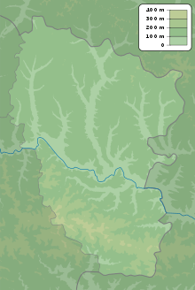
Luhansk Oblast is located in eastern Ukraine. The area of the oblast (26,700 km²), comprises about 4.42% of the total area of the country.
Its longitude from north to south is 250 km, from east to west – 190 km. The oblast has the longest segment of the Ukrainian international border with Russia among other regions (see State Border of Ukraine) consisting of 746 km (464 mi). It borders the Belgorod and Voronezh Oblasts of Russia on the north, while the Rostov Oblast is located to the east and the south. Among Ukrainian regions, the oblast borders the Kharkiv and Donetsk Oblasts to its west.
The region is located in the valley of Siversky Donets which splits the region approximately in half. The southern portion of the region is elevated by the Donetsk Ridge which is located closer to the southern border. The highest point is Mohyla Mechetna (367 m (1,204 ft)) which is the highest point of Donetsk Ridge.
The left bank of Siversky Donets is part of the Starobilsk Plain which to the north transforms into the Central Russian Upland.
History
The oblast originated in 1938 as Voroshylovhrad (Russian: Voroshilovgrad) Oblast after the Donetsk Oblast was split between Voroshylovhrad and Stalino (today Donetsk Oblast) oblasts. After the invasion by Nazi Germany in 1941 the region came under a German military administration, due to its proximity to frontlines. It was occupied at the end of 1942 as part of Case Blue German offensive directed towards Stalingrad. However soon after the battle of Stalingrad, in the spring of 1943 Luhansk region (at that time Voroshilovgrad) once again became center of military operations during the Soviet counter-offensive operation Little Saturn. By the summer of 1943 the region was liberated from the Nazi Germany Armed Forces. During the Soviet times the Oblast bore its current name between 1958 and 1970.
During the fateful March Referendum of 1991, 70.16% of all Ukrainians voted to remain a part of the Soviet Union as a sovereign republic, while only 27.99% voted 'no'.[10] In the December 1991 referendum, (after the August coup ended all hope of a restored Union,) 83.86% of votes in the oblast were in favor of the Declaration of Independence of Ukraine.
In 1994 a referendum took place in the Donetsk Oblast and the Luhansk Oblast, with around 90% supporting the Russian language gaining status of an official language alongside Ukrainian, and for the Russian language to be an official language on a regional level; however, the referendum was annulled by the Kiev government.[11][12]
On April 8, 2014, following the annexation of Crimea by Russia, pro-Russian separatists occupying the Luhansk Oblast administrative building planned to declare the independence of the region as the Luhansk Parliamentary Republic, after other pro-Russian separatists declared Donetsk People's Republic in the Donetsk Oblast (April 7, 2014). When the Luhansk Parliamentary Republic ceased to exist, the separatists declared the Luhansk People's Republic (April 27, 2014) and held a disputed referendum on separating from Ukraine on May 11, 2014. The legitimacy of the referendums was not recognized by any government.[13] Ukraine does not recognize the referendum, while the EU and US said the polls were illegal.[14] Subsequently, the War in Donbass started.
As a result of the War in Donbass, Luhansk insurgents control the southern third of the oblast, which includes the city of Luhansk, the region's most populous city as well as the capital of the oblast. Due to this, most oblast government functions have moved to Sievierodonetsk, which forces of the Government of Ukraine recaptured in July 2014. Many universities located in the occupied areas have moved to government-controlled cities such as Sievierodonetsk, Starobilsk or Rubizhne.[15][16] A survey conducted in December 2014 by the Kyiv International Institute of Sociology found 5.7% of the oblast's population supported their region joining Russia, 84.1% did not support the idea, and the rest were undecided or did not respond; insurgent-controlled areas were not polled.[17]
Administrative subdivisions

| English Name | Local Name | Type | Area (km2) | Population Census 2001 | Population Estimate 1 Jan 2012 | Admin.ctr |
|---|---|---|---|---|---|---|
| Alchevsk | Алчевськ | city of regional significance | 49 | 119,193 | 112,071 | Alchevsk |
| Antratsyt | Антрацит | city of regional significance | 61 | 90,835 | 78,482 | Antratsit |
| Antratsitivsky | Антрацитівський (район) | raion | 1,662 | 36,971 | 31,454 | Antratsit |
| Bilokurakynsky | Білокуракинський (район) | raion | 1,436 | 23,807 | 19,858 | Bilokurakyne |
| Bilovodsky | Біловодський (район) | raion | 1,597 | 27,559 | 24,459 | Bilovodsk |
| Brianka | Брянка | city of regional significance | 64 | 61,357 | 54,085 | Brianca |
| Kirovsk | Кіровськ | city of regional significance | 35 | 45,012 | 36,708 | Kirovsk |
| Krasnodon | Краснодон | city of regional significance | 77 | 118,168 | 104,640 | Krasnodon |
| Krasnodonsky | Краснодонський (район) | raion | 1,386 | 32,846 | 29,983 | Krasnodon |
| Krasnyi Luch | Красний Луч | city of regional significance | 154 | 145,129 | 125,166 | Krasnyi Luch |
| Kreminsky | Кремінський (район) | raion | 1,627 | 51,927 | 42,357 | Kreminna |
| Luhansk | Луганськ | city of regional significance | 286 | 503,248 | 466,627 | Luhansk |
| Lutuhynsky | Лутугинський (район) | raion | 1,057 | 73,914 | 67,977 | Lutuhyne |
| Lysychansk | Лисичанськ | city of regional significance | 96 | 133,258 | 120,785 | Lysychansk |
| Markivsky | Марківський (район) | raion | 1,166 | 19,002 | 15,991 | Markivka |
| Milovsky | Міловський (район) | raion | 971 | 17,415 | 15,696 | Milove |
| Novoaidarsky | Новоайдарський (район) | raion | 1,536 | 28,451 | 25,618 | Novoaidar |
| Novopskovsky | Новопсковський (район) | raion | 1,623 | 38,322 | 35,271 | Novopskov |
| Perevalsky | Перевальський (район) | raion | 807 | 87,383 | 72,387 | Perevalsk |
| Pervomaisk | Первомайськ (Міськрада) | city of regional significance | 89 | 80,622 | 70,581 | Pervomaisk |
| Popasniansky | Попаснянський (район) | raion | 1,325 | 50,559 | 41,232 | Popasna |
| Rovenky | Ровеньки | city of regional significance | 217 | 91,712 | 84,366 | Rovenky |
| Rubizhne | Рубіжне | city of regional significance | 34 | 65,322 | 60,750 | Rubizhne |
| Sievierodonetsk | Северодонецьк | city of regional significance | 58 | 129,752 | 120,264 | Sieverodonetsk |
| Slovianoserbsky (raion) | Слов'яносербський (район) | raion | 1,113 | 62,125 | 55,462 | Slovianoserbsk |
| Stakhanov | Стаханов | city of regional significance | 92 | 108,266 | 92,818 | Stakhanov |
| Stanychno-Luhansy | Станично-Луганський (район) | raion | 1,896 | 52,762 | 49,732 | Stanychno-Luhanske |
| Starobilsky | Старобільський (район) | raion | 1,582 | 57,755 | 47,765 | Starobilsk |
| Svativsky | Сватівський (район) | raion | 1,739 | 43,069 | 37,652 | Svatove |
| Sverdlovsk | Свердловськ | city of regional significance | 84 | 110,159 | 99,024 | Sverdlovsk |
| Sverdlovsky | Свердловський (район) | raion | 1,132 | 14,574 | 12,210 | Sverdlovsk |
| Troitsky | Троїцький (район) | raion | 1,633 | 25,704 | 21,205 | Troitske |
| Total Oblast | Луганська (Область) | oblast | 26,683 | 2,546,178 | 2,272,676 | Luhansk |
Like the rest of the provinces in Ukraine, Luhansk Oblast has double jurisdiction. The oblast is predominantly administrated by the Luhansk Oblast State Administration headed by the governor of the oblast and appointed by the President of Ukraine. The province also has a representative body, the provincial council, which is headed by its chairman and elected by popular vote.
The province is primarily divided into 18 raions (districts), and 37 cities, including 14 cities of regional significance. The administrative center is Luhansk. These are listed below with their areas and populations.[18]
The province's secondary division consists of various municipalities. Those municipalities may consist of one or more populated places. The municipalities are administratively subordinate to the raion in which they are located, with the exception of 14 cities subordinated directly to the oblast. In addition, the city of Luhansk is subdivided into its own four city-districts (boroughs).
All subdivisions are governed by their respective councils (radas).
Cities
Demographics

The population is largely Russian-speaking, although ethnic Ukrainians constitute a majority (58.0%). Among the minorities are native Russians (39.1%), Belarusians (0.8%), and others (1.4%). Ukrainians constitute the majority in all raions except for Stanytsia-Luhanska Raion and Krasnodon Raion, both of which are east of Luhansk. Ethnic Russians also constitute the majority in regionally significant cities, such as Krasnodon, Sverdlovsk, Krasnyi Luch and Stakhanov.
According to the 2001 Ukrainian Census, more than 68.8% of the population consider themselves Russian speakers, while 30.0% consider themselves Ukrainian speakers. The Russophone population predominates in the southern portion of the region and around the city of Luhansk, while the northern region is less populated, mostly agricultural and Ukrainophone.
Its population (as of 2004) of 2,461,506 constitutes 5.13% of the overall Ukrainian population. The Luhansk Oblast rates fifth in Ukraine by the number of its inhabitants, having an average population density of 90.28/km². About 87% of the population lives in urban areas, while the remaining 13% reside in agricultural areas. According to the national census, 54% of the population are Ukrainians and 42% are Russians.
Age structure
- 0-14 years: 12.3%

- 15-64 years: 71.4%

- 65 years and over: 16.3%

Median age
- total: 42.1 years
- male: 38.2 years
- female: 45.9 years
Economy
Economically the region is connected with the Donets Basin.
Extracting industry
- Lysychansk Coal
- Luhansk Coal
- Sverdlov Anthracite
- Anthracite
- Pervomaisk Coal
- Rovenky Anthracite
- Donbas Anthracite
Machine building
Chemical and oil refinery
- Severdonetsk Association Azot
- Association Skloplastyk
- Lysynchansk Oil Refinery
Agriculture
Power generation
Transport
Through the region pass two major European routes ![]()
![]()


- There is also another highway

Rail transportation is administered by the Donetsk Railway.
There is also its regional airport Luhansk International Airport with its own carrier.
Education
Specialized
- Luhansk State Medical University
- Luhansk National Agrarian University
- Luhansk State University of Internal Affairs
Points of interest

The following sites were nominated for the Seven Wonders of Ukraine.
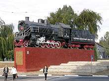
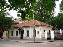
- The house of Dal's birth (Luhansk)
- Fighters for the Revolution monument
- Derkul horse factory
- Royal Rocks (Luhansk State Preserve)
- Chasm Steppe (Sverdlovsk Raion)
- Ram Foreheads (limestone rocks)
- Mścichowski Palace (Палац Мсциховського)
See also
References
- Oda, UA: LG, 2007, archived from the original on 2008-08-05.
- Umoloda, Kiev, UA.
- Oda, UA: LG, 1930, archived from the original on 2011-05-24.
- "Territory", 70 years, UA: LG, 2008-03-14 [1977].
- "70 years", Calendar, UA: LG, 2008-04-11.
- "Zelensky explains move to change Luhansk region's governor". UNIAN. October 28, 2019. Retrieved November 8, 2019.
- Владимир Николаевич ПРИСТЮК [Vladimir nikolaevich Pristyuk] (in Russian), Luhansk Oblast Council, archived from the original on 2010-04-24.
- "State Statistics Committee of Ukraine". Archived from the original on September 15, 2002. Retrieved September 1, 2014.
- "In Severodonetsk, Petro Poroshenko presented Luhansk RSA Head Hennadiy Moskal". President of Ukraine, official website. Archived from the original on 2015-03-18.
- "Ukraine's Eastern Region Of Luhansk May Now Hold Referendum On Joining Russia". Business Insider. Retrieved 12 May 2014.
- BBC News 12 May 2014
- "Archived copy". Archived from the original on 2015-03-18. Retrieved 2015-01-21.CS1 maint: archived copy as title (link)
- "Lugansk University. Location, phone, address, contacts". luganskukraine.info.
- Лише 3% українців хочуть приєднання їх області до Росії [Only 3% of Ukrainians want their region to become part of Russia]. Dzerkalo Tyzhnia (in Ukrainian). 3 January 2015.
- State Statistics Committee of Ukraine, Kiev.
External links
- Official site of Luhansk Oblast Administration (in Ukrainian)
- Information Card of the Region – official site of the Cabinet of Ministers of Ukraine
- The Official Site of the Radomysl Castle
| Raions | |||||
|---|---|---|---|---|---|
| Hromadas | |||||
| Cities |
| ||||
| |||||
| Oblasts | |
|---|---|
| Cities with special status | |
| Autonomous republic | |
| Administrative centers | |
1Claimed and controlled by Russia as the Republic of Crimea and the Federal City of Sevastopol 2Regions are partly controlled by Pro-Russian separatists states of Donetsk People's Republic and Luhansk People's Republic | |
| Authority control |
|
|---|