List of hillside letters
This is a list of hillside letters (also known as mountain monograms), large geoglyphs found primarily in the Western United States.[1][2][3] There are about 600 in total, but the status of many of these symbols are uncertain, due to vagueness in sources.
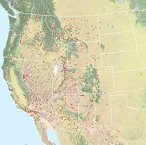
The states with the most hillside letters are:
United States
Arizona
California
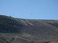
Colorado
At least 25 monograms, possibly 28
 Western Colorado University's W Mountain
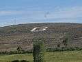 Hillside monogram on Signal Hill as seen from U.S.Hwy 50 entering the town.
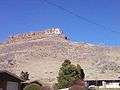 South Table Mountain Golden, Colorado
 Salida Downtown Historic District in Salida, Colorado
 Mount Zion Mountain west of Golden, Colorado
Idaho
Montana
Nevada
New Mexico
At least 30 monograms, possibly 37
Oregon
Texas
Texas' 16 or more monograms are all in the western, most mountainous, part of the state. There are six (in various states of repair) in El Paso alone, the most in any single city in the United States.
Utah
Washington
Most of Washington's 18 to 19 monograms are in the arid Eastern part of the state.
Wyoming
Between 22 and 23 monograms
Other states
Other countries
| Monogram | Town | Country | Description | Coordinates |
|---|---|---|---|---|
| LONGVIEW | Longview, Alberta | Canada | 50.5437°N 114.2189°W | |
| 113 51 137 151 | Calgary, Alberta | Canada | Military memorials in Battalion Park | 51.021°N 114.173°W |
| MOUNT PANORAMA | Bathurst, New South Wales | Australia | Mount Panorama Circuit (and surrounding neighbourhood) | 33.455°S 149.552°E |
| NZ | Bulford | England | Writing beneath the Bulford Kiwi | 51°11′38.84″N 001°42′54.20″W |
| Z | Wythenshawe | England | Two "Z"s on the A5103 roundabout | |
| 선군 조선의 태양 김정은 장군 만세! | Ryanggang Province | North Korea | “Long Live General Kim Jong-un the Shining Sun!” | |
| JESUCRISTO ES EL SEÑOR | Tijuana | Mexico | 32.4753°N 116.9°W | |
| B | Mexico City | Mexico | El Centro Escolar Benemérito de las Américas | 19.539°N 99.1602°W |
| BIENVENIDOS ATE | Lima | Peru | Ate District, above the Estadio Monumental | 12.052°S 76.9346°W |
| TORREBLANCA | Lima | Peru | Juventud Torre Blanca football club? | 12.0014°S 76.9927°W |
Messages are common on the bare mountains surrounding Lima, Peru; most of them are personal graffiti, not community symbols.
See also
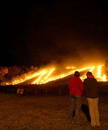
- Gozan no Okuribi, Japanese festival involving giant hillside bonfires in the shape of characters
Notes
- Corning, Evelyn (2007). Hillside Letters A to Z : A Guide to Hometown Landmarks. Missoula, Mont.: Mountain Press Publishing Company.
- Rocha, Guy (June 2004), "Hillside Letters: In Plain Sight But Not Intended for Planes", Sierra Sage, archived from the original on 2011-07-22, retrieved 2011-08-09
- Parsons, James J. (1988). "Hillside Letters in the Western United States". Landscape. Sante Fe, N.M. 30 (1): 15–23. Retrieved 2011-08-09.
External links
| Wikimedia Commons has media related to Hillside letters. |
- Mountain Monograms, a website explaining the origins and with an incomplete list and pictures
- Hillside Letters, a companion website to a book on the subject
- Letters on Hills, a category on waymarking.com for geocachers