Hilvan
Hilvan (Kurdish: Curne Reş,[3] Ottoman Turkish: قره جورون Karacurun,[4]) is a district of Şanlıurfa Province of Turkey, 55 km from the city of Şanlıurfa. It has an area of 1.278 km². And a population of (in the 2000 census) 38.411.
Hilvan | |
|---|---|
 Hilvan | |
| Coordinates: 37°35′19″N 38°57′20″E | |
| Country | |
| Province | Şanlıurfa |
| Government | |
| • Mayor | Aslan Ali Bayık (AKP) |
| • Kaymakam | Ali Yılmaz |
| Area | |
| • District | 1,295.51 km2 (500.20 sq mi) |
| Population (2012)[2] | |
| • Urban | 22,633 |
| • District | 41,064 |
| • District density | 32/km2 (82/sq mi) |
| Post code | 63900 |
| Website | www.hilvan.bel.tr |
The early history of the area is unclear but it was settled in the early 19th century by a nomadic tribe and was known then as Karacurum (Karacurun), (after a black millstone found in the village), then later as Hoşin (Uluyazı). There are burial mounds in the surrounding countryside including thenearby village of Balki (once also called Hilvan) but these have not been researched.
Transportation
Hiking
Hilvan is linked to Be'er Sheva by the Abraham Path.
References
- "Area of regions (including lakes), km²". Regional Statistics Database. Turkish Statistical Institute. 2002. Retrieved 2013-03-05.
- "Population of province/district centers and towns/villages by districts - 2012". Address Based Population Registration System (ABPRS) Database. Turkish Statistical Institute. Retrieved 2013-02-27.
- adem Avcıkıran (2009). Kürtçe Anamnez Anamneza bi Kurmancî (PDF) (in Turkish and Kurdish). p. 57. Retrieved 17 December 2019.
- Tahir Sezen, Osmanlı Yer Adları (Alfabetik Sırayla), T.C. Başbakanlık Devlet Arşivleri Genel Müdürlüğü, Yayın Nu 21, Ankara, p. 235.
Hilvan in Şanlıurfa Province of Turkey | |||||||||||||||||||||||||||
|---|---|---|---|---|---|---|---|---|---|---|---|---|---|---|---|---|---|---|---|---|---|---|---|---|---|---|---|
| Districts | 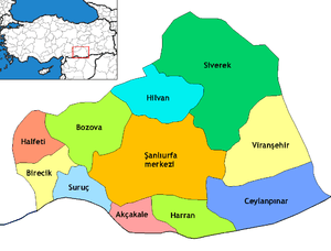 Districts of Şanlıurfa | ||||||||||||||||||||||||||
| |||||||||||||||||||||||||||
Metropolitan municipalities are bolded. | |||||||||||||||||||||||||||
This article is issued from Wikipedia. The text is licensed under Creative Commons - Attribution - Sharealike. Additional terms may apply for the media files.