Konya Province
Konya Province (Turkish: Konya ili) is a province of Turkey in central Anatolia. The provincial capital is the city of Konya. By area it is the largest province of Turkey. Its traffic code is 42.
Konya Province Konya ili | |
|---|---|
 Location of Konya Province in Turkey | |
| Country | Turkey |
| Region | West Anatolia |
| Subregion | Konya |
| Government | |
| • Electoral district | Konya |
| Area | |
| • Total | 38,257 km2 (14,771 sq mi) |
| Population (2018)[1] | |
| • Total | 2,205,609 |
| • Density | 58/km2 (150/sq mi) |
| Area code(s) | 0332 |
| Vehicle registration | 42 |
The Kızören solar power plant in Konya will be able to produce 22.5 megawatts of electricity in an area of 430,000 square meters.[2]
Demographics
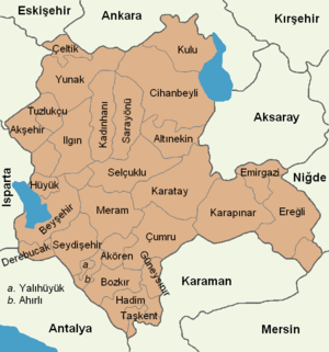
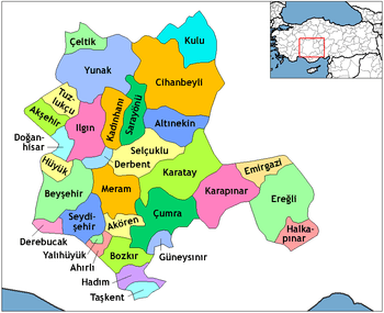
In 2011 the Konya Metropolitan Municipality had a population close to 1.1 million, out of the 2 million in the Konya Province (76.2% of the population in Konya Province lives in the city, while the remainder live in the villages, sub-districts and districts.) Konya Province has 31 districts, three of which are central districts: Karatay, Meram and Selçuklu.
Divisions
The Konya province is divided into thirty-one districts three of which are actually included in the municipality of Konya city (shown in boldface letters).
Caves
Caves in Konya Province are:[4]
- Balatini Cave, Beyşehir
- Büyü Düden Cave, Derebucak
- Körükini Cave, Beyşehir
- Tınaztepe Caves, Seydişehir
See also
- Konya Province, Ottoman Empire
Gallery
 Nalçacı Street
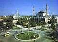 Mevlana Square
 Dedeman Konya Hotel
 Alaaddin Hill
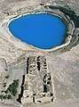 Obruk Lake and Obruk Caravansary
 The traditional food, Etli ekmek
References
- "Population of provinces by years - 2000-2018". Turkish Statistical Institute. Retrieved 9 March 2019.
- Company opens Turkey’s ‘largest solar power plant’ in Central Anatolia
- Türkiye Nüfus Sayimlarinda Azinliklar. Retrieved 16 December 2018.
- "Konya Mağaraları" (in Turkish). Kültür ve Turizm Bakanlığı - Yatırım ve İşletmeler Genel Müdürlüğü. Retrieved 2017-01-26.
External links
| Wikimedia Commons has media related to Konya Province. |
| ||
Metropolitan municipalities are bolded. | ||