Bursa Province
Bursa Province (Turkish: Bursa ili) is a province in Turkey along the Sea of Marmara coast in northwestern Anatolia. It borders Balıkesir to the west, Kütahya to the south, Bilecik and Sakarya to the east, Kocaeli to the northeast and Yalova to the north. The province has an area of 11,043 km2 and a population of 2,994,521 as of 2018.[1] Its traffic code is 16.
Bursa Province Bursa ili | |
|---|---|
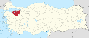 Location of Bursa Province in Turkey | |
| Country | Turkey |
| Region | East Marmara |
| Subregion | Bursa |
| Government | |
| • Electoral district | Bursa |
| Area | |
| • Total | 11,043 km2 (4,264 sq mi) |
| Population (2018)[1] | |
| • Total | 2,994,521 |
| • Density | 270/km2 (700/sq mi) |
| Area code(s) | 0224 |
| Vehicle registration | 16 |
The vast majority of the Bursa Province districts (and the city of Bursa) are located within the Marmara Region, but the districts of Büyükorhan, Harmancık, Keles and Orhaneli are located within the Aegean Region.
The city of Bursa was the capital of the Ottoman State between 1326 and 1365, until the Ottoman conquest of Edirne, then known as Adrianople, which became the new Ottoman capital between 1365 and 1453, when Constantinople became the final Ottoman capital.
Districts
Demographics
| Historical population | ||
|---|---|---|
| Year | Pop. | ±% p.a. |
| 1927 | 401,595 | — |
| 1940 | 461,648 | +1.08% |
| 1950 | 545,919 | +1.69% |
| 1960 | 693,894 | +2.43% |
| 1970 | 847,884 | +2.02% |
| 1980 | 1,148,492 | +3.08% |
| 1990 | 1,603,137 | +3.39% |
| 2000 | 2,125,140 | +2.86% |
| 2010 | 2,605,495 | +2.06% |
| 2018 | 2,994,521 | +1.75% |
| source:[2][3] | ||
References
- "Population of provinces by years - 2000-2018". Turkish Statistical Institute. Retrieved 9 March 2019.
- Genel Nüfus Sayımları
- tuik
External links
| Wikivoyage has a travel guide for Bursa Province. |
| Wikimedia Commons has media related to Bursa Province. |
- (in English) Pictures of the capital of this province
- (in Turkish) Bursa city sport portal, Bursa
- (in Turkish) Gokoz Village, Bursa
- (in Turkish) Golyaka Village - orhangazi pictures and information, Bursa
- (in English) Bursa travel & tourism

| ||
Metropolitan municipalities are bolded. | ||