Greymouth
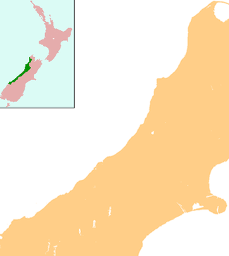
Greymouth (/ˈɡreɪmaʊθ/) (Māori: Māwhera) is the largest town in the West Coast region in the South Island of New Zealand, and the seat of the Grey District Council. The population of the whole Grey District is 13,750, which accounts for 42% of the West Coast's inhabitants. The Greymouth urban area had an estimated population of 8,160 (June 2019).[1]
Greymouth Māwhera (Māori) | |
|---|---|
 | |
 Greymouth | |
| Coordinates: 42°28′S 171°12′E | |
| Country | New Zealand |
| Region | West Coast |
| District | Grey District |
| Government | |
| • MP | Damien O'Connor (Labour) |
| Population (June 2019)[1] | |
| • Total | 8,160 |
| Postcode(s) | 7805 |
| Local iwi | Ngāi Tahu |
Location

The town is located at the mouth of the Grey River, on a narrow coastal plain close to the foot of the Southern Alps. In clear weather, Aoraki / Mount Cook can be clearly seen to the south from near the town. The mouth of the river divides the town into three areas: Blaketown, close to the river's mouth on the south bank; Karoro, to the southeast, separated from Blaketown by a series of small estuarine lakes; and Cobden, formerly a separate town, on the river's north bank.
Greymouth is on State Highway 6, which connects it with Hokitika in the south and Westport in the north. It also stands at the terminus of State Highway 7, which runs through Dobson and Reefton, eventually reaching North Canterbury and its junction with State Highway 1 at Waipara, 55 kilometres (34 mi) north of Christchurch, via Lewis Pass. Highway 73 is accessed 20 kilometres (12 mi) south of Greymouth, which is the most direct route to or from Christchurch. The town is also the western terminus of the Midland line from Christchurch. Large coal trains often operate from Greymouth on this line to Christchurch. The famous TranzAlpine train also terminates at Greymouth. The Greymouth Airport is only 1.9 kilometres (1.2 mi) south of the centre of the town.
Climate
Köppen-Geiger climate classification system classifies its climate as oceanic (Cfb).[2] Greymouth receives mean annual rainfall high by New Zealand standards and this rainfall is distributed relatively evenly throughout the year.[3] This is due to its position receiving marine westerlies throughout the year that often do not rise above the Southern Alps. As a result of this, it creates a rain shadow effect that sees east coast locations having far sunnier and warmer summers. This extreme marine influence also shelters the Greymouth area from hot summer days and cold winter nights. Snow is rare, the last reported event occurring on 4 August 2019.[4]
| Climate data for Greymouth Airport (1947–2015, Humidity 1972–2015) | |||||||||||||
|---|---|---|---|---|---|---|---|---|---|---|---|---|---|
| Month | Jan | Feb | Mar | Apr | May | Jun | Jul | Aug | Sep | Oct | Nov | Dec | Year |
| Record high °C (°F) | 28.8 (83.8) |
29.7 (85.5) |
27.7 (81.9) |
25.0 (77.0) |
23.8 (74.8) |
18.0 (64.4) |
18.1 (64.6) |
19.3 (66.7) |
22.3 (72.1) |
23.2 (73.8) |
26.5 (79.7) |
28.8 (83.8) |
29.7 (85.5) |
| Average high °C (°F) | 19.7 (67.5) |
19.9 (67.8) |
18.9 (66.0) |
16.8 (62.2) |
14.5 (58.1) |
12.4 (54.3) |
11.9 (53.4) |
12.8 (55.0) |
14.1 (57.4) |
15.1 (59.2) |
16.5 (61.7) |
18.4 (65.1) |
15.9 (60.6) |
| Daily mean °C (°F) | 16.1 (61.0) |
16.3 (61.3) |
15.2 (59.4) |
13.1 (55.6) |
10.9 (51.6) |
8.8 (47.8) |
8.1 (46.6) |
9.0 (48.2) |
10.4 (50.7) |
11.7 (53.1) |
13.1 (55.6) |
14.9 (58.8) |
12.3 (54.1) |
| Average low °C (°F) | 12.5 (54.5) |
12.7 (54.9) |
11.5 (52.7) |
9.5 (49.1) |
7.3 (45.1) |
5.2 (41.4) |
4.3 (39.7) |
5.2 (41.4) |
6.8 (44.2) |
8.3 (46.9) |
9.7 (49.5) |
11.5 (52.7) |
8.7 (47.7) |
| Record low °C (°F) | 3.8 (38.8) |
1.5 (34.7) |
0.1 (32.2) |
−0.1 (31.8) |
−2.2 (28.0) |
−2.5 (27.5) |
−2.4 (27.7) |
−2.4 (27.7) |
−2.4 (27.7) |
−0.7 (30.7) |
1.0 (33.8) |
2.9 (37.2) |
−2.5 (27.5) |
| Average rainfall mm (inches) | 202.3 (7.96) |
161.5 (6.36) |
188.6 (7.43) |
209.5 (8.25) |
220.7 (8.69) |
218.0 (8.58) |
193.6 (7.62) |
191.6 (7.54) |
197.3 (7.77) |
225.1 (8.86) |
210.1 (8.27) |
225.6 (8.88) |
2,442.5 (96.16) |
| Average rainy days (≥ 1.0 mm) | 12.5 | 10.8 | 12.6 | 13.7 | 15.4 | 14.6 | 13.9 | 15.0 | 15.9 | 17.4 | 15.5 | 15.0 | 171.4 |
| Average relative humidity (%) (at 9am) | 82.5 | 84.4 | 84.4 | 84.8 | 85.5 | 84.3 | 83.5 | 82.0 | 82.1 | 82.1 | 81.2 | 82.1 | 83.1 |
| Mean monthly sunshine hours | 196.7 | 173.2 | 157.6 | 131.4 | 104.5 | 89.6 | 107.9 | 130.3 | 135.8 | 147.7 | 164.1 | 173.8 | 1,719.1 |
| Source: CliFlo[5] | |||||||||||||
History
Māori had lived in Greymouth for considerable time before European settlement, and called the area Māwhera (for 'wide spread river mouth',[6] still an alternative name for the Grey River). The first European to visit the site of what is now Greymouth was Thomas Brunner in 1846. Brunner discovered coal in the Grey valley, and several places in the region (notably the town of Brunner and Lake Brunner) bear his name. Brunner himself named the Grey River after prominent 19th century New Zealand politician Sir George Grey.[7] Together with gold, coal mining was a major impetus in the town's early European history.[6]
From 1853 until the abolition of provinces in 1876, Greymouth was first part of Canterbury Province (the West Coast part of the Province was known as West Canterbury) and then part of an independent Westland Province. However Cobden, on the north (or right) bank of the Grey River was a part of Nelson Province from 1853 to 1876. The boundary between the Canterbury and Nelson provinces had been set as a straight line from the head of the Hurunui River to Lake Brunner at a time when the area was virtually uninhabited, but the West Coast Gold Rush straddled that boundary, with a population boom also straddling the boundary.[8] In 1866, there had been a proposal for portions of Canterbury Province, including the urban area of Greymouth and the rural area south, to be annexed and solely administered by Nelson Province.[9] The situation for the citizens of the area was partially alleviated with the creation of the County of Westland – which had all the administrative powers of a provincial council, but saw the legislative powers remain with Parliament in Wellington. Members of Parliament were not happy with having to spend their time on local legislation, and in 1873 the government elevated the county to full provincial status as Westland Province.
John Rochfort undertook the original survey of the site of the township in 1865.[10][11]


Greymouth has a history of coal and gold mining. When the mining industry started to decline, forestry became a new staple industry. Fishing has long been important to the town, despite the fact that the entrance to the Grey River has two notoriously dangerous sandbars; an inner and outer bar.[12] Greymouth was regularly flooded by the Grey River. Since the 1860s, the town had been under water almost two dozen times. When the town was flooded twice in 1988, the mayor of Greymouth, Barry Dallas, embarked on an ambitious project to build a flood protection wall. Since its completion, river flooding has not affected the town again.[13]
In 1988 flooding occurred in May and September. The May event brought flooding to the West Coast, particularly the Greymouth area. A Civil Defence Emergency was declared for the Greymouth Borough on 20 May, and roads and properties suffered damage. Four hundred people had to be evacuated with 102 houses affected and 2 being condemned.[14]
Greymouth also has an historic World War II gun emplacement at Cobden. The Grey District Council destroyed part of this site, without consultation, in 2007 to make way for a sewer line.[15]
On 10 March 2005, a major tornado, which started as a waterspout, made landfall in Blaketown, a suburb of Greymouth. It quickly moved through the town passing just south of the main town centre. The tornado was one of the largest reported in recent history in the West Coast region and caused millions of dollars in damage and injured several people.[16]
On 19 November 2010, there was an explosion at the Pike River Mine, trapping 29 miners.[17] Attempts to rescue the trapped miners were repeatedly delayed due to high levels of methane gas until a second explosion on 24 November was believed to dash all hope of survival for the miners.[18]
Economy
The town's major industries include fishing, mining, forestry, and ecotourism, the latter two of these industries holding an uneasy relationship with each other. The Pancake Rocks at Punakaiki, 45 kilometres (28 mi) to the north are a popular local tourist attraction, while many also pass through on the route to or from the glaciers to the south.
Greymouth is also known for its Pounamu ("Greenstone", a form of Jade) carving industry which goes back to Māori origins.[6] The town also has a local brewery, Monteith's, which produces beer since 1868,[7] now sold countrywide.
The planned opening of the Pike River Mine in early 2008 spurred new investments in upgrading port facilities at the town.[19] Without the development, a closure of the port had been mooted, and hopes are now that the coal barges travelling to and from reshipment facilities in Taranaki can also carry containerised cargo to the town. The opening of the new mine, as well as the planned Spring Creek mine, was called the biggest investment happening in the area for a hundred years.[20]
Education
There are four schools in the central Greymouth area, and other schools in the suburbs or adjoining areas of Blaketown, Cobden and Karoro.
Greymouth High School is a secondary (years 9–13) school with a roll of 549.[21]
Greymouth Main School is a full primary (years 1–8) school with a roll of 346.[22]
John Paul II High School is a secondary (years 9–13) school with a roll of 183.[23] The school was formed in 1980 from the merger of Marist Brothers Boys’ School and St Mary’s High School.[24]
St Patrick's School is a full primary (years 1–8) school with a roll of 105.[25] Both are state integrated Catholic schools. The schools are adjacent to each other and have a shared Board of Trustees.[26][27]
There is also a tertiary provider. Tai Poutini Polytechnic has its head office based in Greymouth. It also has campuses in Auckland, Christchurch, Hokitika, Reefton, Wanaka and Westport.
Suburbs
- Inner suburbs:
- Cobden
- Greymouth Central
- Blaketown
- Wharemoa
- Karoro
- Outer suburbs:
- South Beach
- Paroa
- Rutherglen
- Gladstone
- Camerons
Notable people
- Blair Tennent, politician
- Mark Priest, cricketer
- Paul Coll, squash player
Gallery
.jpg) Greymouth Floods May 1988
Greymouth Floods May 1988 Greymouth Floods May 1988
 Greymouth Floods May 1988
 Greymouth Floods May 1988
 Greymouth Floods May 1988
References
- "Subnational Population Estimates: At 30 June 2019". Statistics New Zealand. 22 October 2019. Retrieved 11 January 2020.
- "Climate: Greymouth – Climate graph, Temperature graph, Climate table". Climate-Data.org. Retrieved 30 January 2014.
- "Western South Island". www.niwa.co.nz. 28 February 2007. Retrieved 13 December 2015.
- Harris, Dominic. "Short-lived snow flurries will live long in the memory for Coasters". Stuff.co.nz. Retrieved 5 August 2019.
- "CliFlo – National Climate Database". NIWA. Retrieved 14 December 2015.
- Greymouth (from Tourism New Zealand, the official New Zealand tourism agency)
- Greymouth / Blackball Archived 14 October 2008 at the Wayback Machine (from the Tourism West Coast website)
- McLintock, A. H., ed. (22 April 2009) [First published in 1966]. "Westland Province and Provincial District". An Encyclopaedia of New Zealand. Ministry for Culture and Heritage / Te Manatū Taonga. Retrieved 5 December 2013.
- "Proposal to Join the Grey District to Nelson Province". Grey River Argus. 21 March 1866. Retrieved 5 November 2018.
- McLintock, A. H., ed. (22 April 2009) [First published in 1966]. "Greymouth". An Encyclopaedia of New Zealand. Ministry for Culture and Heritage / Te Manatū Taonga. Retrieved 14 September 2015.
- Pollard, John. "Rochfort, John". Dictionary of New Zealand Biography. Ministry for Culture and Heritage. Retrieved 27 March 2014.
- "Greymouth bar braved by experienced fisherman – NZ News – Video". 3 News. Archived from the original on 20 April 2012. Retrieved 16 October 2012.
- Crean, Mike (30 May 2008). "A mayor with a big flood idea". The Press. Retrieved 18 September 2015.
- hwe.niwa.co.nz https://hwe.niwa.co.nz/event/May_1988_West_Coast_Flooding. Retrieved 7 July 2019. Missing or empty
|title=(help) - Cobden Coastal Defence Gun Emplacement (from the 'nzrifle.com' website. Accessed 16 January 2008.)
- "Widespread damage after Greymouth tornado". The New Zealand Herald. 10 March 2005.
- "Timeline – Pike River mine explosion". The Press. 21 November 2010. Retrieved 2 October 2011.
- Beswick, Angela (24 November 2010). "Second explosion, no survivors". TV3 News. Archived from the original on 11 February 2012. Retrieved 30 November 2010.
- How the West was won:Pike River on track – New Zealand Construction News, Volume 2, Issues 3, July 2007
- Graham, Pam (14 January 2007). "Pike River coal mine goes ahead on DOC land". The New Zealand Herald.
- Education Counts: Greymouth High School
- Education Counts: Greymouth Main School
- Education Counts: John Paul II High School
- "Description of the School". John Paul II High School.
- Education Counts: St Patrick's School, Greymouth
- "Education Review Report: John Paul II High School". Education Review Office. August 2007.
- "Education Review Report: St Patrick's School Greymouth". Education Review Office. August 2006.
External links
| Wikivoyage has a travel guide for Greymouth. |
| Wikimedia Commons has media related to Greymouth. |